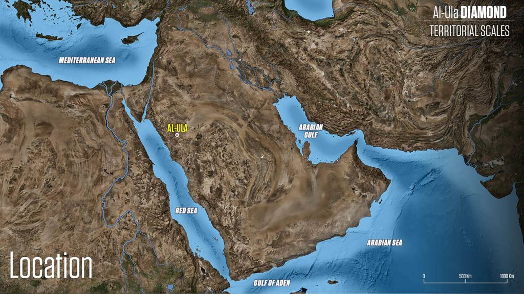
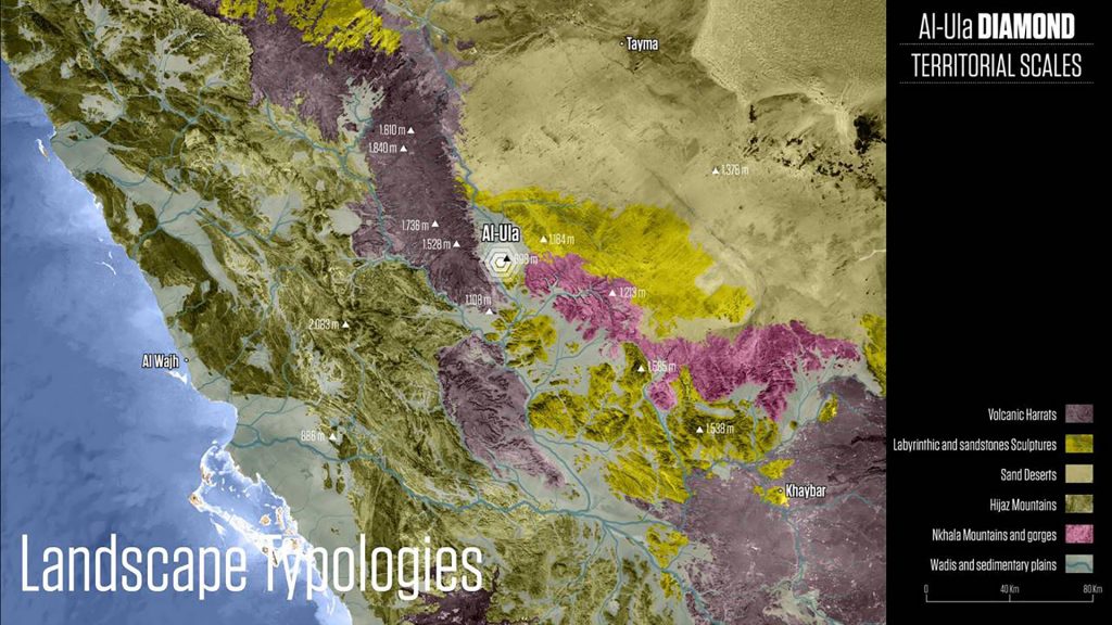
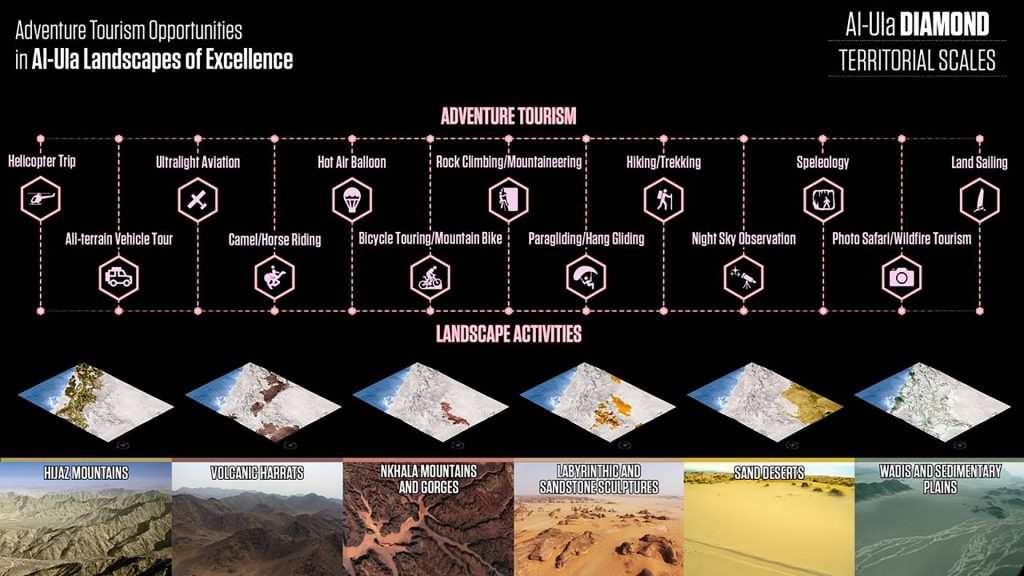
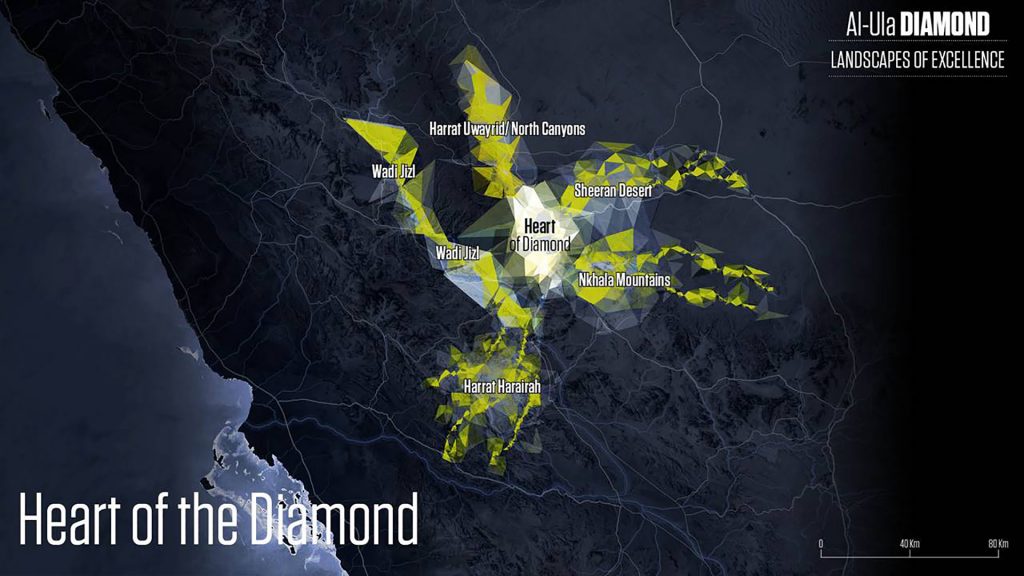
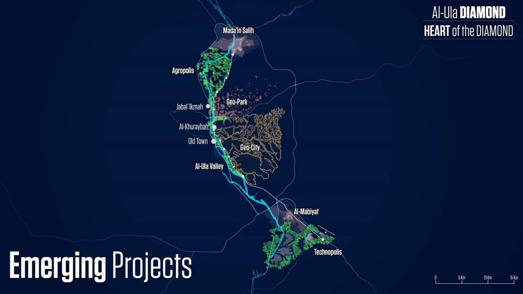
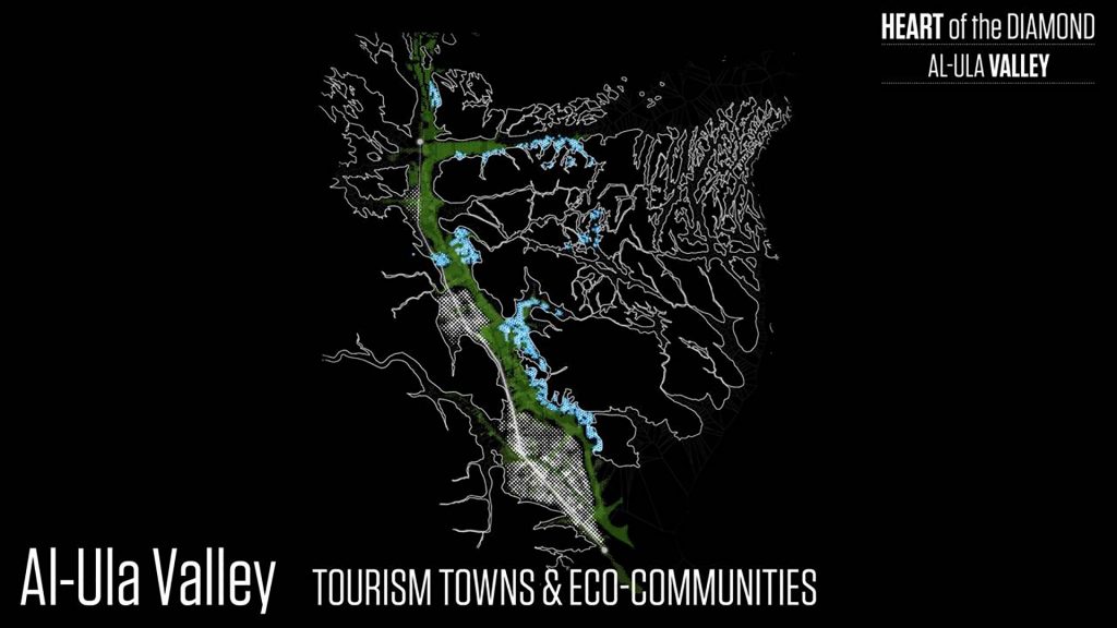
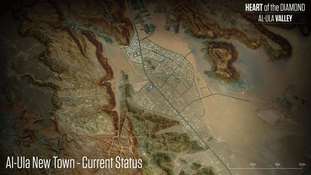
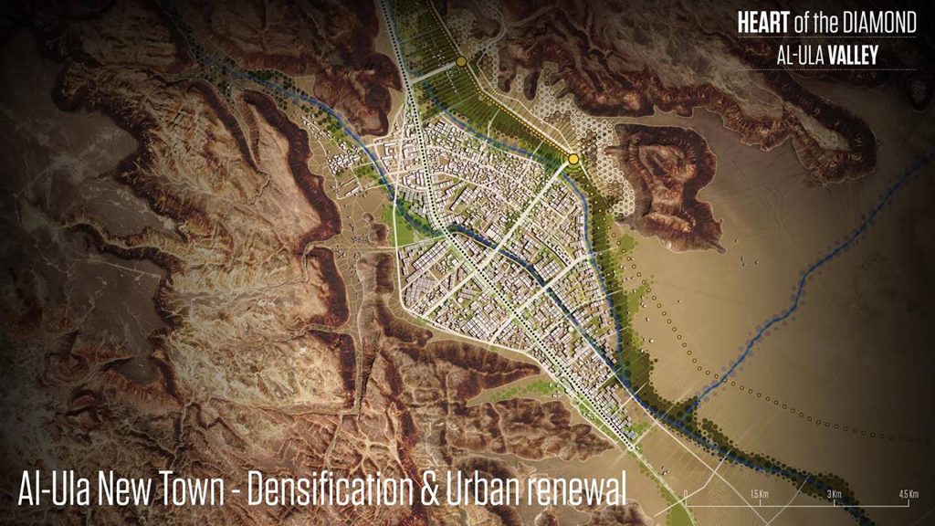
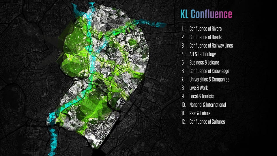
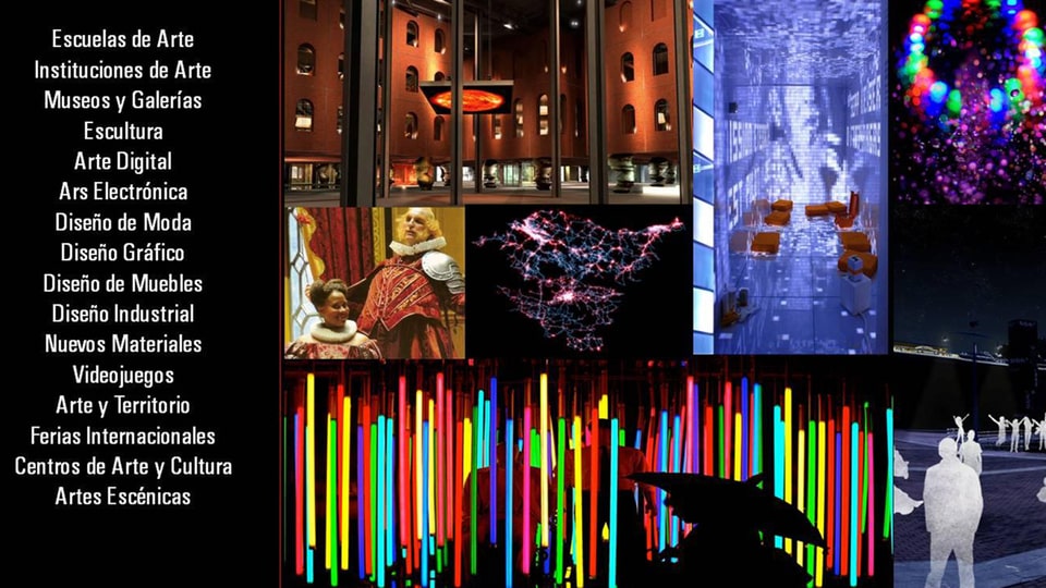
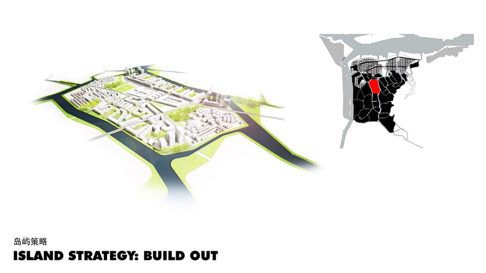
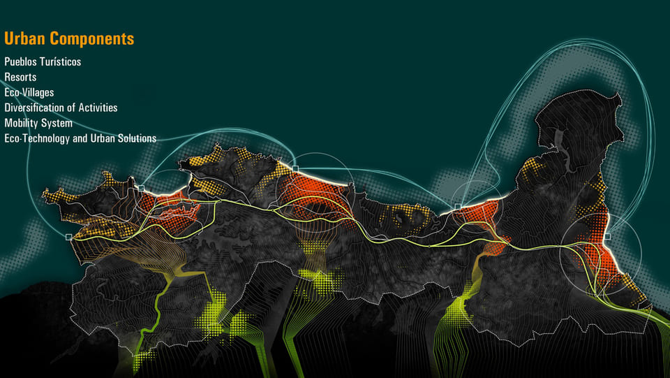
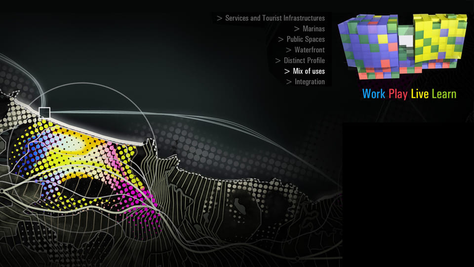
Projects
Territorial
- diamonds
Designing the Territories of the Future
The regional scale has become vital for maintaining competitiveness in a globalizing, innovation-driven economy. Today, competition occurs not between nations but among cities and regions, which can better support businesses and enhance residents’ quality of life. Key developments, such as the easing of trade barriers, rapid information access, and improved transportation and communication, will greatly shape future cities. Metropoli, a pioneer in large-scale spatial development, collaborates with cities and regional governments to create “Urban Ecosystems of Innovation” and “Territorial Diamonds.” These “Territorial Diamonds” integrate cities (“Points”), transportation networks (“Lines”), and developed or rural areas (“Surfaces”) into cohesive systems. This structure enables regions to leverage shared resources and foster synergies that benefit each part individually through close cooperation.

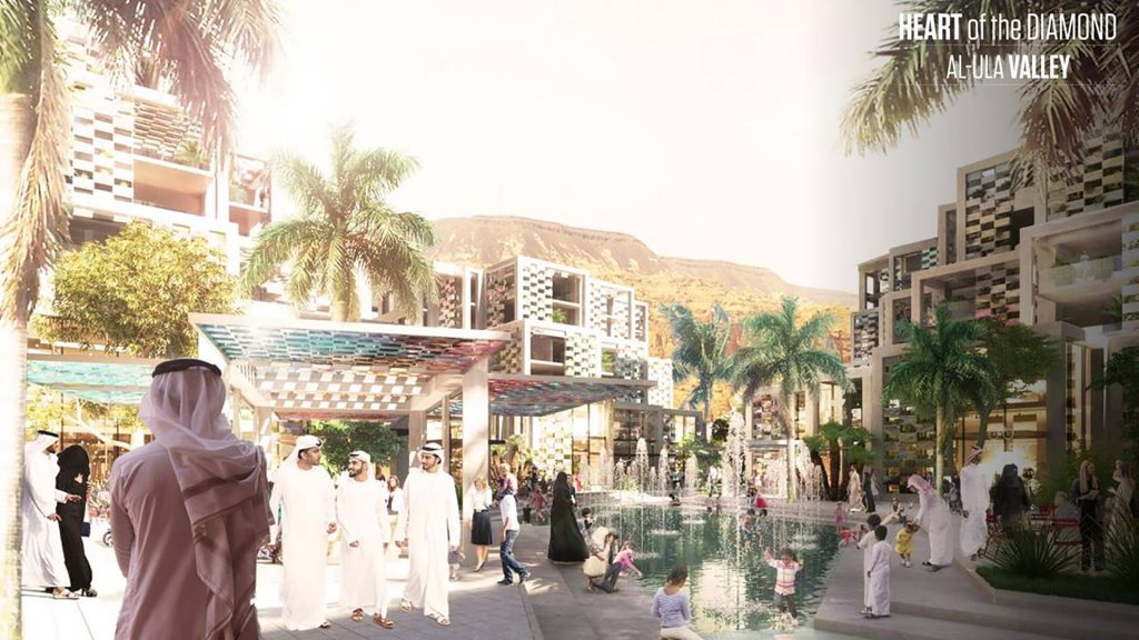


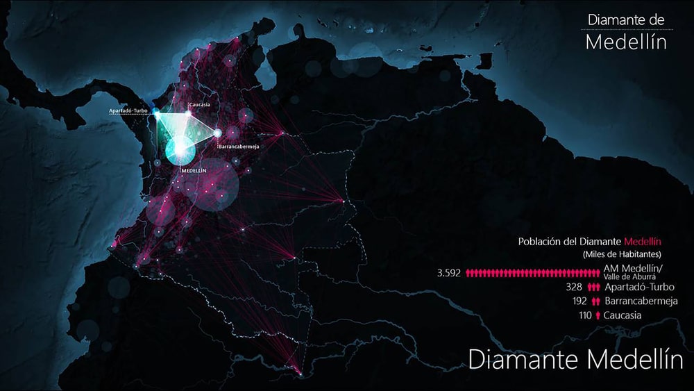
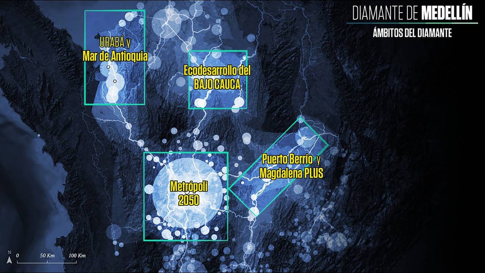
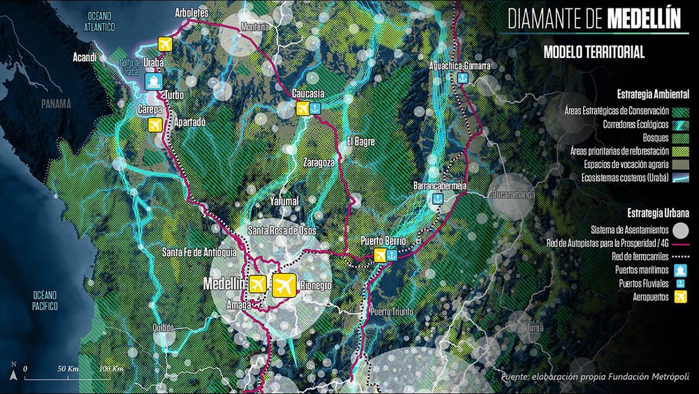
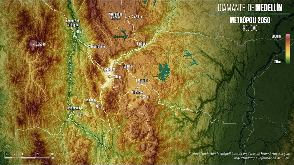
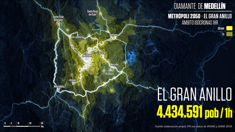
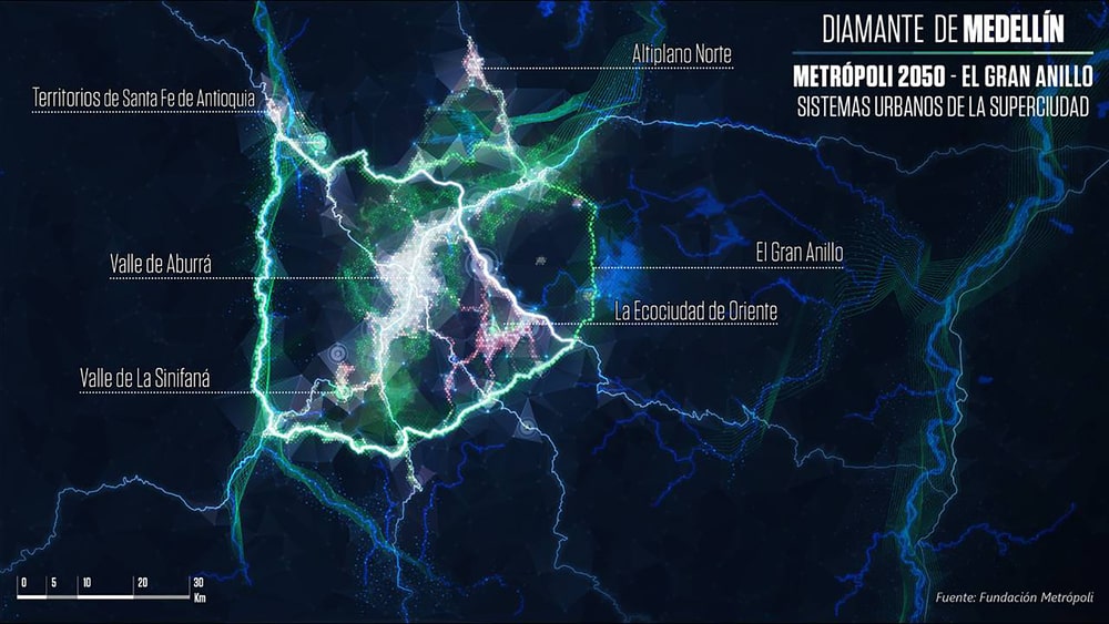
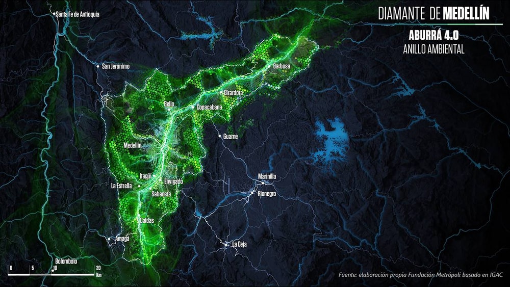
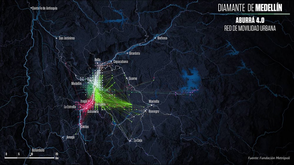
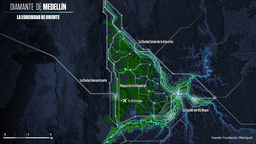
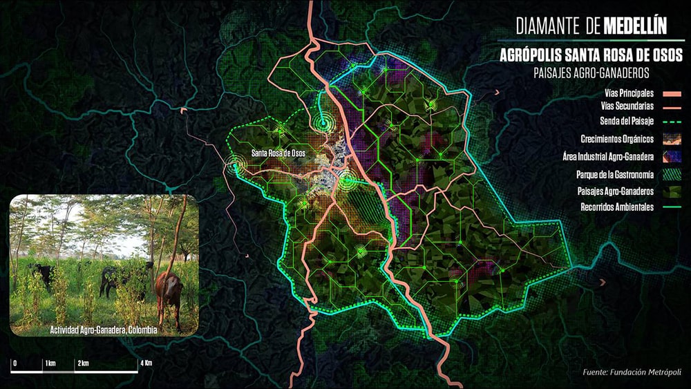
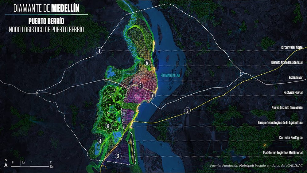
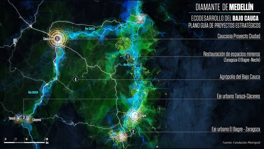
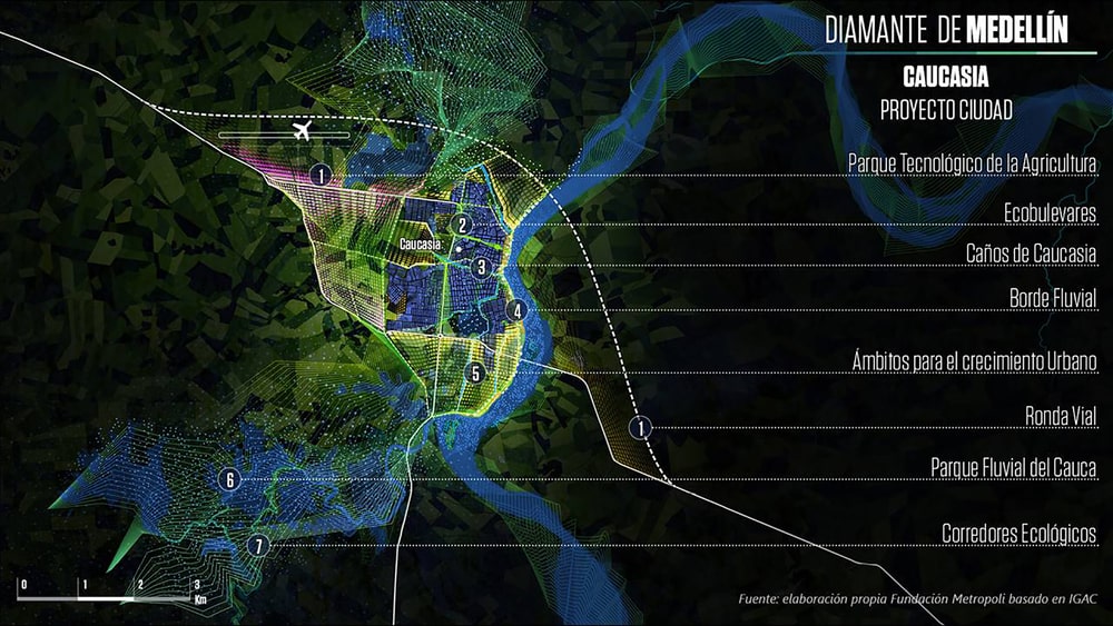
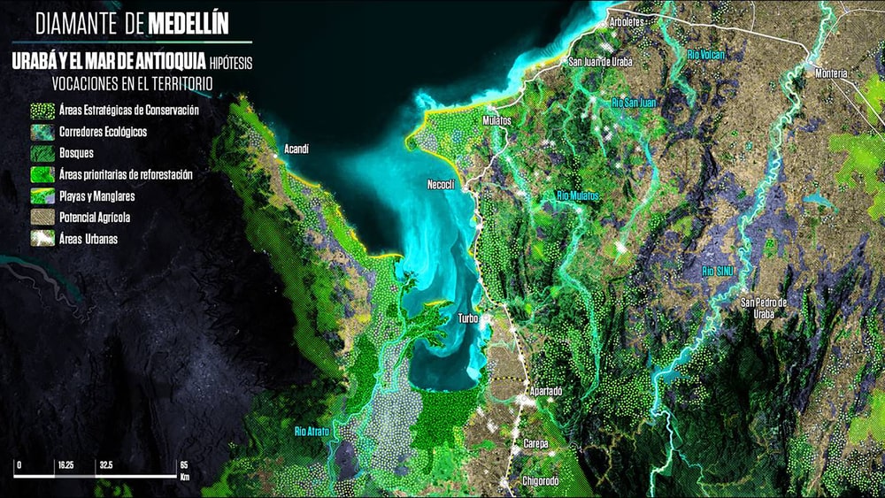
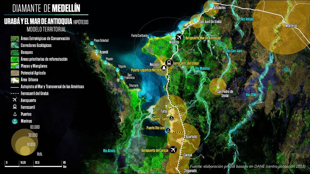
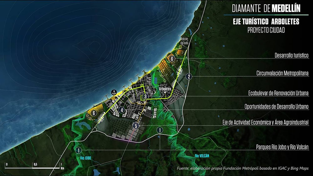
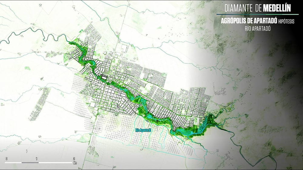
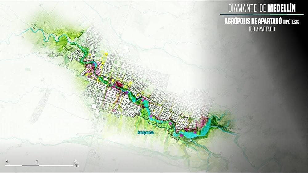
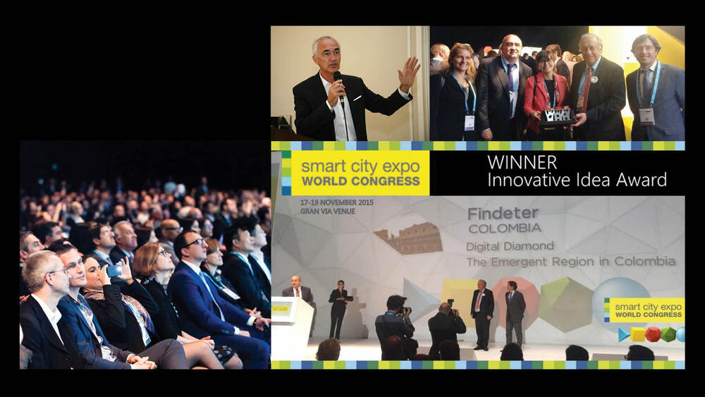
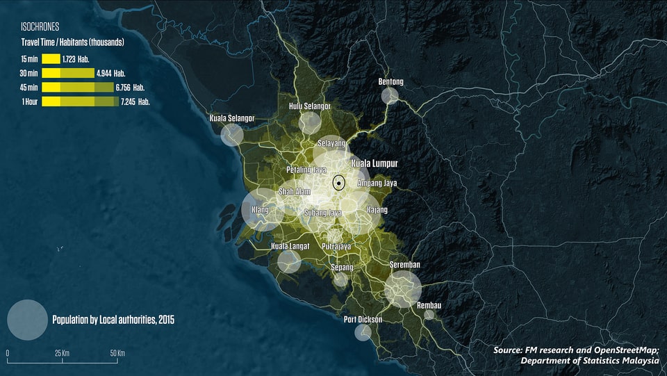
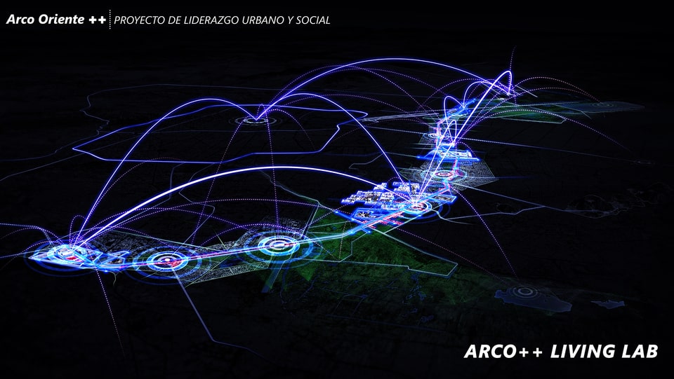
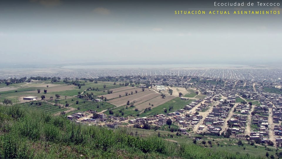
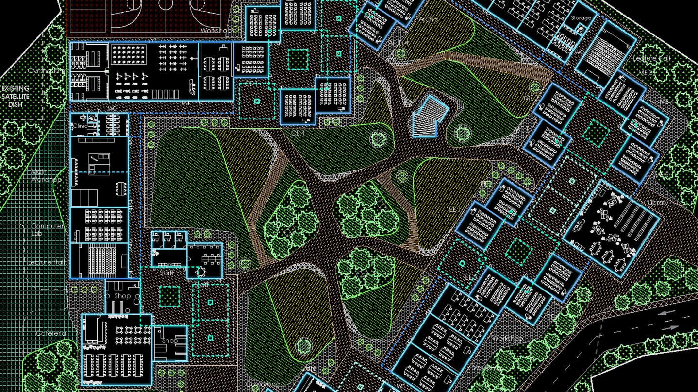
The project aims to boost this region as the engine of Colombia by integrating strategic proposals of intervention over the territory and incorporating the advances of new digital technologies for the population. Its basis is the articulation of the area as a polycentric urban system strengthened through strategic projects capable of transforming the territory and society.
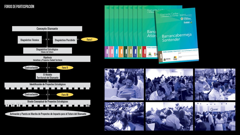
From the diagnosis based on the problems and opportunities of each department and its main cities, and with the results of an extensive process of participation, socialization and dissemination, the Diamond identifies strategic opportunities and synergies between the different cities and departments from a new scale of the territory. These strategic projects which are agreed with local leaders incorporate urban and territorial initiatives and the new solutions offered by digital technology.
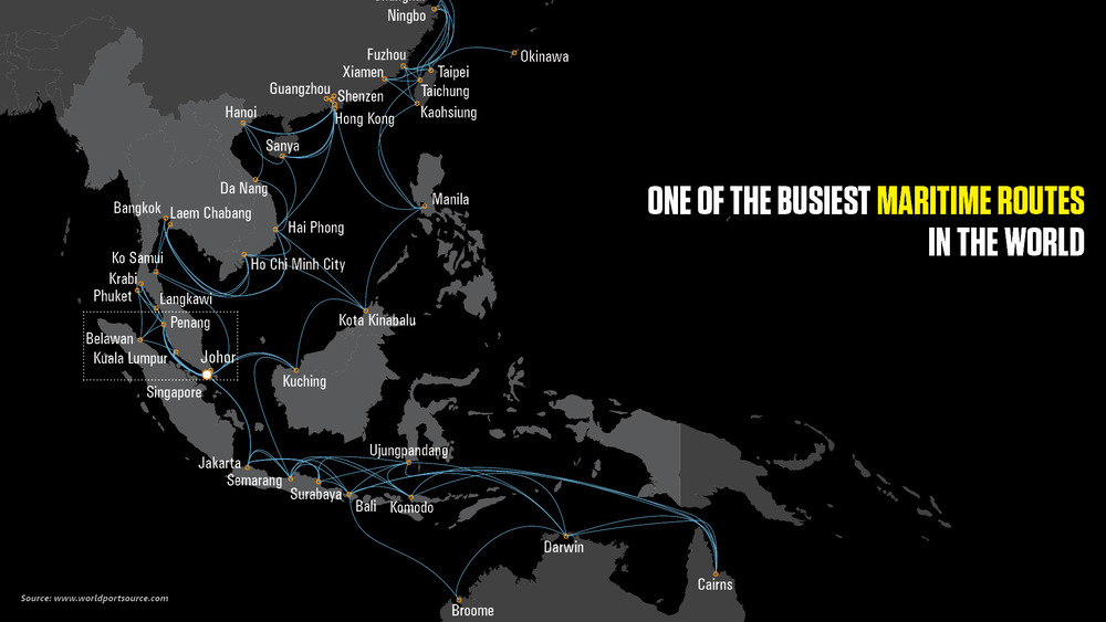
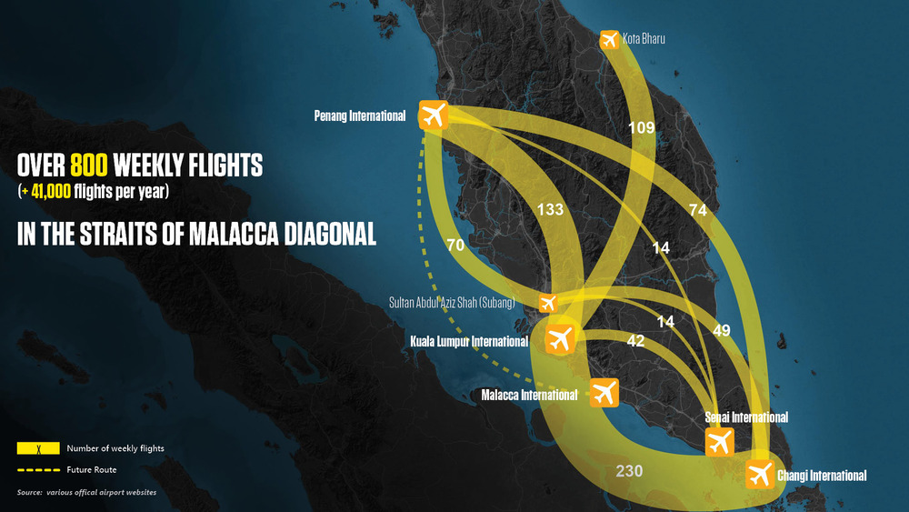
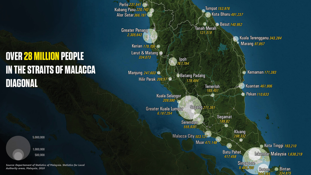
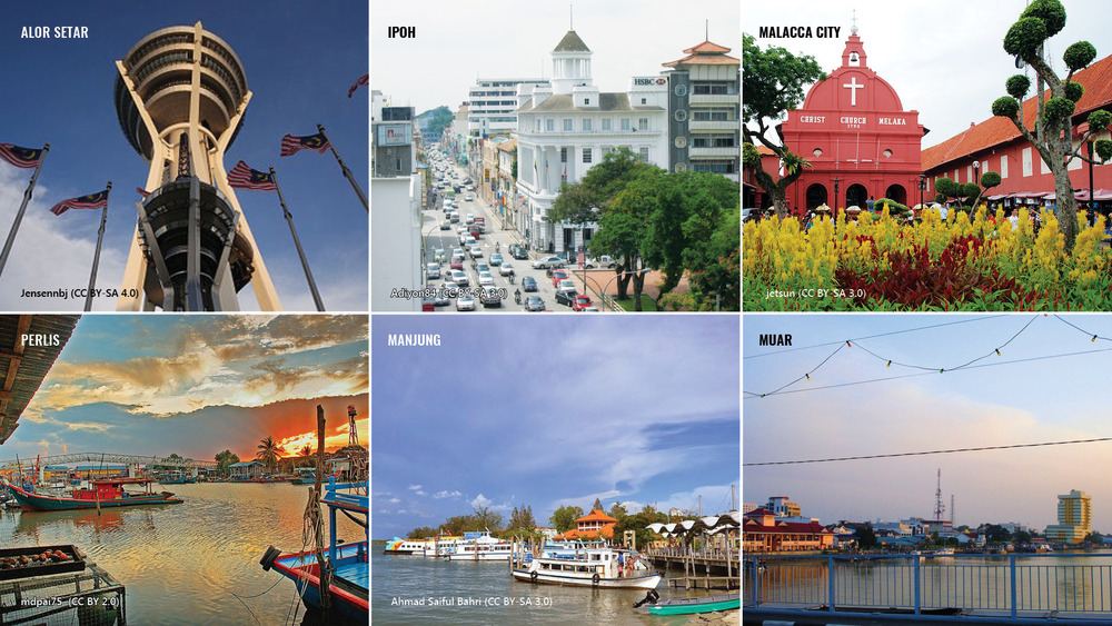
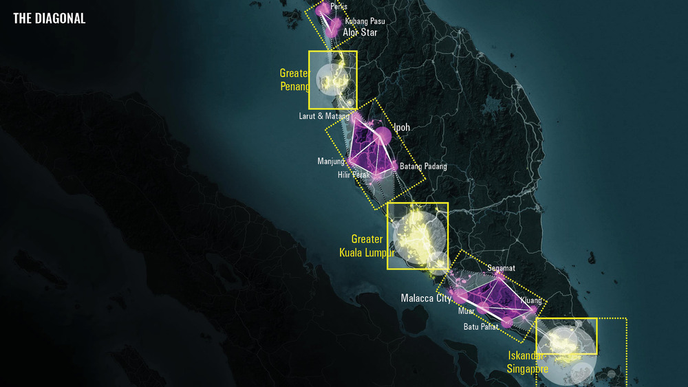
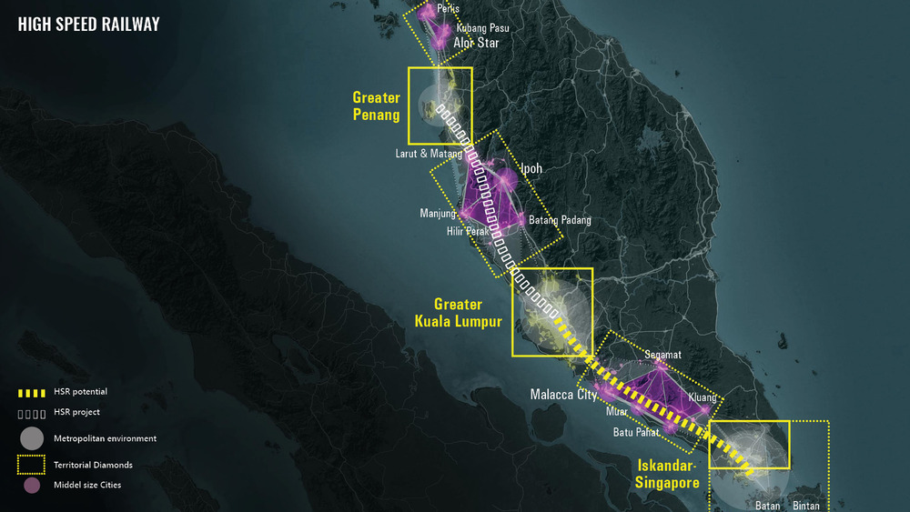
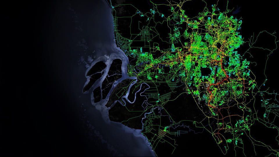
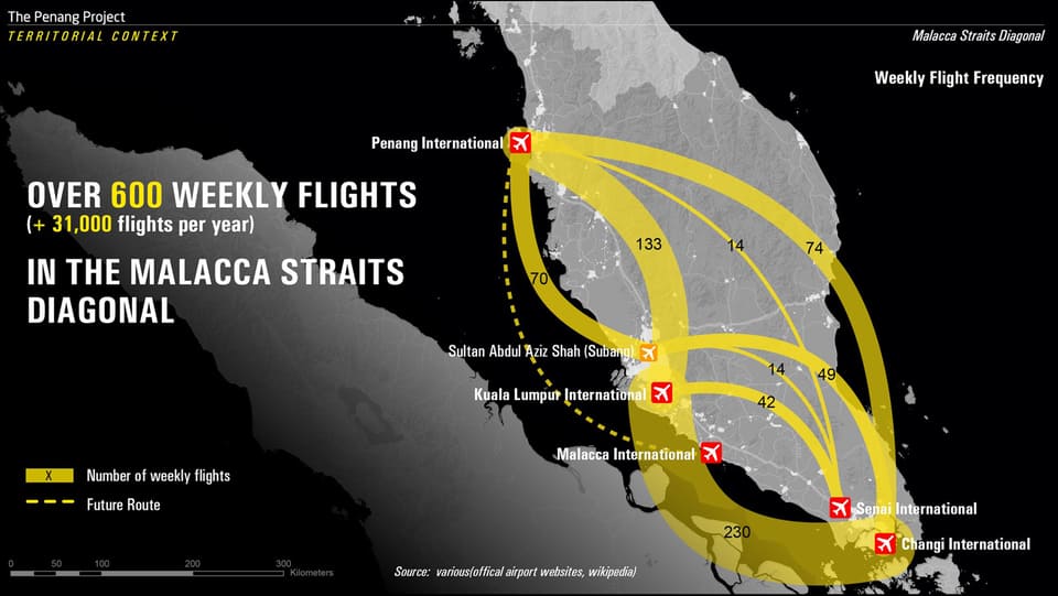
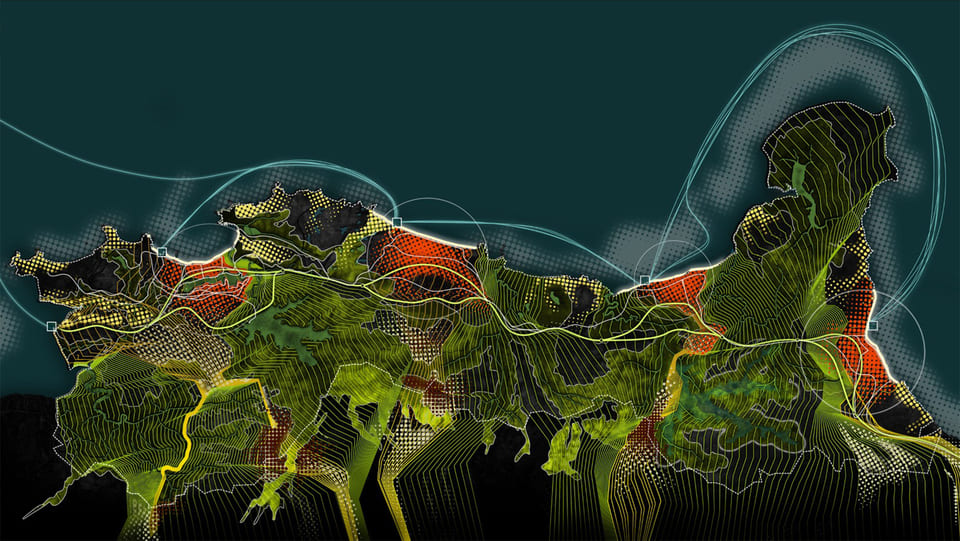
The objective of the Malacca Straits Diagonal characterization is to define a territorial vision from a global and integrated perspective of the whole of this territory. This Diagonal vision Model can inspire the development of cooperation initiatives at local, regional, national and supranational levels.
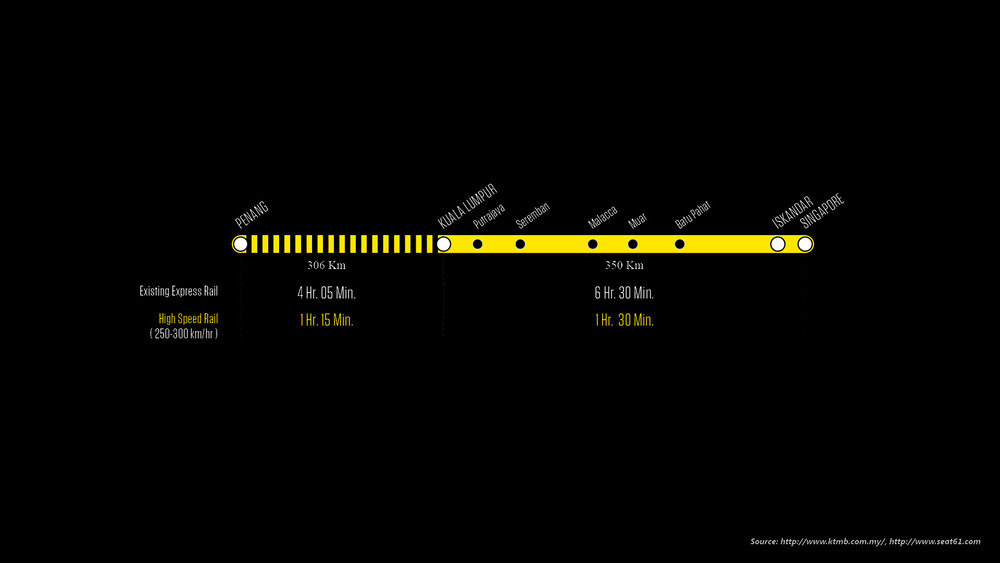
The Malacca Straits Diagonal concept envisions a dynamic economic corridor connected with high-speed rail, motorways and digital links, assuring the functional integration of a traditionally fragmented region. The concept will connect cities, ports, and airports, adding further potential to extend toward the north until the metropolitan areas of southern Thailand.
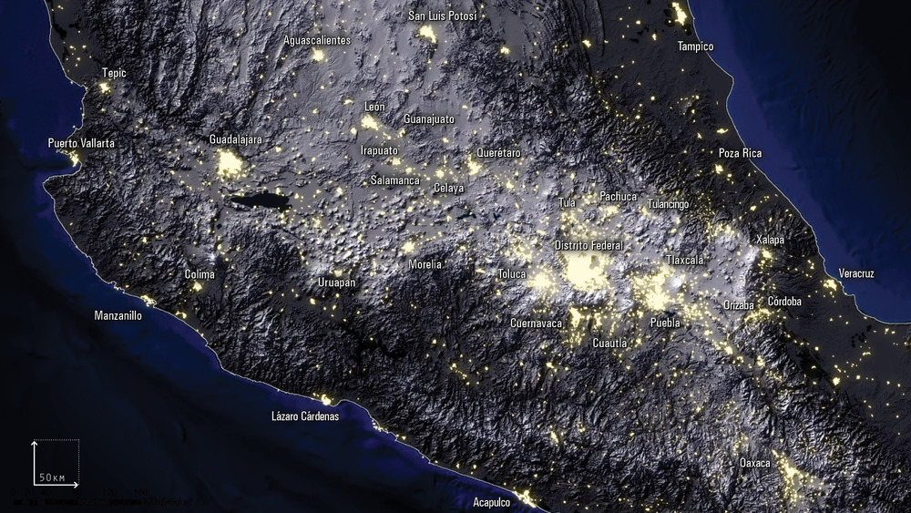
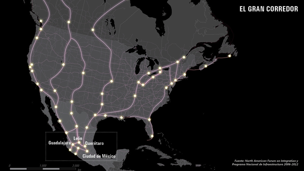
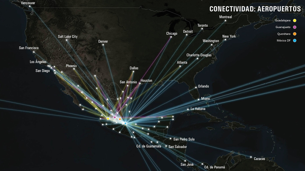
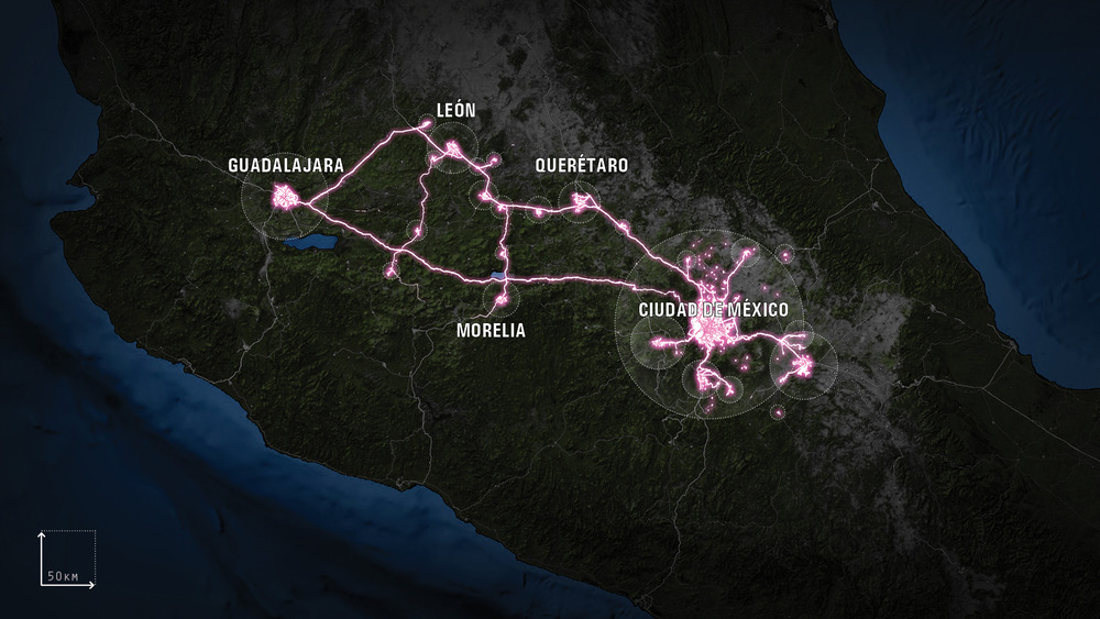
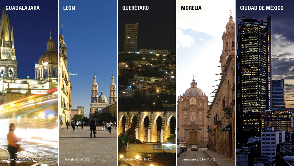
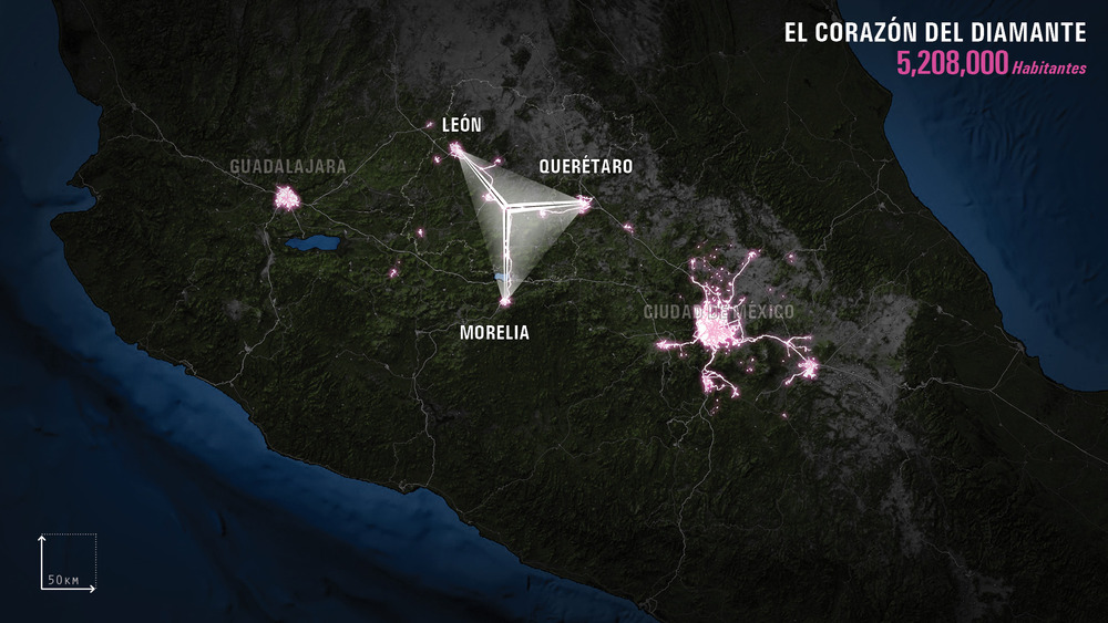
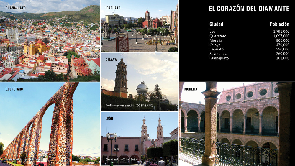
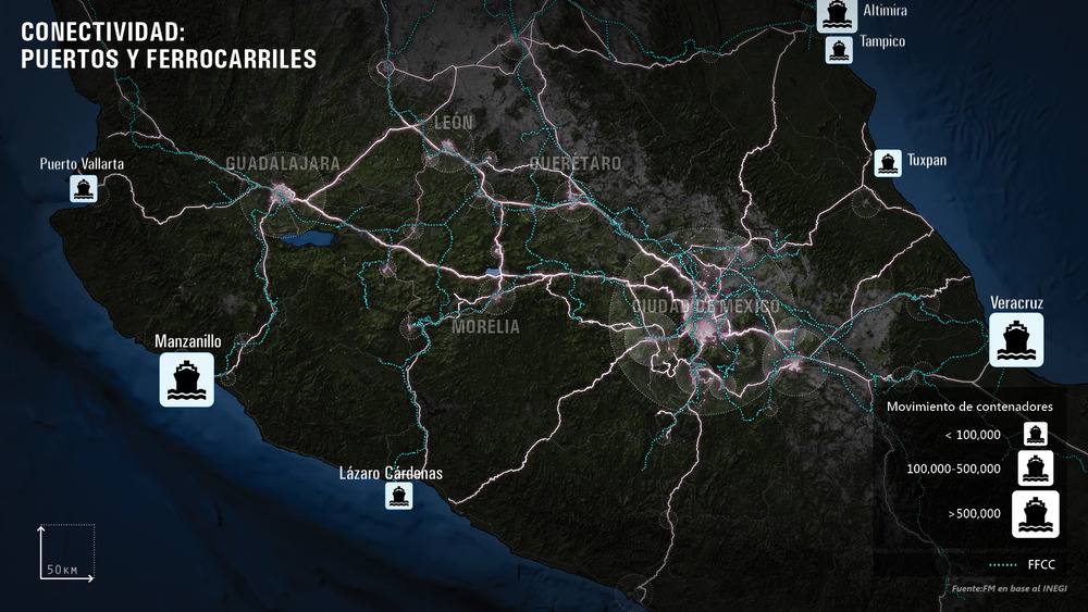
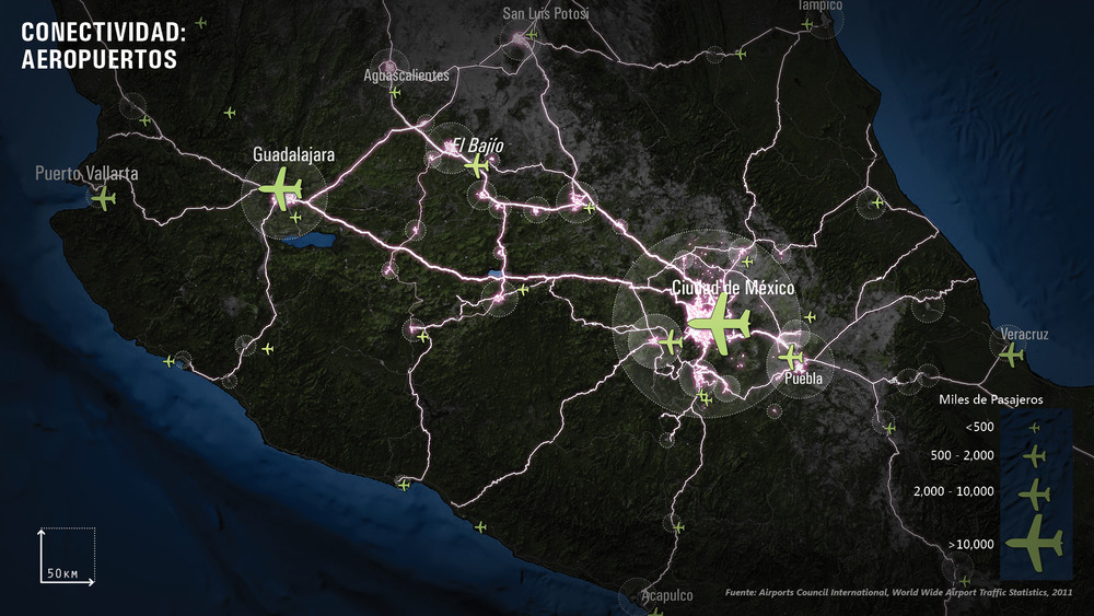
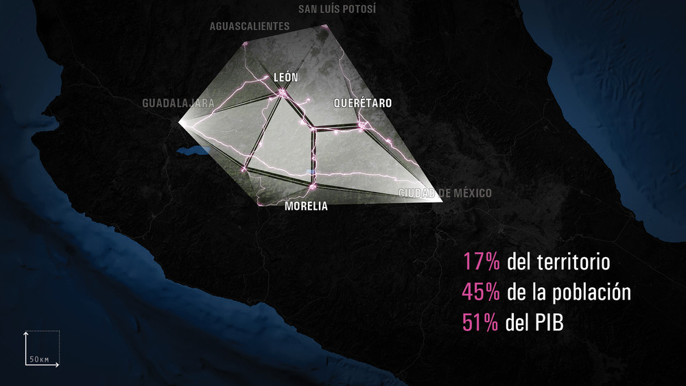
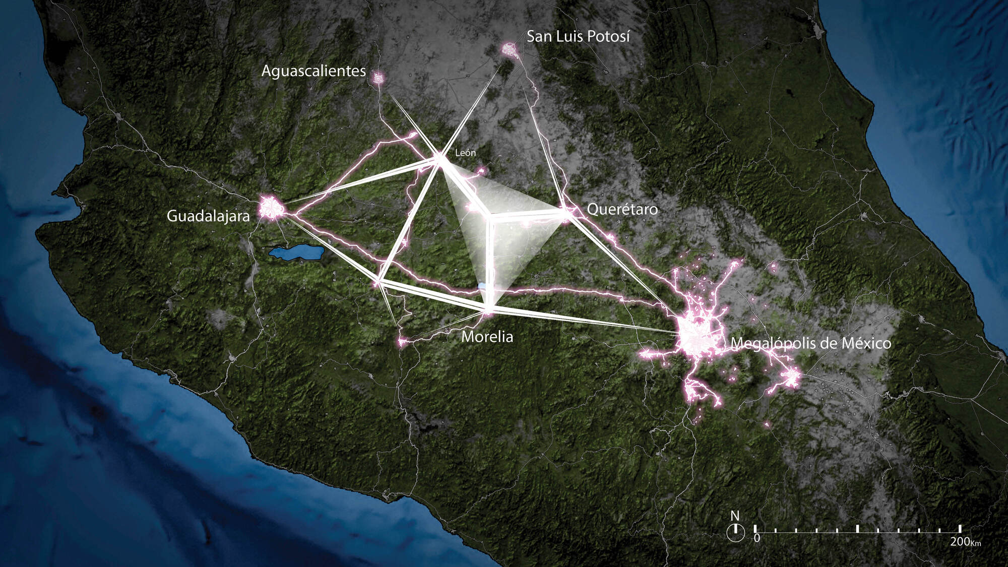
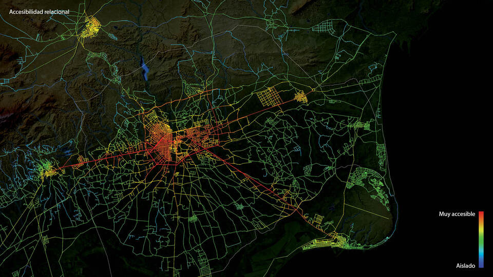
The Mexican Diamond is configured around the cities of Guadalajara, Leon, Querétaro and Morelia, along with the Megalopolis of Mexico. It is the most densified urban area of the country, located on the main axes of national development, with immediate access to the main ports, the Pacific and the Atlantic and interconnected by a dense network of highways, railways and airports. Here are the conditions for articulating a large urban region by configuring a more powerful structure in the line of processes that are shaping the main economic nodes of the world.
It is a space with greater diversity and, therefore, with greater opportunities and an increased capacity to benefit from the complementarities between different areas and spaces with different characteristics. Diversity, complexity, density, openness to the outside, connectivity and possibilities of interrelation are the essential factors to promote creative and innovative spaces, sustainable and competitive.
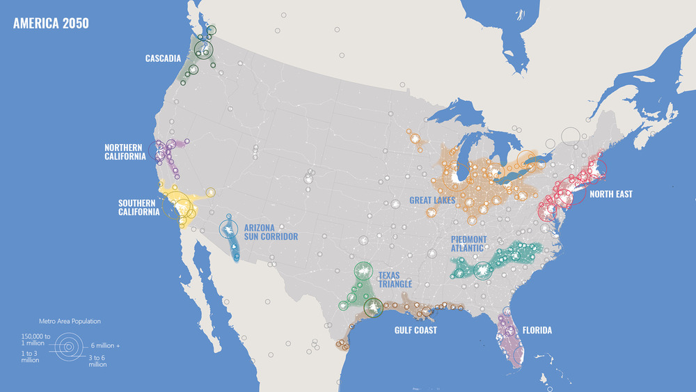
The ‘America 2050’ strategy is focused on researching innovative policies and investment schemes that will maximise the competitiveness and quality of life of the ten emerging mega-regions within the United States.
America’s mega-regions are composed of the city centres, suburban areas, and hinterlands into which several cities have grown. They play an active and influential socio-economic role in the United States at both the micro and global scales. These mega-regions are defined by five layers of relationships (environmental systems and landscape, networks of infrastructure, economic links, settlement patterns and land use, common heritage) which, together, structure a common interest. This common interest should be the basis for policies that boost America’s competitiveness and opportunities, capable as well of ensuring a sustainable and balanced distribution of wealth for people and territories.
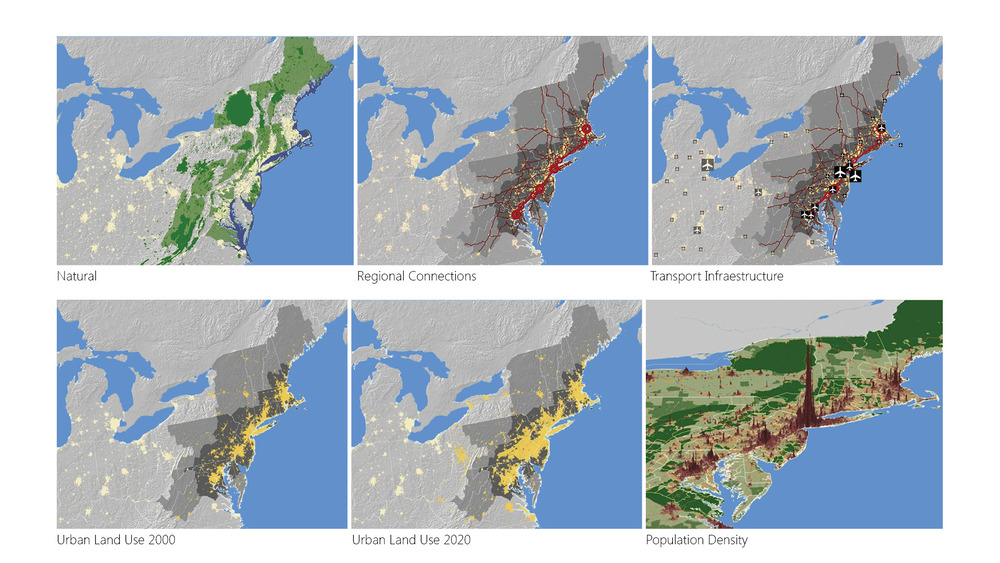
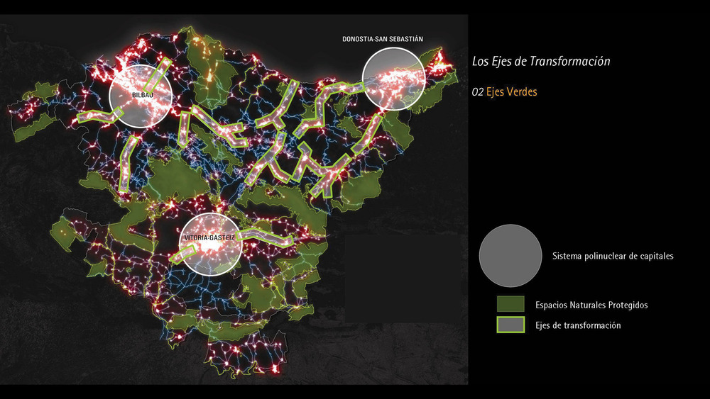
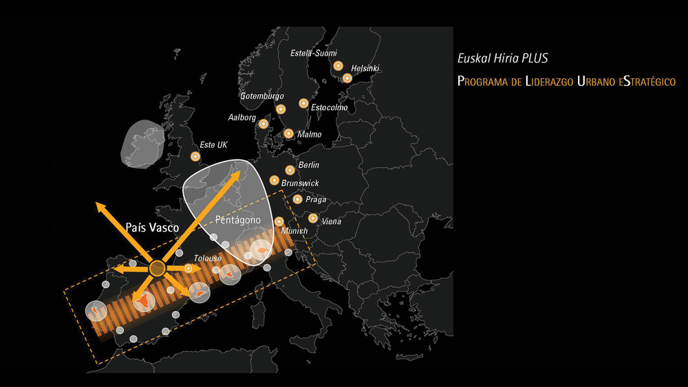
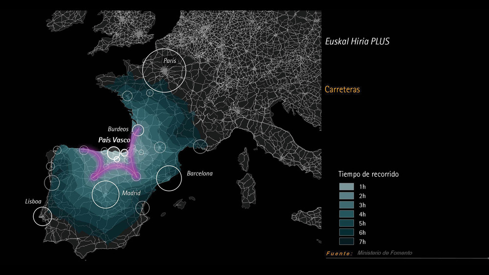
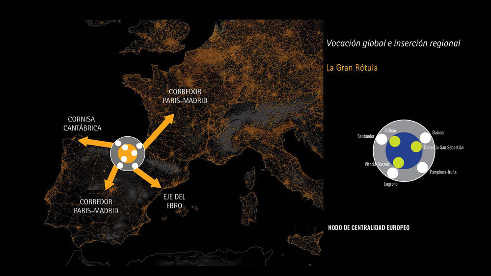
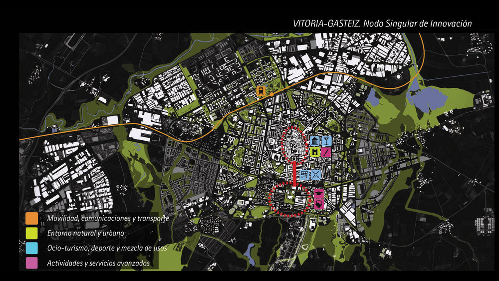
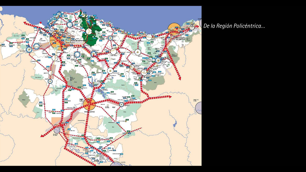
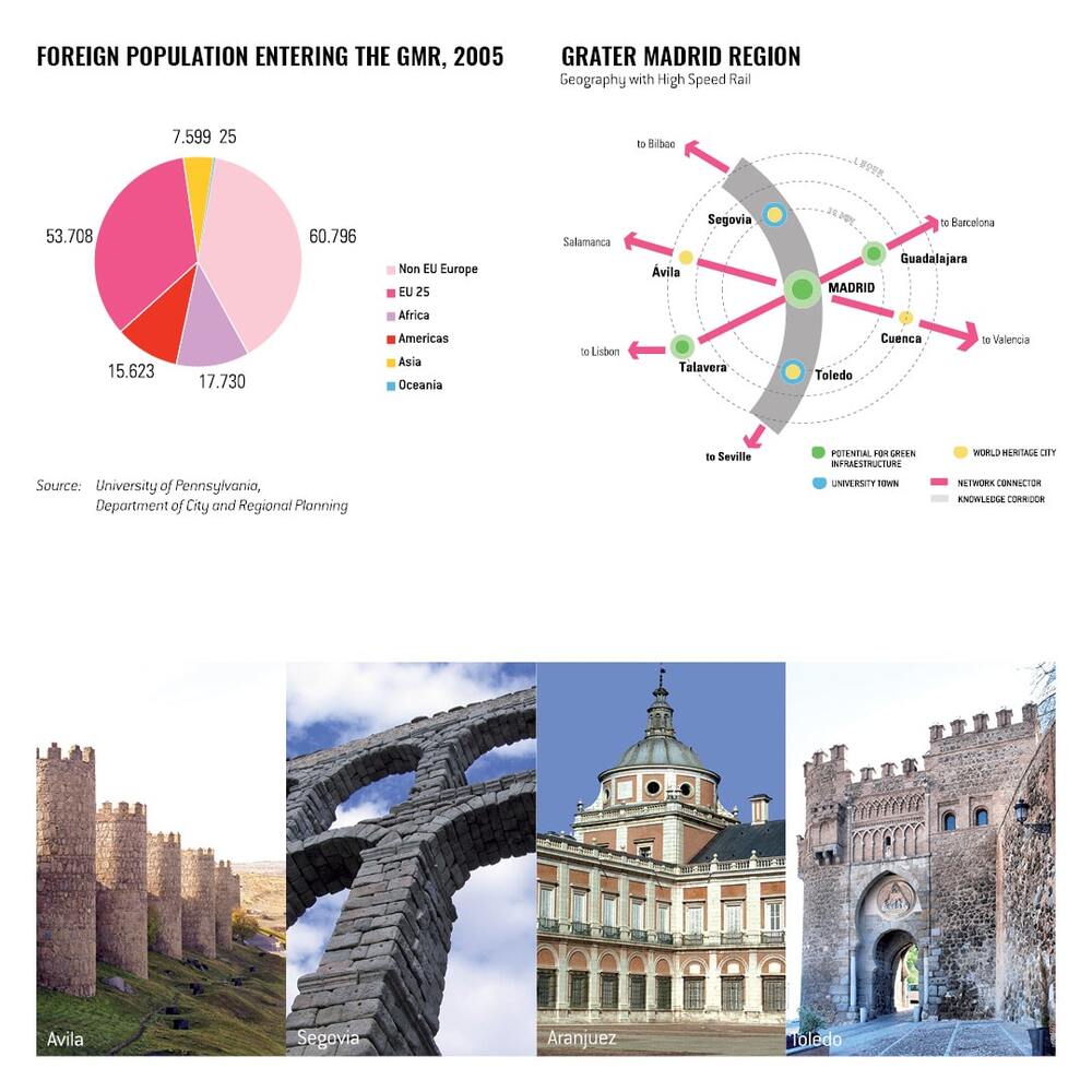
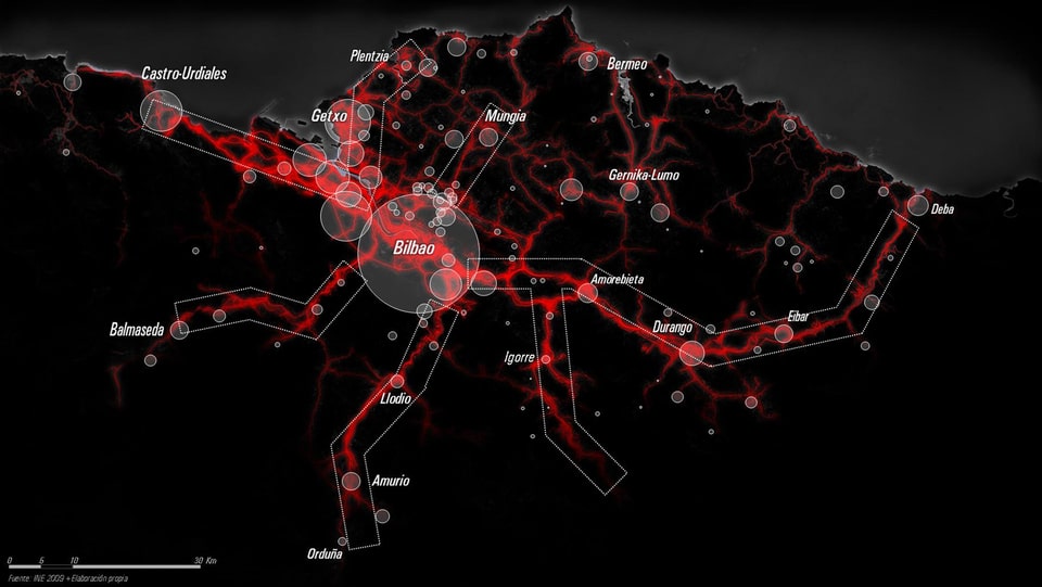
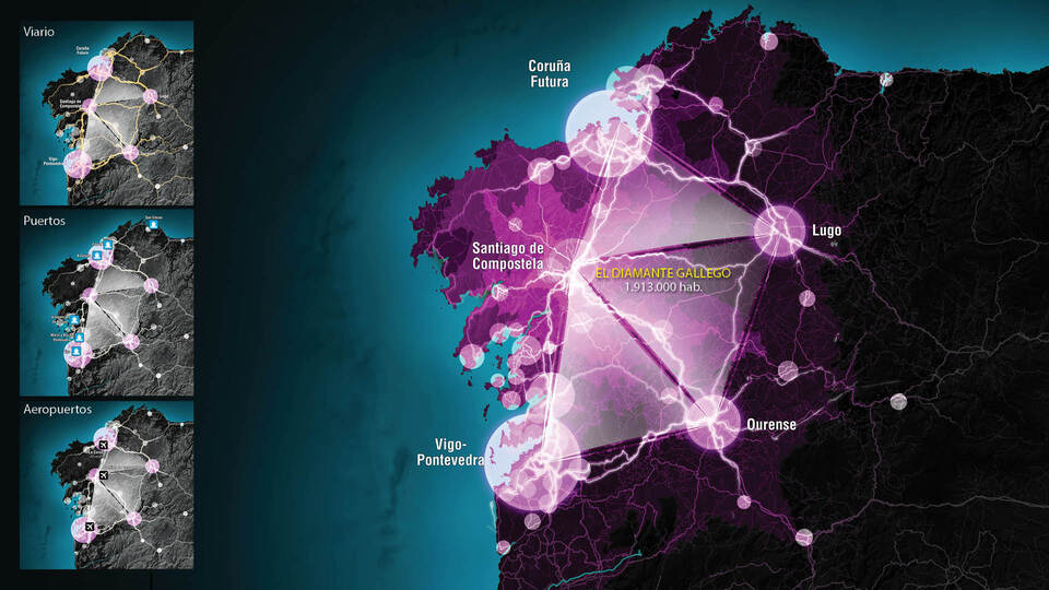
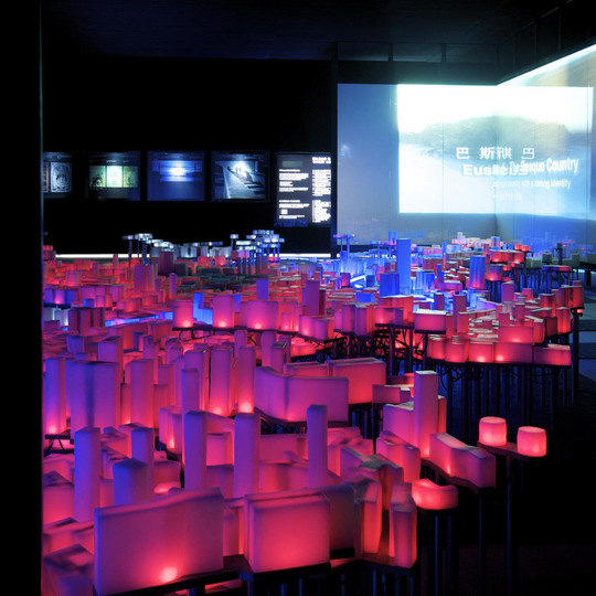
The Autonomous Community of the Basque Country (or Euskadi) is an authentic city-region within the international context, which a population of slightly more than two million and a density of 300 inhabitants per square kilometre. The scale of Euskadi is similar to other city-regions around the world. Indeed, the metropolitan Miami is larger than Euskadi, and metropolitan Sydney has about the same physical size, but twice as many inhabitants.
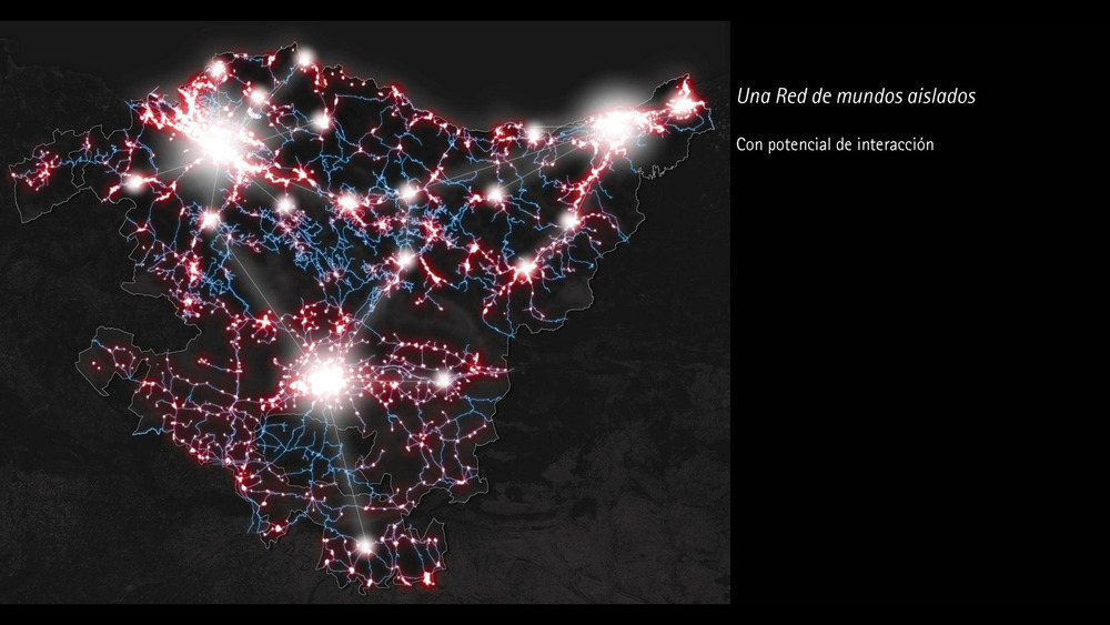
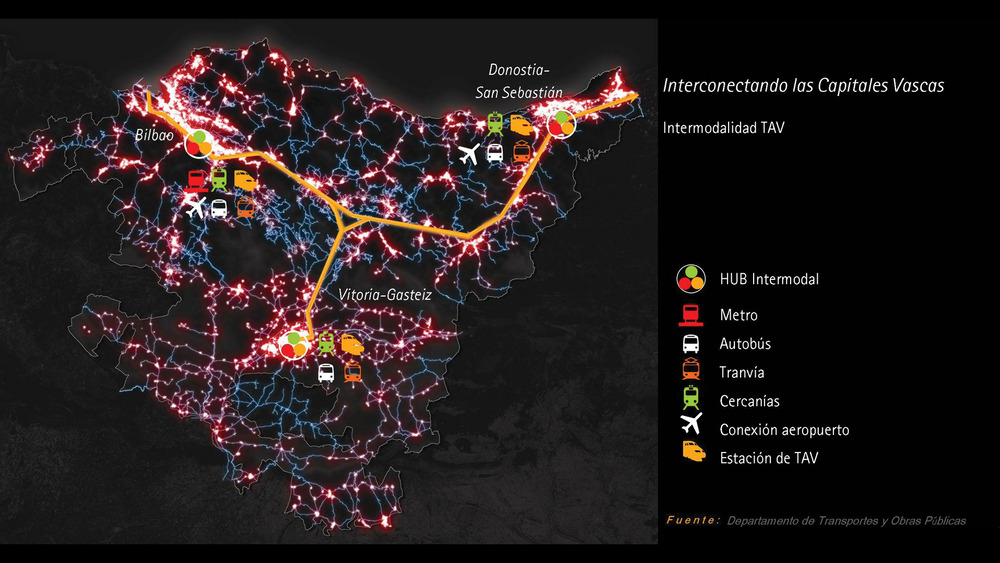
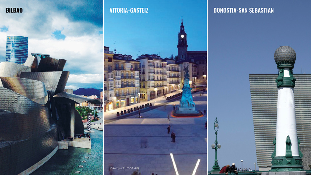
The concept of “Euskal Hiria” or “Basque City Region” responds to the opportunity of seeking interrelations and complementarities among the three Basque capitals (Bilbao, San Sebastián and Vitoria), and between these and the other urban settlements in Euskadi. None of the cities that make up the Basque urban system would be able, on their own, to possess the critical mass needed to offer the set of specialised services, infrastructure, facilities and options that are offered in successful global cities. Nevertheless, within the framework of emergent city-regions, the structure of the Basque territory has some unique singularities and competitive advantages.
Through the Proyecto CITIES methodology, Fundación Metrópoli identified the “components of excellence” for each of the three capital cities as well as for Euskadi as a whole. The study was undertaken in collaboration with the University of the Basque Country and the University of Deusto, and supported by the Basque Government and the City Halls of Bilbao, San Sebastián and Vitoria.


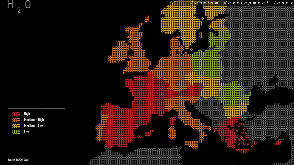
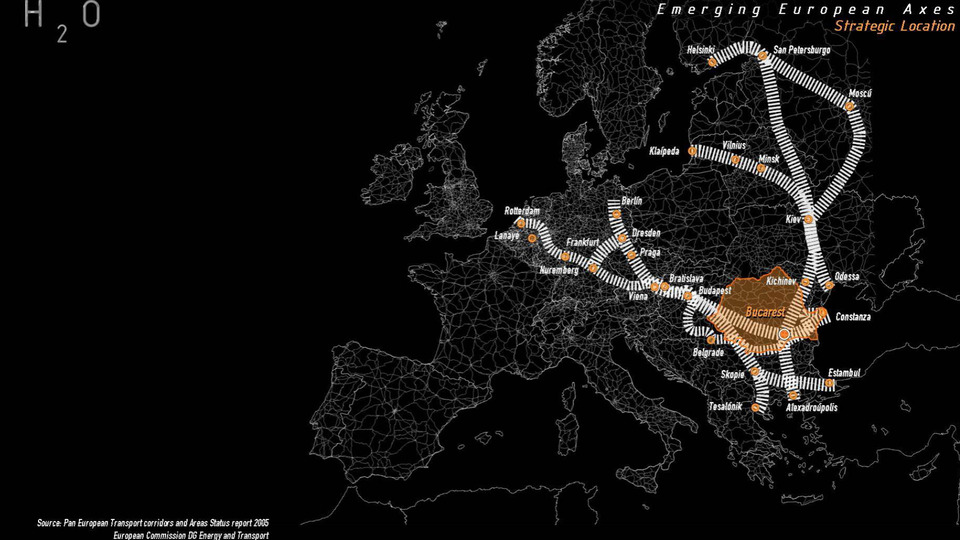
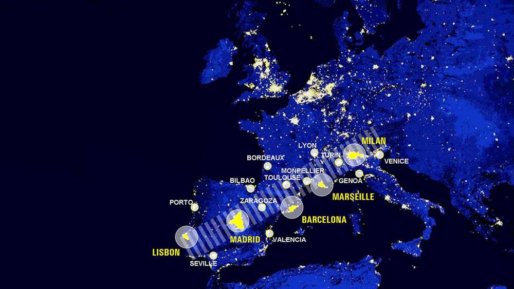
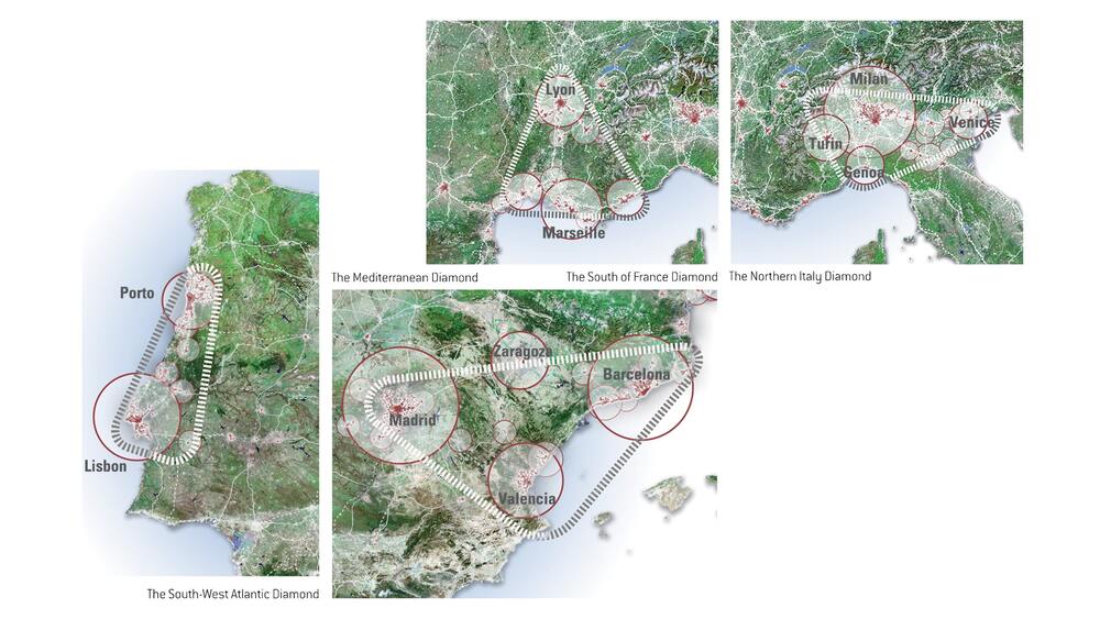
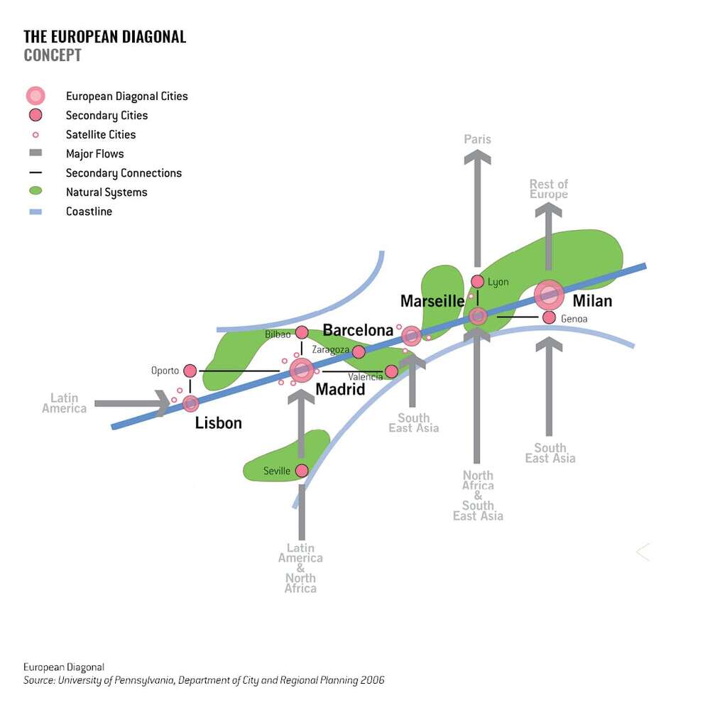
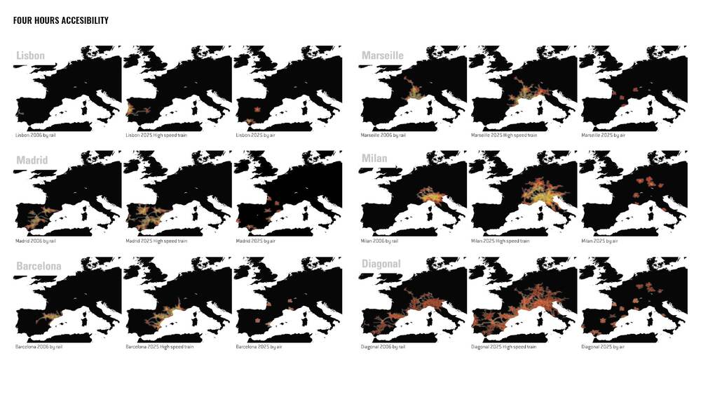
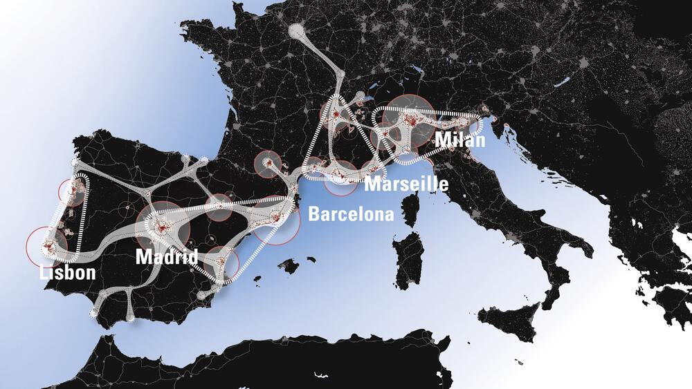
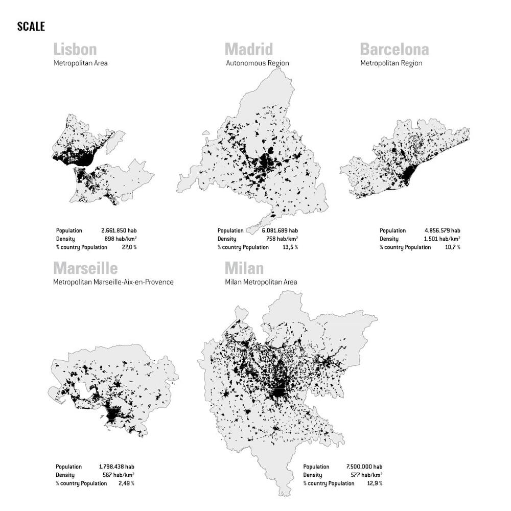
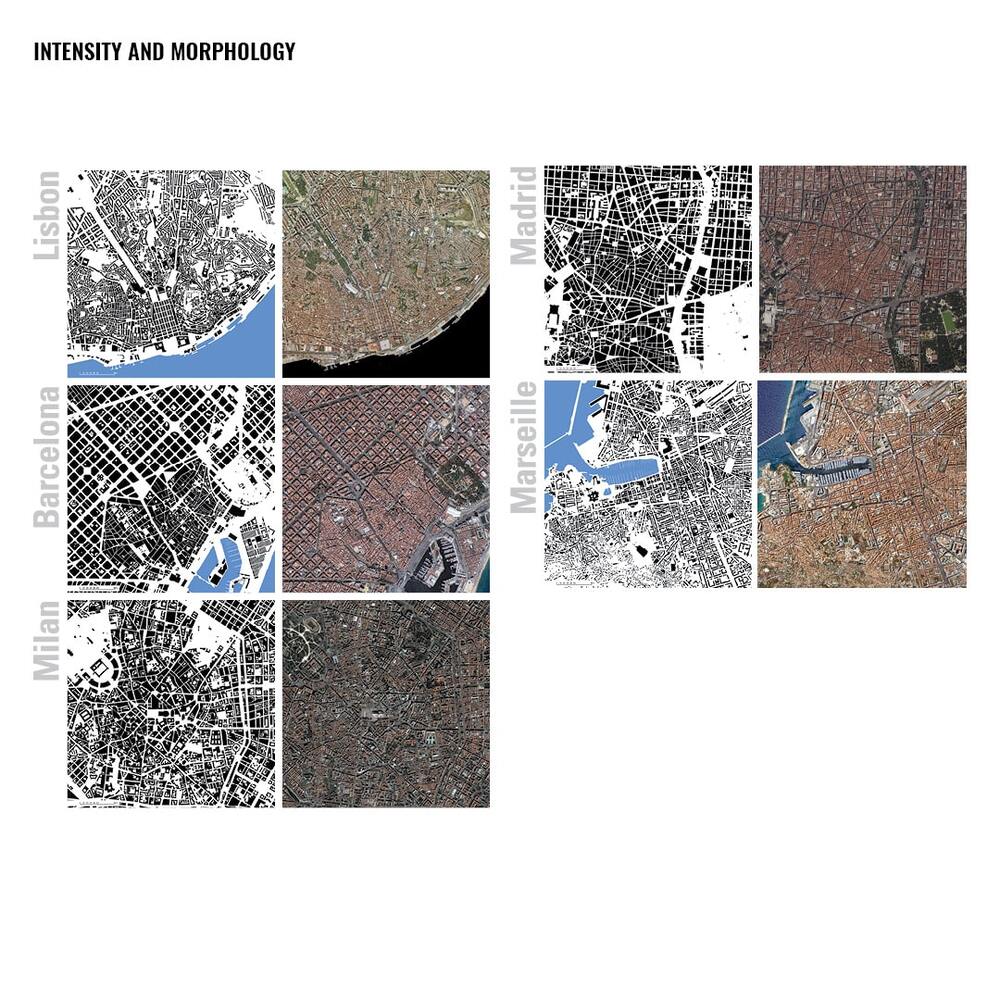
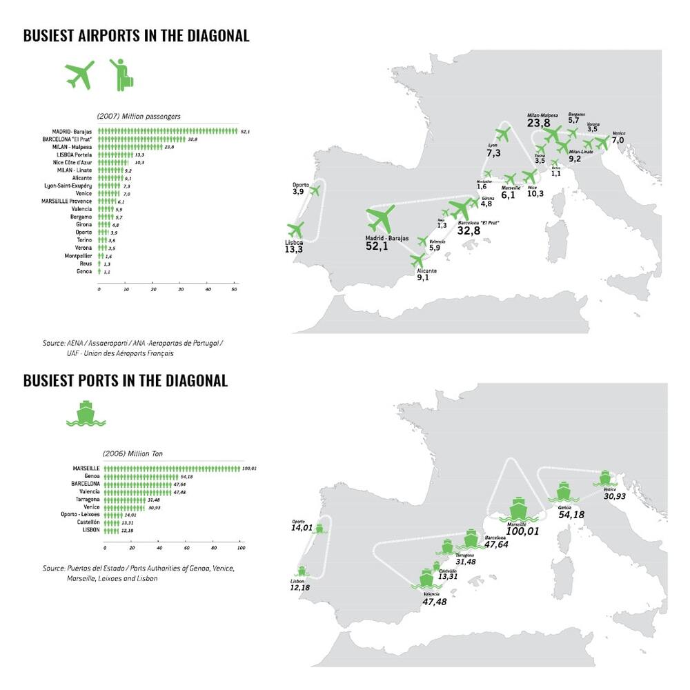
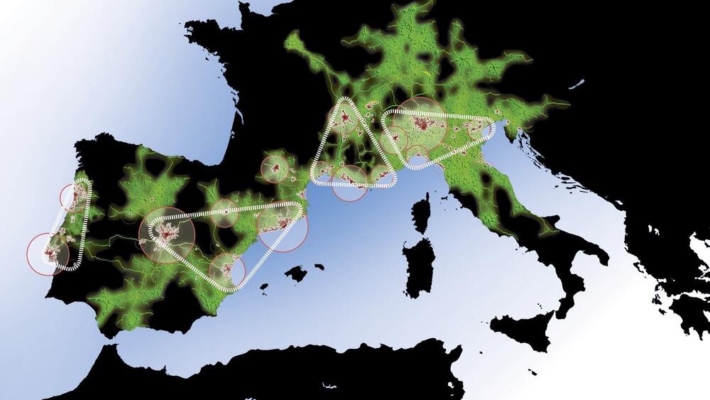
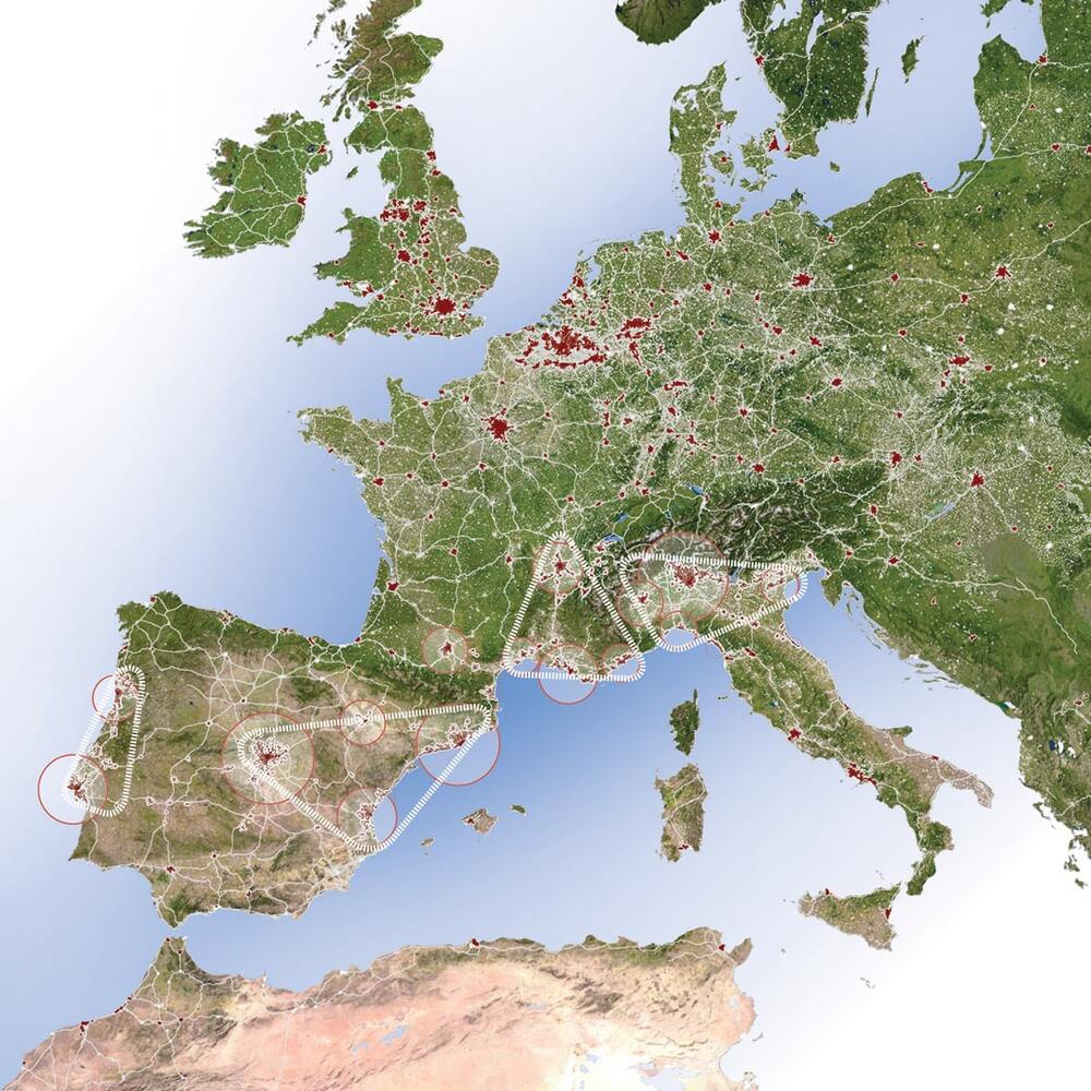
The ‘European Diagonal’ is the concept of a mega-region emerging in the most dynamic part of Europe with Lisbon, Madrid, Barcelona, Marseille and Milan as its key cities. The Diagonal in the south has the potential to complement the ‘Pentagon’ in the north-west, identified in the European Spatial Planning Perspective as the only global mega-region in Europe.
‘Building the European Diagonal’ focuses on four ‘Mediterranean Diamonds’: south-western Atlantic Portugal, Mediterranean Spain, southern France and northern Italy. They are the driving forces of this mega-city network, an emerging gateway to South America, North Africa, the Middle East and Asia. This project explores strategic development options of major metropolises in the Diagonal within this evolving territorial context.
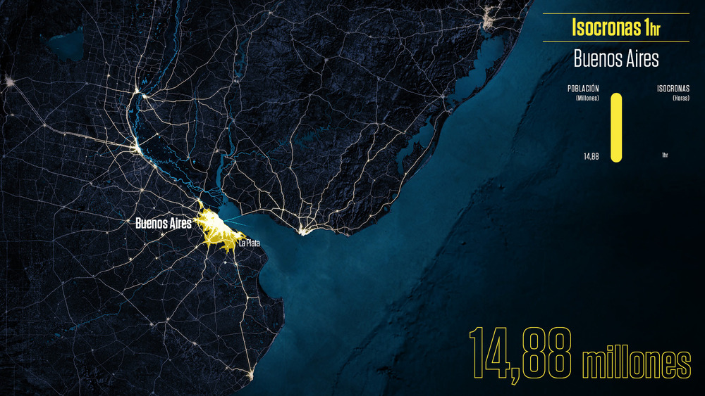
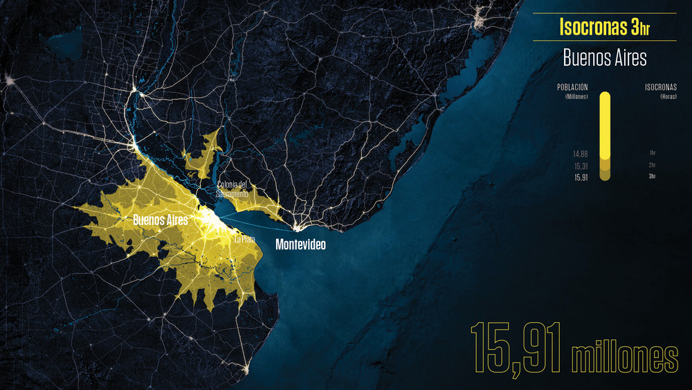
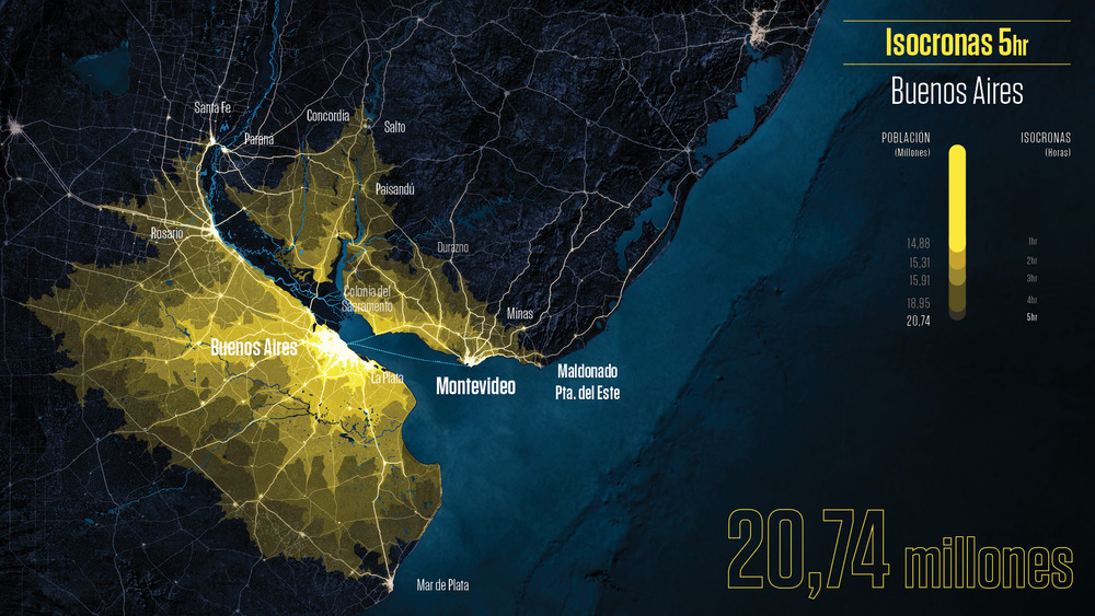
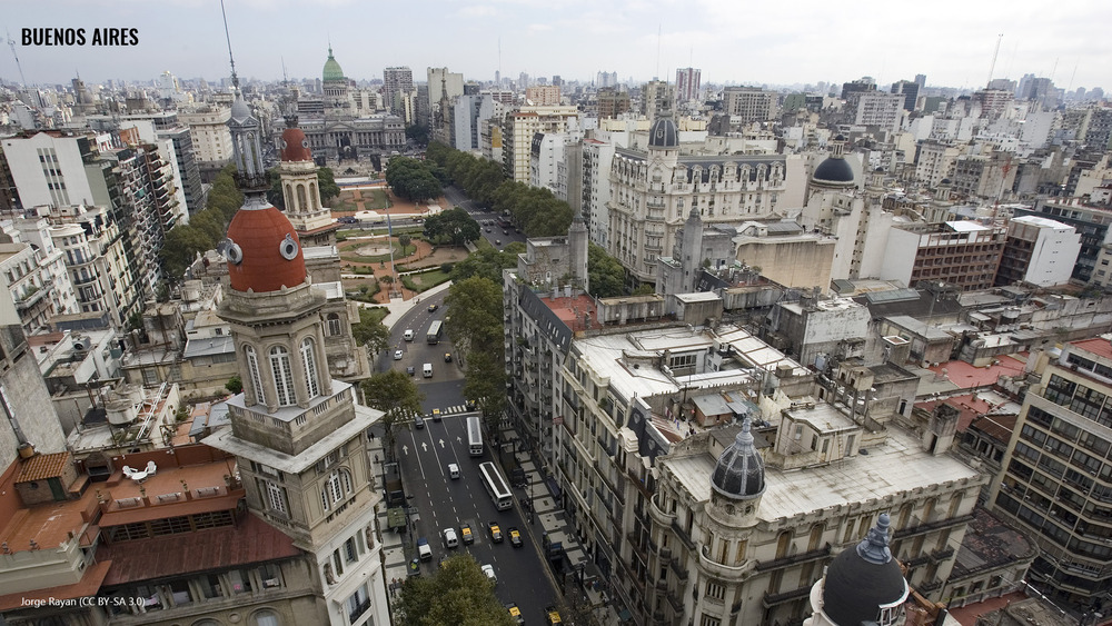
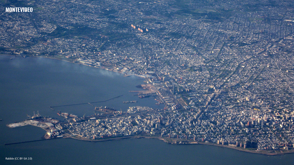
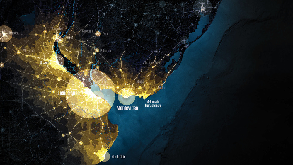
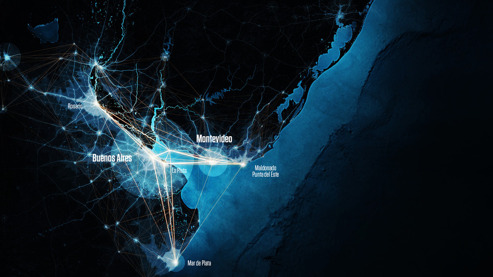
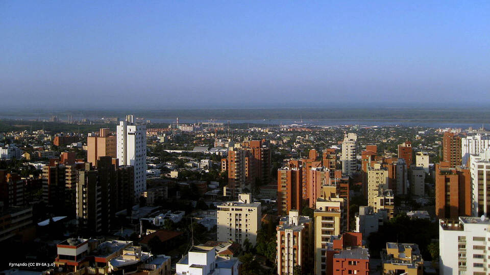
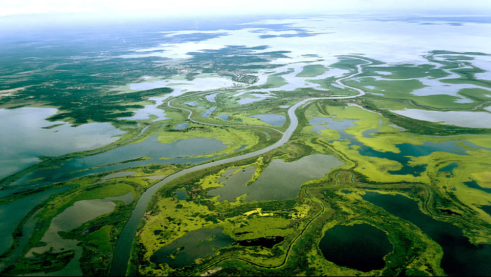
Around the great estuary of the Rio de la Plata are some of the most developed and largest urban systems of South America with a population of just over 21 million inhabitants. Main cities of Argentina and Uruguay are located within this area at a very short distance by sea and by land.
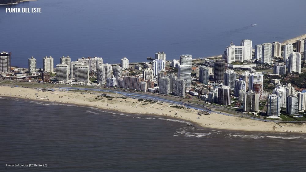
Main urban node is the Metropolitan Region of Buenos Aires, which with 14.3 million inhabitants is one of the great megacities of the world. Although this urban area occupies only 0.5% of the total area of Argentina, within it 35% of the country’s population lives and more than 30% of the country’s GDP is generated. With almost one million inhabitants, in the stretches of the Paraná River near the mouth the city of Rosario and Santa Fe are located, while in the southernmost part of the estuary is the Mar del Plata with almost 800,000 inhabitants. In the Uruguayan section towards the Metropolitan Area of Montevideo we must add the presence of the Maldonado-Punta del Este Urban Area. Along the lower course of the Uruguay River are the other two major cities of the country, Salto and Paysandú.
The estuary is also the natural outlet to the sea and the point of convergence of the axes of communication of a vast territory of almost 3 million km2, which covers Uruguay and almost all of northern Argentina, in addition to the entire territory of Paraguay with the Metropolitan Area of Asunción and great extensions of east Bolivia and the south of Brazil.
The Diamond of Buenos Aires is an initiative for this territory to participate with a significant role in the new international scenario of global cities through strategies supported by complementarity and synergies between the different nodes that compose it.

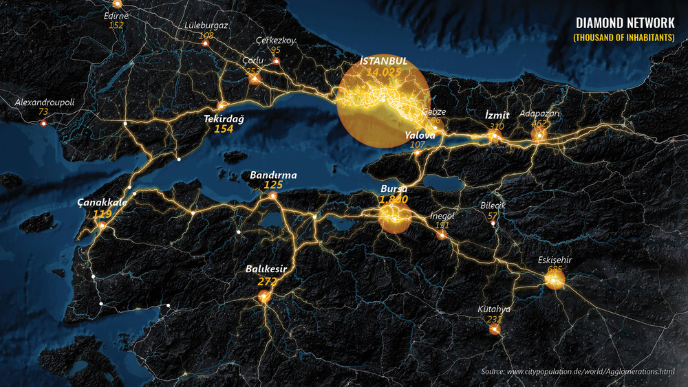
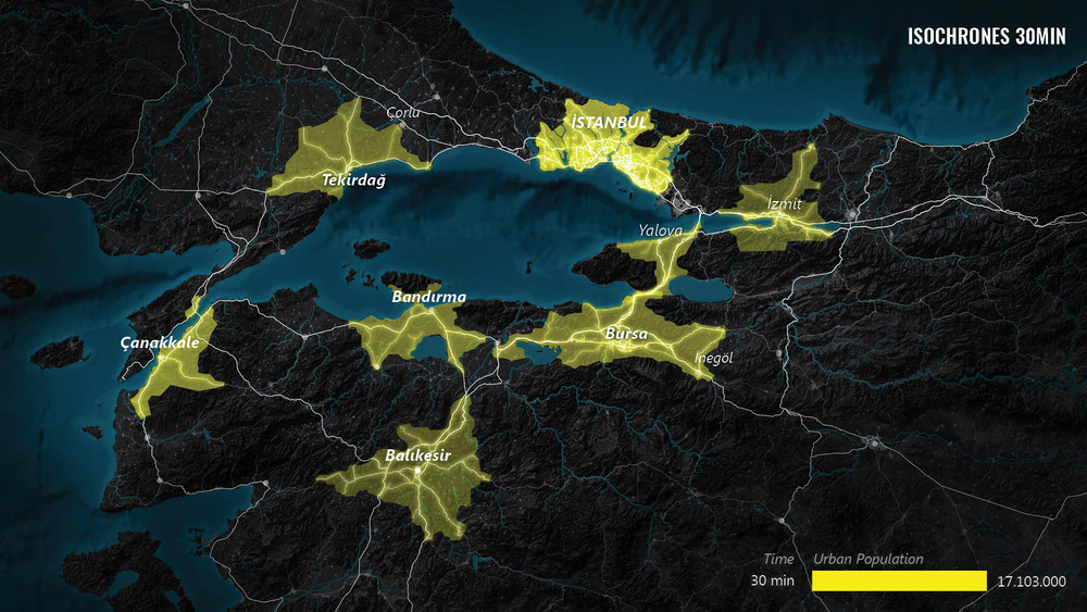
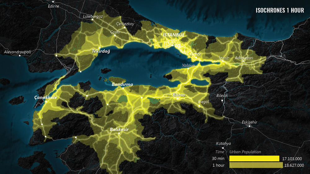
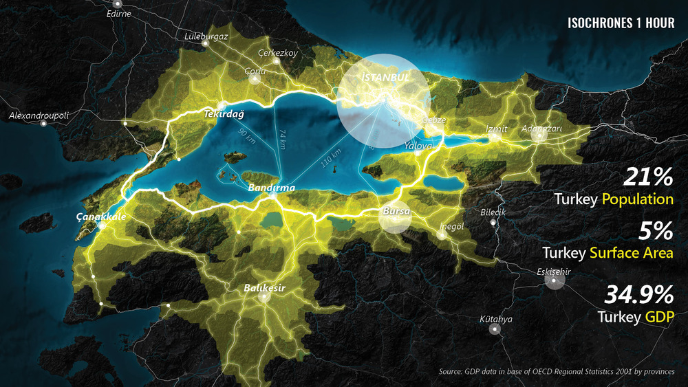
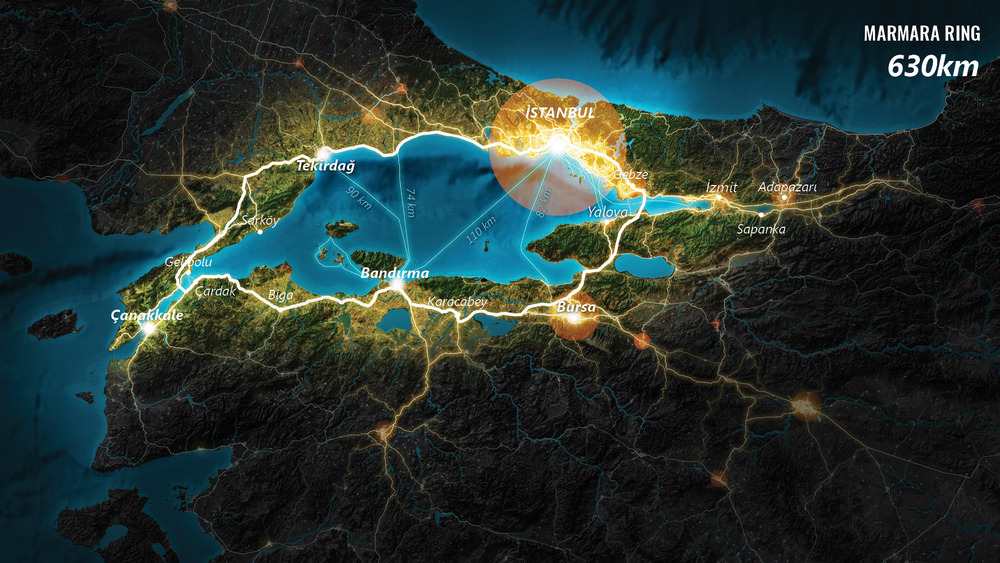
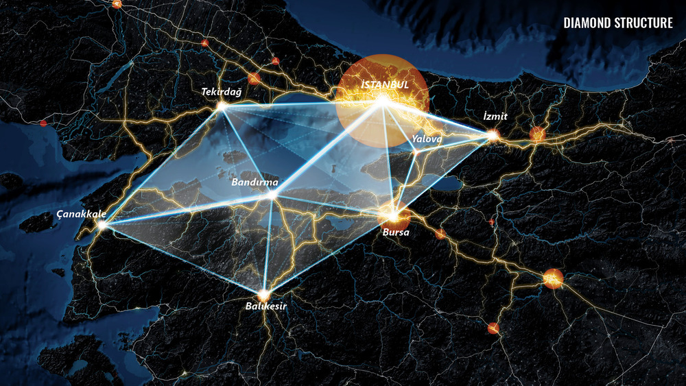
The Marmara Sea Diamond is an initiative presented by Fundacion Metropoli for the articulation of a global discourse about the landscapes of the Marmara Sea, alongside with a strategy to identify opportunities for Turkey.
The articulation of the Marmara Sea Dimond spells out a territory with greater capacity to respond to future global challenges of sustainability and competitiveness. Such a strategy reinforces the collective regional offering as well as the complementarities between very distinct but cooperative places. For Turkey, and for Istanbul, the Diamond will mean greater international visibility, increased ability to attract investment and innovation, and an augmented offering of high-quality services.
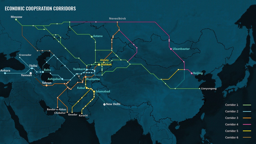
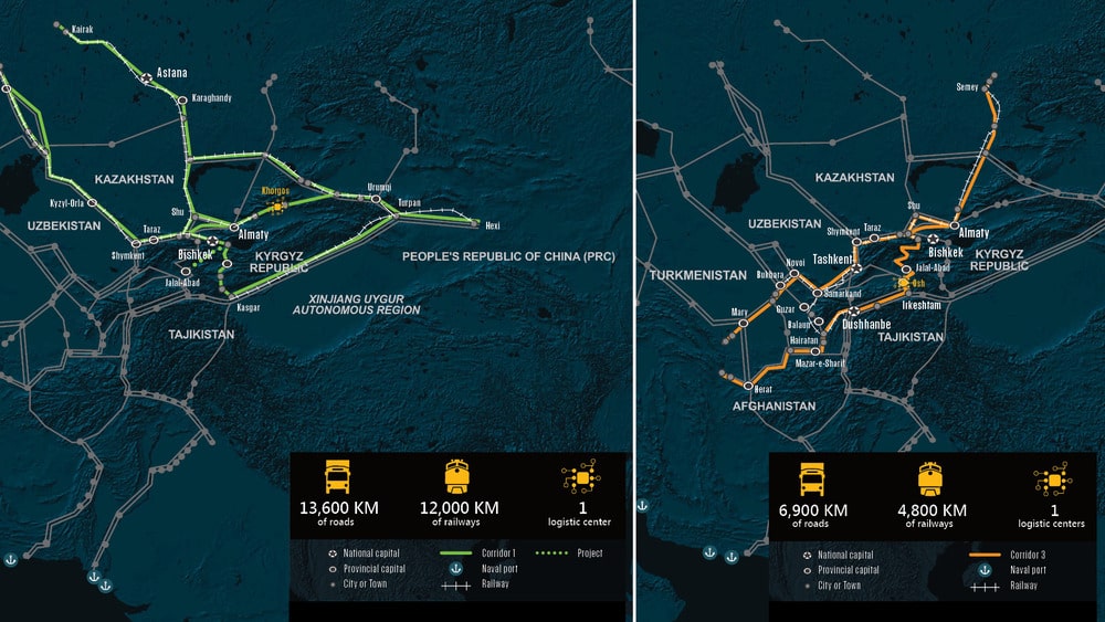
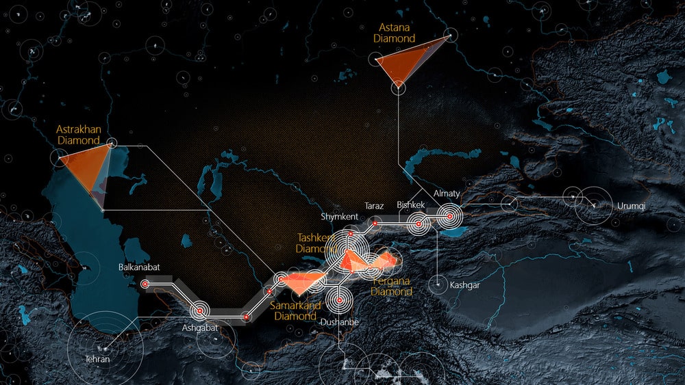
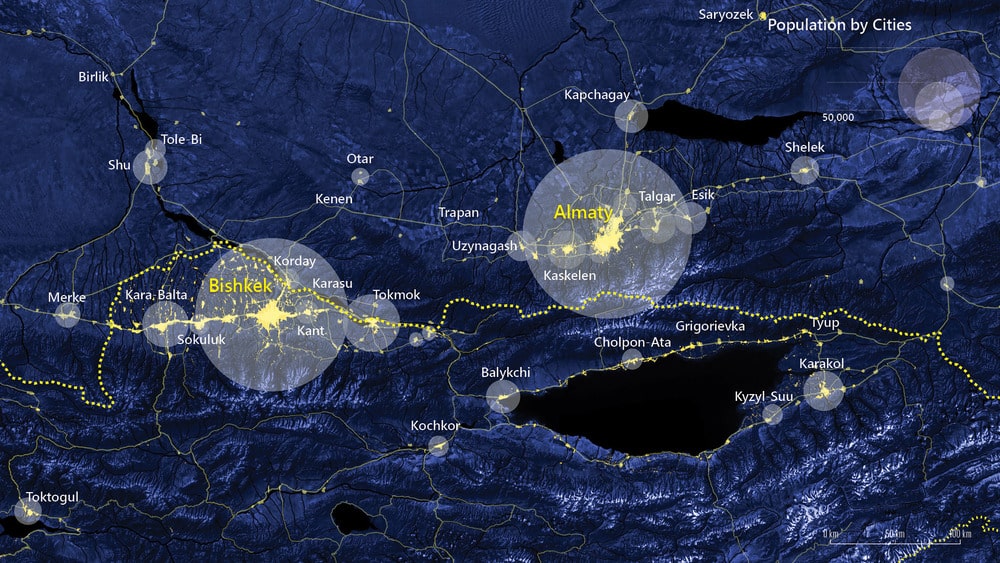
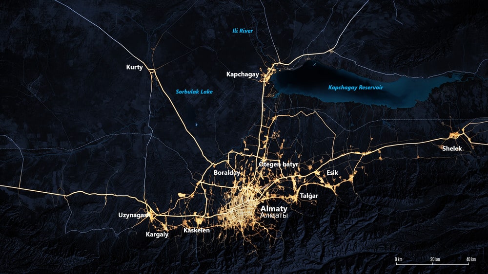
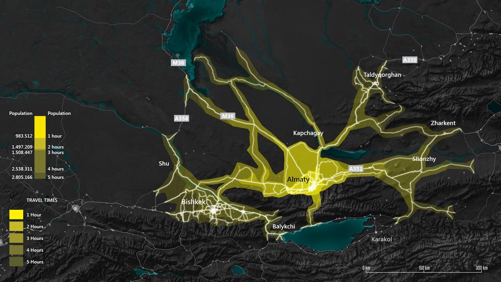
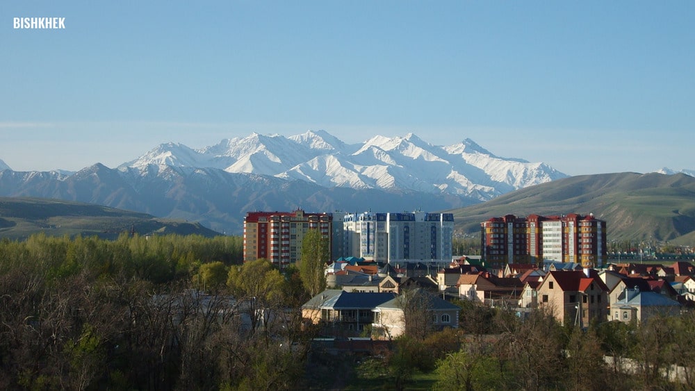
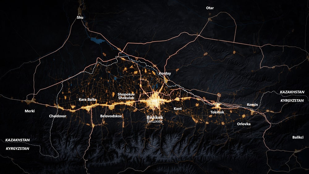
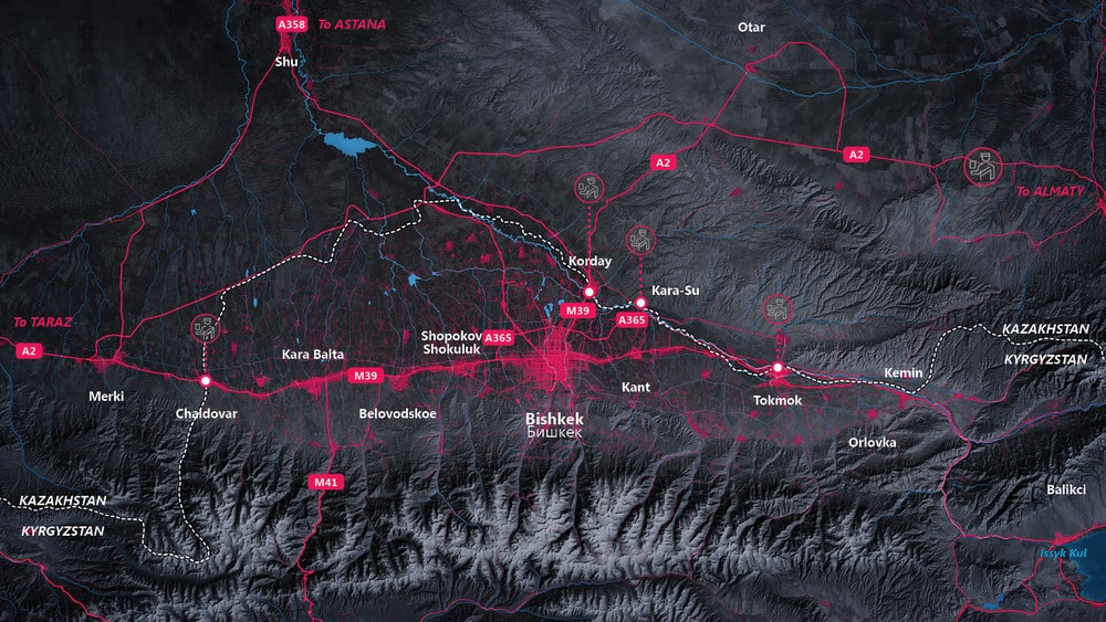
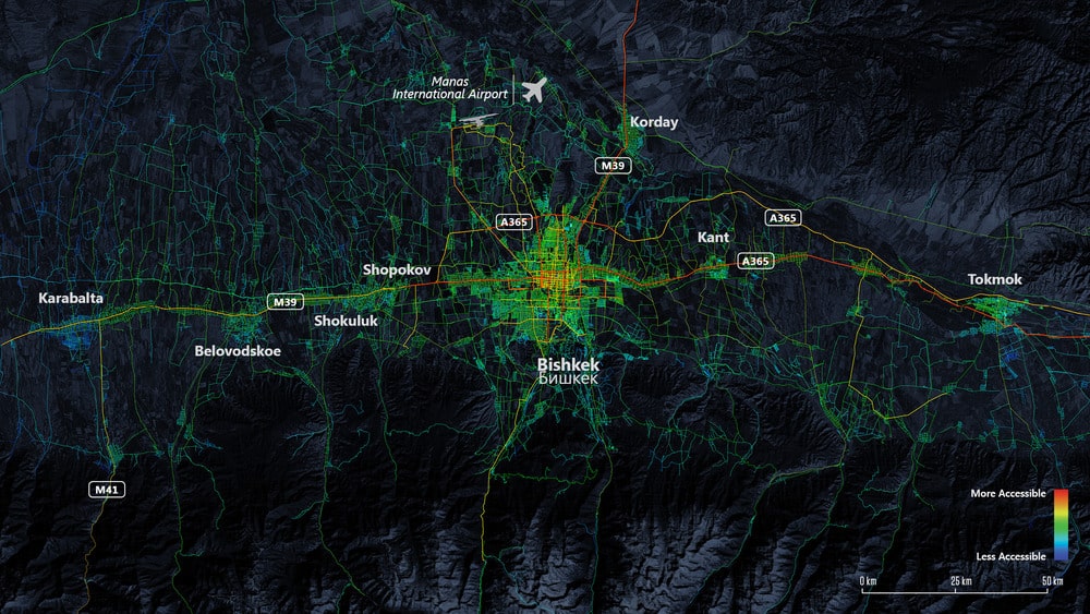
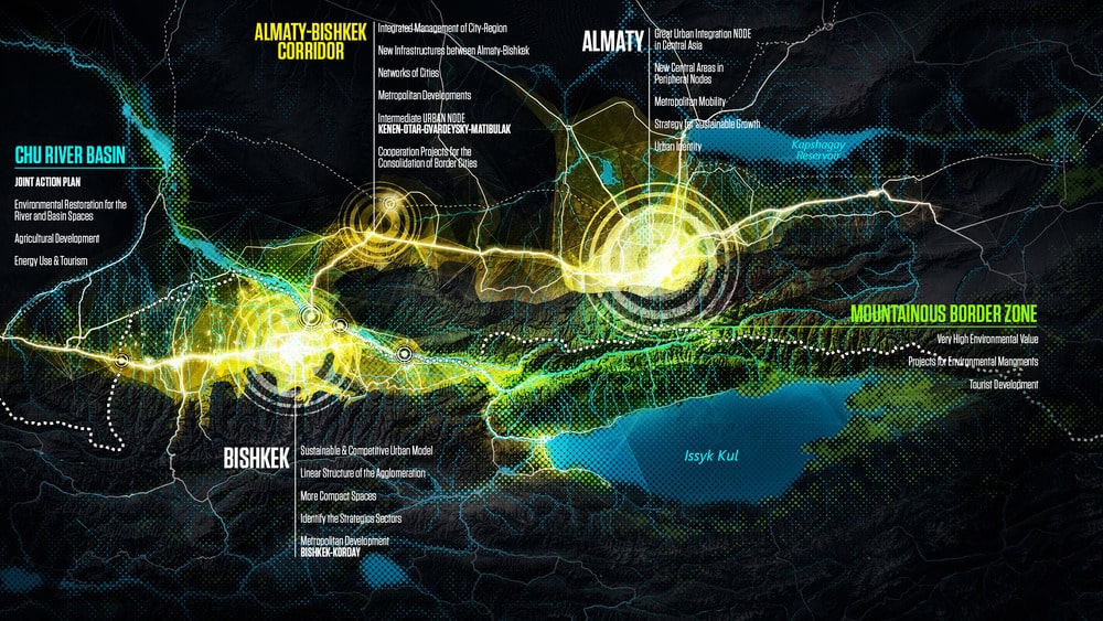
The main objective of the project “Almaty Bishkek Economic Corridor” is to create a vision for the future of the region and identify and design strategic projects with the capacity to accelerate innovation, economic development and competitiveness in the region through the construction of a polycentric urban system that triggers complementarity and interrelation between the main cities in Central Asia. “ABEC” is an opportunity for the regional context to lead the Central Asian Diamond, a territory with the natural capacity to become articulator between Europe and Asia. It is an economic space with great potential to grow and transform the economy of the region and its international positioning.
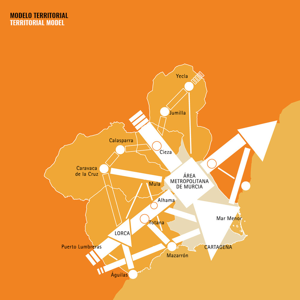
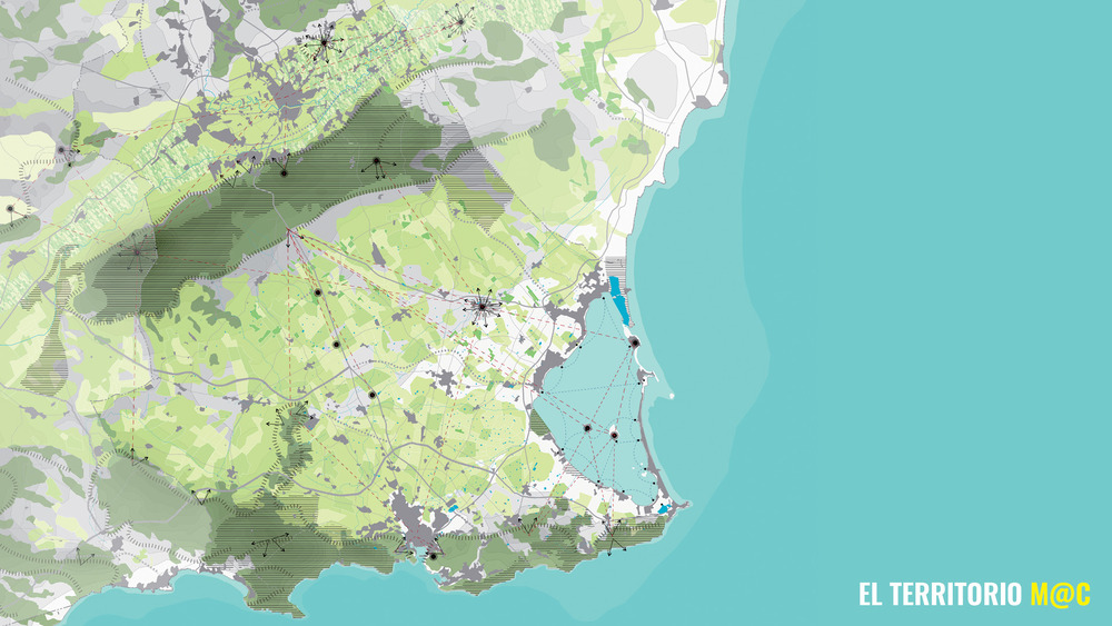
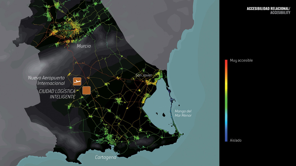
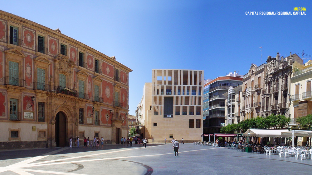
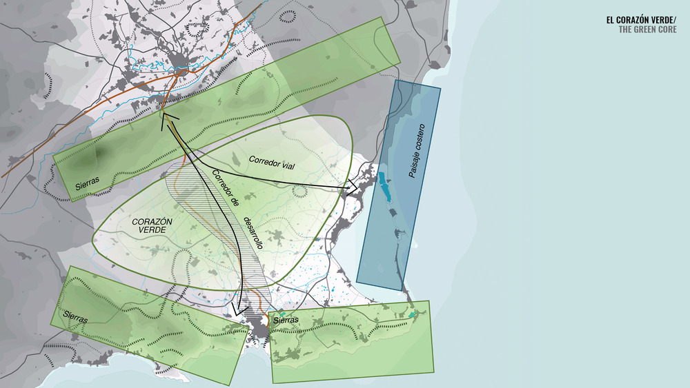
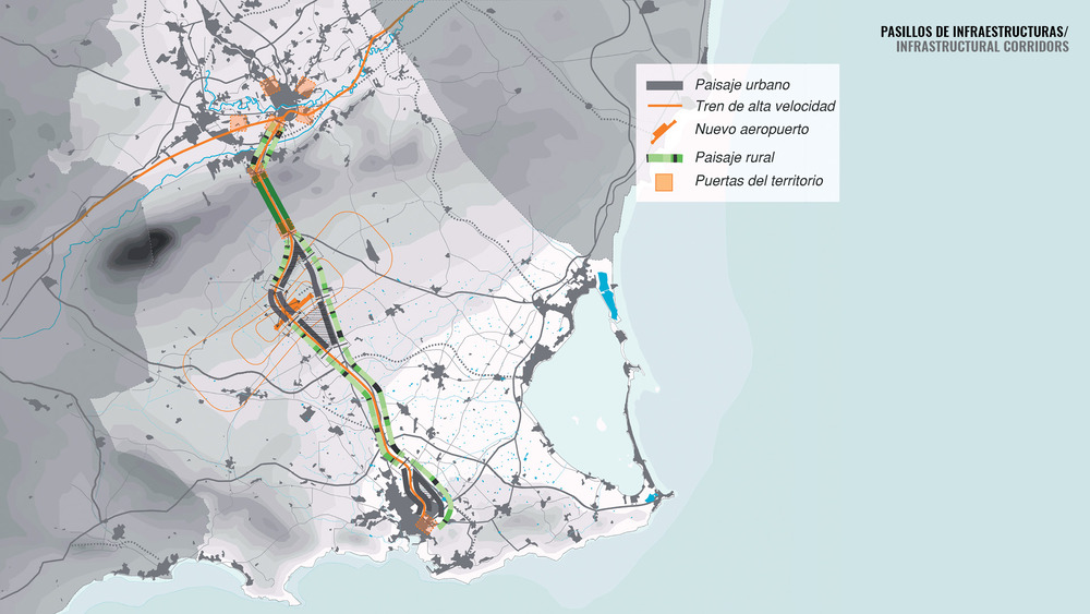
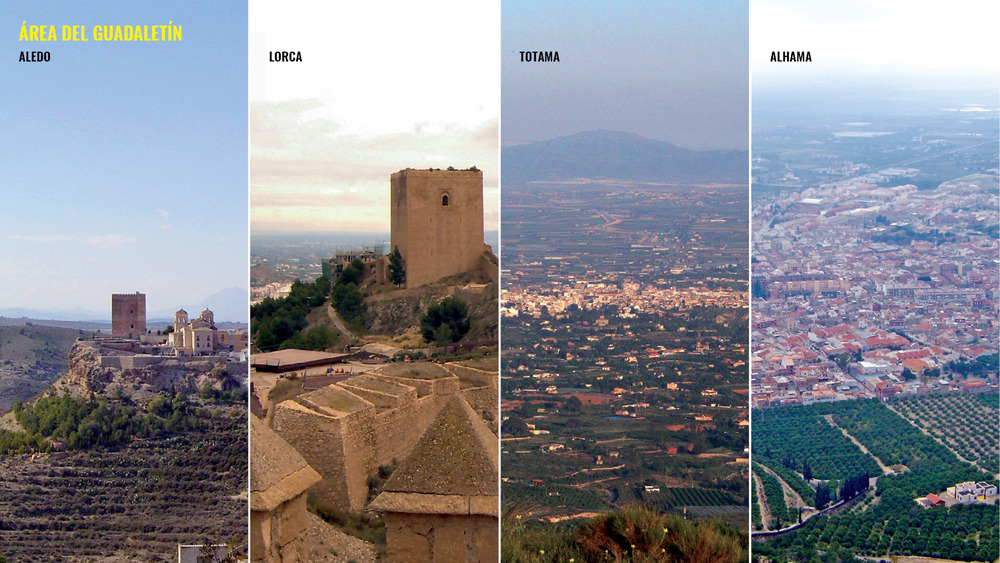
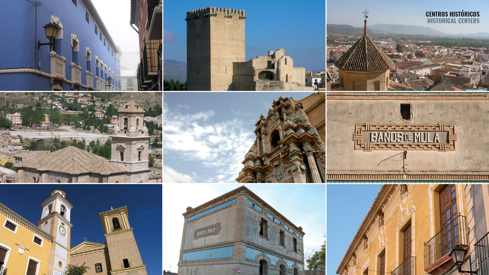
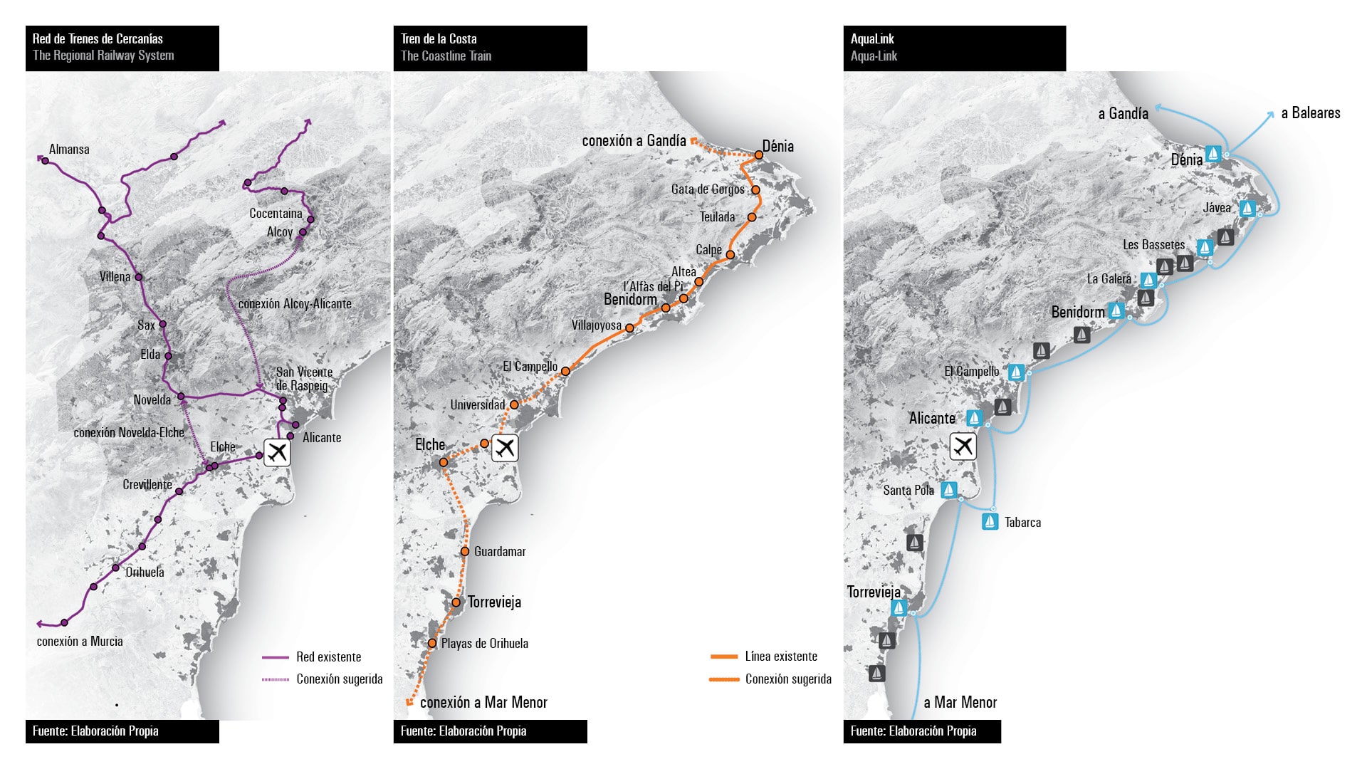
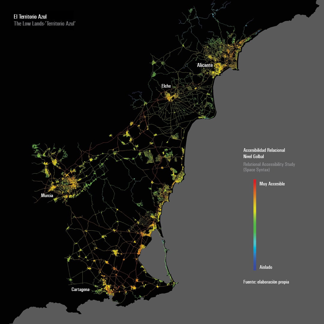
Murcia I+T outlines the major challenges facing the Region of Murcia in the future, and defines a proposal for a new territorial model and strategic orientations for regional planning policies. One of the most decisive projects is to consolidate the Murcia-Cartagena Axis (Territorio M@C) as a major integrated urban space. In recent years, the metropolitan area of Murcia and Cartagena grew to become the sixth-largest in Spain.
Overall, the Territorio M@C has tremendous development and regeneration potentials due to its increasing centrality on the Mediterranean coast. The development strategy of this sprawling area is to restructure the region into more concentrated polycentric networks connected by good quality public transport corridors, while protecting the orchards and preserving the green heart at the centre of the region. Efforts are made to attract a high-speed train station to both Murcia and Cartagena to boost the centrality of the region and its metropolitan areas. Another project is to create a multimodal transport interchange with an international airport, a high-speed rail station, and a logistic park, connected by motorway with Murcia, Cartagena, the Mar Menor and the rest of the coastal region.

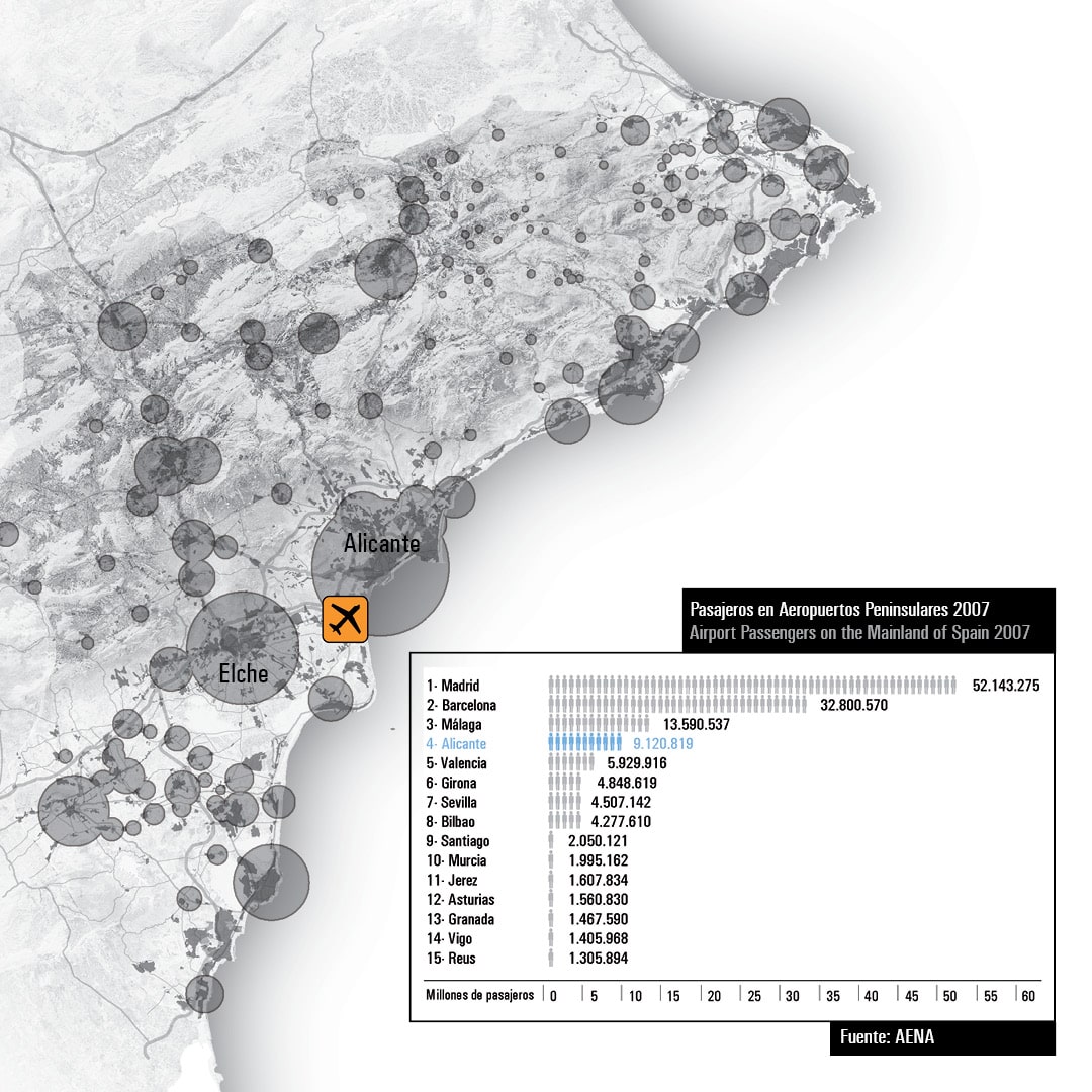
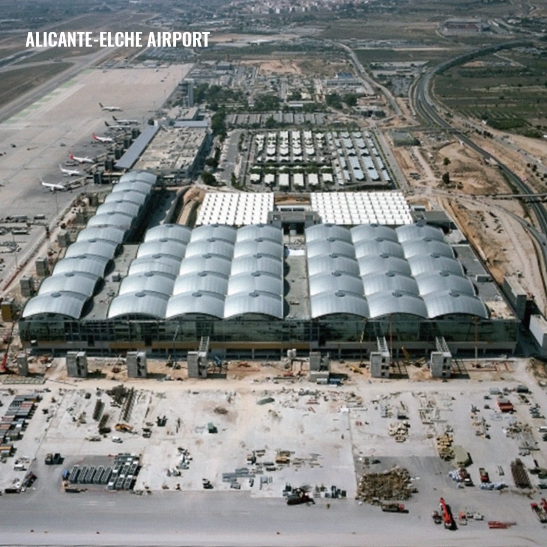
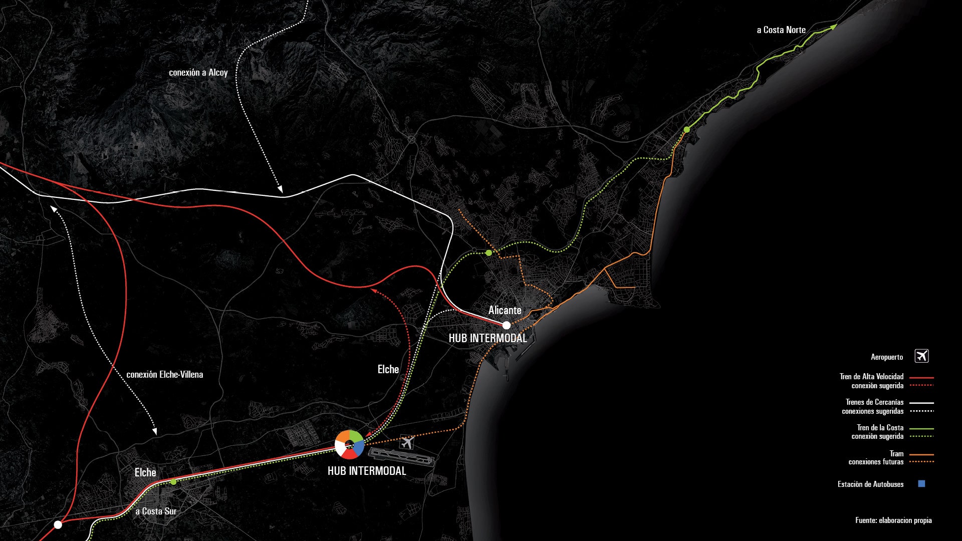
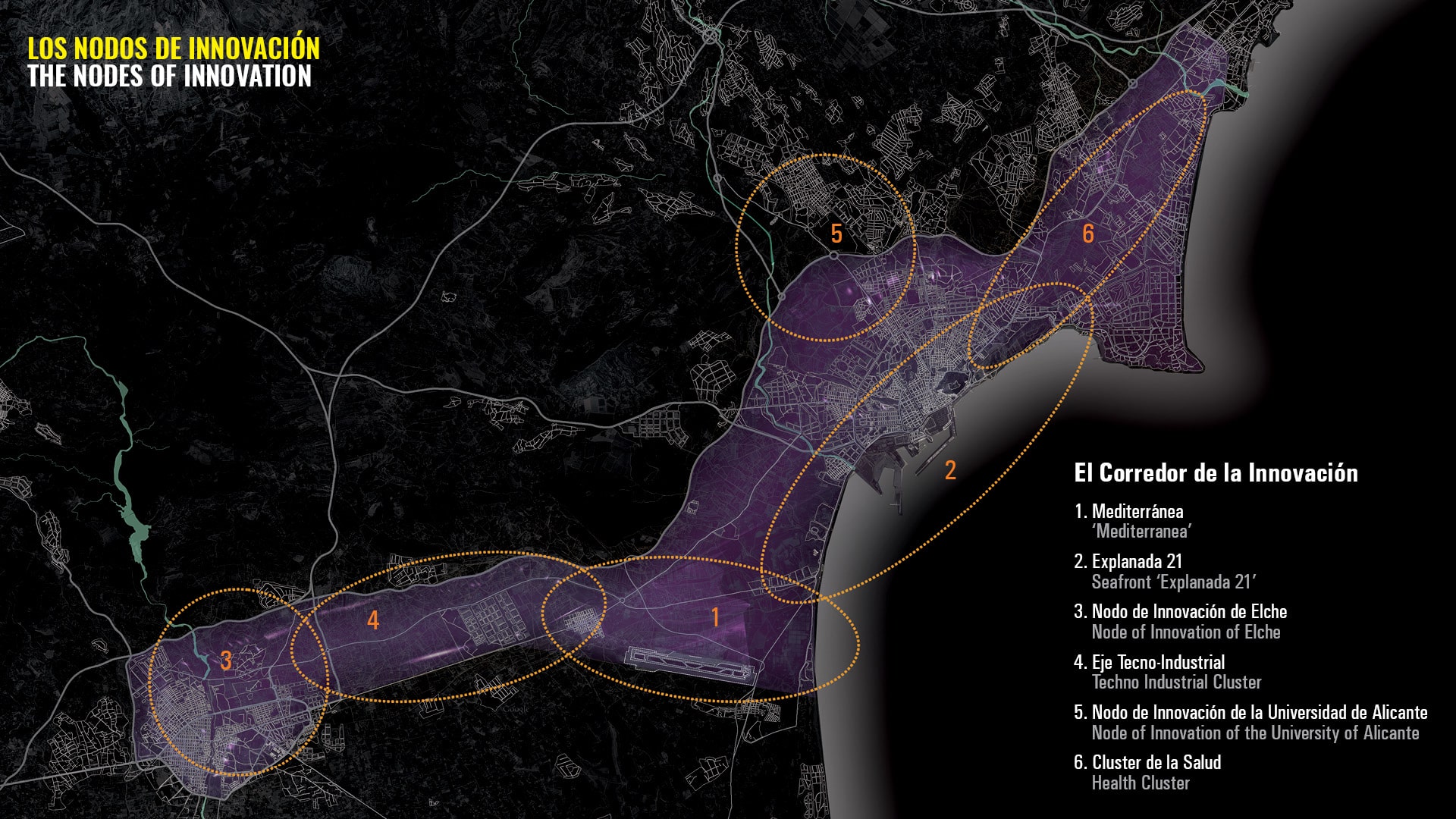
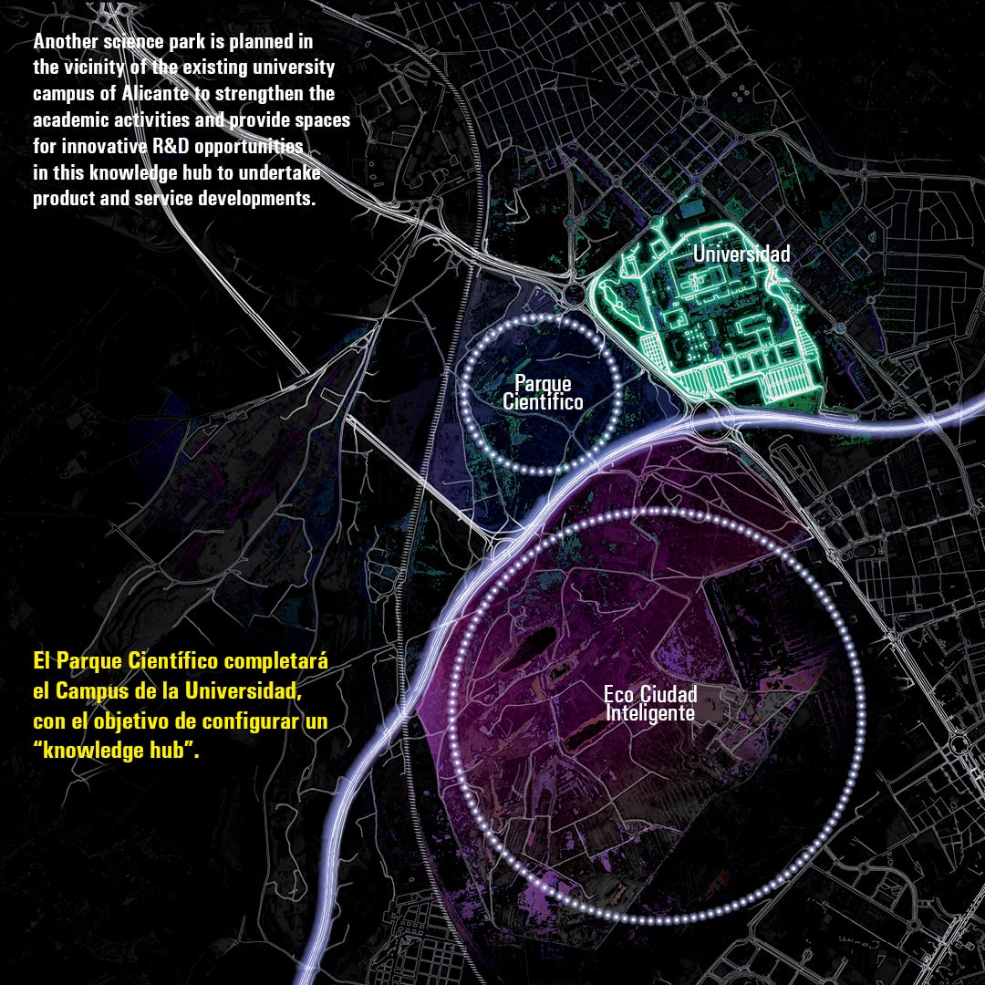
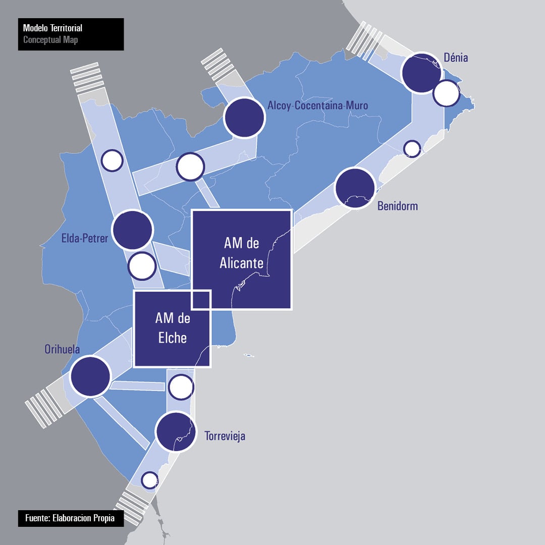
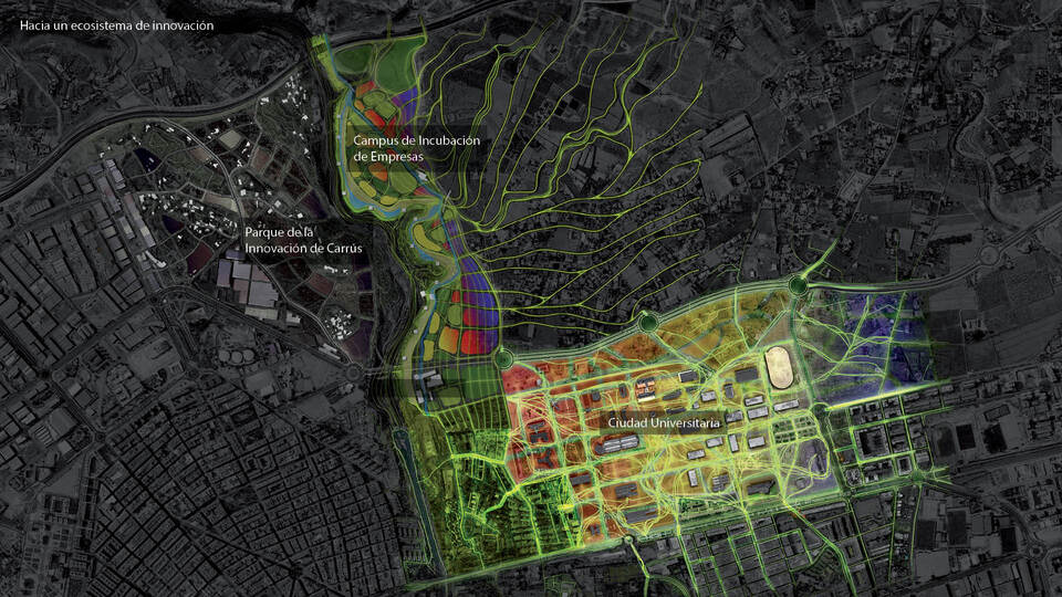
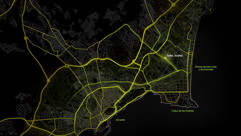
Alicante I + T is a territorial strategy to transform the Province of Alicante into an Ecosystem of Innovation.
Innovation Ecosystems arise in cities, or in more complex territories organized as networks of cities, or cities-region. They are environments where wealth is generated, mainly through the innovation and applications of scientific discoveries, but also through the ideas and new visions proposed by the most creative people in our society. Cities are privileged places where this creativity is liberated and nourished and where we can best channel the efforts leading to sustainable development. Creativity and innovation are essential for the sustainable development of cities and territories.
At regional level, in the more developed countries there is an increasingly close symbiosis between the urban and the rural. In this context, the strategy of converting the Province of Alicante into an Innovation Ecosystem requires a more coherent integration between the design of cities and the treatment of rural and natural areas. Urban Ecosystems of Innovation can be developed at the scale of entire regional spaces, at the scale of whole cities, or at the scale of concrete innovation nodes that are related forming clusters with other innovative spaces, thus contributing to the evolution, transformation and development of the Ecosystems of Innovation. This territorial strategy for the Province of Alicante incorporates that kind of creative and complex interaction that our territory must respond in the coming decades.

Cities
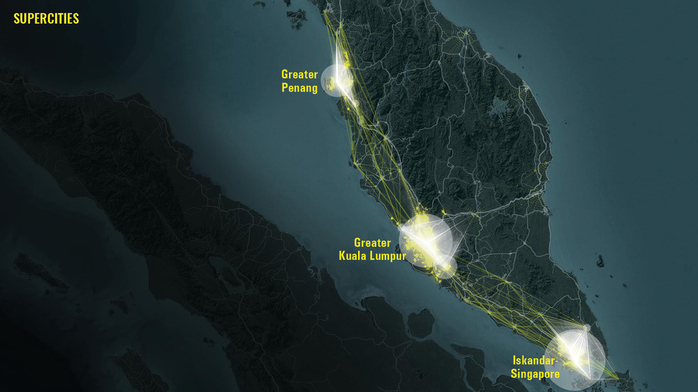
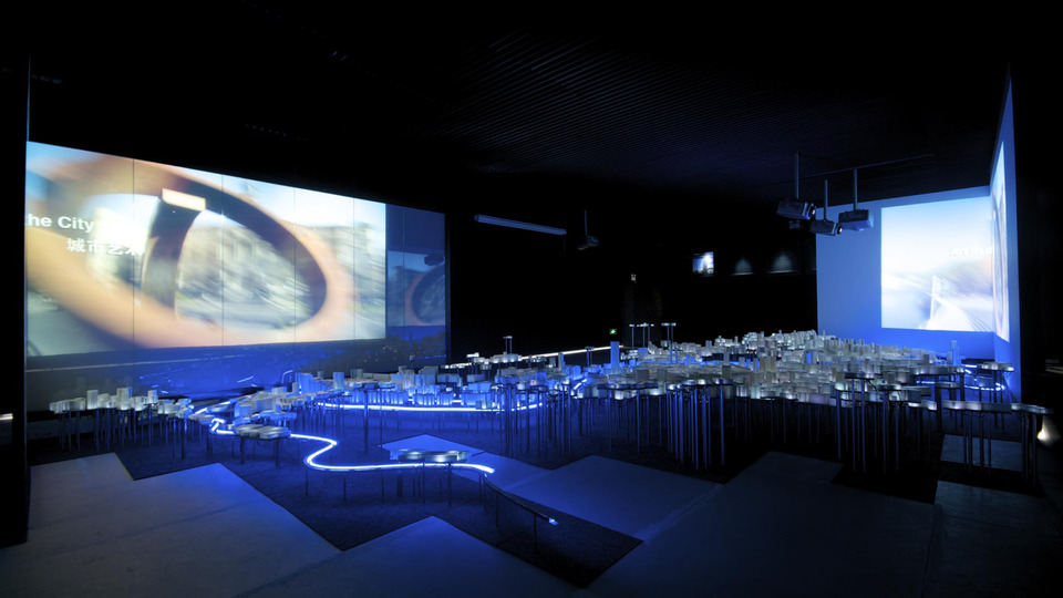
Designing cities of the future requires addressing significant challenges like fostering social cohesion, protecting ecosystems, and responding to climate change. Cities often face these issues with limited resources, short governance cycles, and restricted political influence. In response, “SuperCities” have emerged—unique cities driven by leadership, creativity, and shared vision, which are drawing people in and launching impactful social projects. Metropoli collaborates with cities worldwide to help them uncover their unique identity and strengths. By identifying their core qualities, cities can define their urban profiles, activate cooperative networks, and build projects that reflect their distinctive character and aspirations.
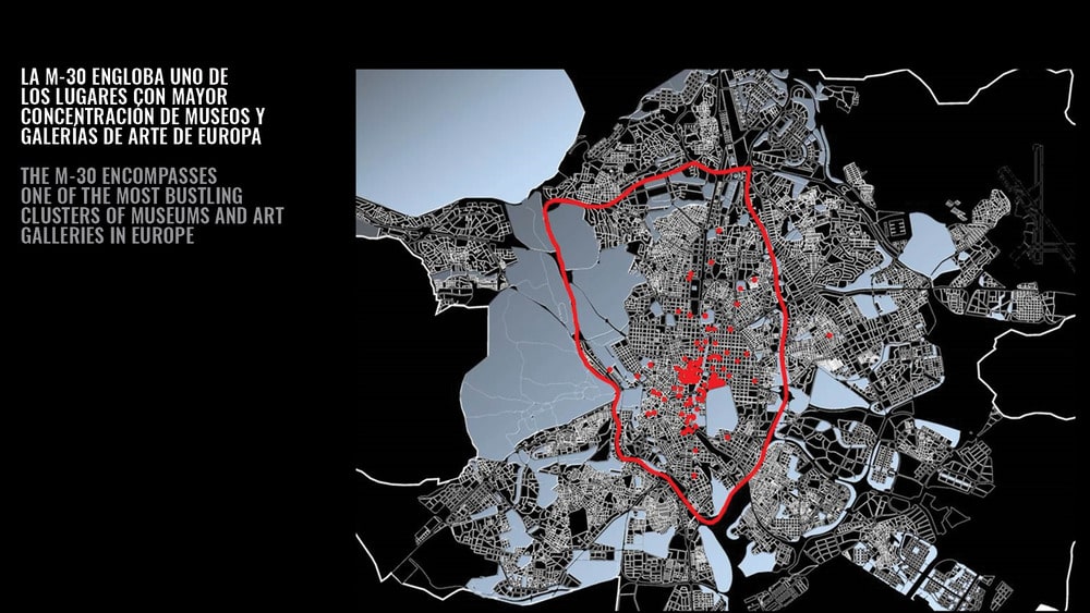
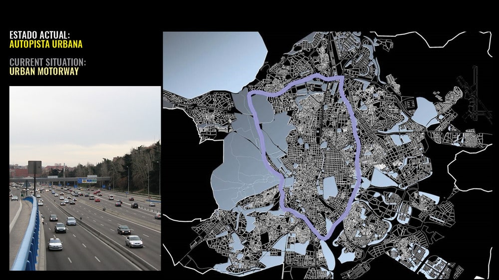
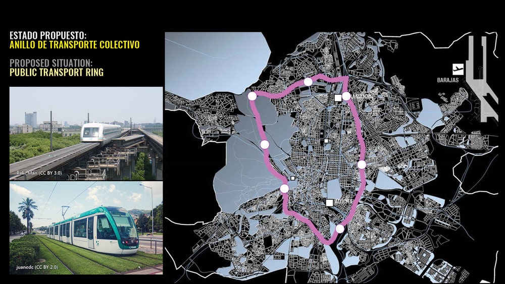
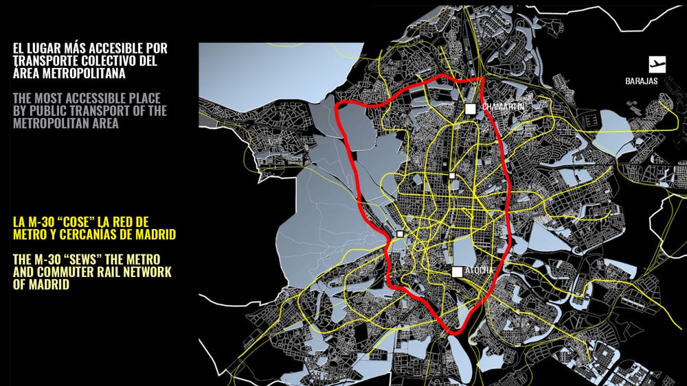
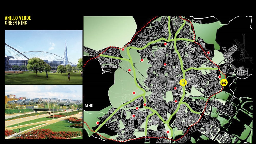
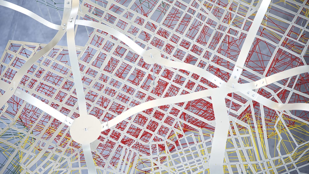
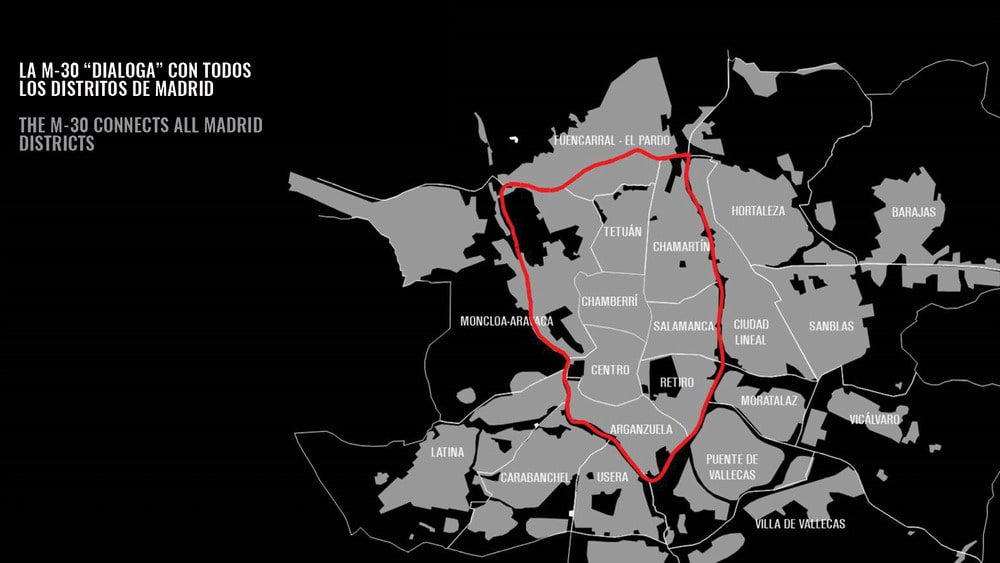
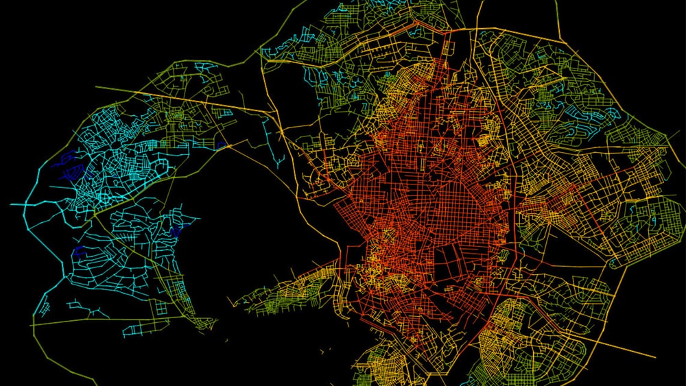
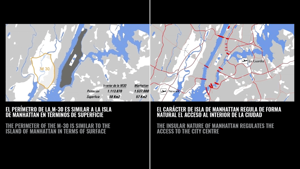
Applying the Proyecto Cities “Cluster of Excellence” methodology to Madrid, Fundación Metropoli identified that the existing M-30 ring expressway is a critical urban element around which a coherent “Proyecto Ciudad” (city-wide project) could be articulated. The M-30 is about 34 kilometres long, and defines the centre of the city of Madrid. This almond-shaped space is really an unpolished diamond within which all the different Components of Excellence of the Capital of Spain are located.
The proposal is to transform the M-30 into an urban boulevard (BM-30) with radial connections to the M-40 (the second ring expressway of Madrid). The M-30 and the radial connections will become the major green and infrastructural axes for Madrid, a city of Boulevards. In addition, the initiative identified the existing Abroñigal Freight Terminal, about 200 hectares, as a strategic location, and proposes its redevelopment into a “City of Knowledge”.

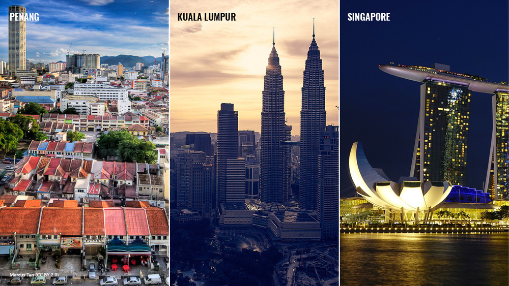
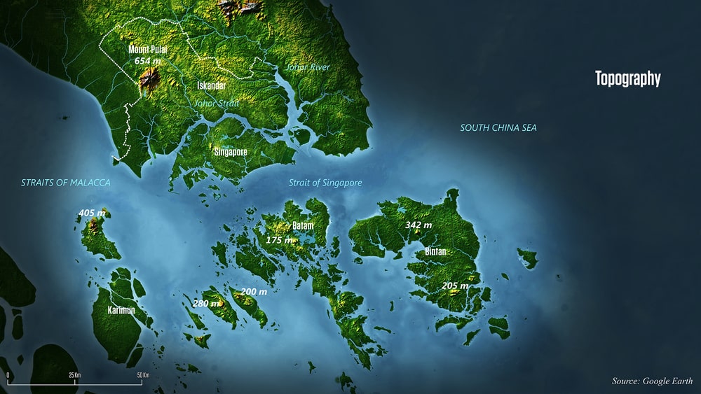
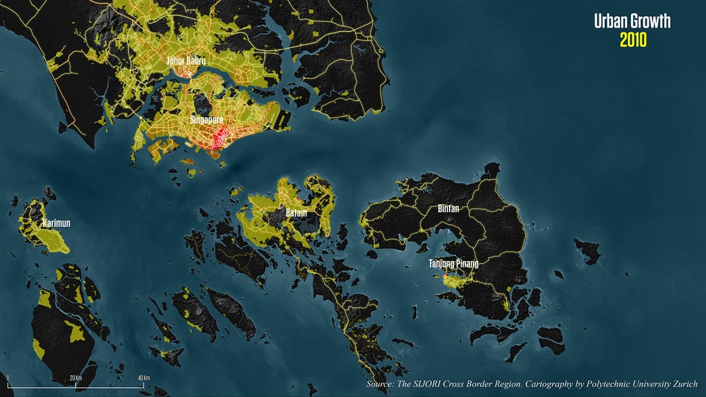
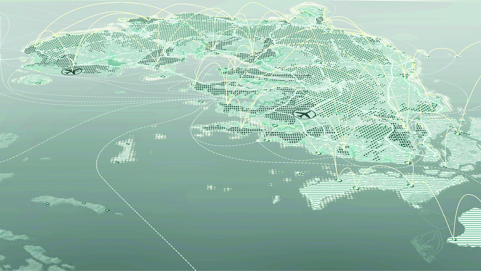
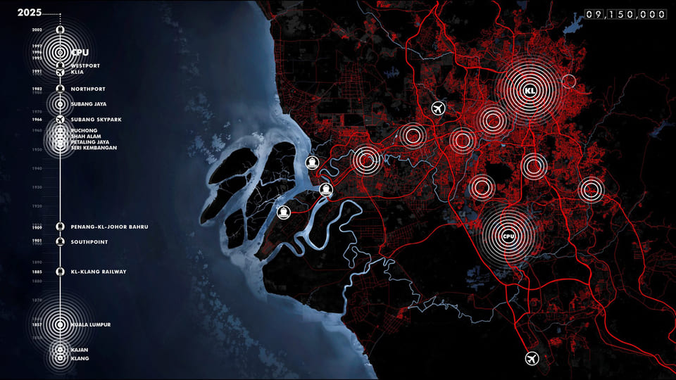
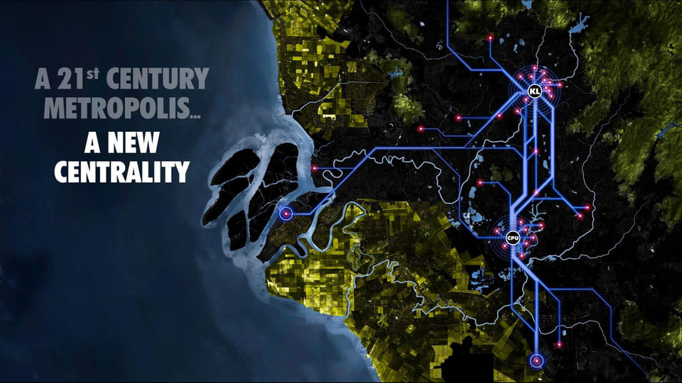
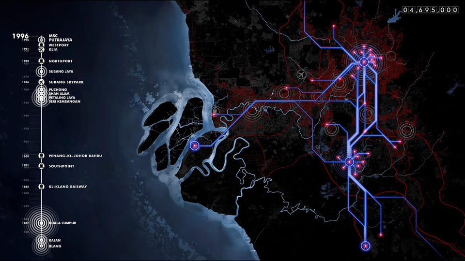
ASEAN Super City proposes to consolidate a process of urban and regional integration for the location of the most advanced economic sectors, those linked to the so-called knowledge economy, and to strengthen regional areas that today present lesser economic development.The expansion of cities and metropolitan areas is giving rise to regional integration processes, new territorial organizations that are sometimes called Super Cities or Urban Diamonds, which are becoming the new economic engine at world level. These large urbanized areas are being formed from the spatial expansion of geographically connected metropolitan areas, the union of regions with high population density, and the integration of large markets.
The development of this Super City will allow increased interconnectivity and interactions, and create new forms of cooperation between cities and between them and their surrounding territories to achieve a substantial improvement in competitiveness. The Super City is more than the sum of each of its separate components. It is an area with a greater diversity of opportunities and geographical contexts that generate new possibilities to expand economic development processes, the dimension of regional productive cluster. Sectorial and territorial interaction will configure more integrated economic, social and environmental strategies.

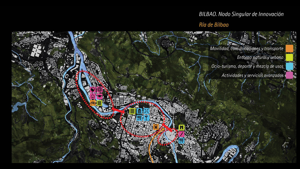
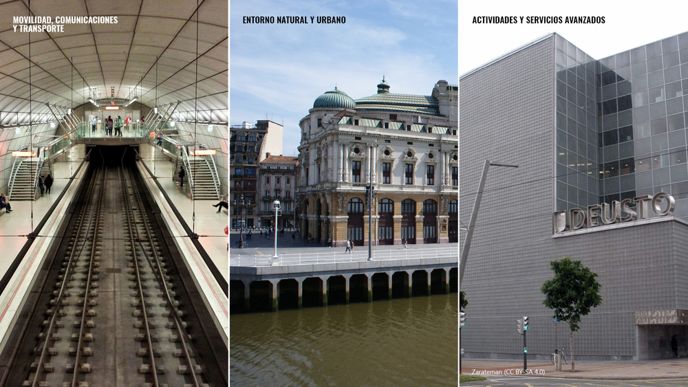
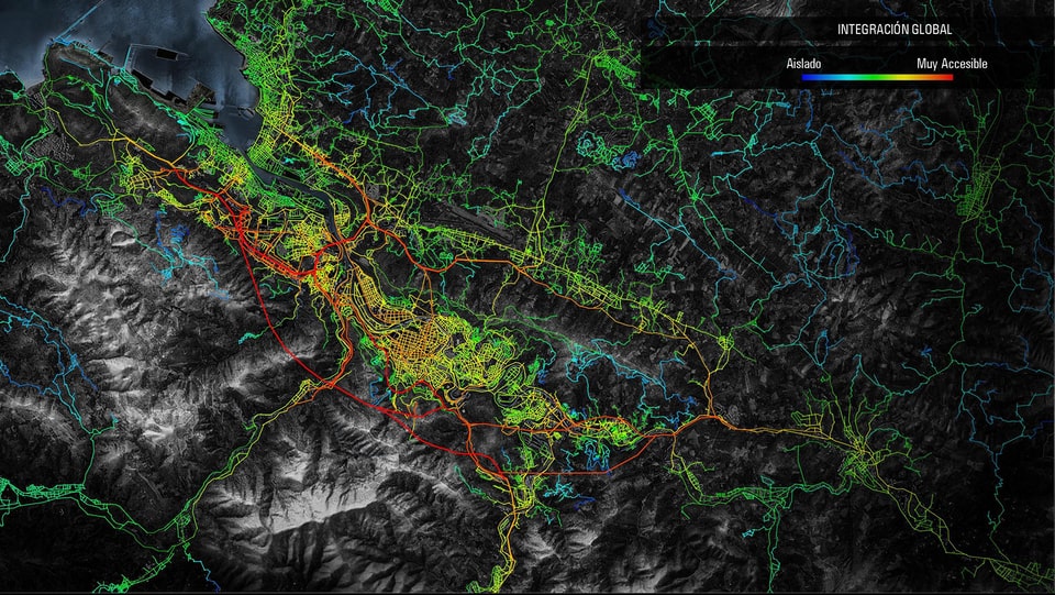
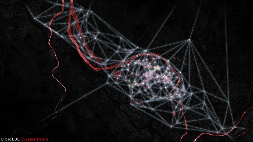
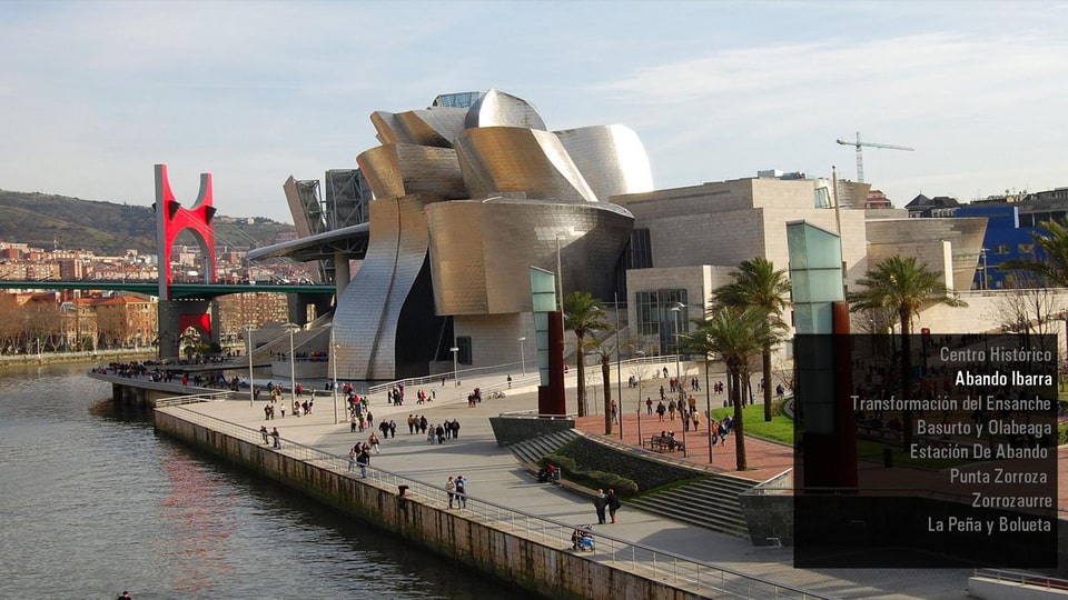
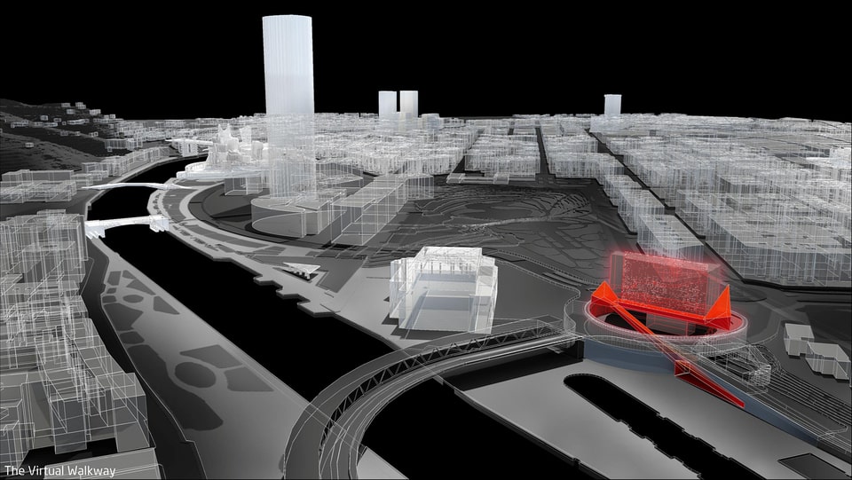
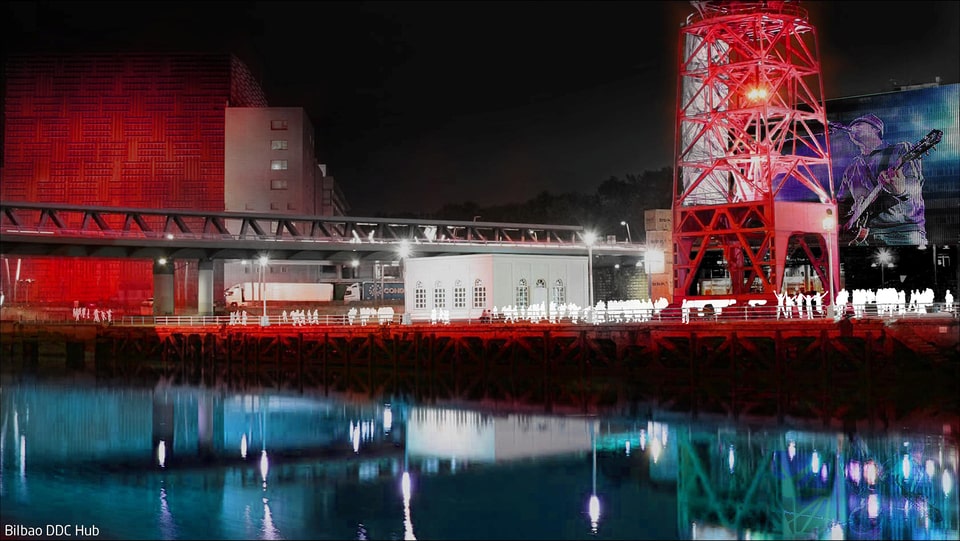
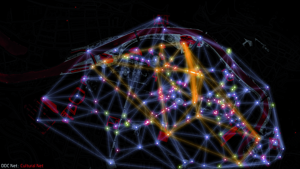
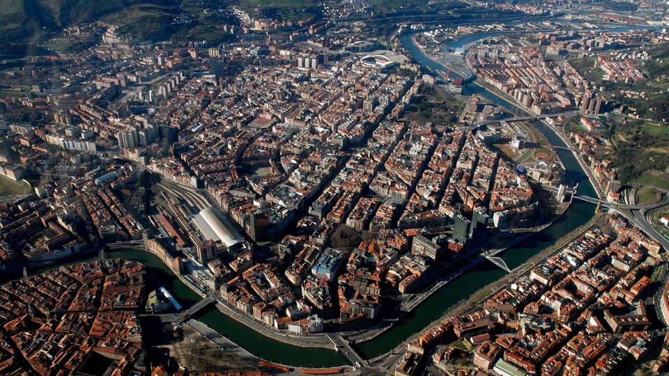
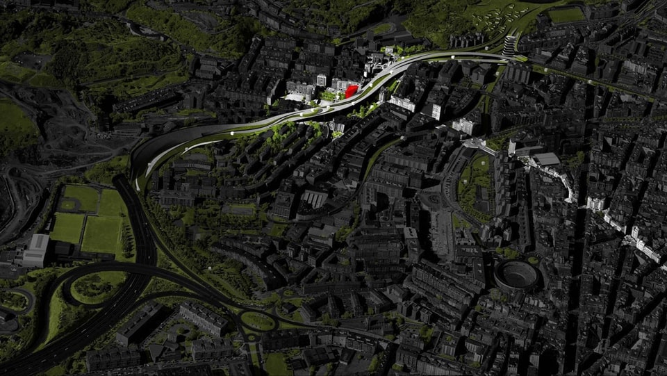
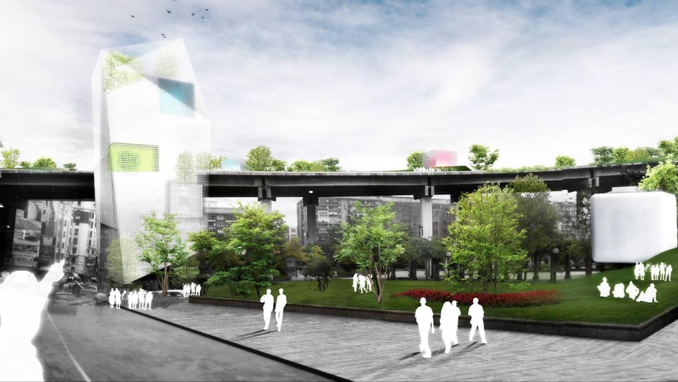
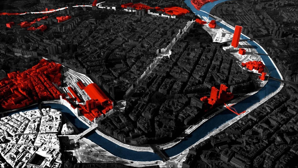
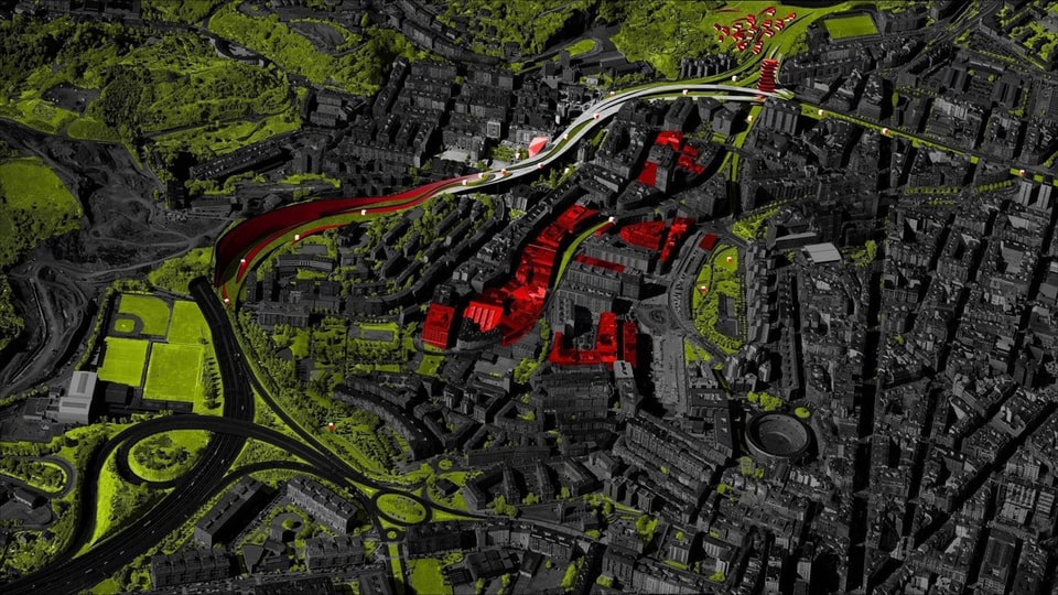
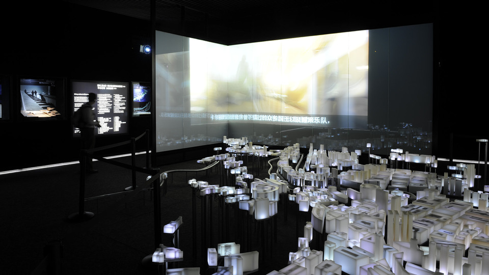
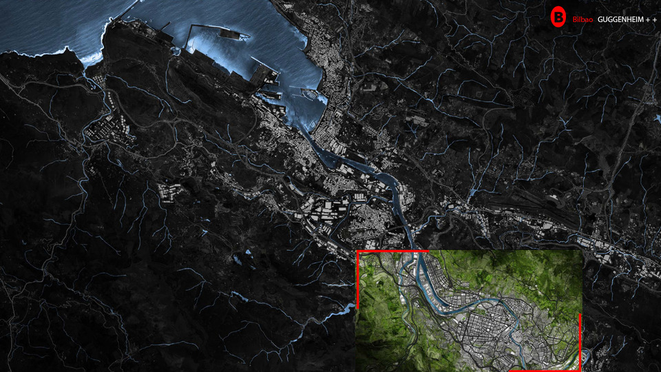
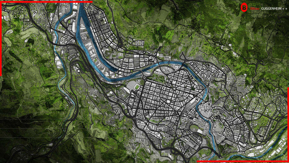
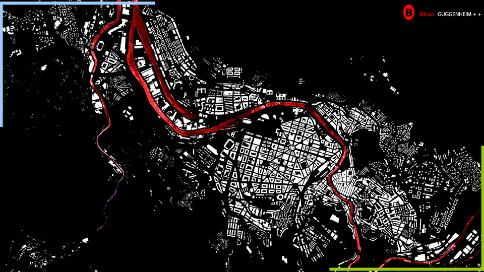
Bilbao Next is a Strategic Urban Leadership Program of the city of Bilbao. It is based on the success factors associated with the incredible urban transformation that Bilbao has undergone in the last 25 years, in order to offer a new impetus to the city and the Basque Country, preparing its transition towards the development of the knowledge economy. Bilbao has experienced an industrial revolution and a subsequent urban revolution. In the coming years Bilbao can face a new revolution: the revolution of talent and the creative economy.
This project is part of the identification of spaces with greater capacity for innovation in the most central places of the city of Bilbao and uses the components of excellence of the revolution as physical spaces to support creative activities linked to the world of digital design and culture. Key to the future of Bilbao is understanding the competitve advantages associated with the city at various scales. Based on geographic, political and cultural identities, the new scale of Bilbao transcends the municipal and metropolitan boundaries to align it´s urban model at the regional or even mega regional scale. The new coherency helps to position Bilbao as a strategic node within traditional views of the European context.

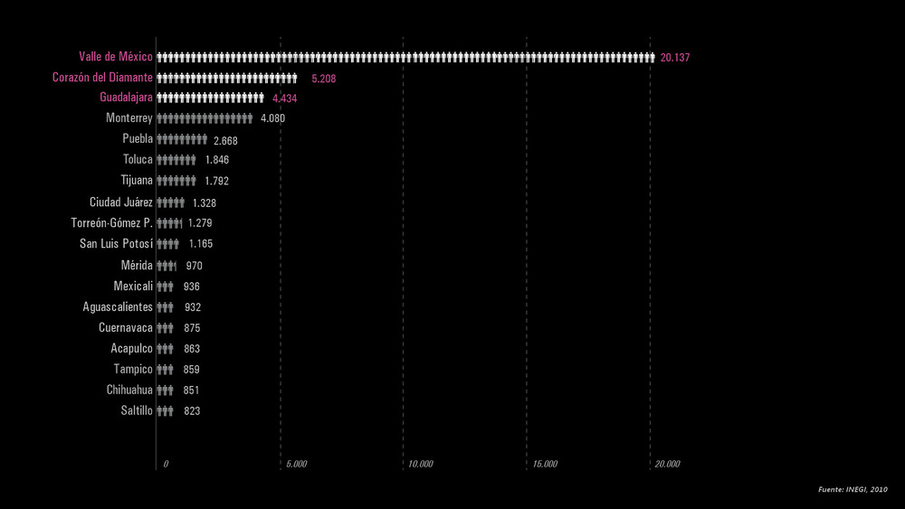
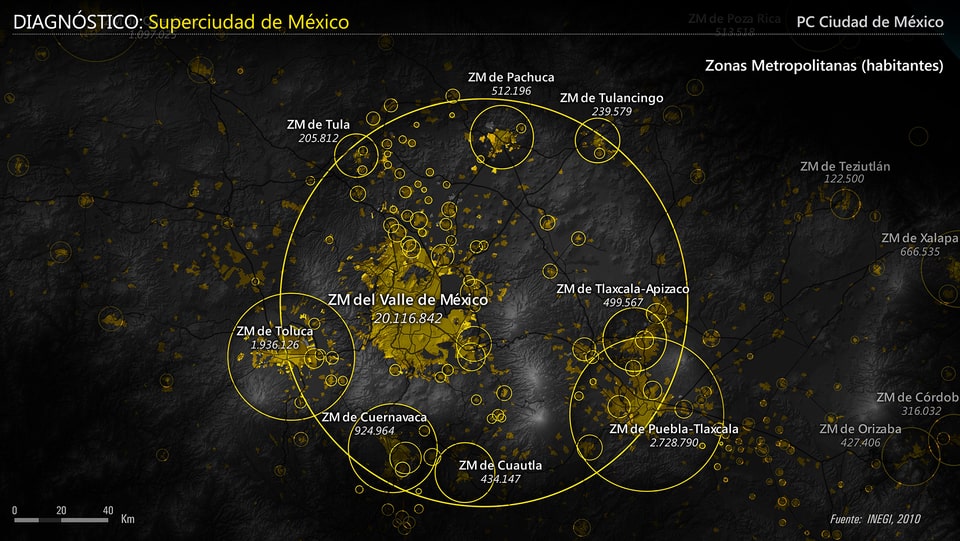
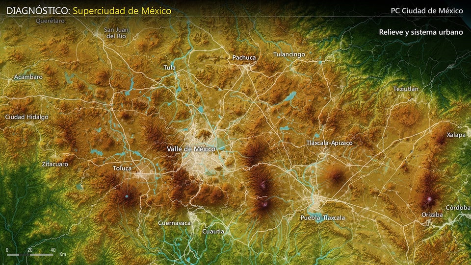
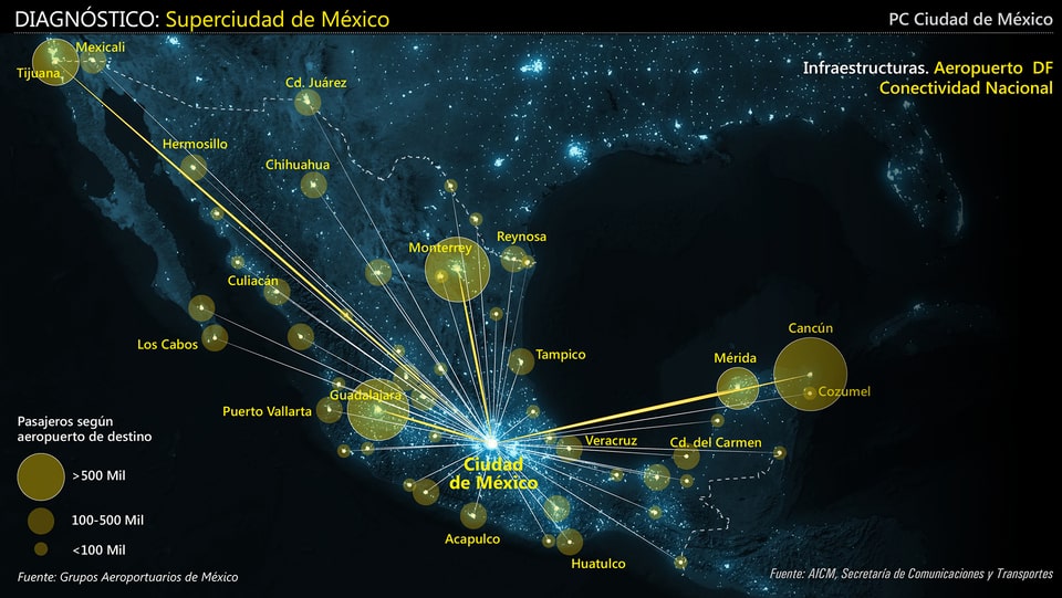
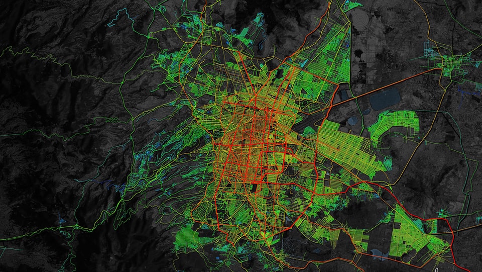
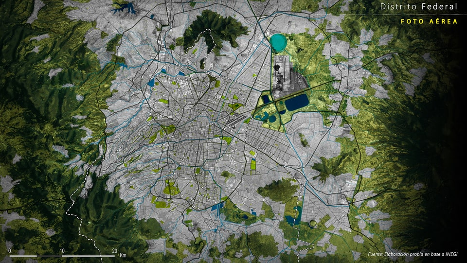
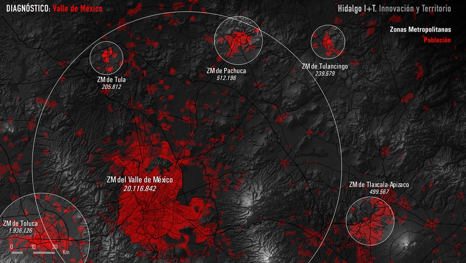
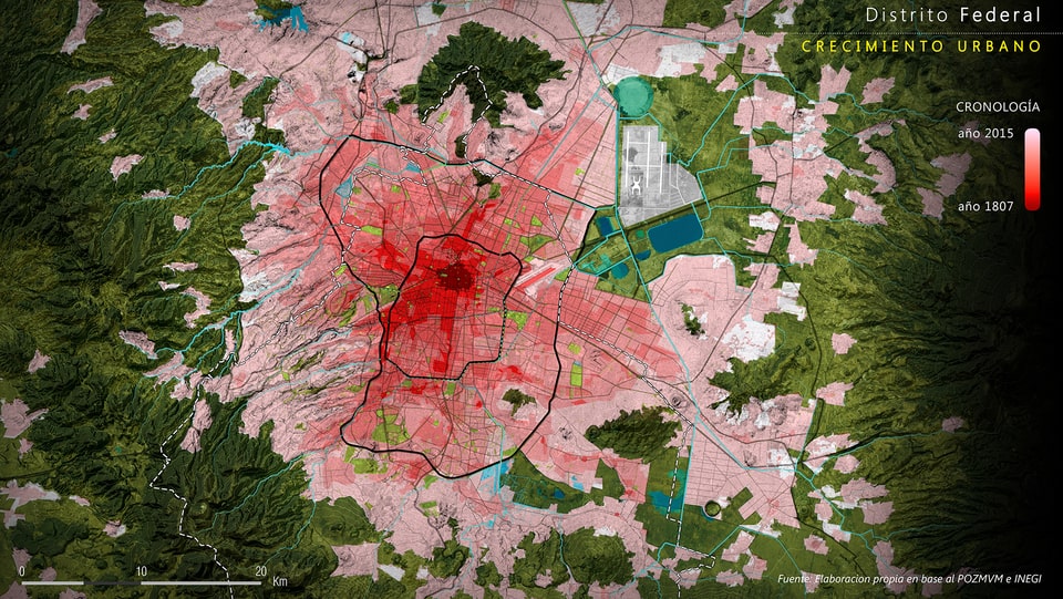
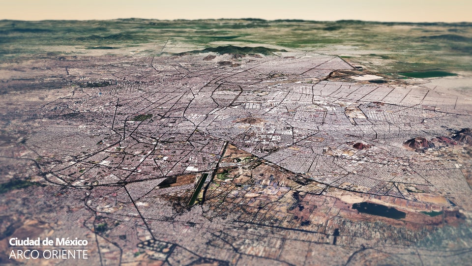
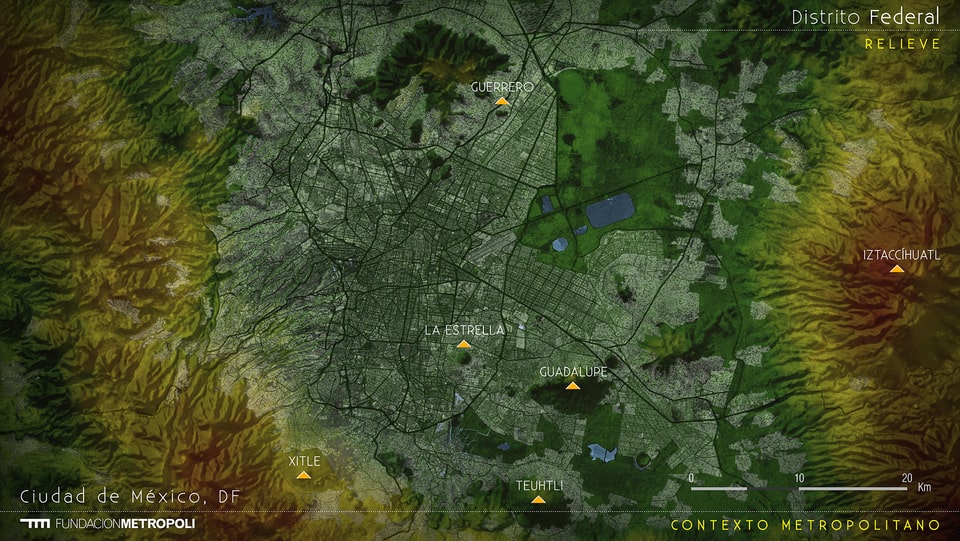
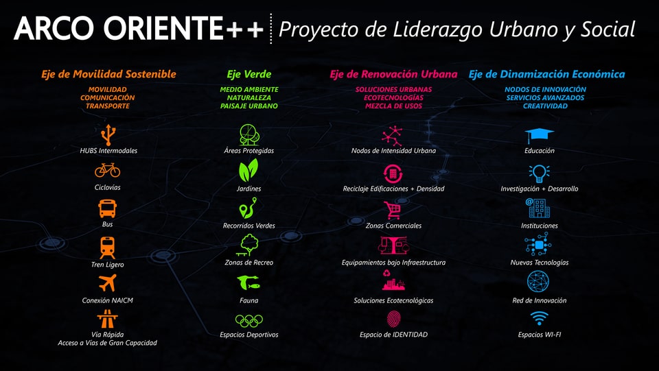
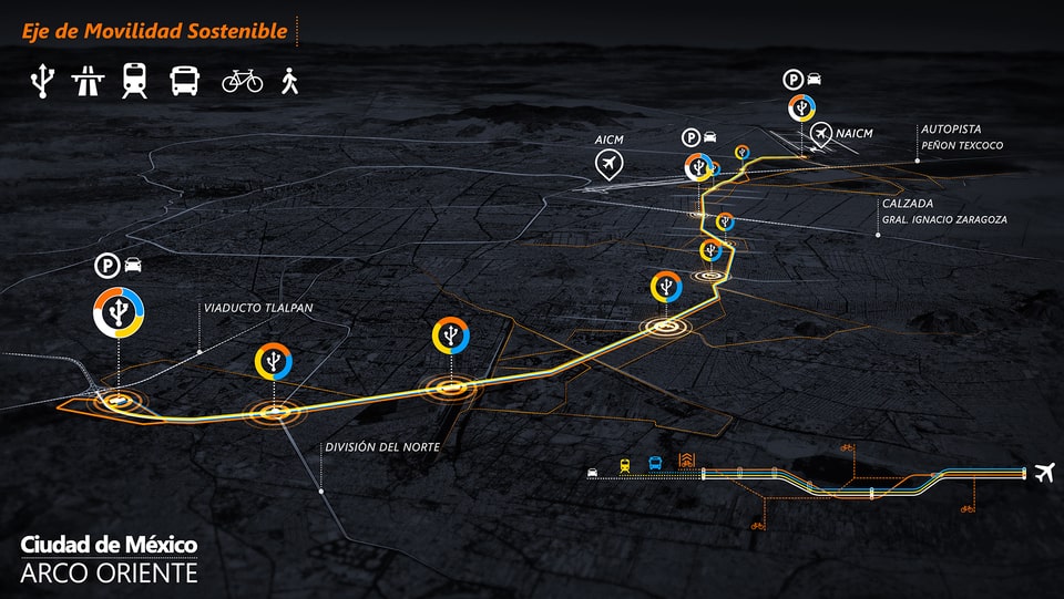
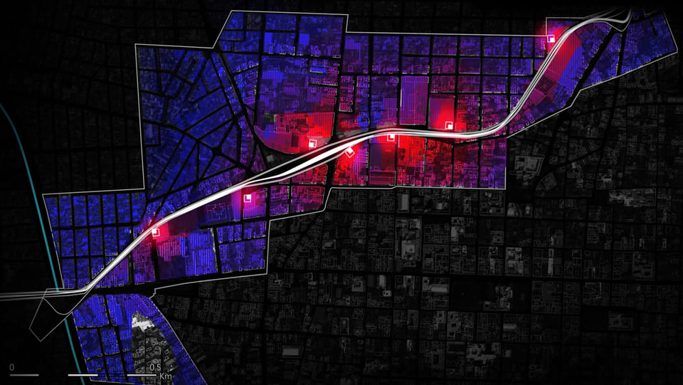
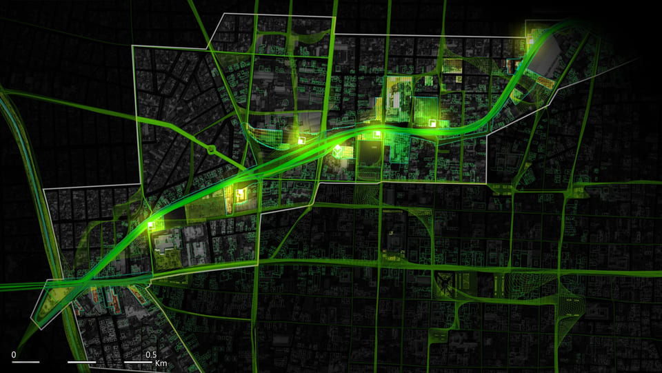
With an estimated population of 21 million people in 2010 the Metropolitan Area of the Valley of Mexico (ZMVM) is one of the most populated metropolis of the planet. The fundamental challenge of the ZMVM is how to ensure urban development orderly, compact and sustainable that allows its inhabitants to continue enjoying a high level quality of life. The social integration, citizen security, mobility and sustainability are permanent challenges which require an approximation to the city to be resolved effectively through a coordinated City Project.
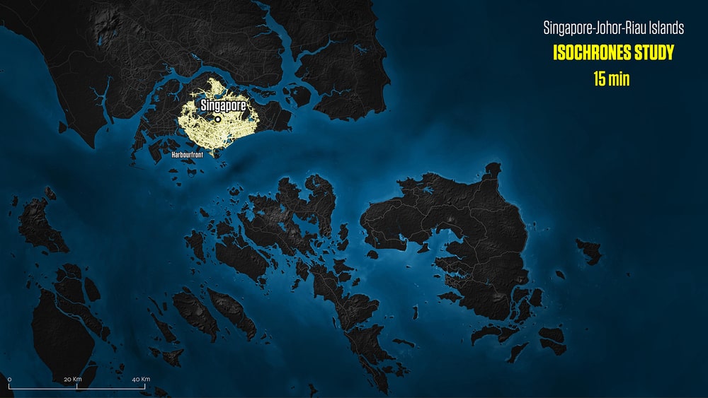
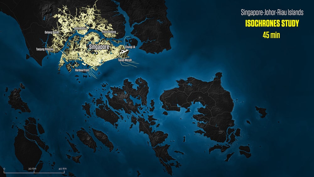
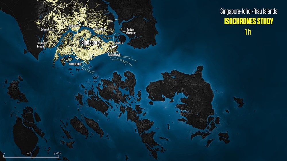
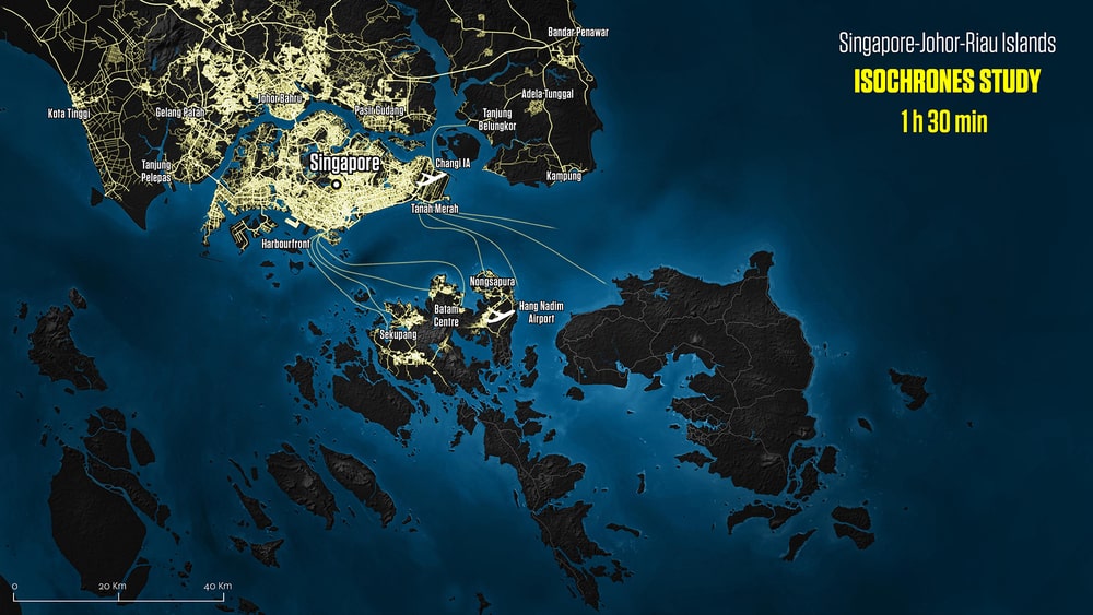
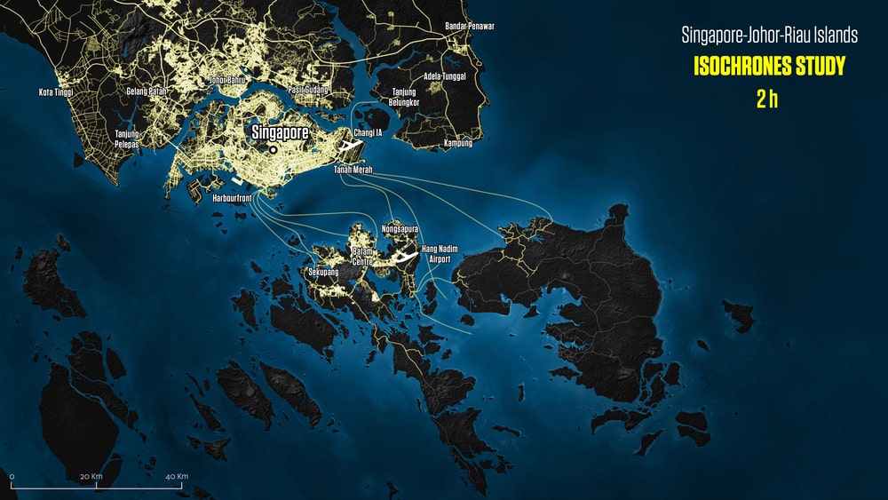
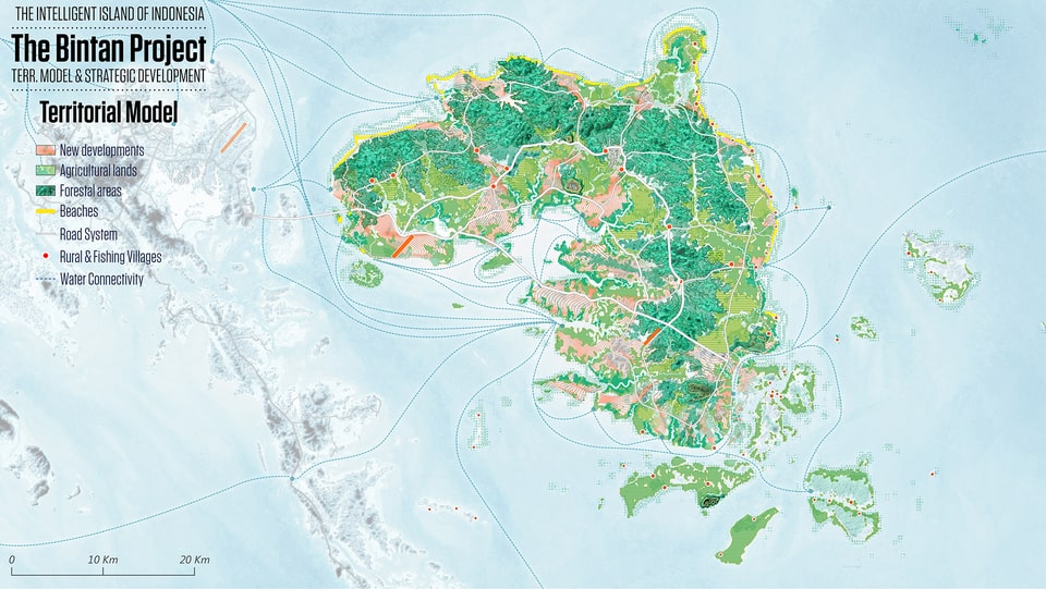
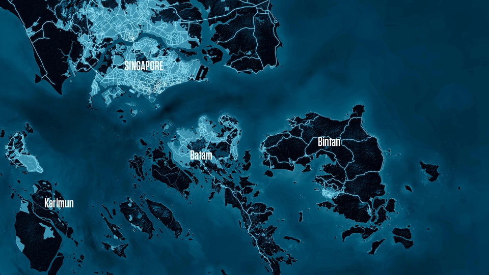
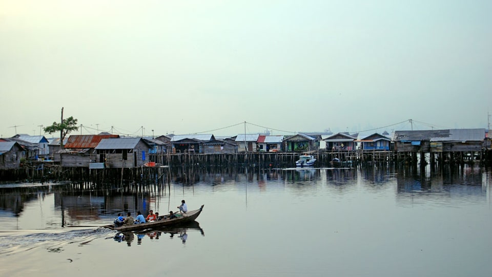
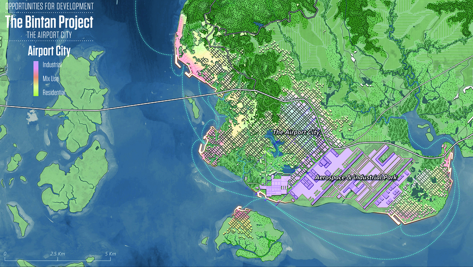
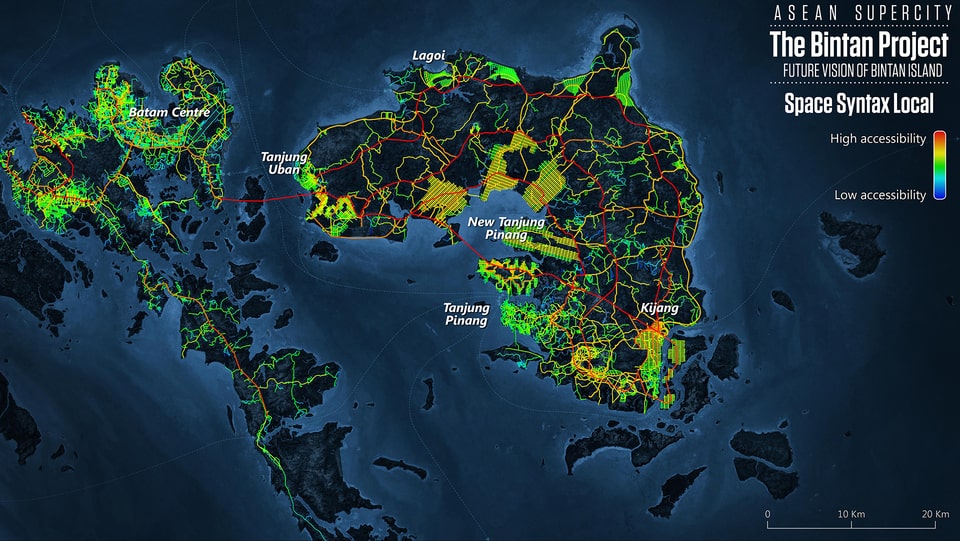
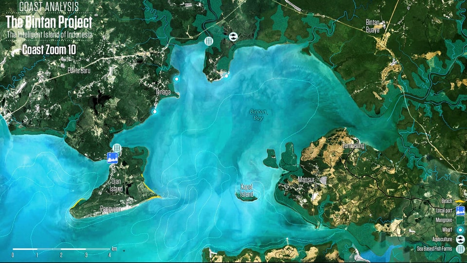
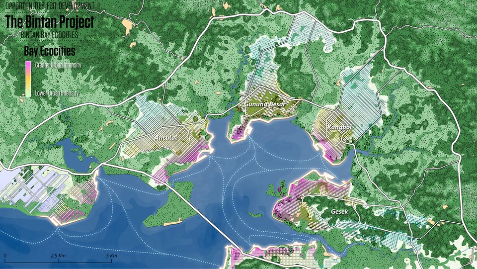
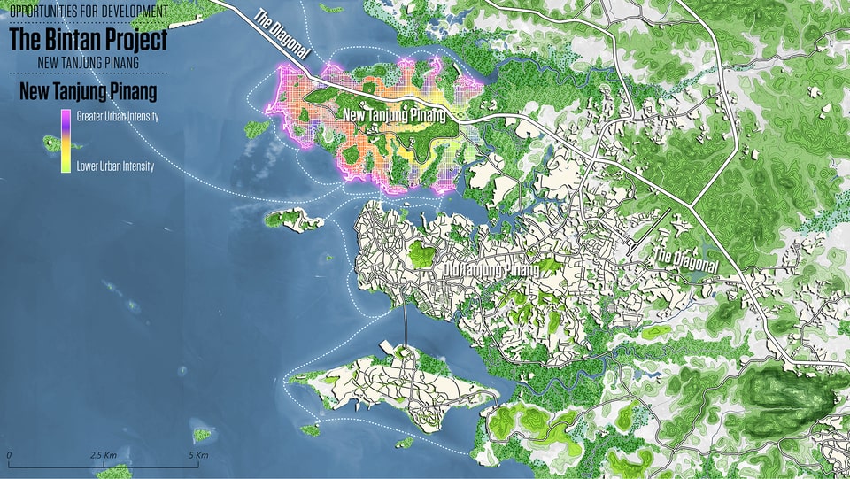
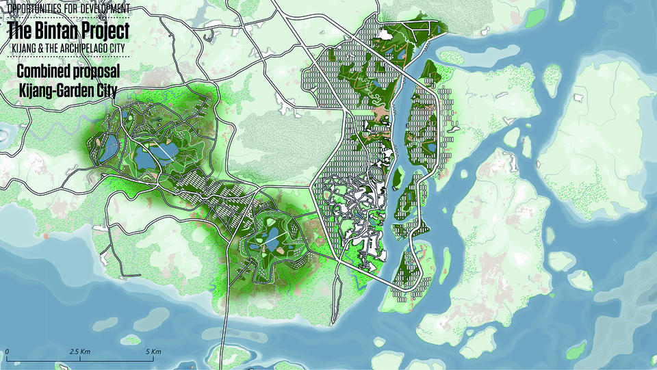
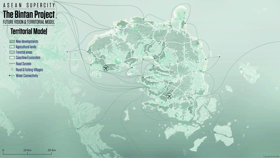
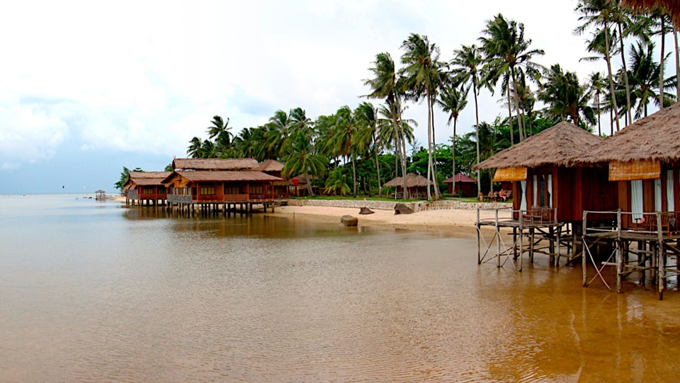
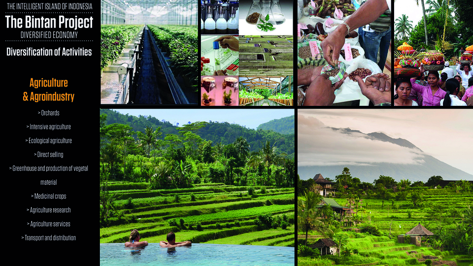
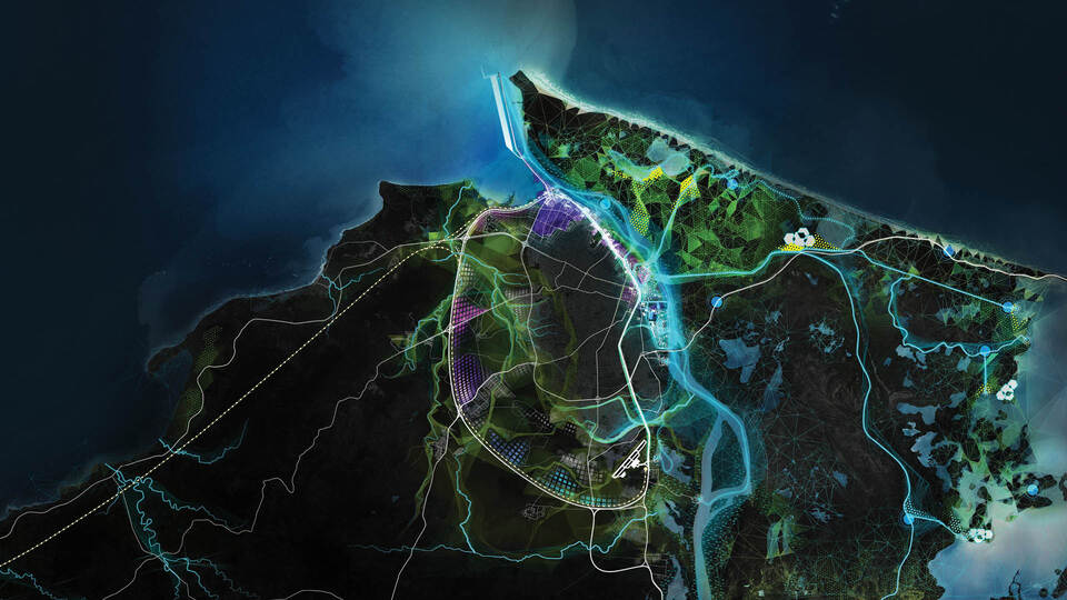
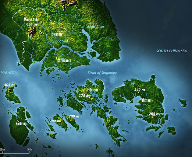
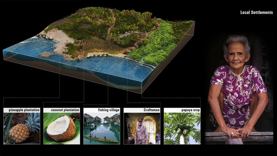
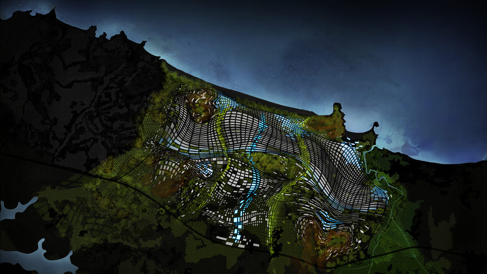
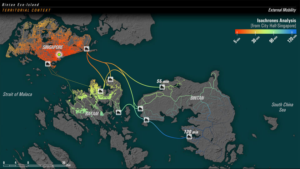
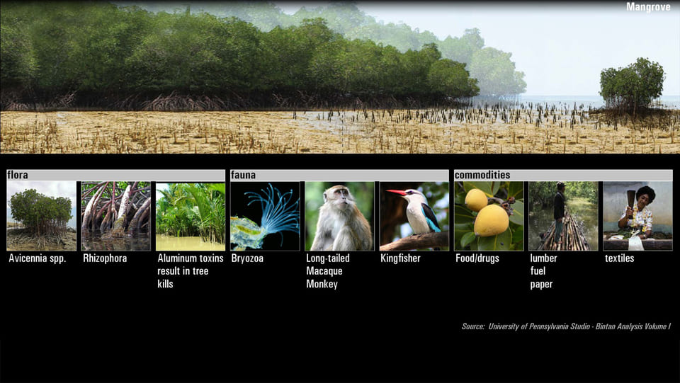
Bintan Project, The Intelligent Island of Indonesia is a research, planning and territorial design effort to define a new and integrated vision of the development of Bintan for the next decades.
This approach establishes a new scale of thinking for Bintan Island in the context of Singapore-Johor-Riau Islands region, the ASEAN SuperCity. It provides a comprehensive framework to design and evaluate future projects, land uses and infrastructures in the territory.
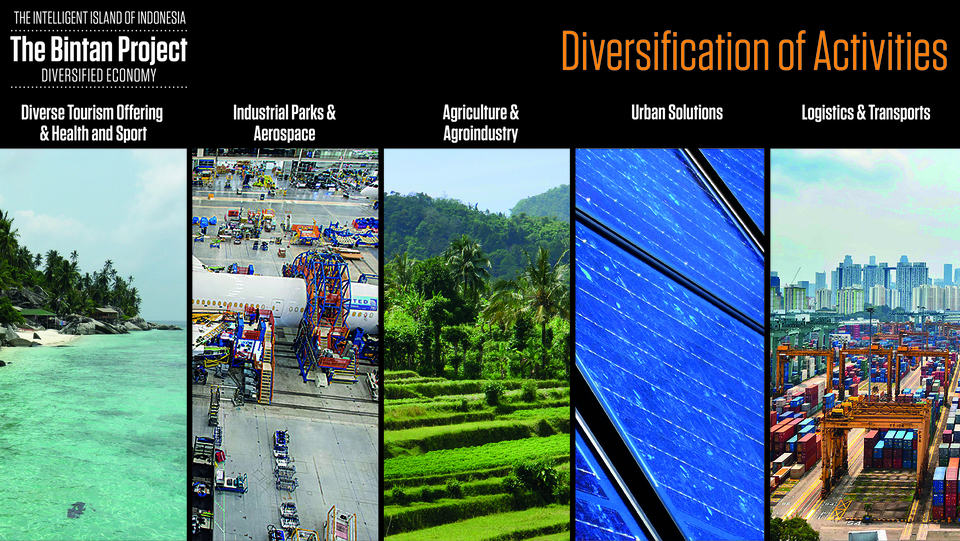
Bintan Project is based in sustainability proposals and urban and infrastructural strategic projects based on its ability to improve the overall Island system. This project emphasizes environmental protection and rehabilitation, sustainable urban development, green mobility, economic magnetism, social integration and innovation.


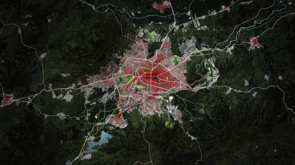
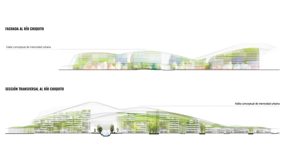
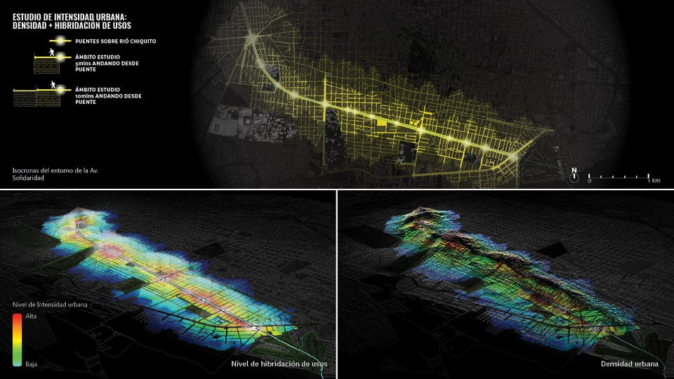
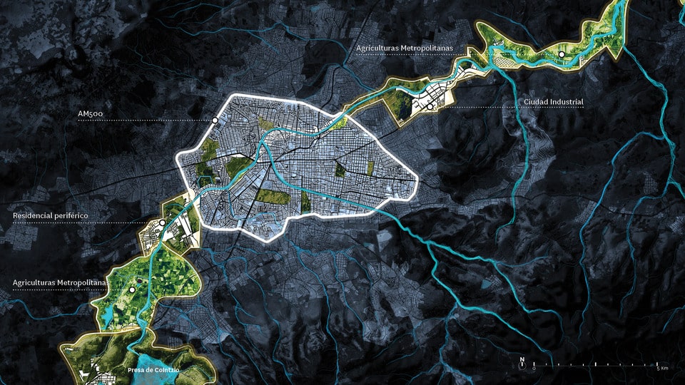
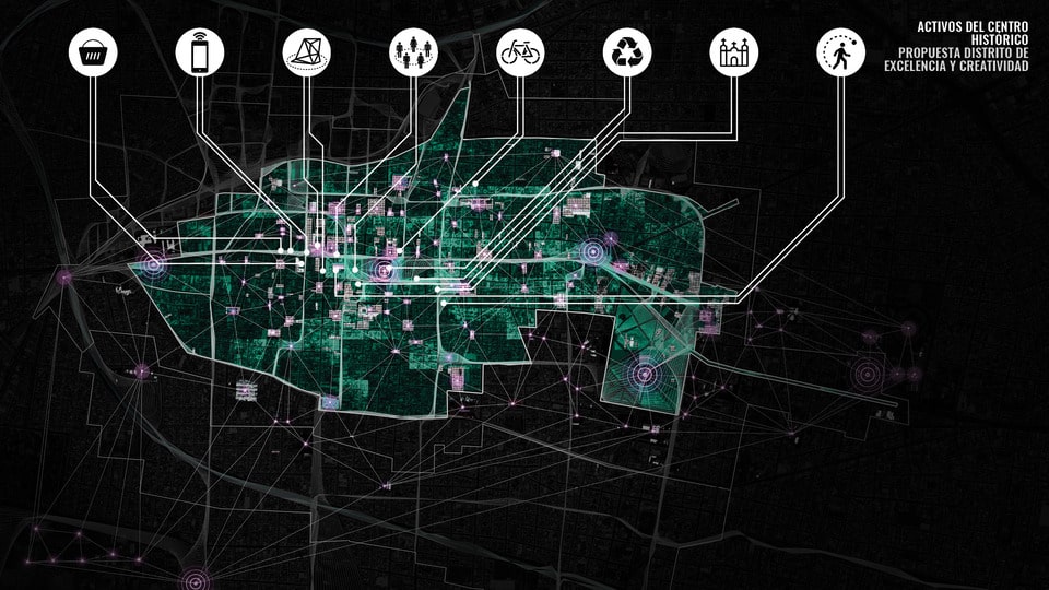
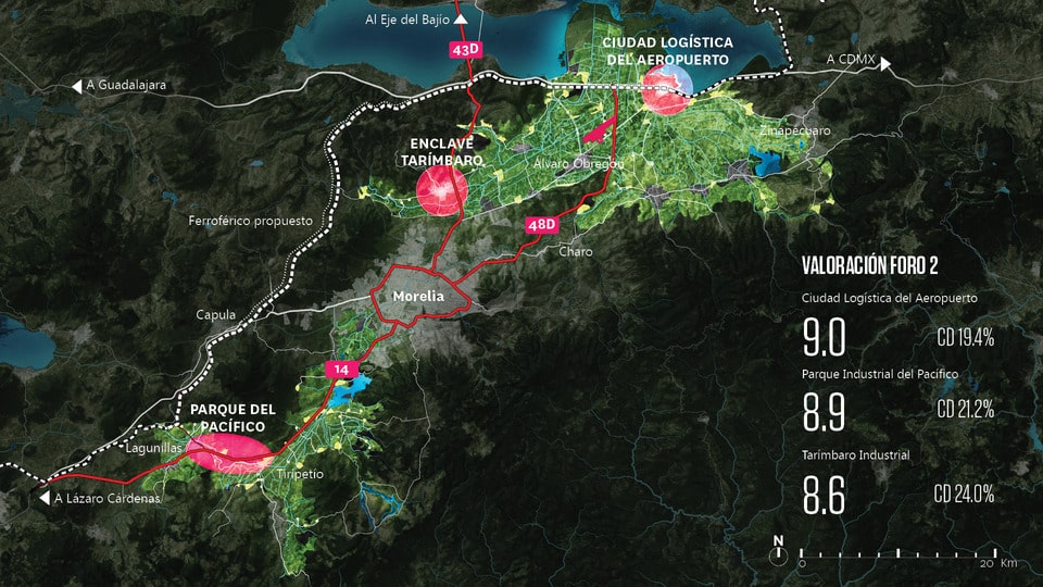
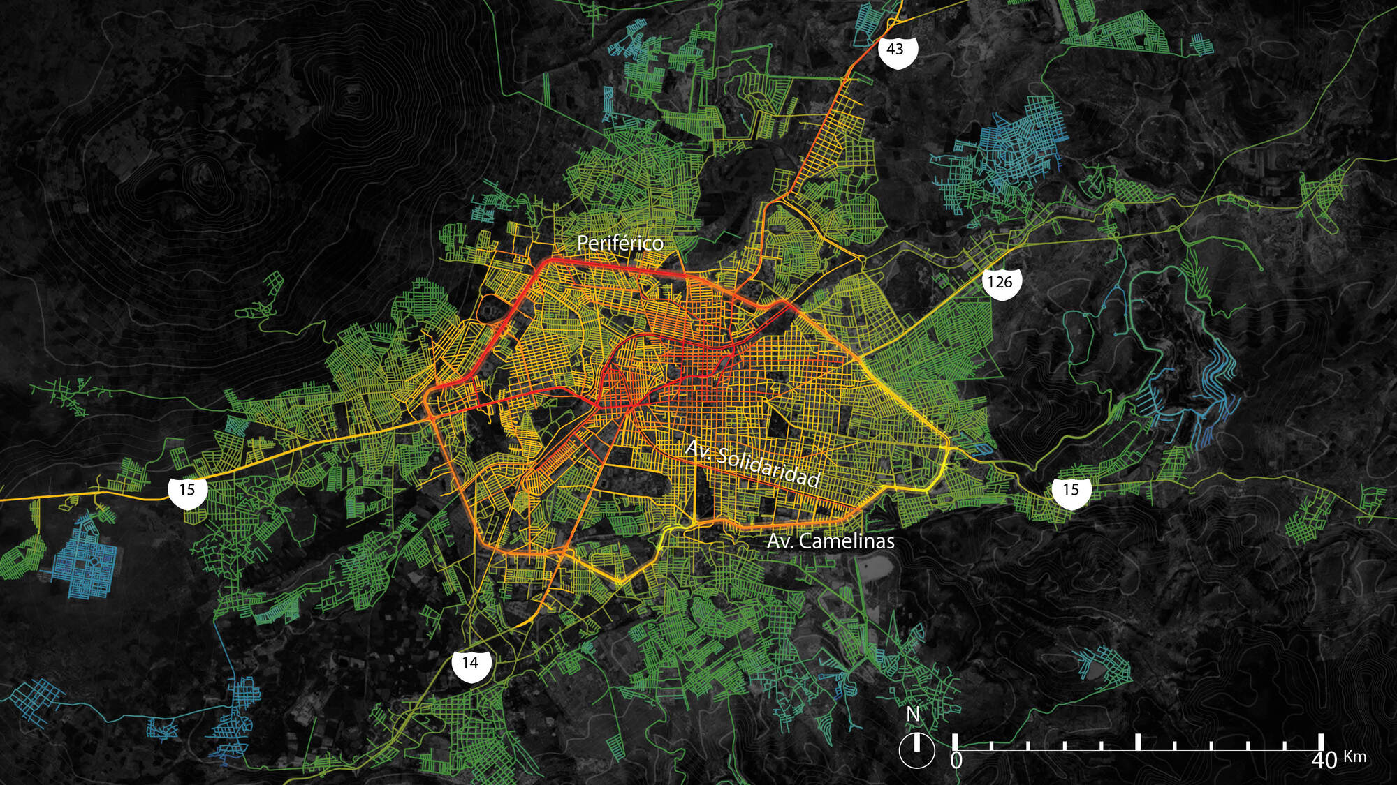
The Great Vision of Morelia NExT (New Economy for the Territory) 2041 is a territorial commitment to boost in Morelia the capacity to respond to contemporary challenges of the most diverse nature. Morelia NExT 2041 is not a global government plan, it is considered as a broad social agreement of long term that covers central aspects of the life of the municipality. Its focus is to define strategies to transform its territory as a basis for improving the quality of life through innovation and design.
Morelia NExT 2041 project will serve to guide its municipality towards a sustainable future in a stage of global transformation, in which knowledge-based society and economy offer greater possibilities for equitable development and economic prosperity.


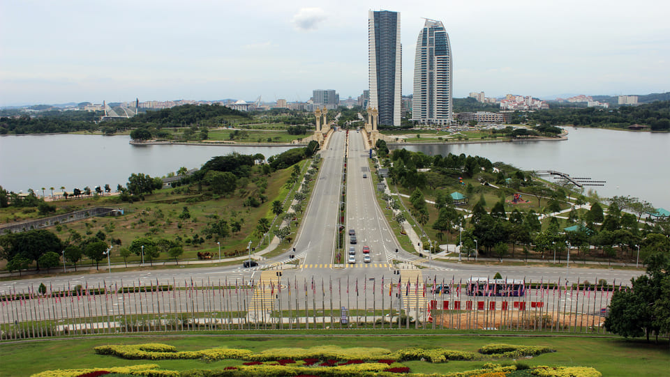
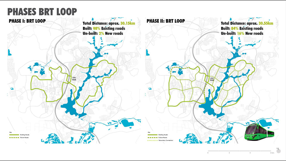
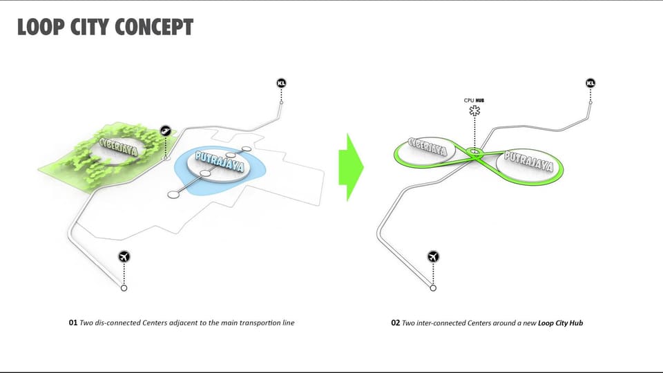
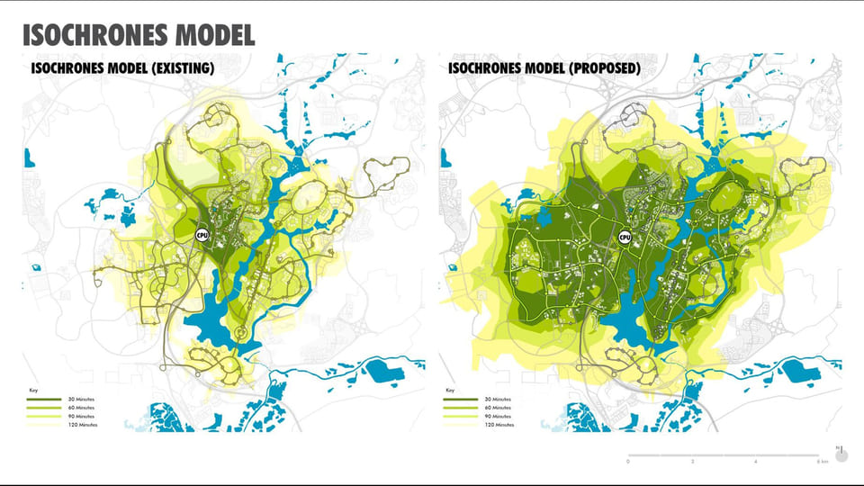
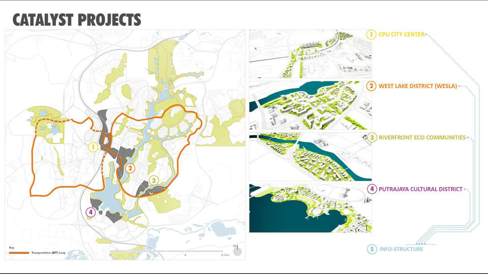
The objective for the Putrajaya Green, Smart, and Connected City initiative is to provide a coherent metropolitan vision, built on the strategic components of excellence found in the territory to insure the long term success and viability the project. Combining smart technologies with strategic spatial planning to make a more competitive, liveable and resilient city – a place that will atract the industries and individuals of the Knowledge Economy to live, work, play and learn. The objective for the roadmap should not be to create a “master plan” in the traditional sense but a more spatial strategy or territorial model structured on a smart grid technology which will give Putrajaya the ability to adjust and accommodate new trends, economic shifts and population growth in the future.
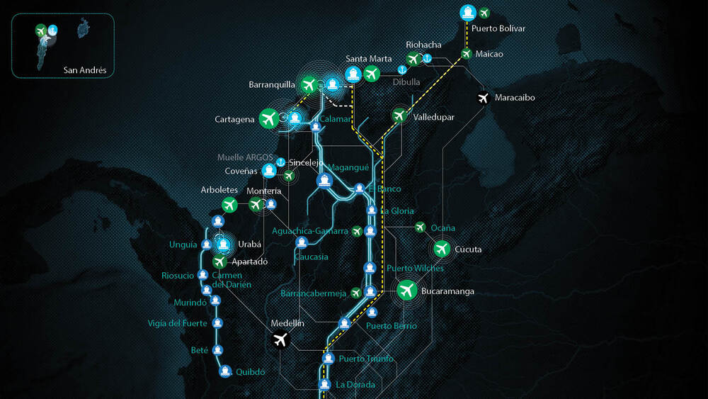
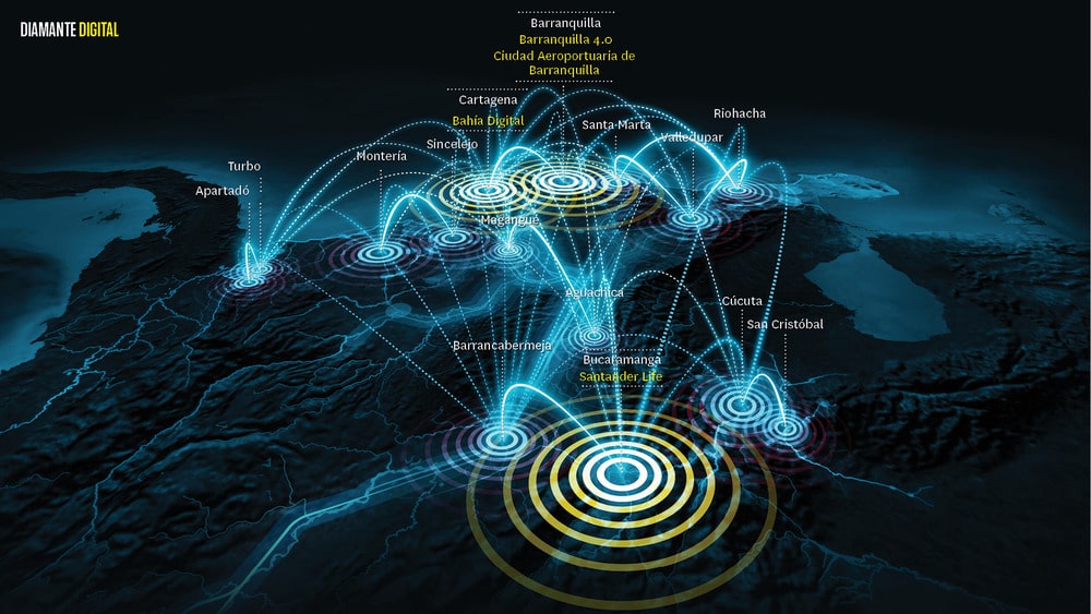
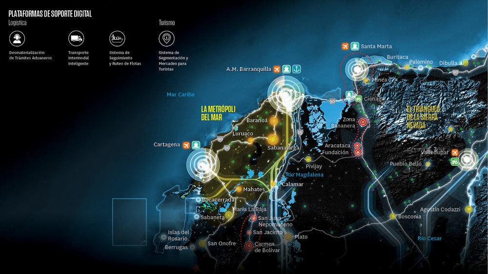
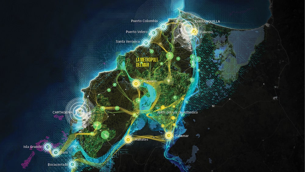
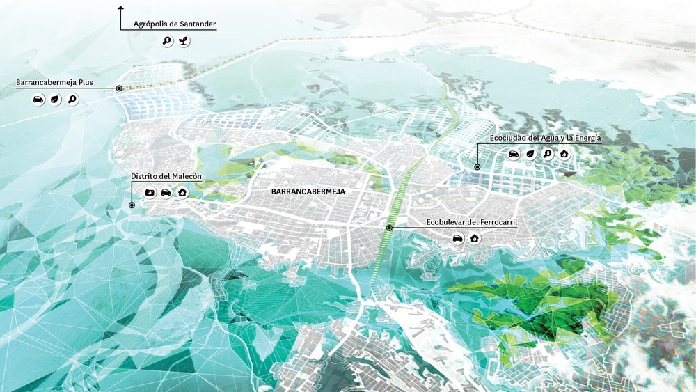
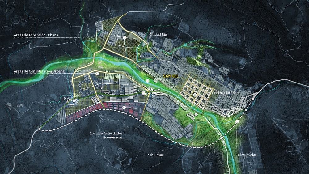
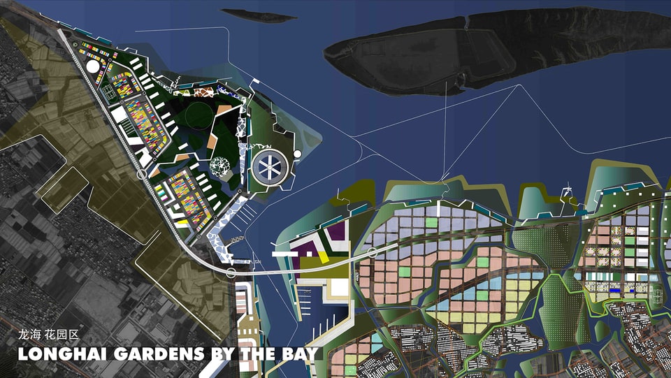
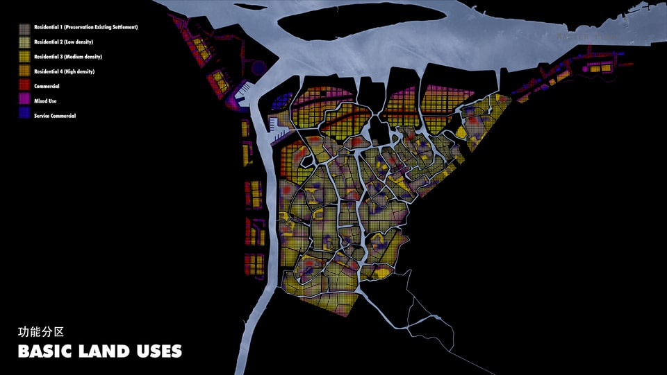
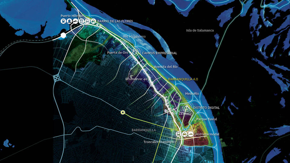
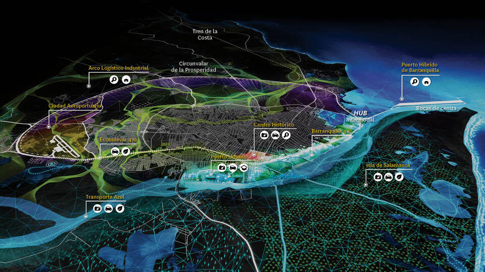
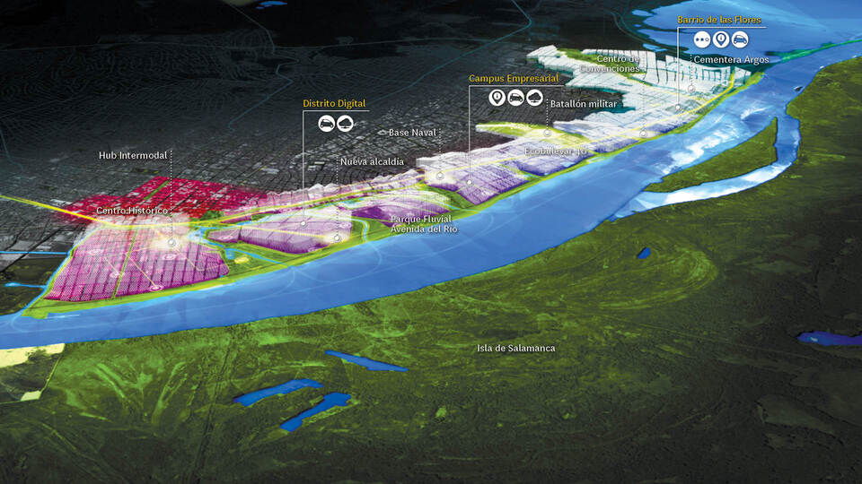
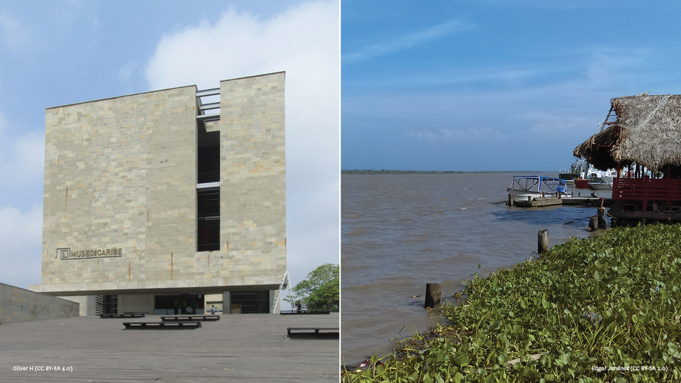
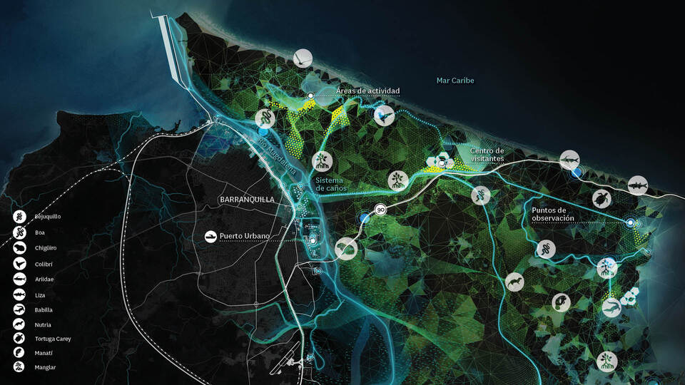
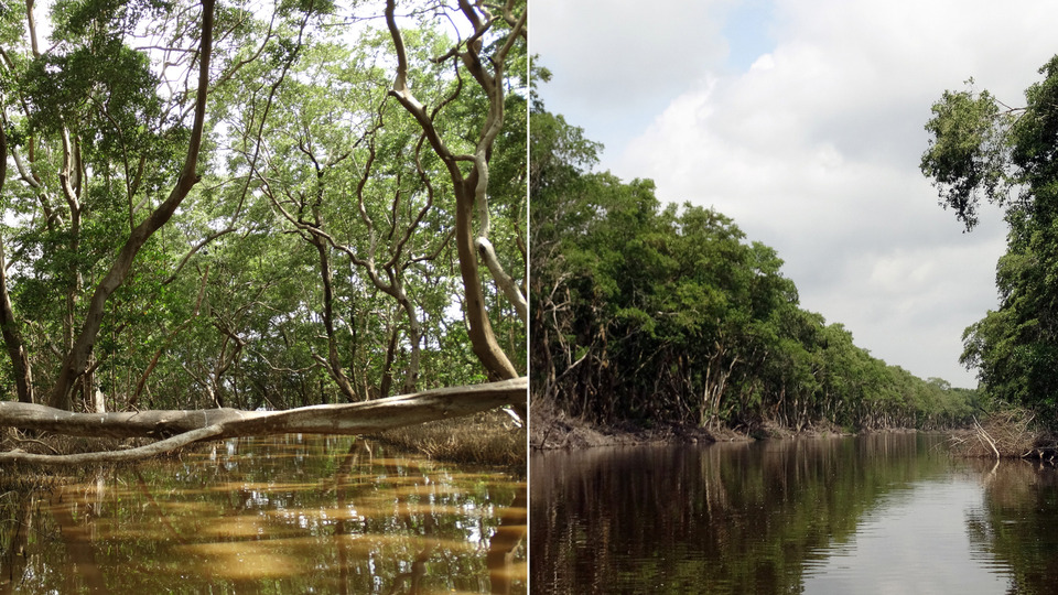
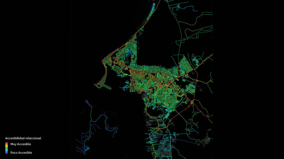
The City-Territory Project of Barranquilla is oriented to discover the main urban and economic development of the city and its metropolitan environment by proposing an urban profile through a set of high-impact strategic projects. The characterization of the different strategic projects is inspired by the identity, singularities and components of excellence of the city and integrates the results of a broad participatory process.
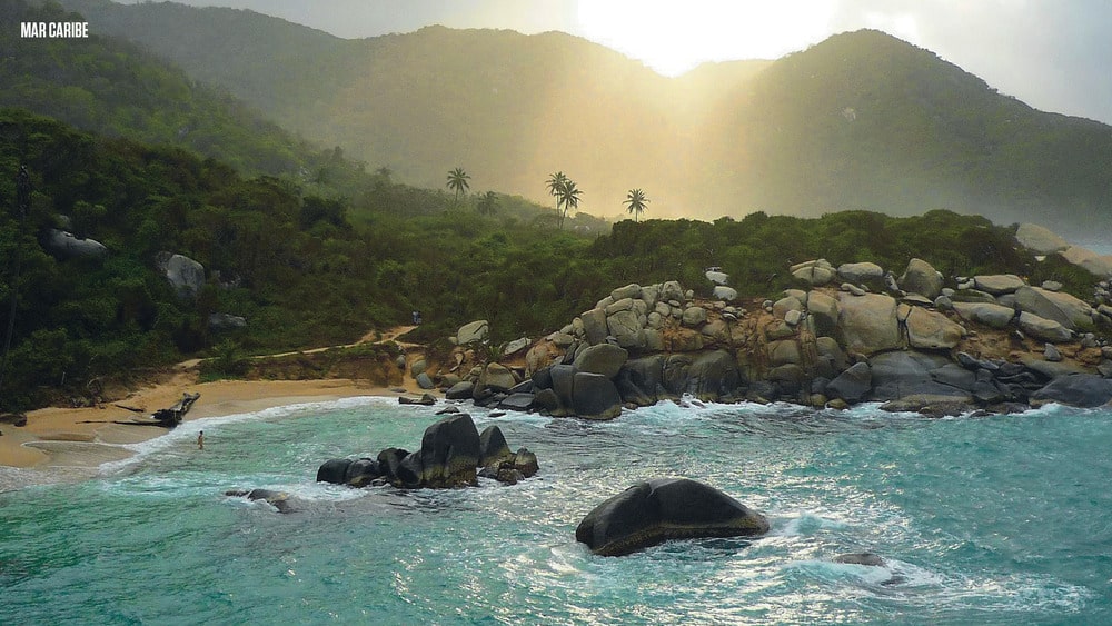
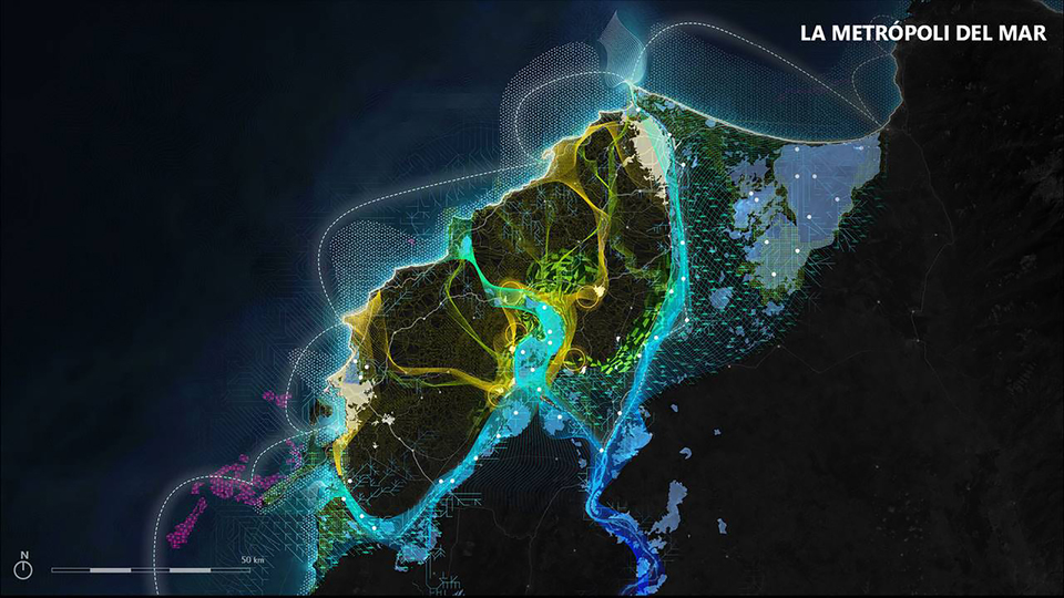
Barranquilla, along with its metropolitan environment, has the vocation of being an urban space fundamental for the development of the Diamond of the Colombian Caribbean. A logistics, industrial, cultural and tertiary center whose main function is to act as a linking node of the Diamond with the global dynamics, serving as a center of attraction of innovative initiatives and generation of processes of change.
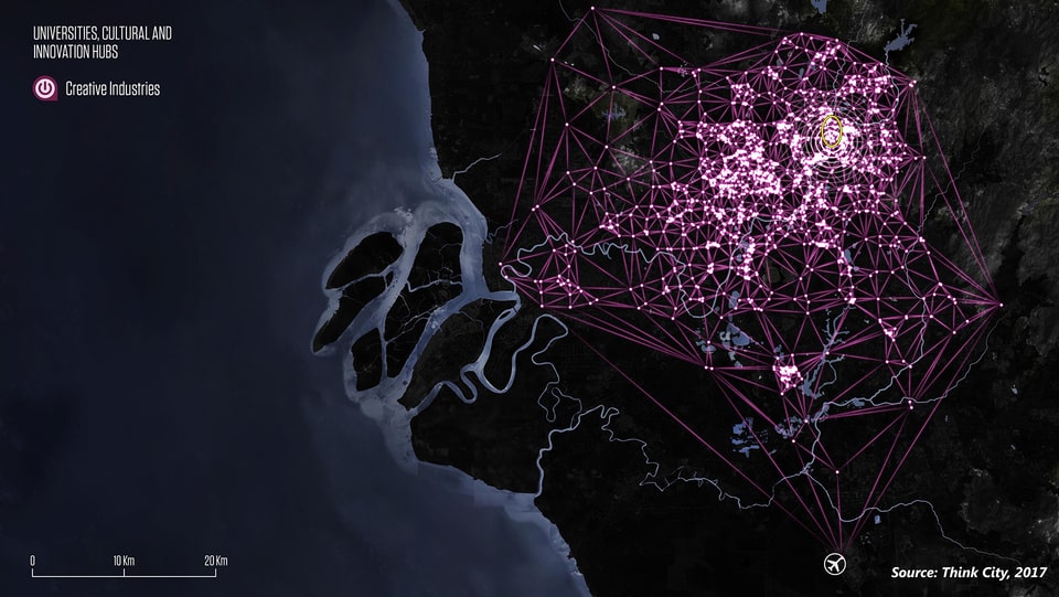
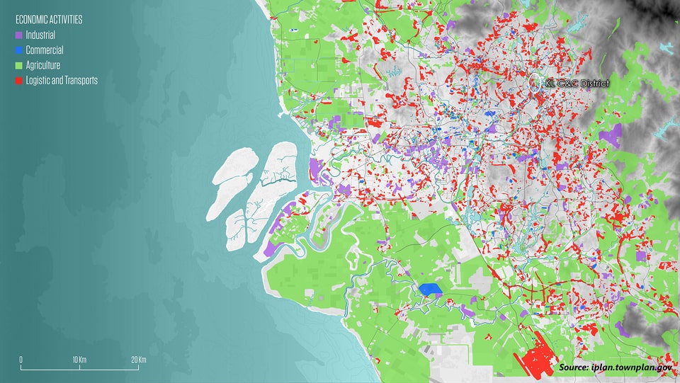
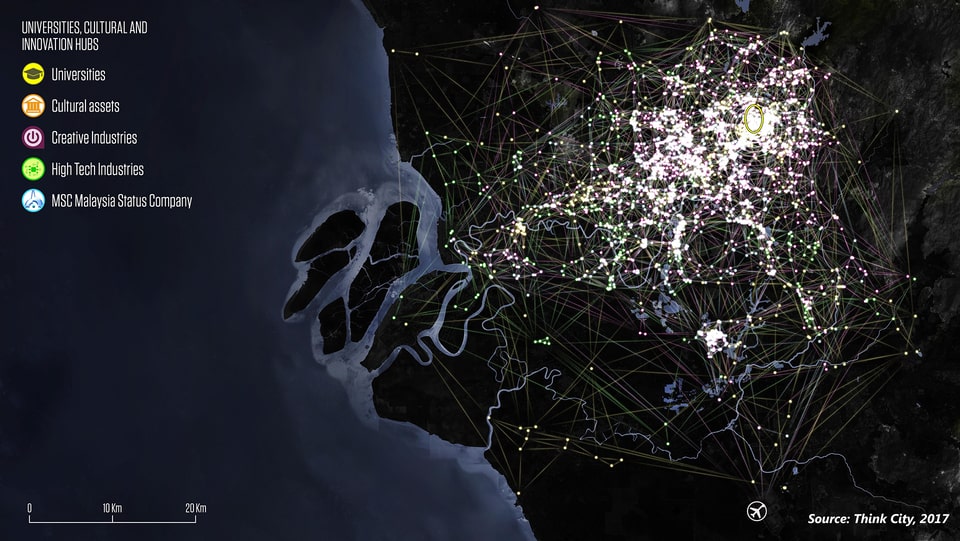
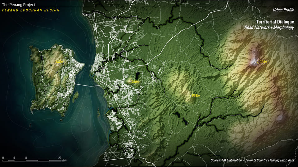
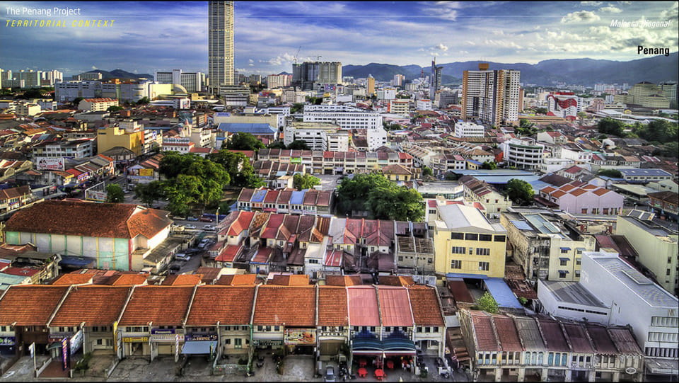
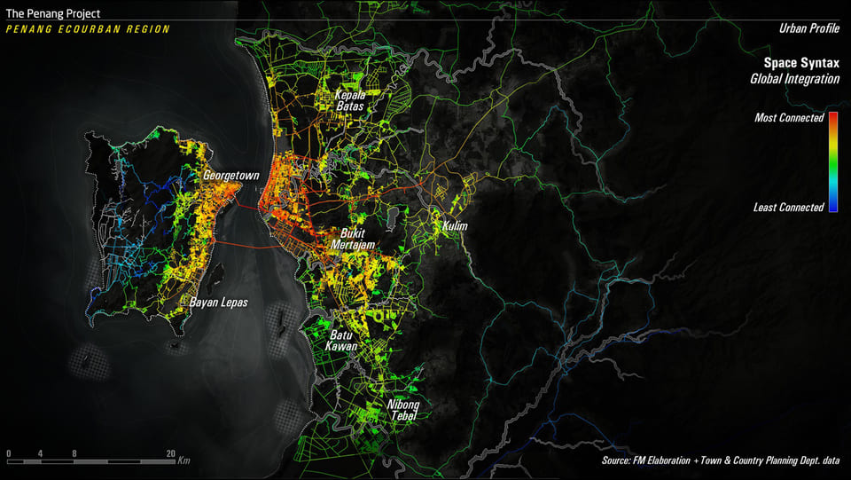
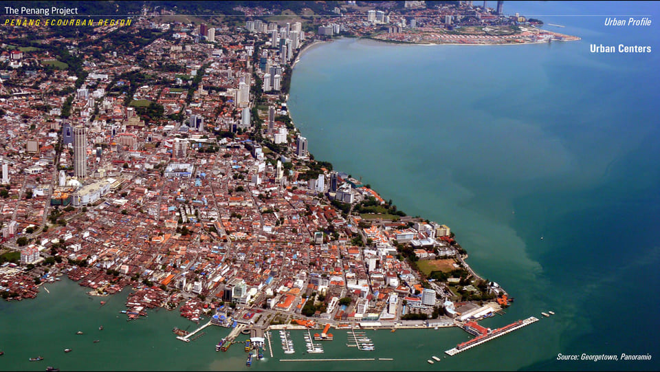
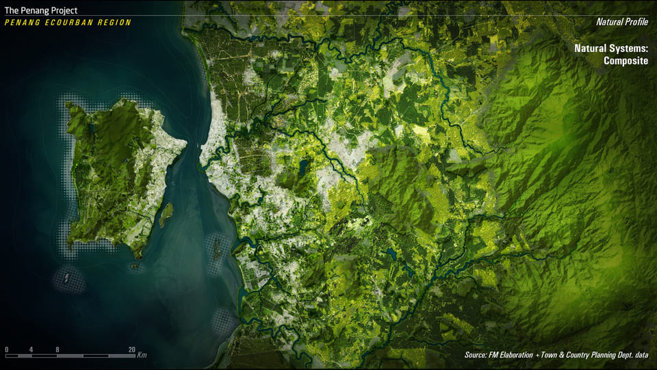
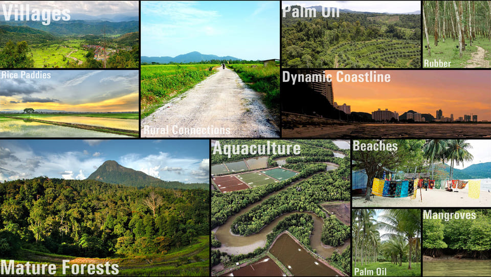
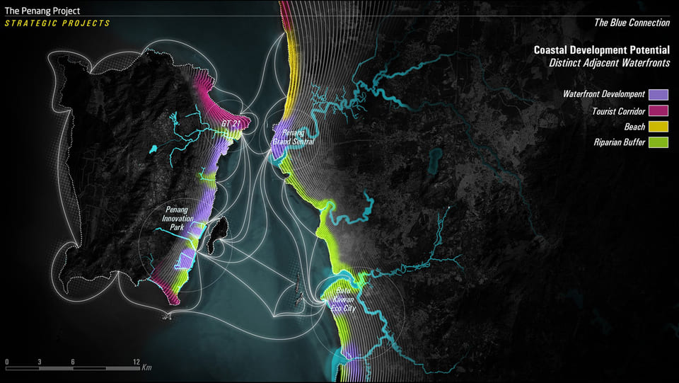
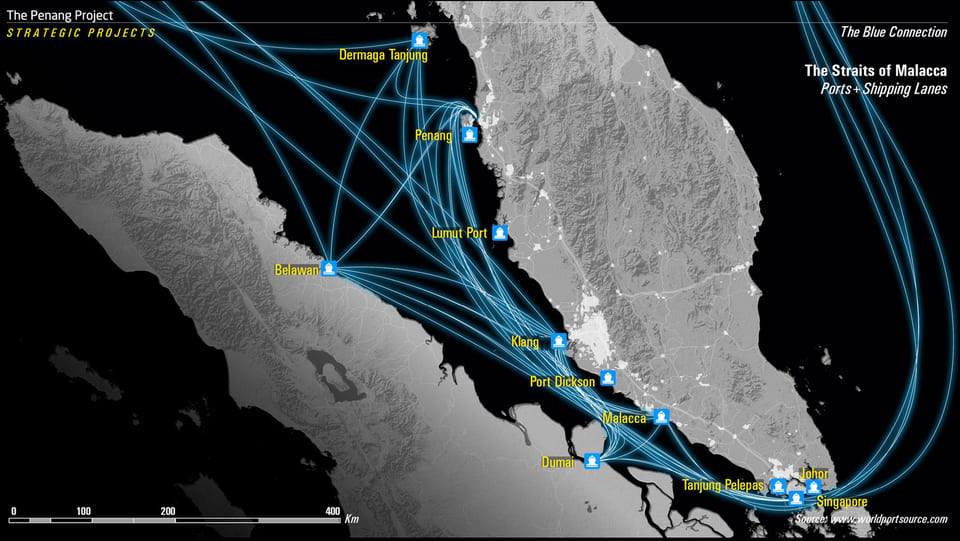
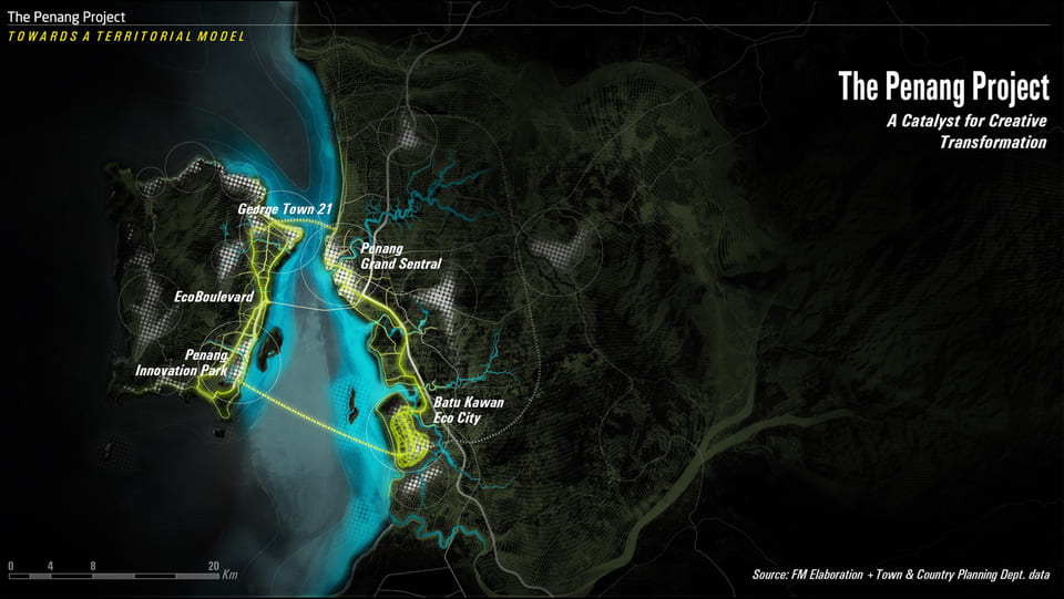
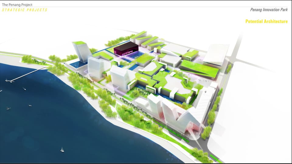
The Penang Project is a pilot project for Eco-regional and Spatial Development Strategies in Malaysia. This project establishes a new scale of planning for Penang by elaborating a territorial approach to spatial planning and sustainable design in the region. This study is a joint effort by Think City Sdn Bhd and Fundación Metrópoli; and is co-funded by the Performance Management and Delivery Unit (PEMANDU) of the Prime Minister’s Department and Khazanah Nasional Bhd.
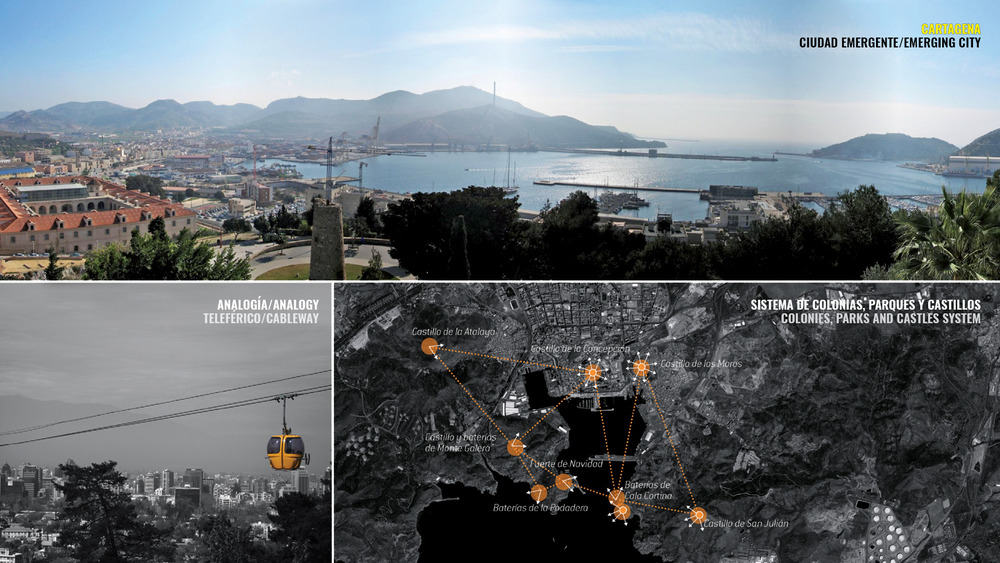
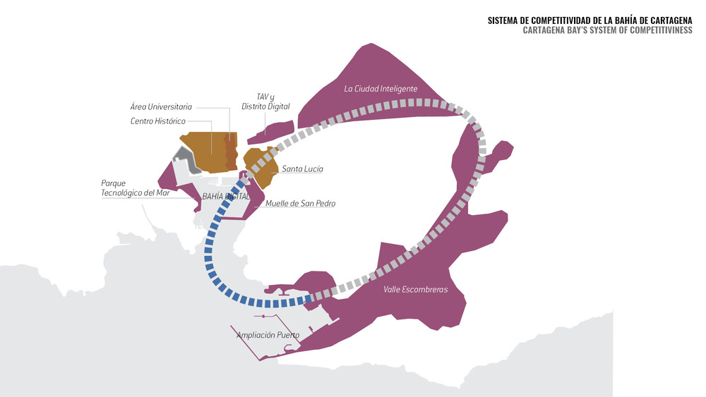
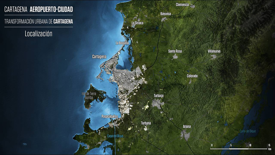
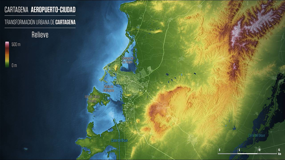
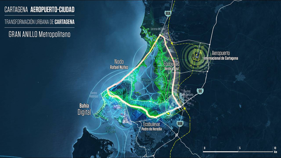
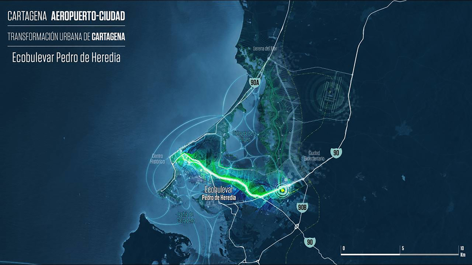
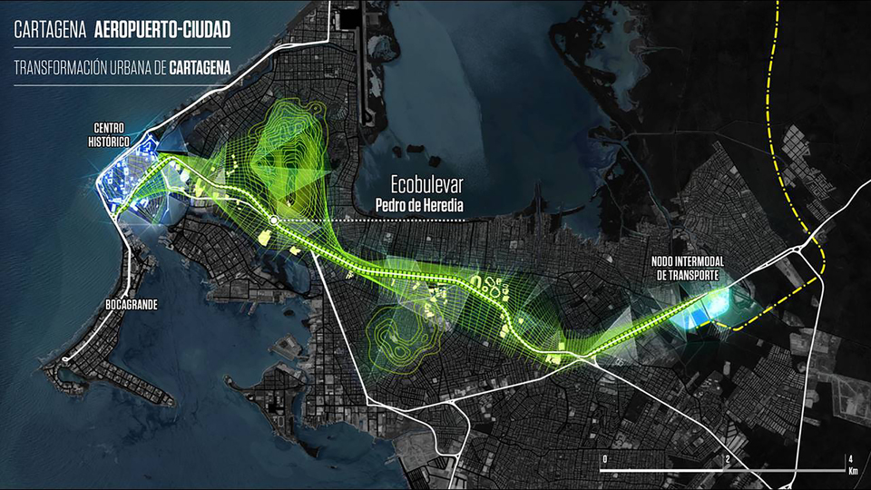
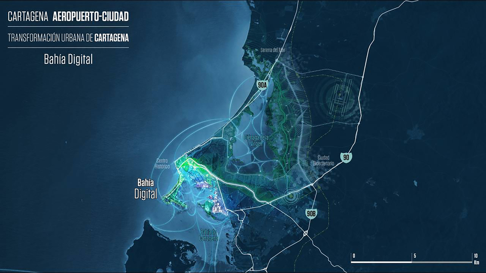
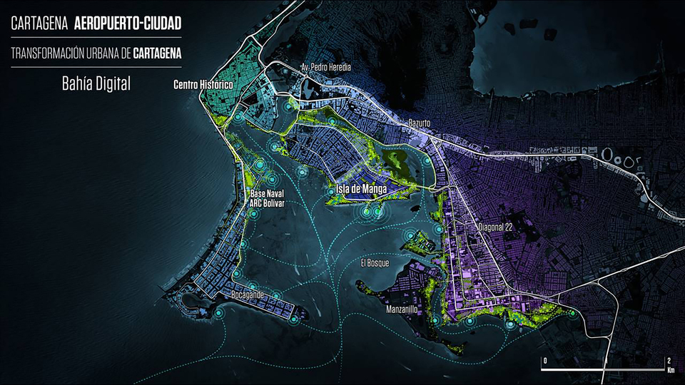
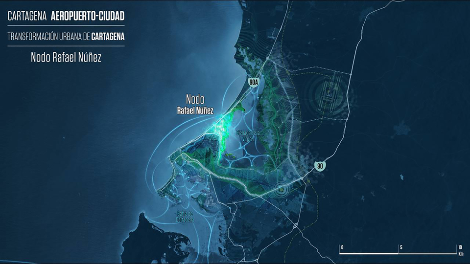
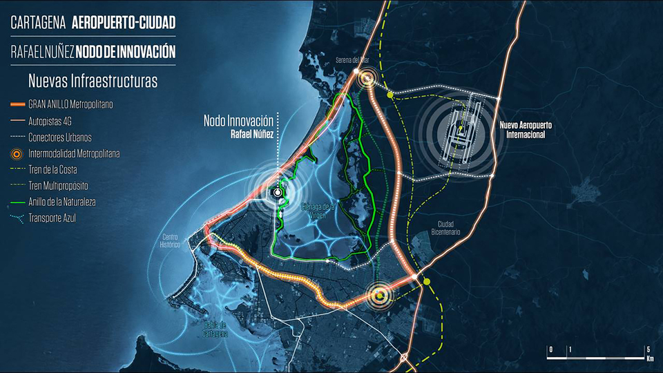
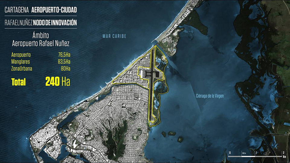
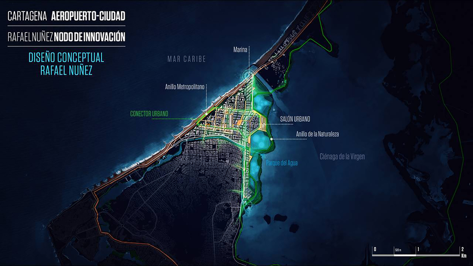
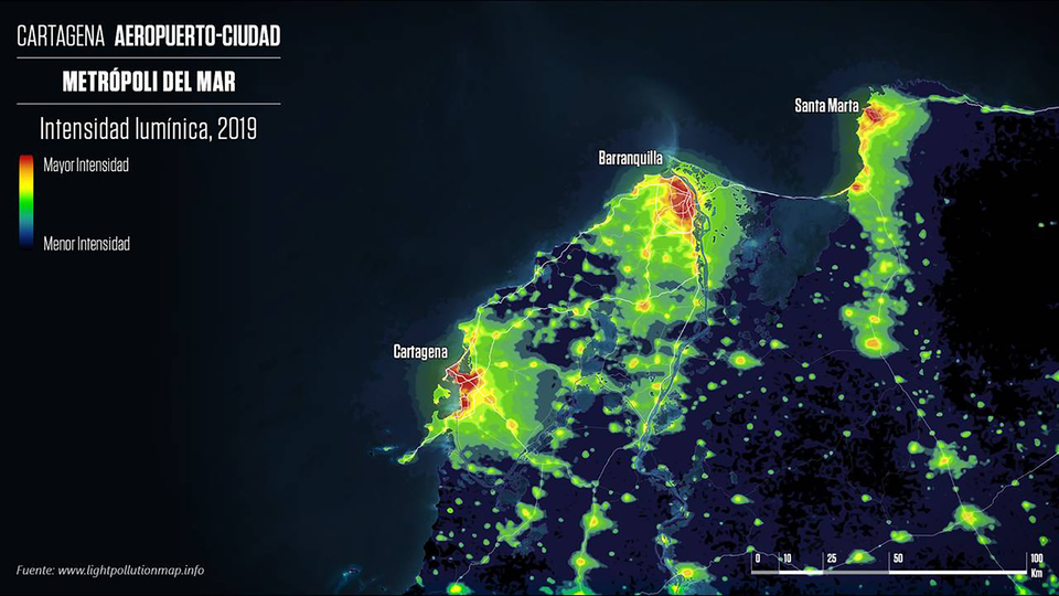
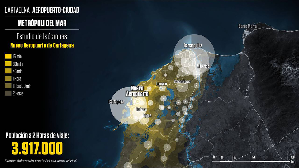
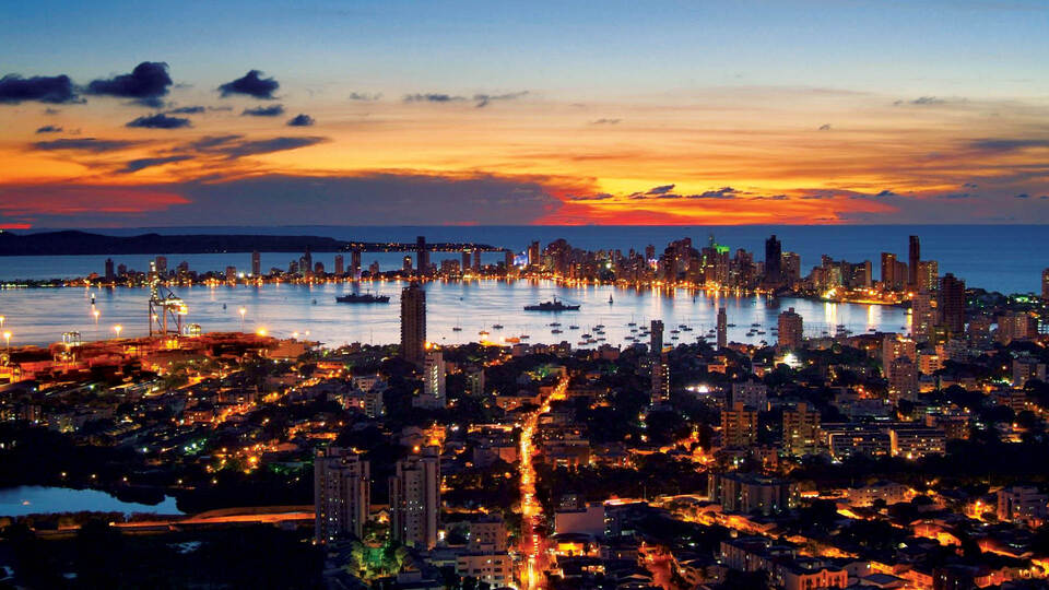
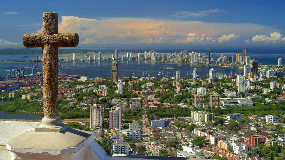
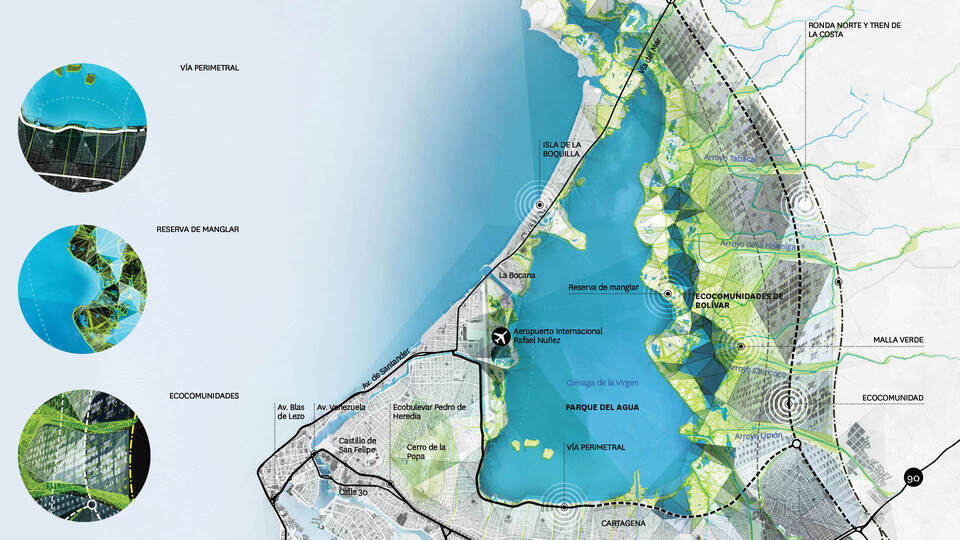
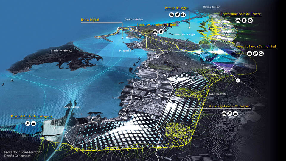
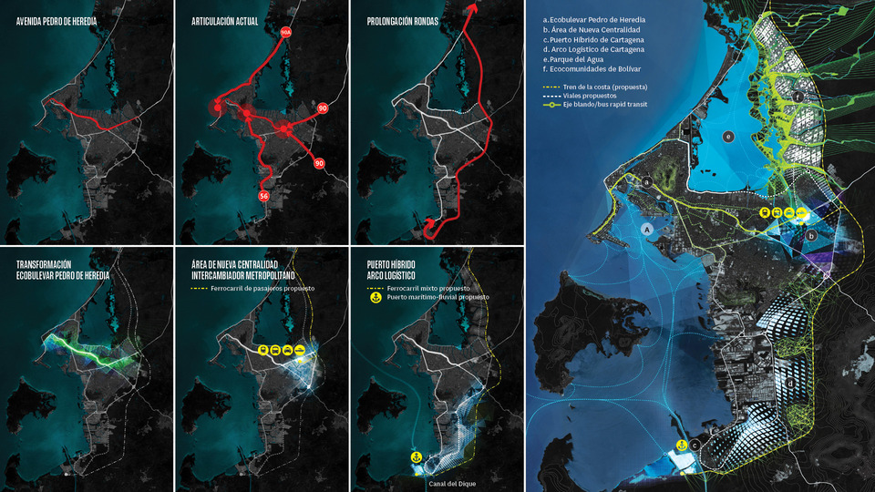
The city of Cartagena and its surroundings have some of the best urban and territorial opportunities of the Diamond to develop initiatives and projects of wide scope and with international projection. The fundamental objective of the proposed strategic projects in Cartagena is to create the appropriate spaces for the development of economic activities that diversify the economy, improve competitiveness and contribute to a more socially balanced city and better integrated with its natural environment.
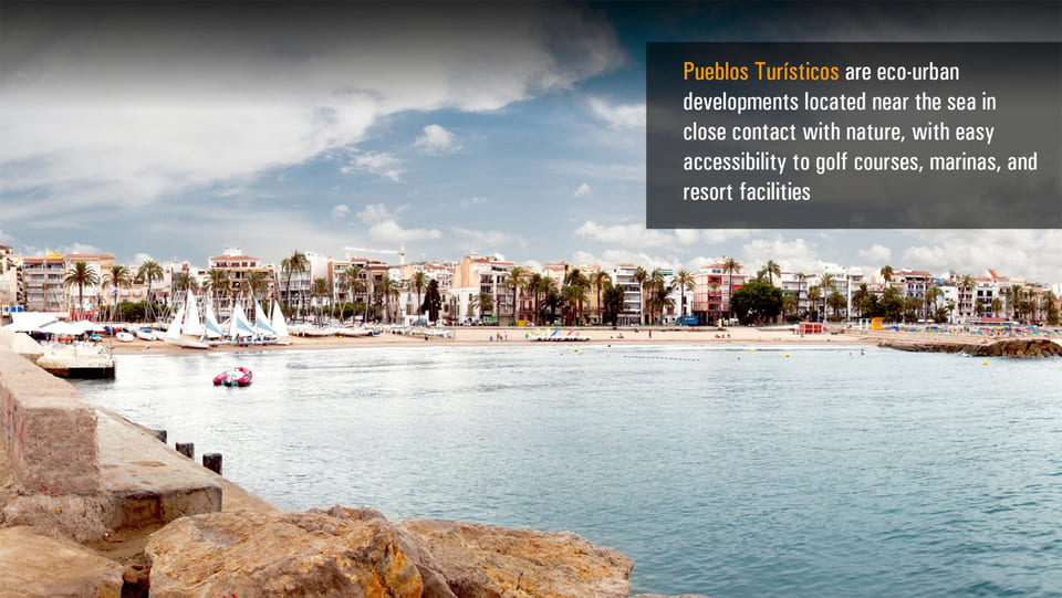
Its maritime location, the values of its environment (especially the coastal areas), and the attractiveness of its Historical Center are key elements to drive a significant growth of the tourism sector. The improvement of environmental quality and living conditions in the city (residential options, international connectivity, internal mobility, socioeconomic balance, citizen security, etc.) are prerequisites for Cartagena to play a relevant role in the knowledge economy.
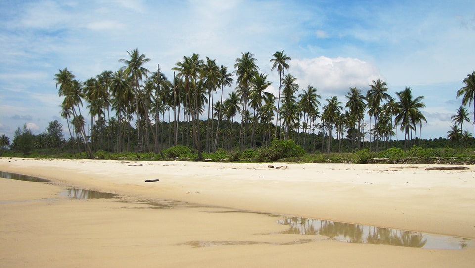
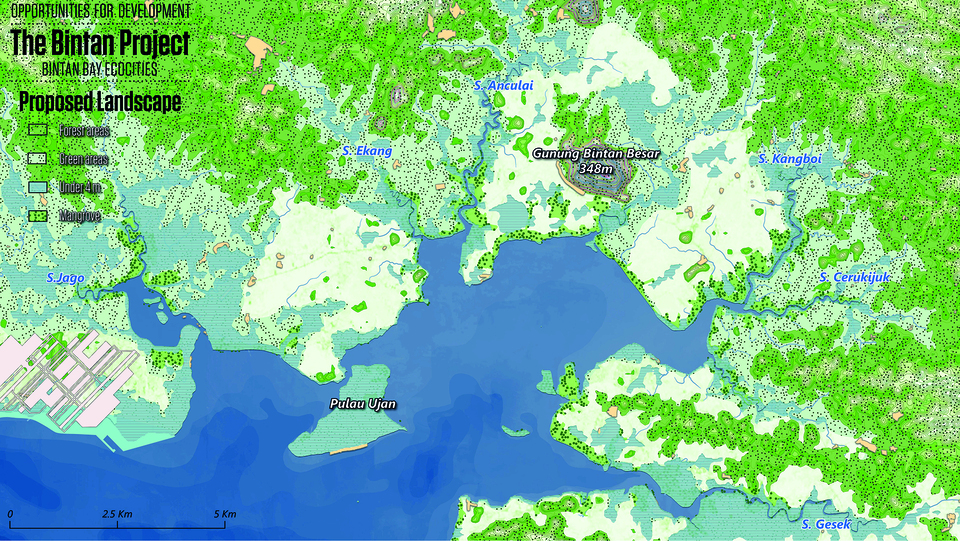
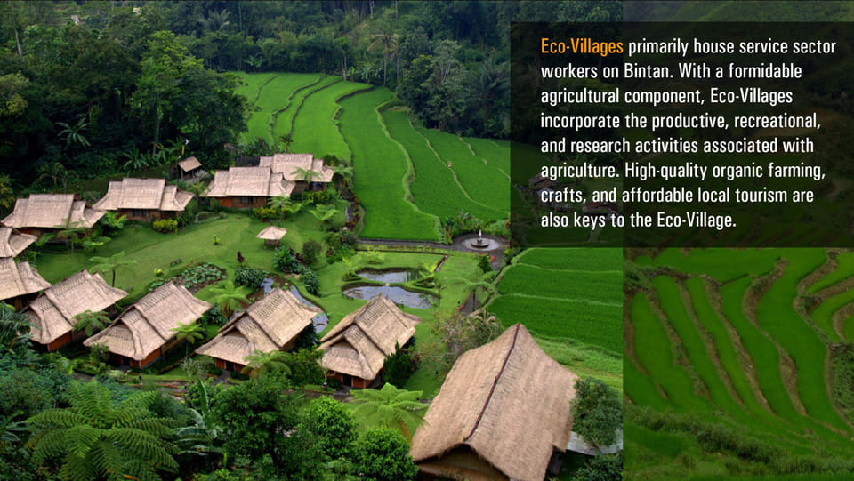
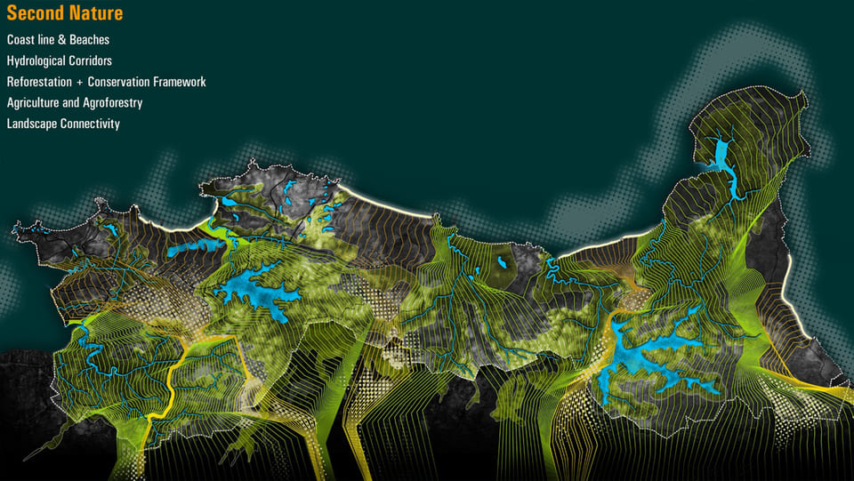
The ‘EcoIsland’ development model projected for Bintan identifies an innovative approach to a sustainable development, creating a dialogue with the natural surroundings and capitalizing on the economic and demographic strengths of the territory.
This development-based strategy combines various aspects of ‘second nature’ or ‘productive & recreational landscapes’ together with contextual and economically viable ‘urban components’ which are then integrated into the existing complex ecosystem found on Bintan Island. By combining eco-island densities and building typologies, sustainable mobility and diversity of tourism-based activities along with emerging economic clusters; this methodology establishes a strategy for landscape intelligence which underscores the competitive advantages for Indonesian economic development together with synergies and investment potential from nearby Singapore.Its maritime location, the values of its environment (especially the coastal areas), and the attractiveness of its Historical Center are key elements to drive a significant growth of the tourism sector. The improvement of environmental quality and living conditions in the city (residential options, international connectivity, internal mobility, socioeconomic balance, citizen security, etc.) are prerequisites for Cartagena to play a relevant role in the knowledge economy.
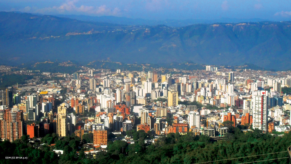
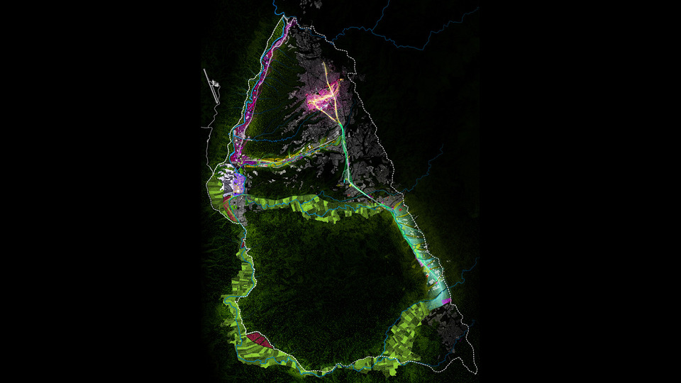
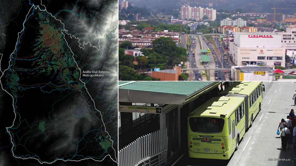
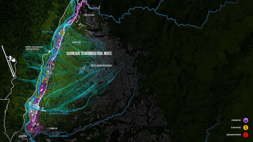
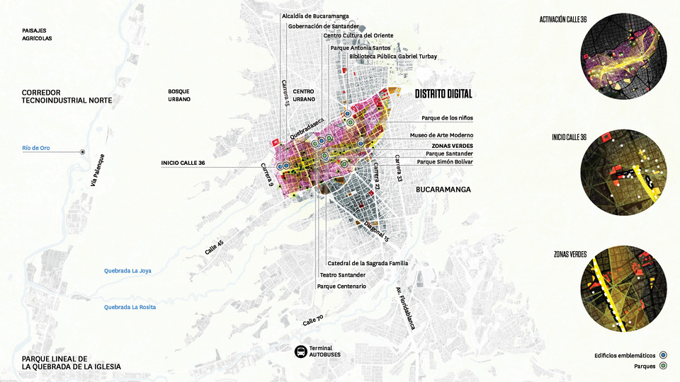
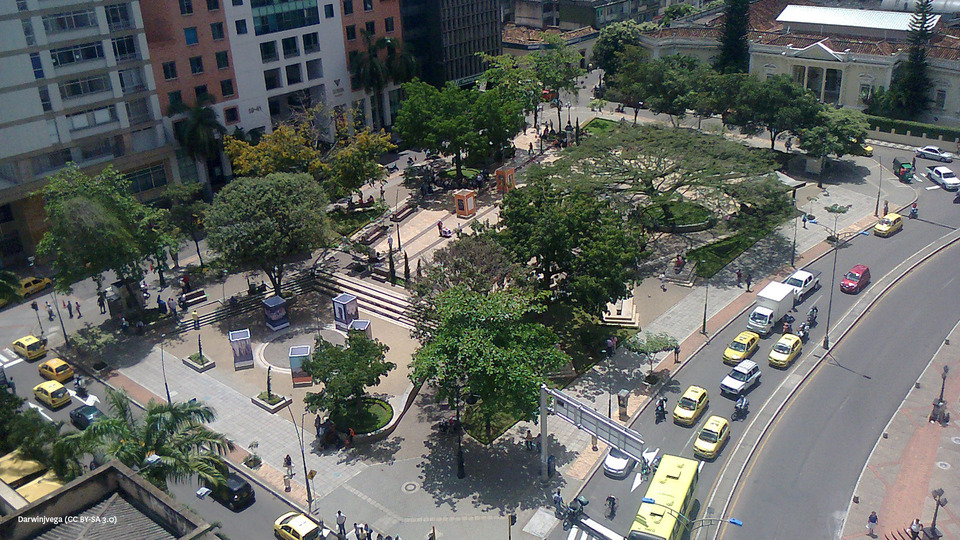
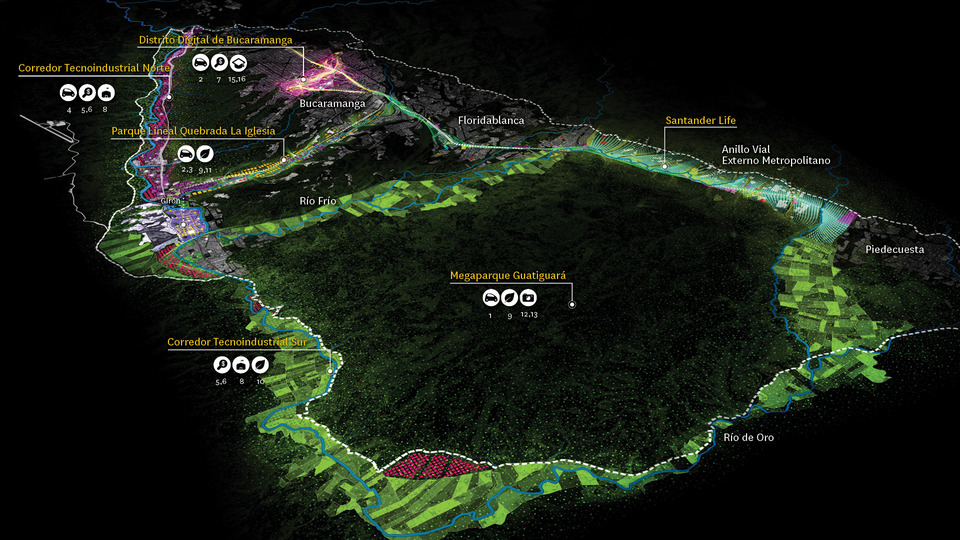
Bucaramanga has high levels of social development in the context of Colombia and a dynamic and diversified economic structure with relevant components of innovation. Around these elements, the proposals that are formulated in the City Project are oriented to the articulation of a metropolitan project that puts in value the aspects of urban excellence.
The objective is to develop a city in which the quality of life is a reference element. It aims to set up a diverse and attractive territory, in which advanced economic activities and with a high technological component, have a growing role.
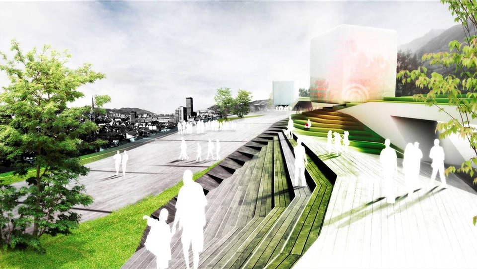
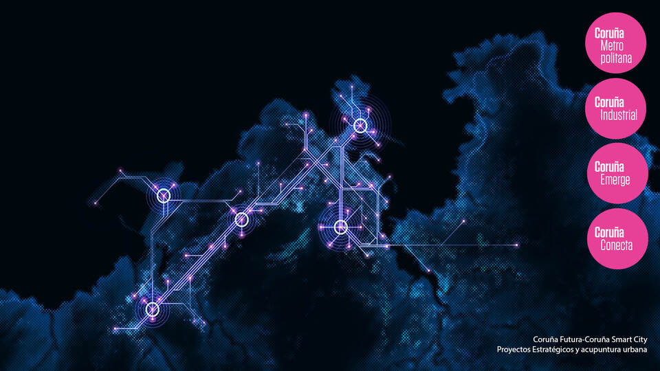
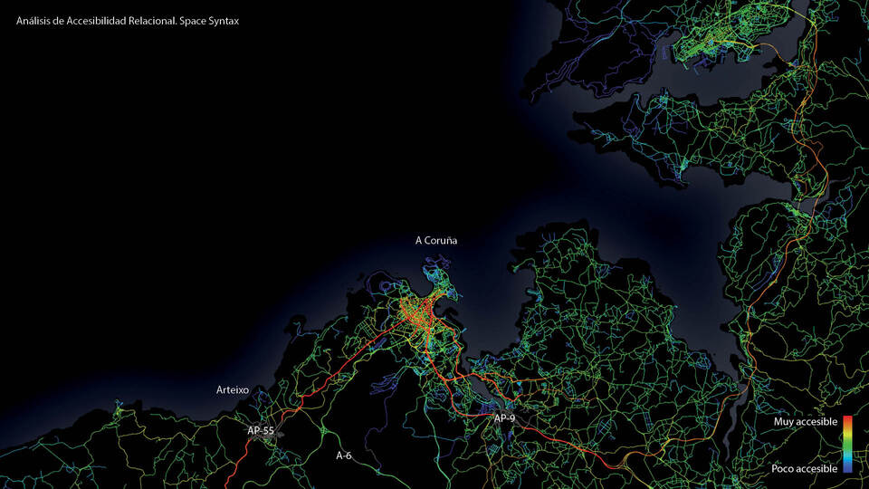
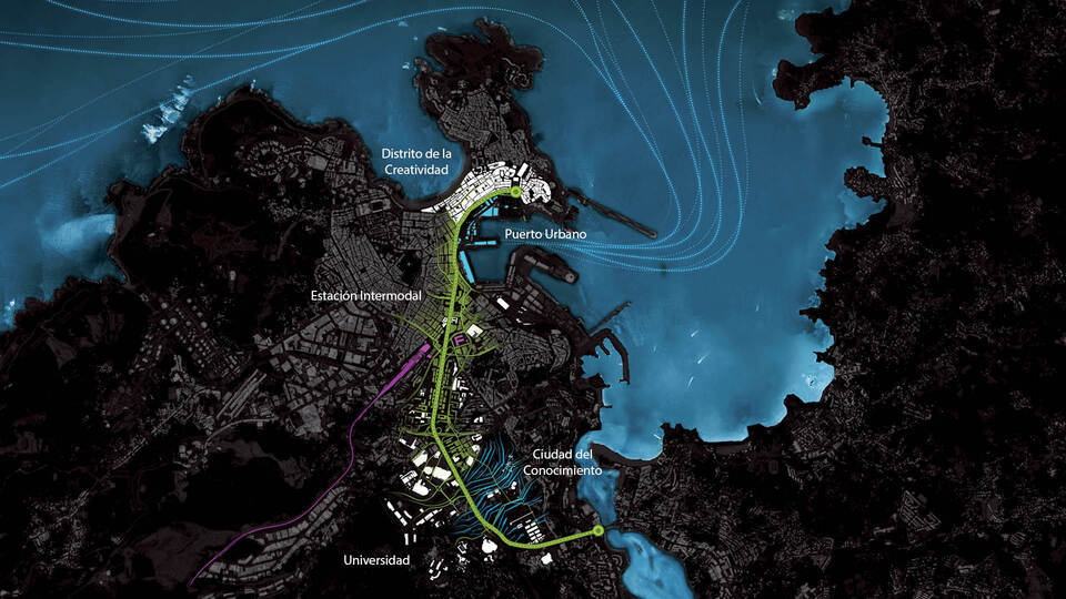
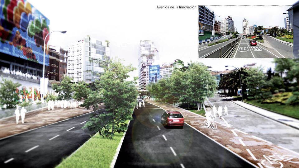
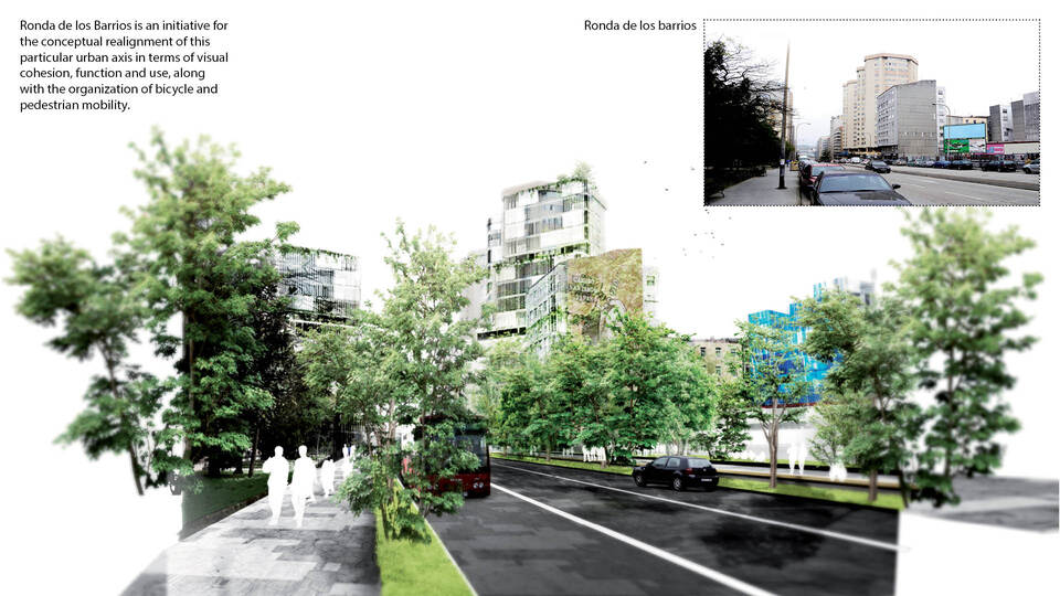
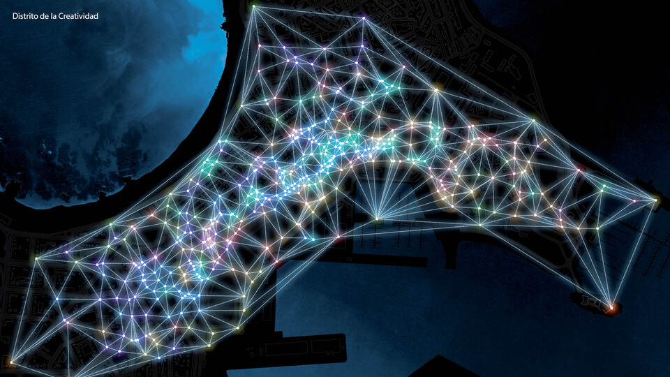
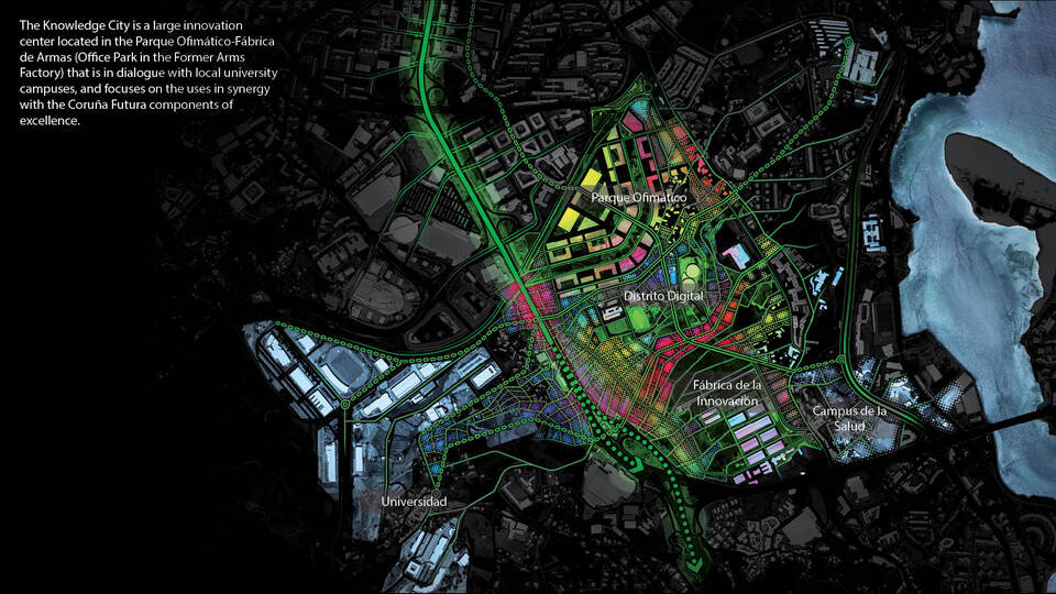
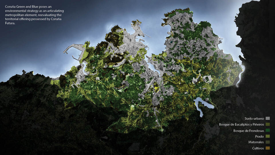
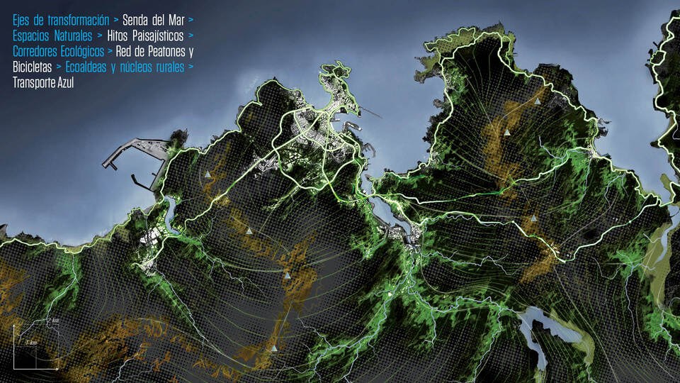
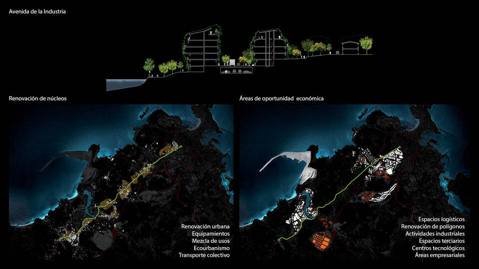
Coruña Futura is an exercise of territorial and urban I+D, aimed to define a City Project and to detect and implement strategic initiatives capable of boosting the city and its metropolitan area’s components of excellence.
The City Project proposes a strategy which links the different urban interventions with the economic clusters that should support the city’s economic strength. It is a framework for the articulation of the metropolitan and inner areas of the city, laying out the different urban uses by allowing an adequate compatibility of industrial, logistic and port activities with the central urban functions. Coruña Futura is an opportunity for reflecting on A Coruña’s future; a vision in which to integrate proposals of sustainable mobility, energy efficiency and smart city strategies with a comprehensive approach.

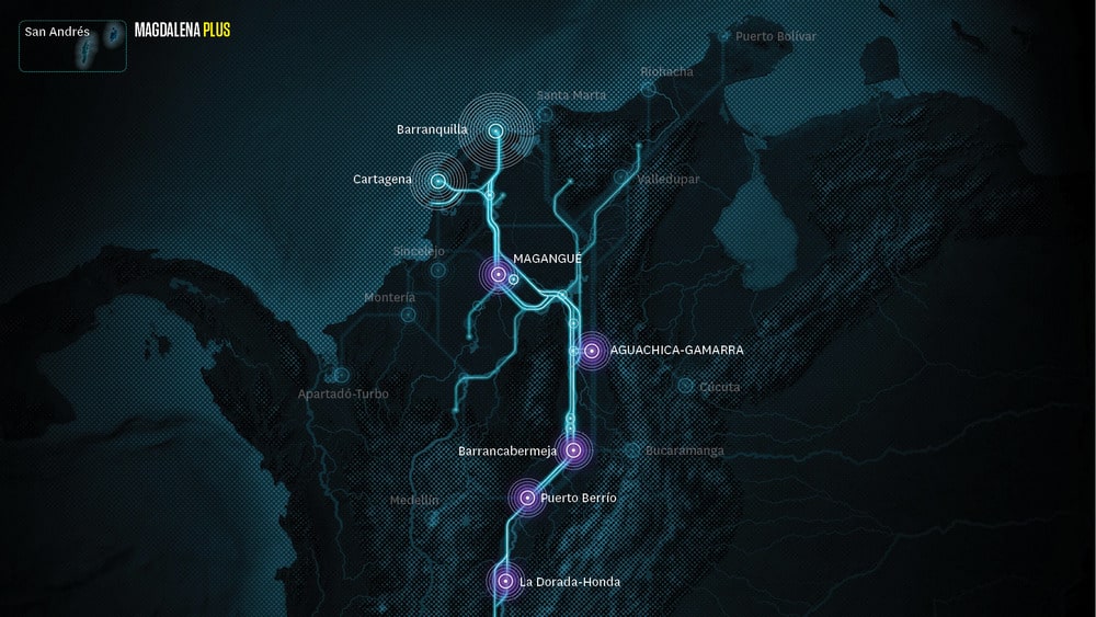
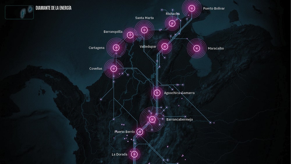
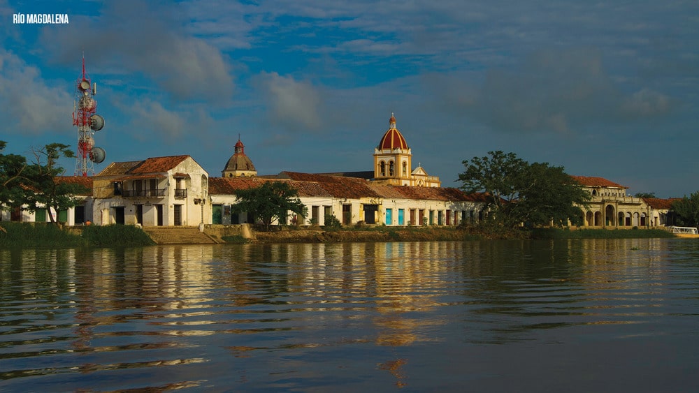
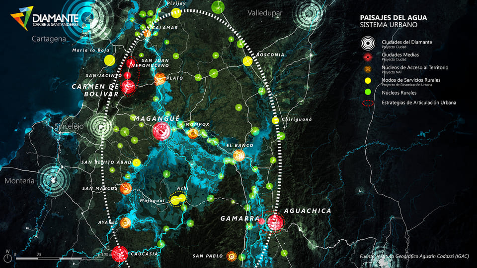
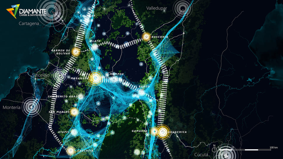
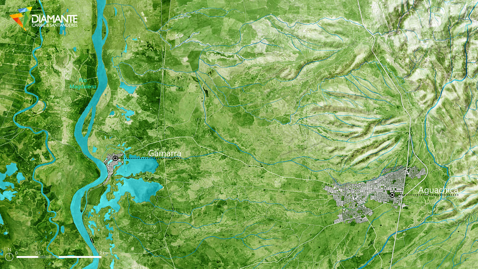
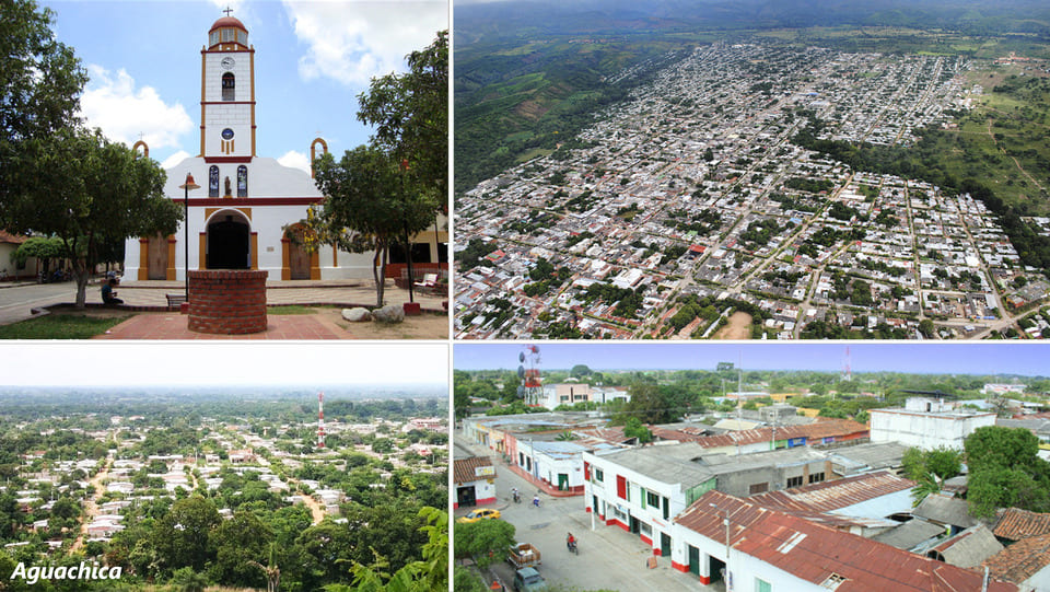
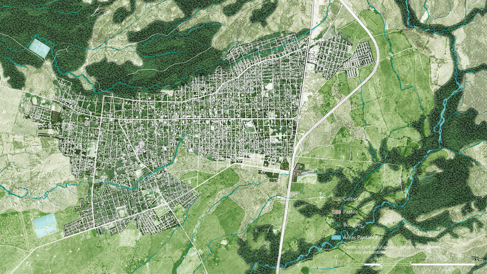
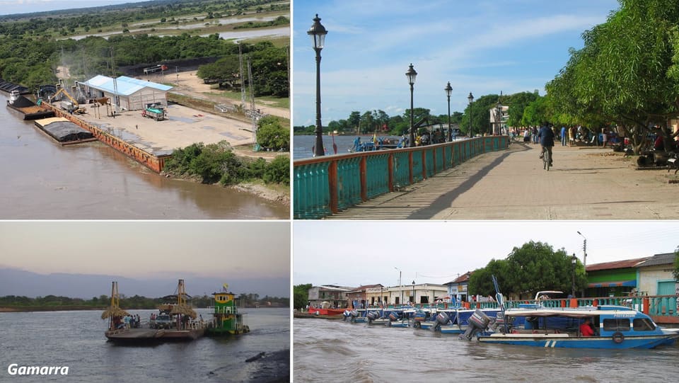
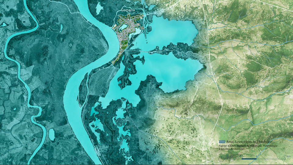
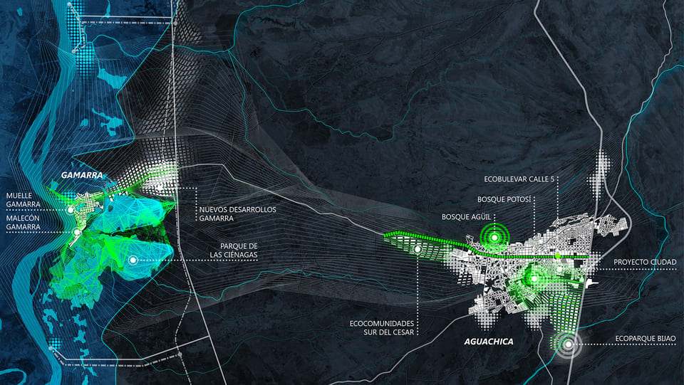
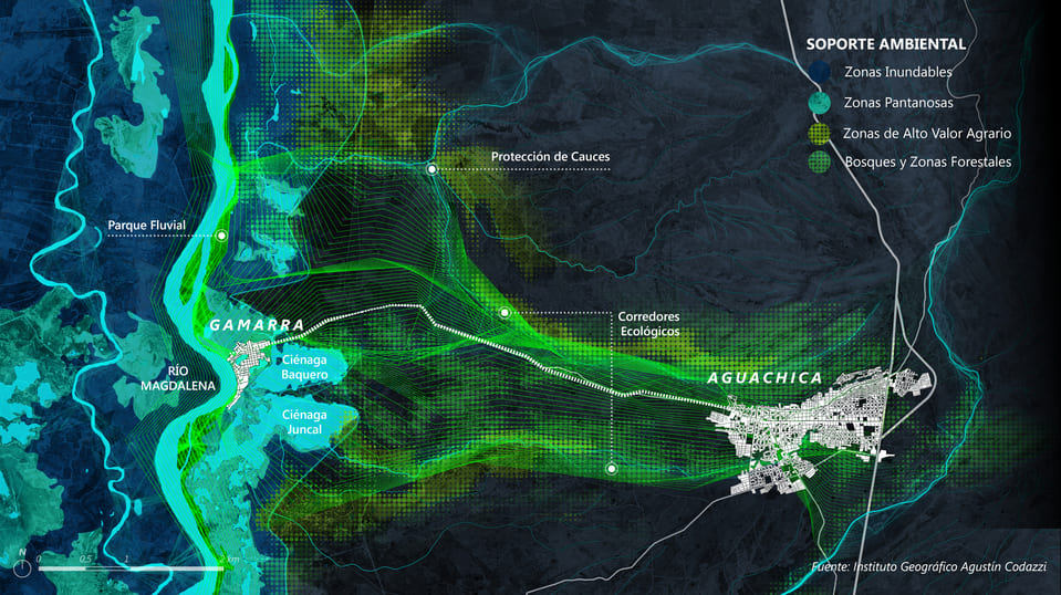
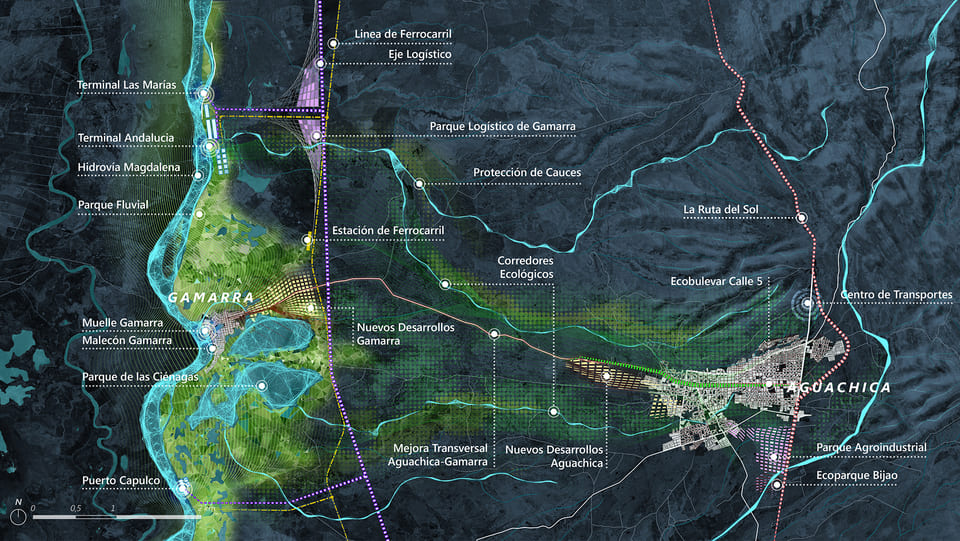
The Aguachica-Gamarra PLUS Territorial Strategy (Urban and Service Logistics Platform) is the initial approach to a key territory for the activation of the opportunities associated with improving the navigability of the Magdalena River in Colombia. The strategy is to develop a Master Plan in this space that allows the development of the infrastructure and the tertiary and urban spaces needed to articulate an important logistics services center in the Magdalena Center.
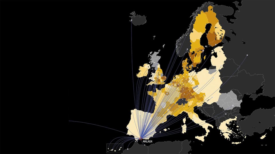
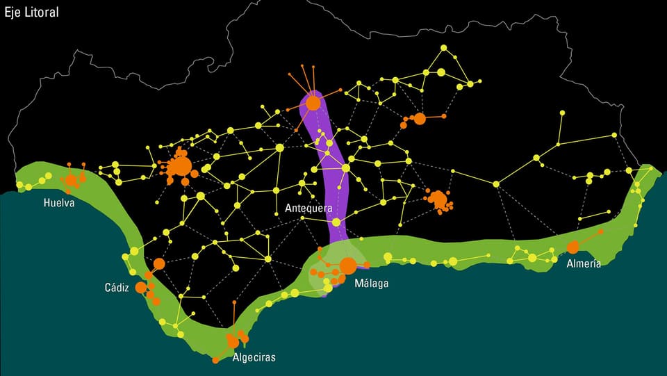
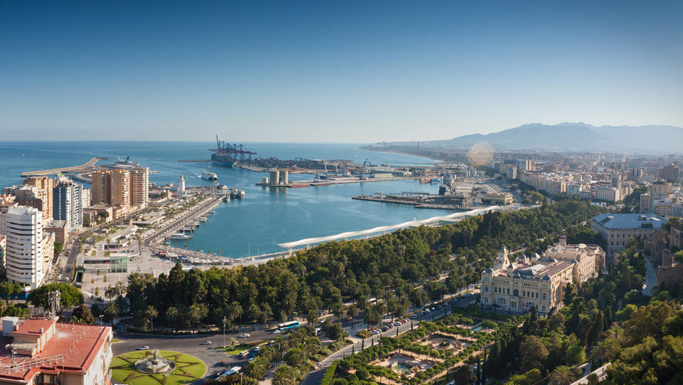
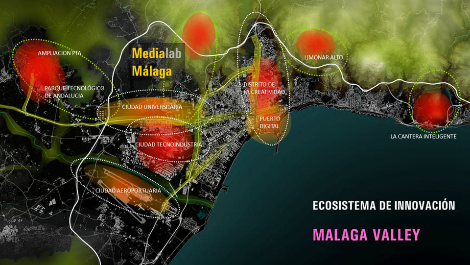
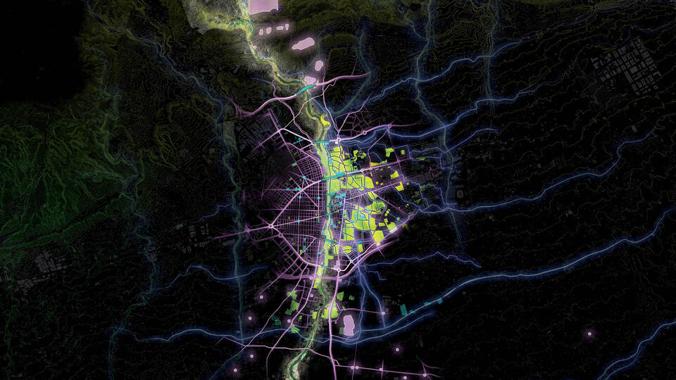
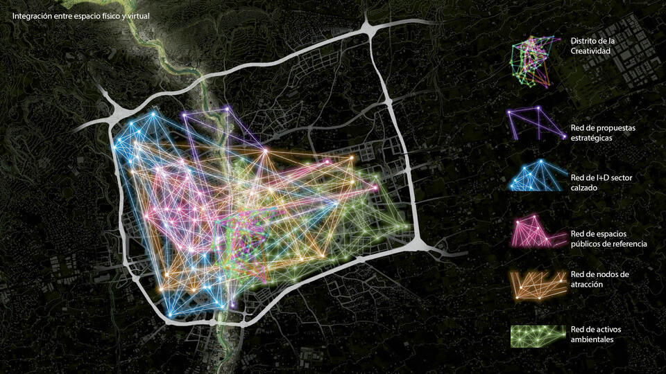
At the city-region scale Malaga’s development process is nested in its regional position as part of a balanced polycentric system of cities in Andalusia, as well as in its geographic location as a gateway to North Africa. The latter gives it great potential to expand its markets internationally, especially through the Euro-Mediterranean Partnership, ‘EuroMed’, with its seat in Barcelona, one of the lead cities of the European Diagonal in which Malaga can become a major partner.
Malaga’s development strategies rely on the components of excellence identified in the Proyecto Cities research, as well as on the priorities elaborated by the specifically constituted Urban Forum of Malaga. The clusters of excellence, strengths, perceived policy gaps and priorities form the basis of long term strategic policy formulation within the conceptual framework of the ‘urban ecosystem of innovation of Malaga’. The key strategy for Malaga which arose from research carried out by the Fundacion Metropoli is to build up a knowledge economy, based on attracting talent, improving and greening its infrastructure for tourism and cultural activities, and a high-quality environment. One of Malaga’s dynamic business community, ‘Malaga Valley’, is instrumental in realising an ICT based future.
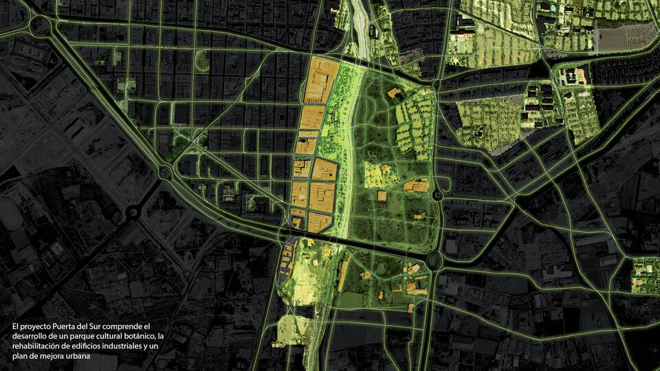
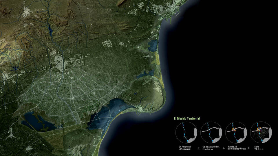
The territorial model proposed for Elche comprises a series of initiatives inspired in the objectives of boosting local identity, innovation and sustainability as keys for the city’s future. Elche has a diverse and valuable environment, and is strategically located in the Mediterranean with good connections with its surroundings.
A very clear territorial structure is laid out through two large perpendicular axes: a North-South axis, with an environmental and heritage vocation, and an East-West axis that enjoys very powerful infrastructures, connecting the future HSR Station with the airport, and which is support for many diverse economic activities.
For its climate, culture, landscape, infrastructures, quality of life and entrepreneur spirit, Mediterranean cities like Elche have a great potential to attract investment and develop innovative initiatives with high added value.
Architecture
+ Design
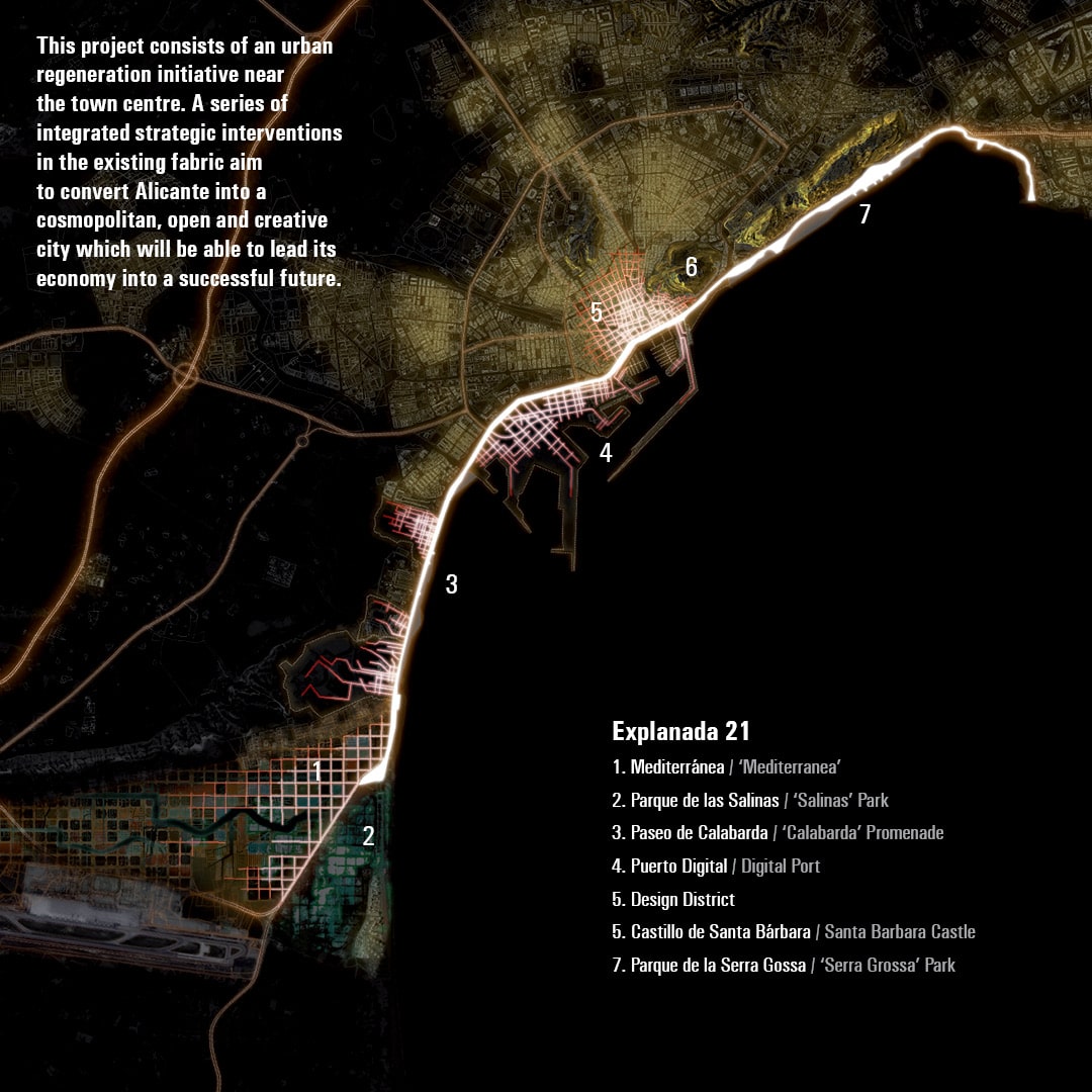
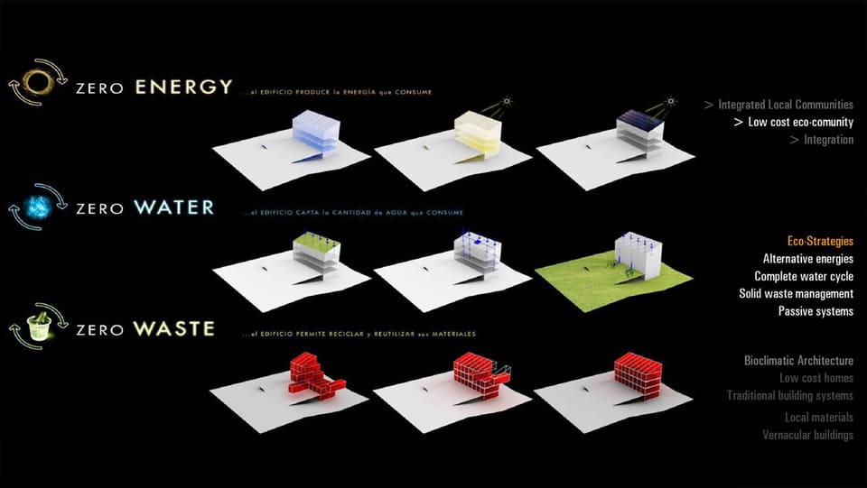
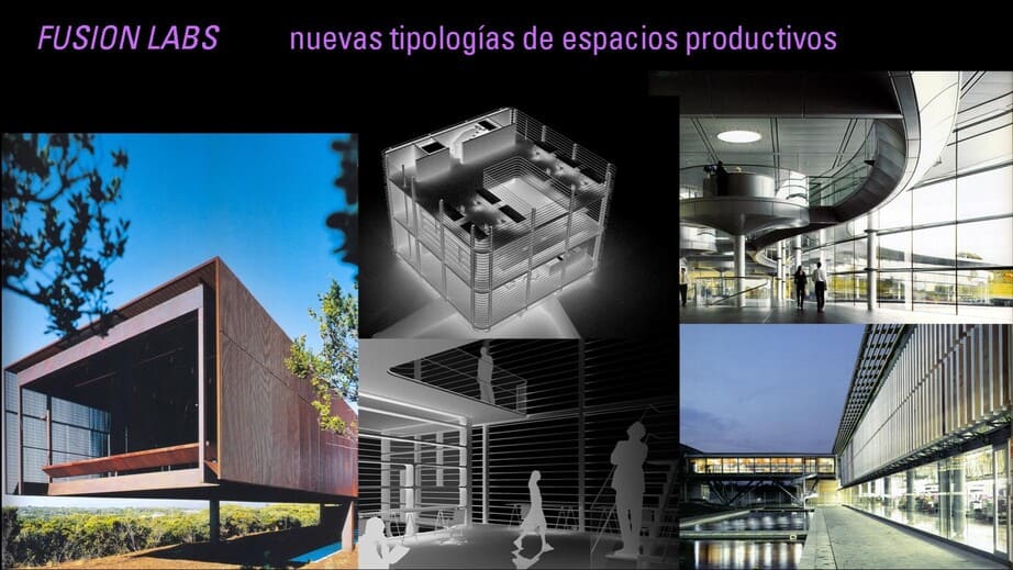
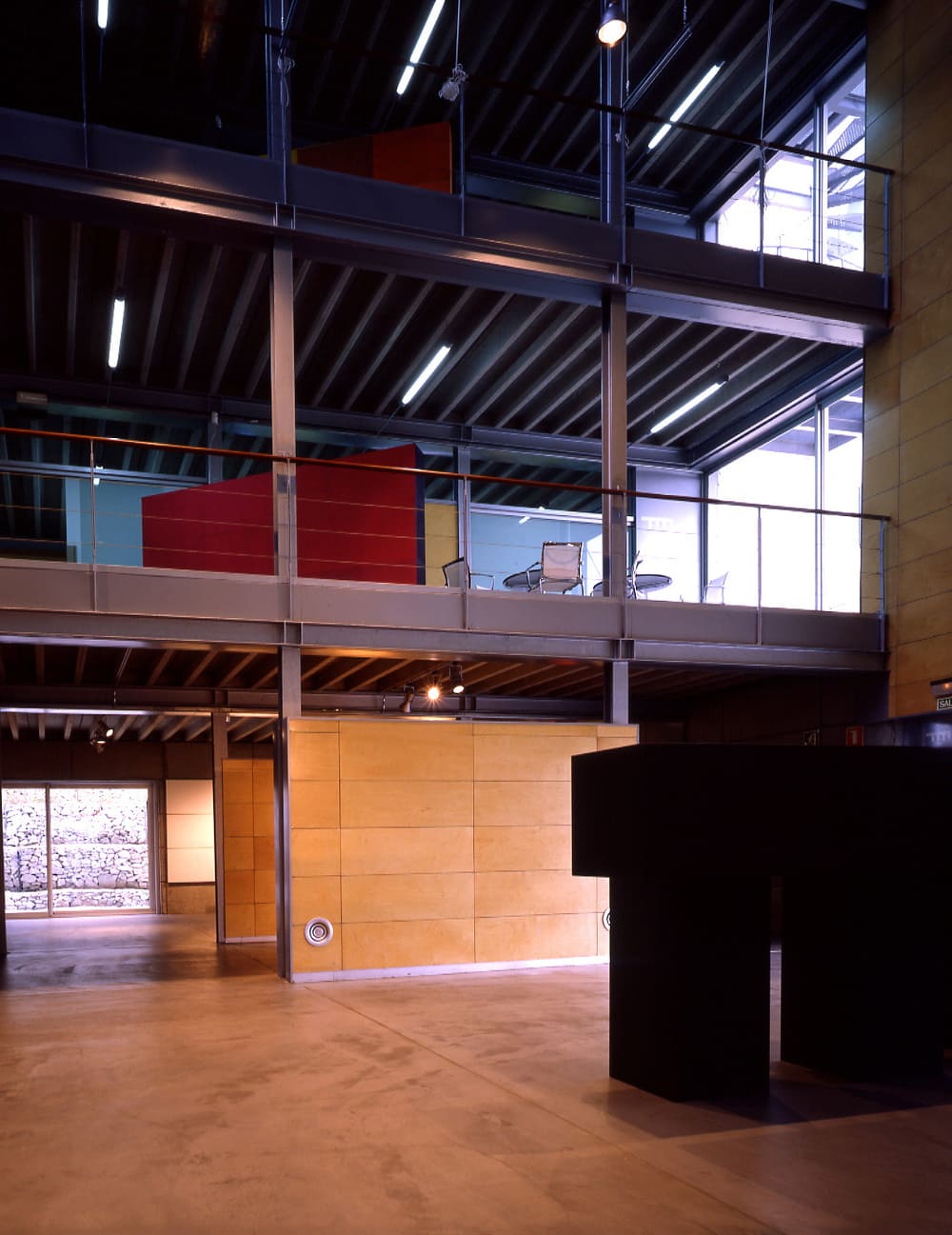
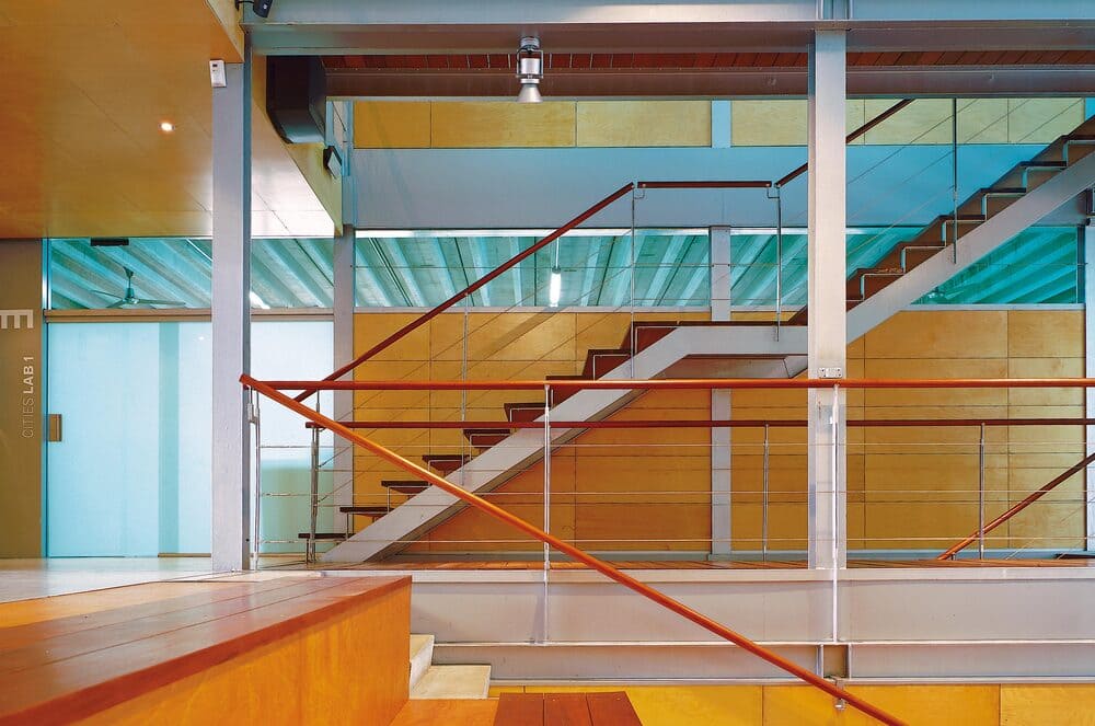
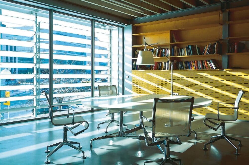
Metropoli’s projects embody the “Intelligent Territories” philosophy, collaborating with public and private sectors to design in the fields of architecture, urban development, regional planning, and technology. Notable architectural projects include the “Ecobox” bioclimatic building in Madrid, the “Aulario” at Alicante University, and experimental works like “Cubes of Innovation” and Zero Energy Buildings. Metropoli’s CitiesLab office in London spearheads architectural initiatives that focus on creating a dialogue between site context, technology, and aesthetics, advancing future-oriented architecture grounded in environmental and contextual responsiveness.
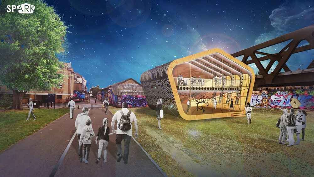
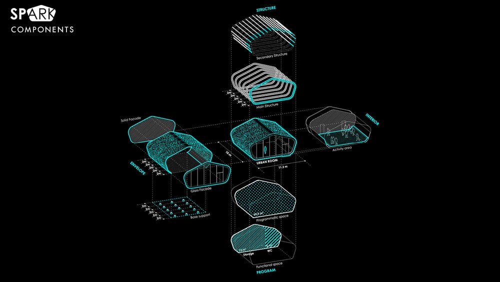
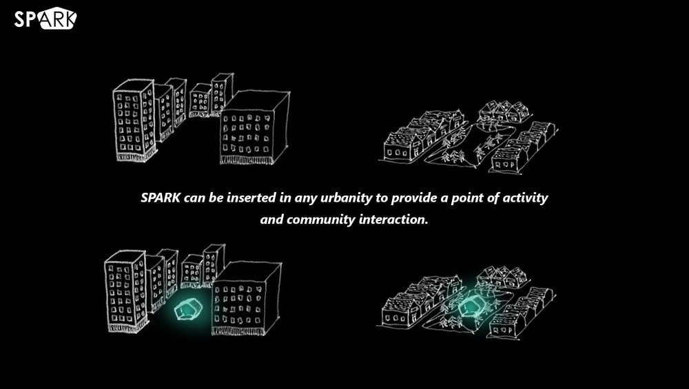
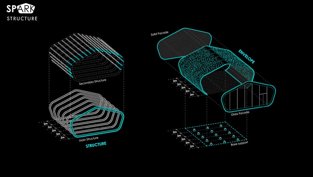
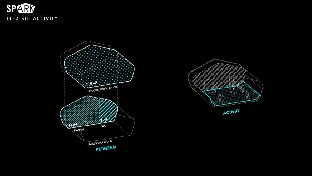
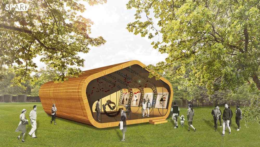
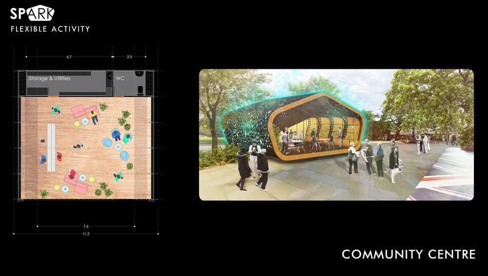
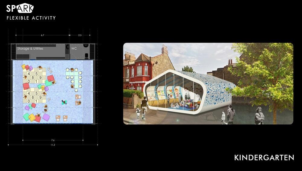
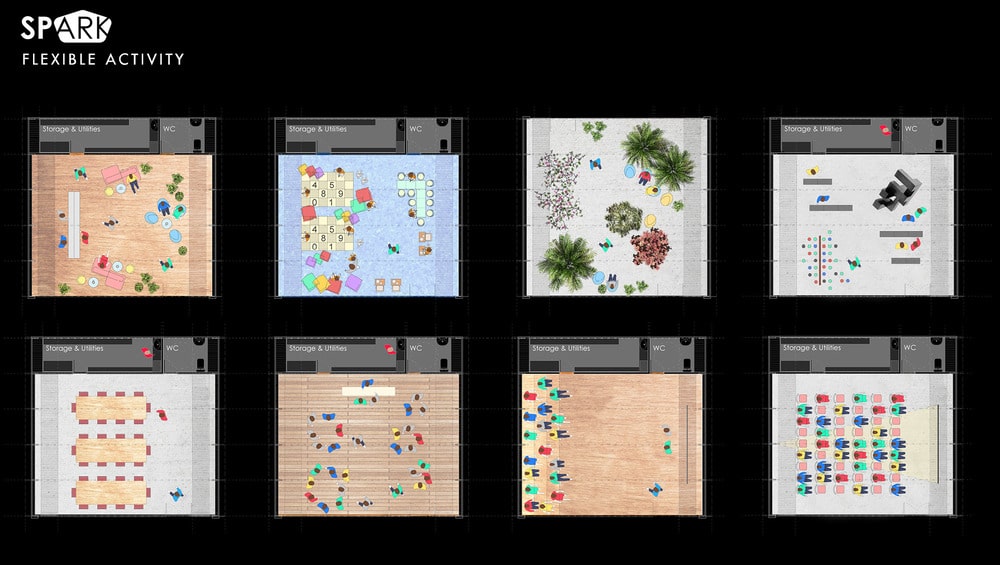
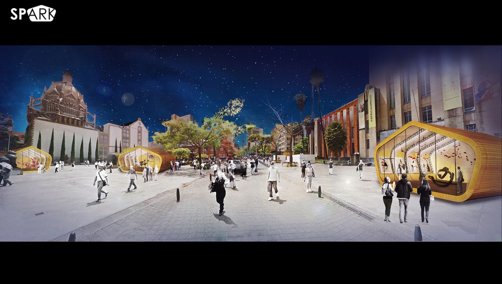
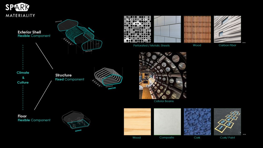
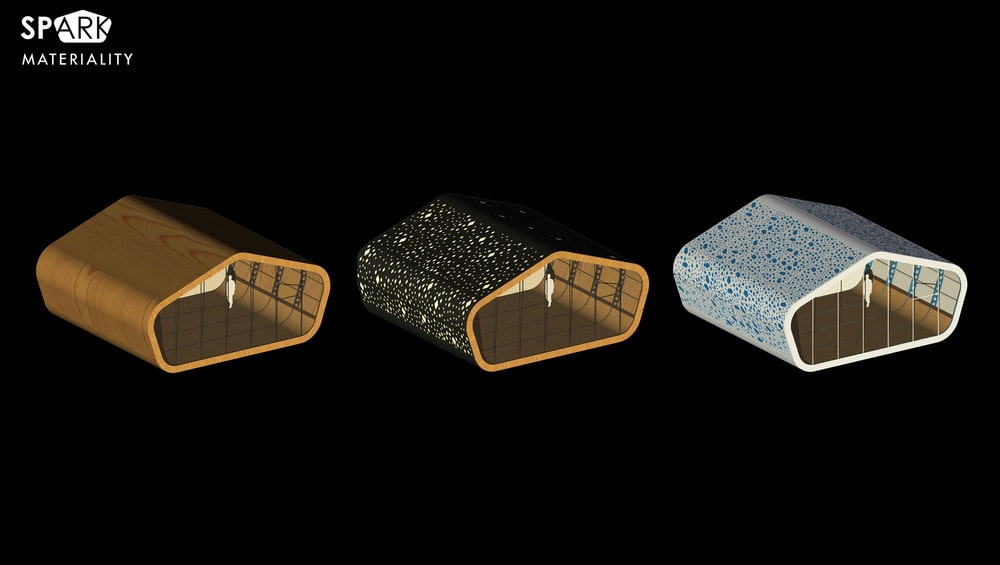
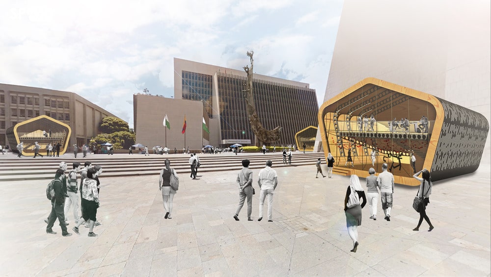
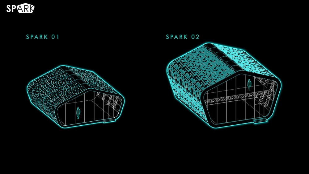
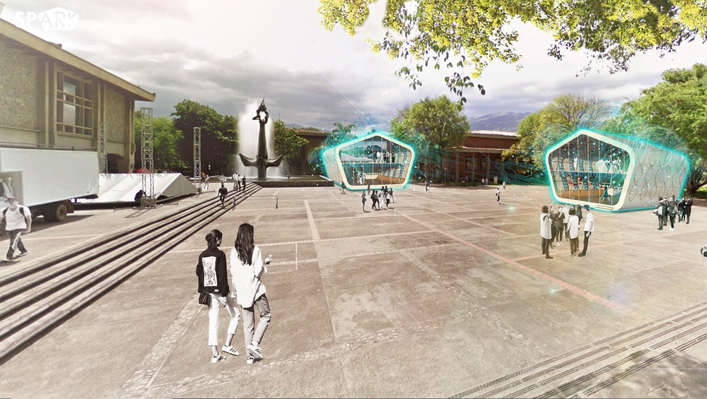
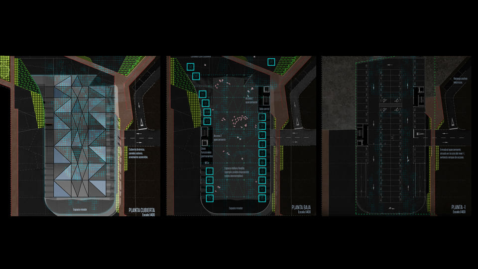
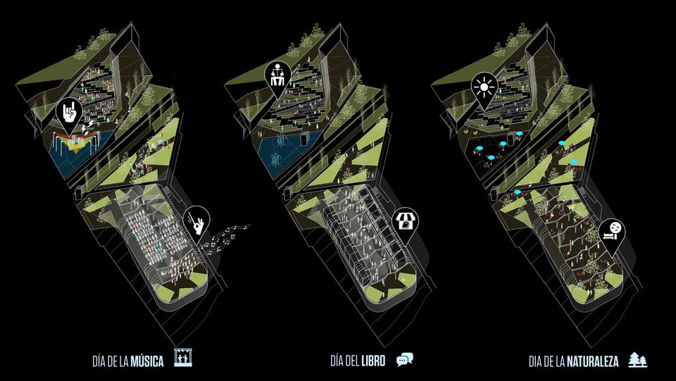
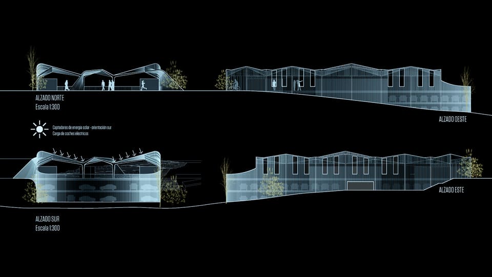
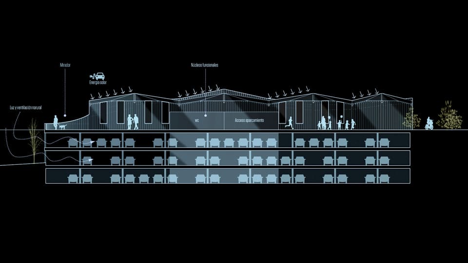
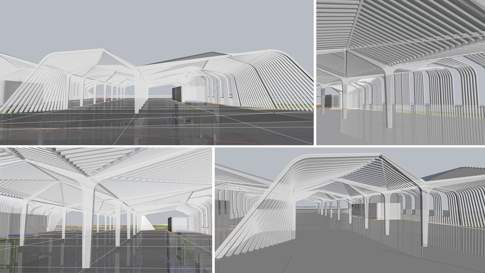
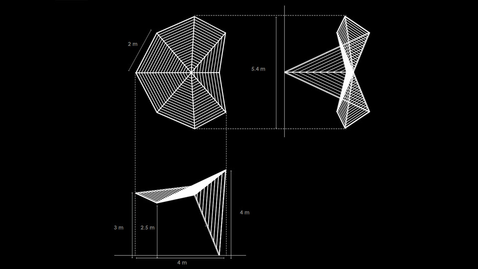
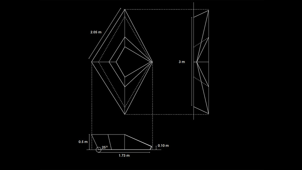
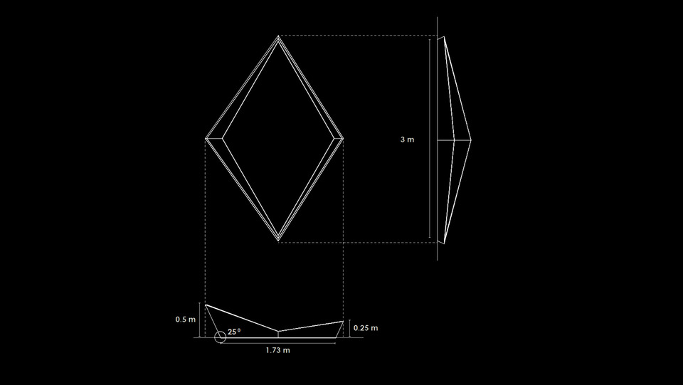
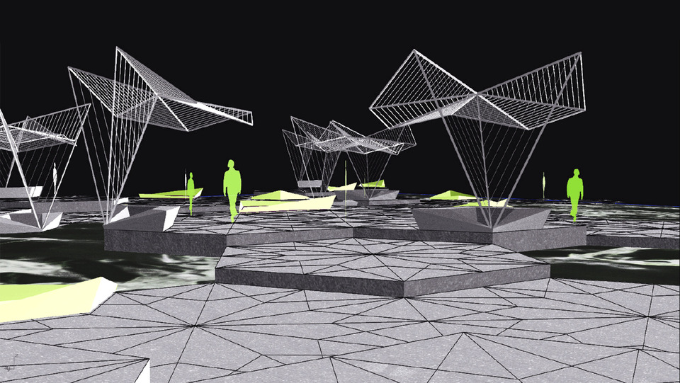
SPARK is a flexible urban module that aims to bring a point of activity to the urban realm. It is thought to be an urban tool to activate public space, help areas in transition and neighborhoods that need complementary amenities.
The envelop of the spark can adapt to any climate and aesthetic context. It can also integrate advanced sustainable and digital components. The interior open space has the capacity to host indefinite possibilities of activities, from educational, cultural to commercial.
Depending on context, we find opportunities in attracting private entities to showcase their work and technologies and become interactive show cases. In the same way that public entities can share initiatives and ideas to the community. Or to become independent activity points that complement to the necessities of the neighbourhood.
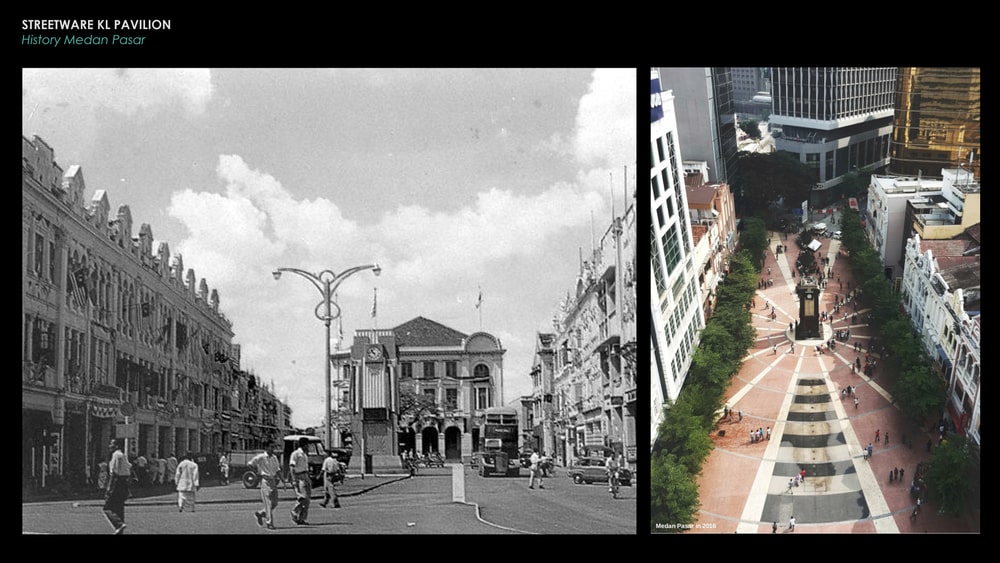
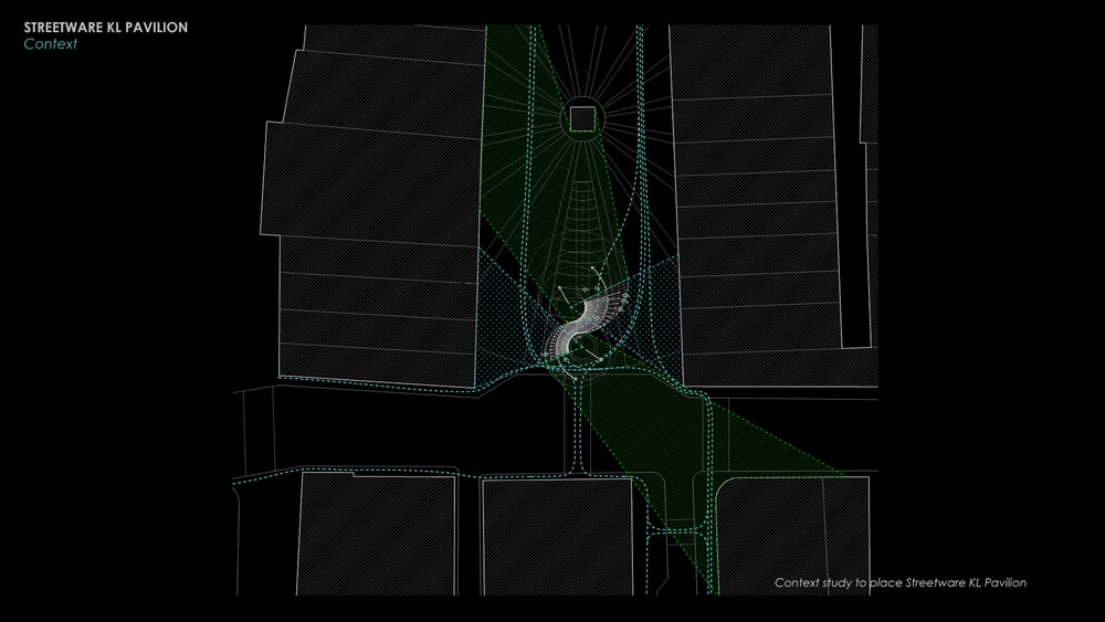
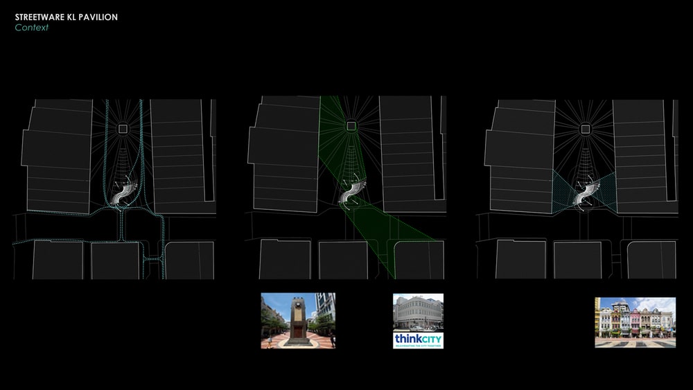
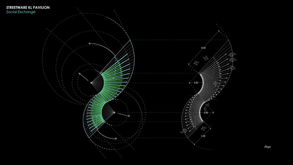
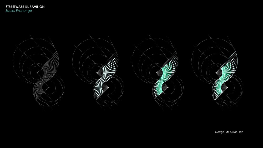
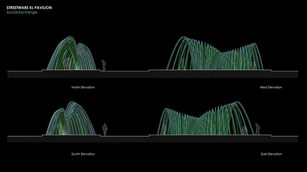
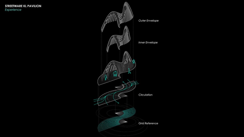
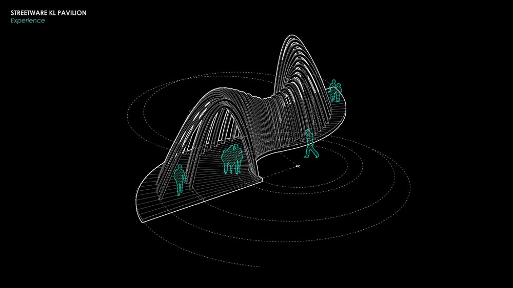
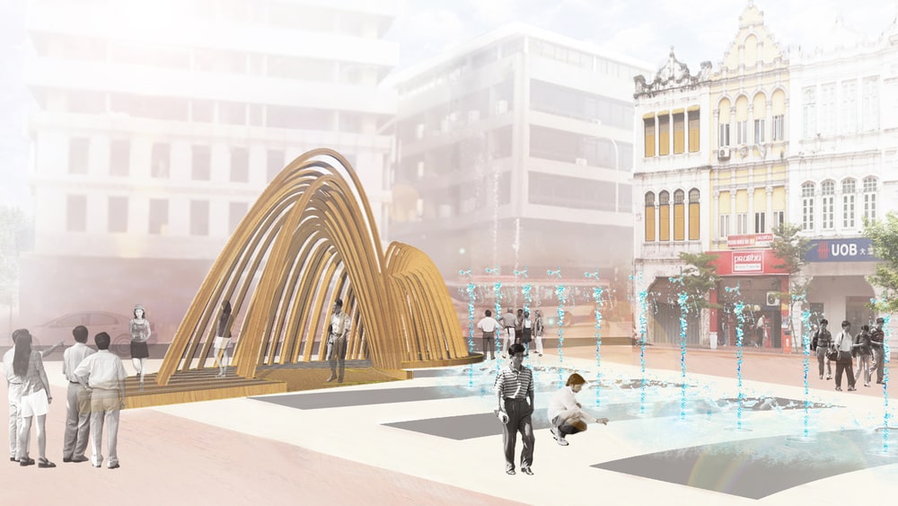
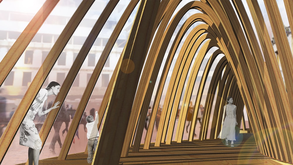
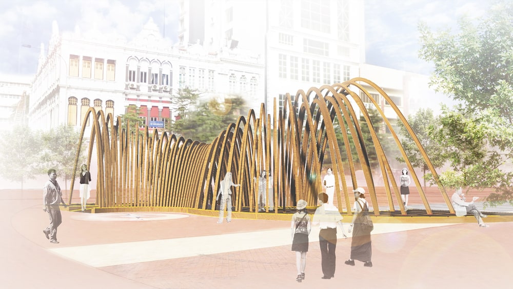
KL Pavilion is located in Medan Pasar (Market Square) once the heart of China Town. The square’s icon is an art deco clock tower built in 1937 to commemorate the coronation of King George VI.
The architecture of the pavilion creates a shadow path through wooden arches of different scales between the street to the centre of the square, the clock. The geometry emphasizes the views toward the protected shophouses at either side by opening up the spacing of the arches.
The use of local material represents the aim to showcase new ways to use and support local manufacture. Whilst the symbol of the pavilion in the square aims to highlight the activation of public space. KL pavilion becomes a place to experience, a place to meet and a place to rest.
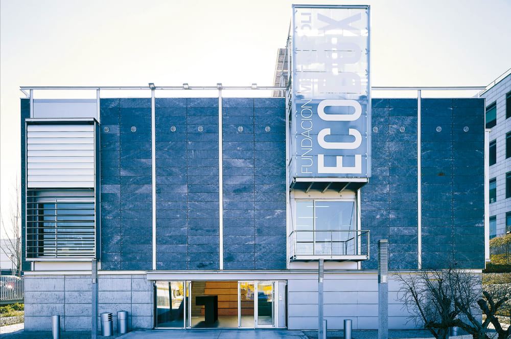
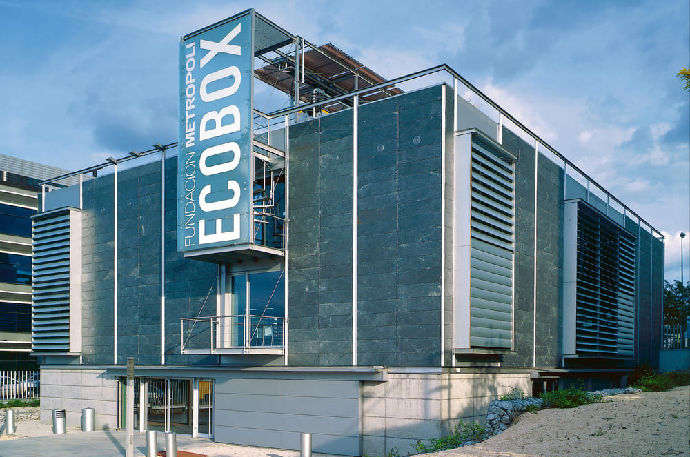
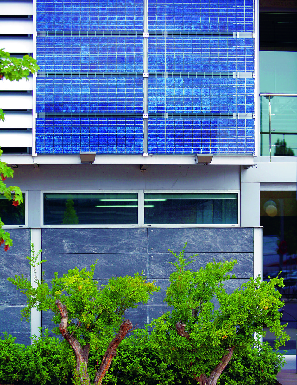
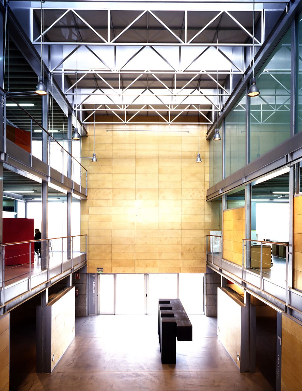
The Fundación Metrópoli building was conceived with two basic criteria: the creation of a place for innovation and creativity, and the commitment to bioclimatic principles. The design of the building was inspired by architectural concepts of sustainability, and incorporates advanced bioclimatic facilities and construction systems.
The objective of the experimental Ecobox was to create an innovative building that promotes the connection between man and nature.
The building takes into account the criteria of energy efficiency, renewable energies and sustainable construction methods.
The philosophy of Ecobox is in line with the overall philosophy of the Fundación Metrópoli: a commitment towards creativity and the construction of a sustainable future for us, our cities and our small planet.
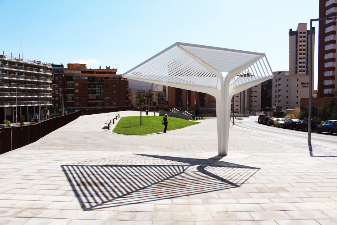
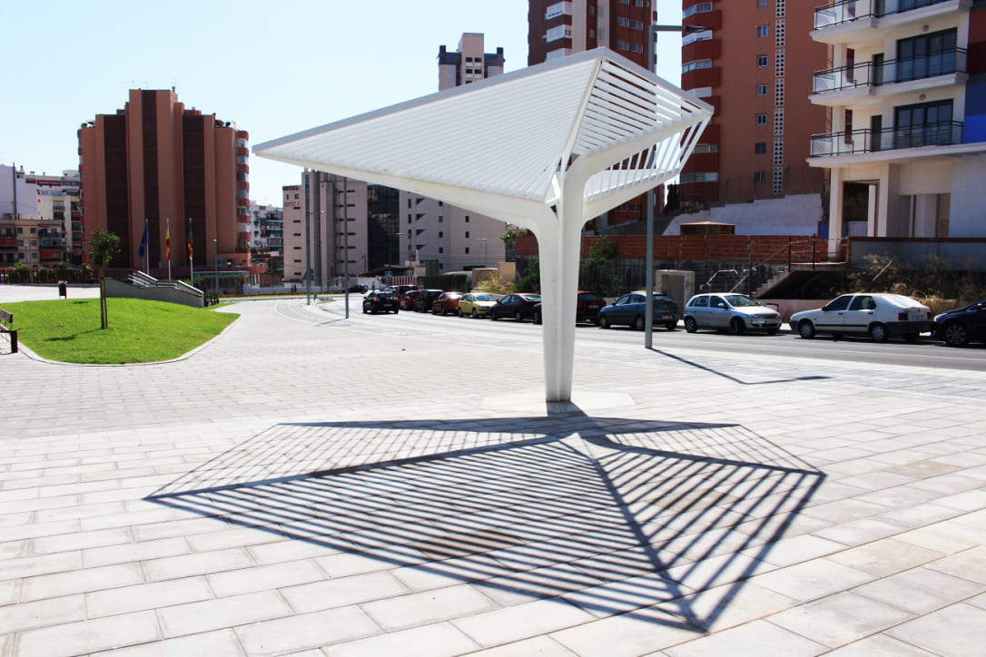
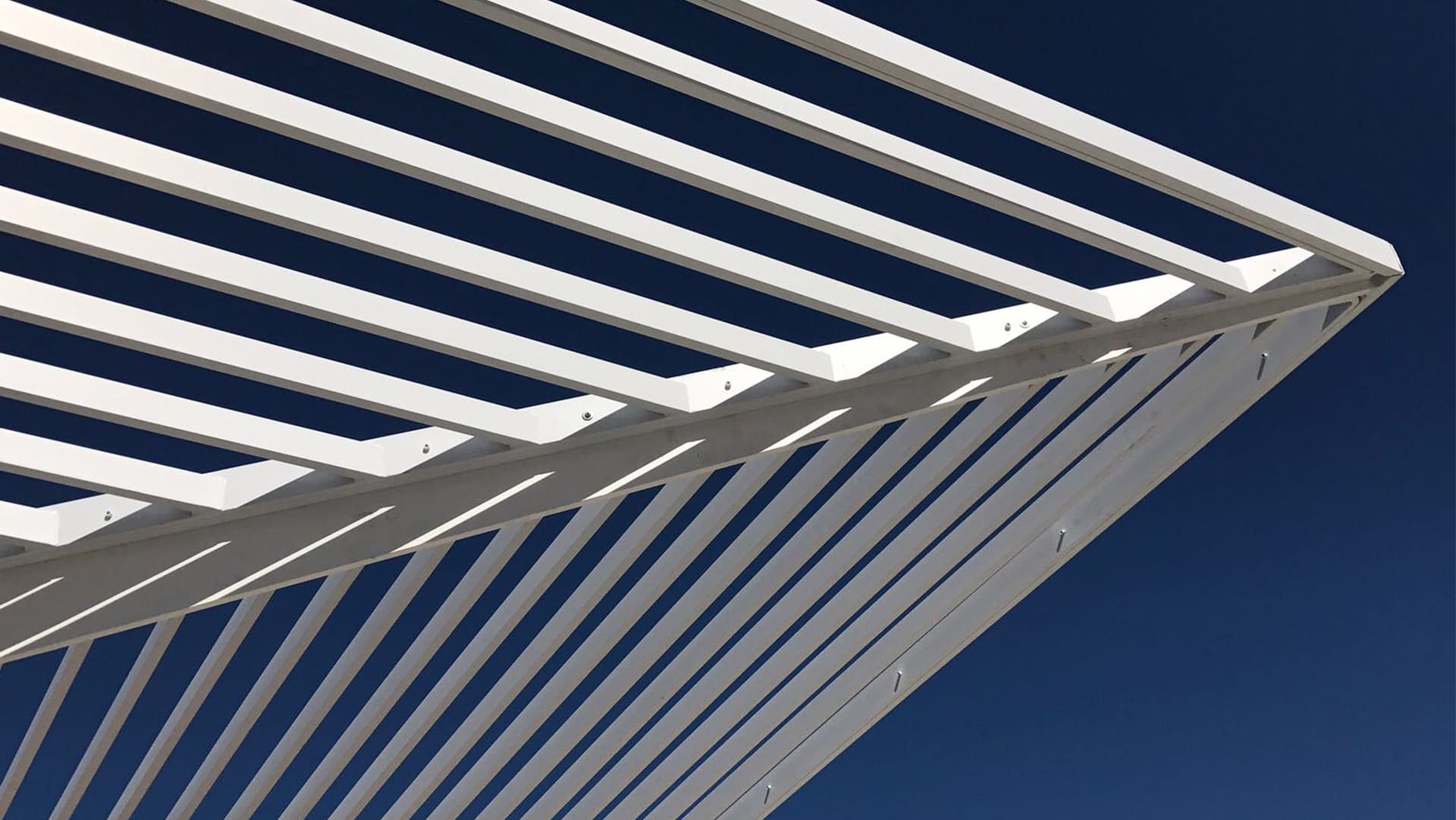
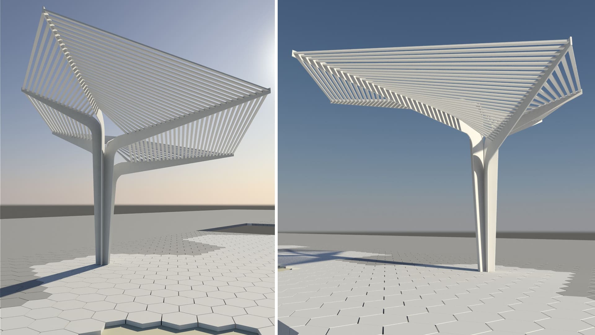
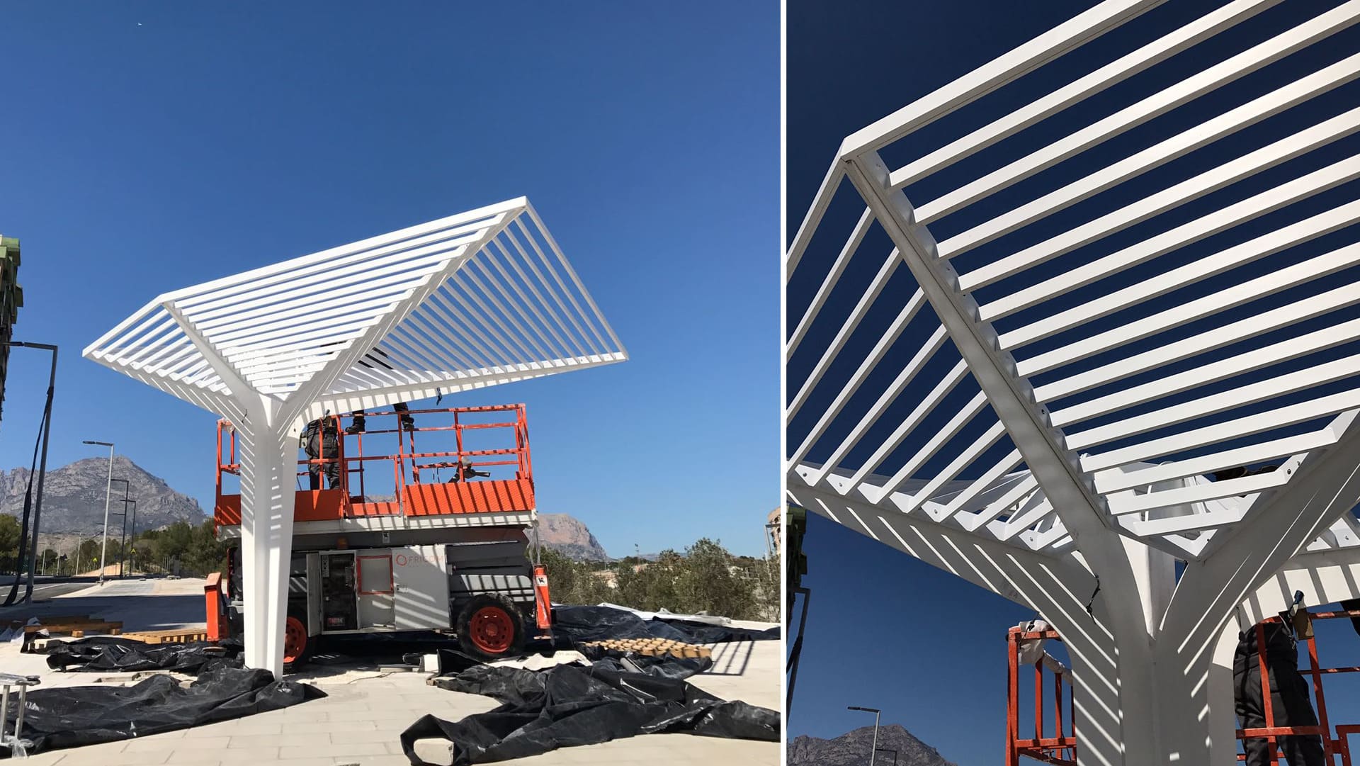
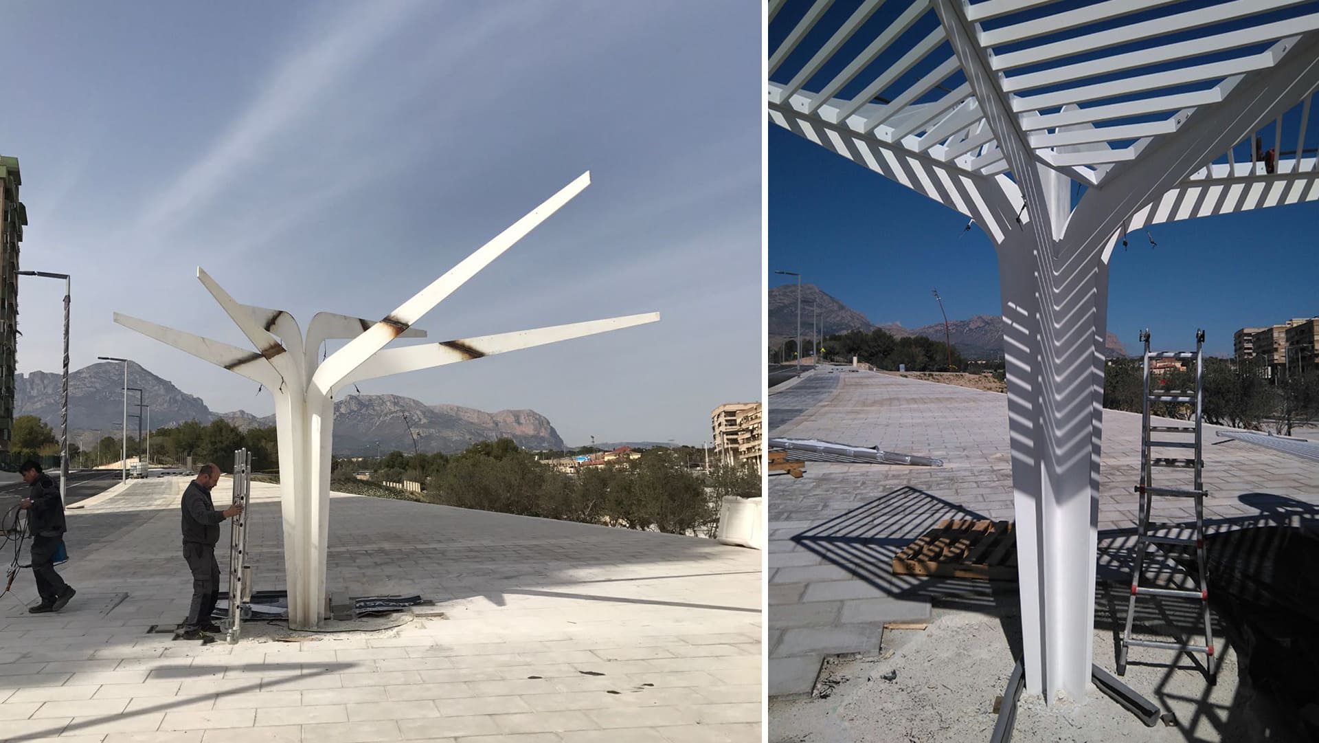
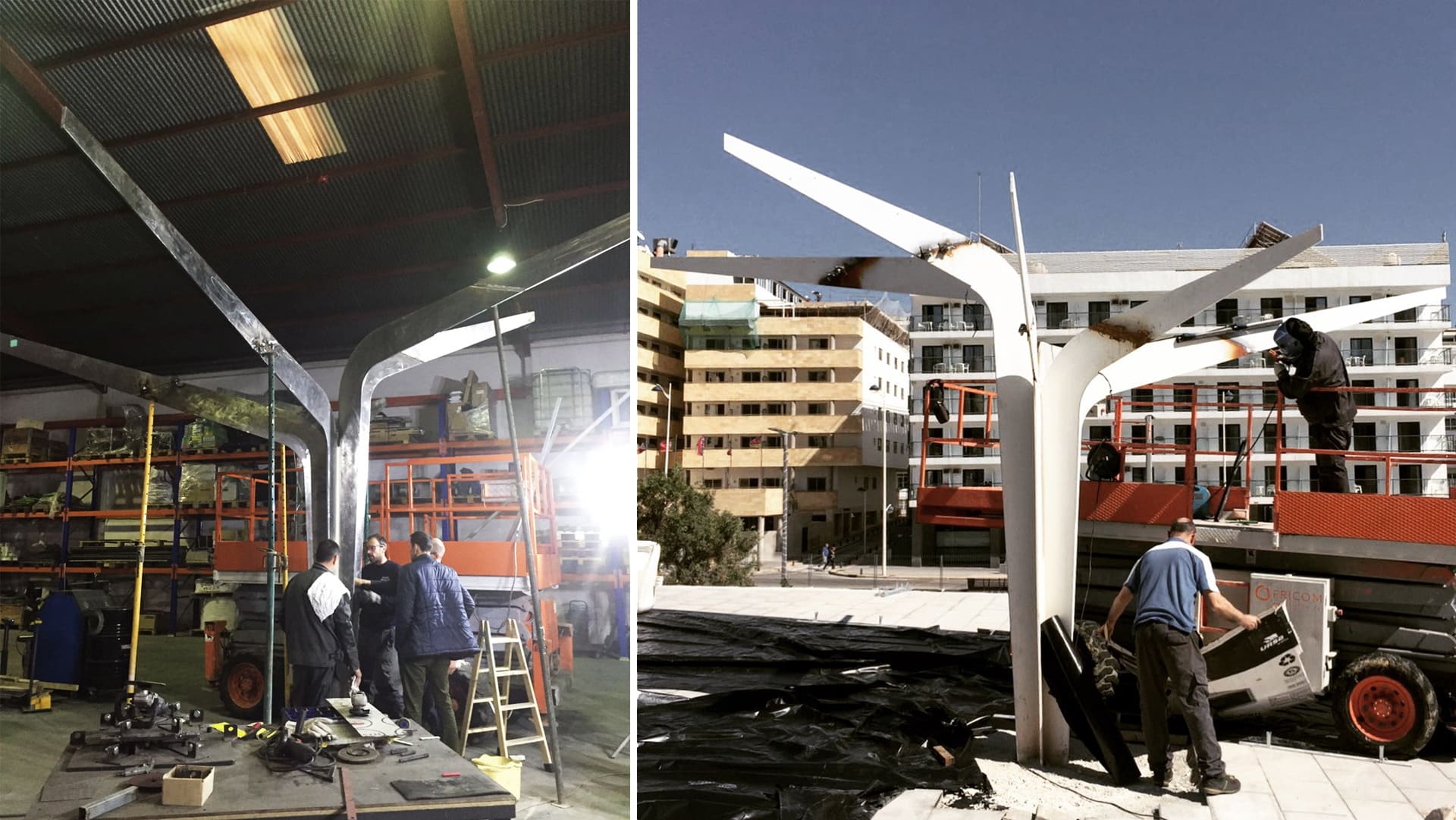
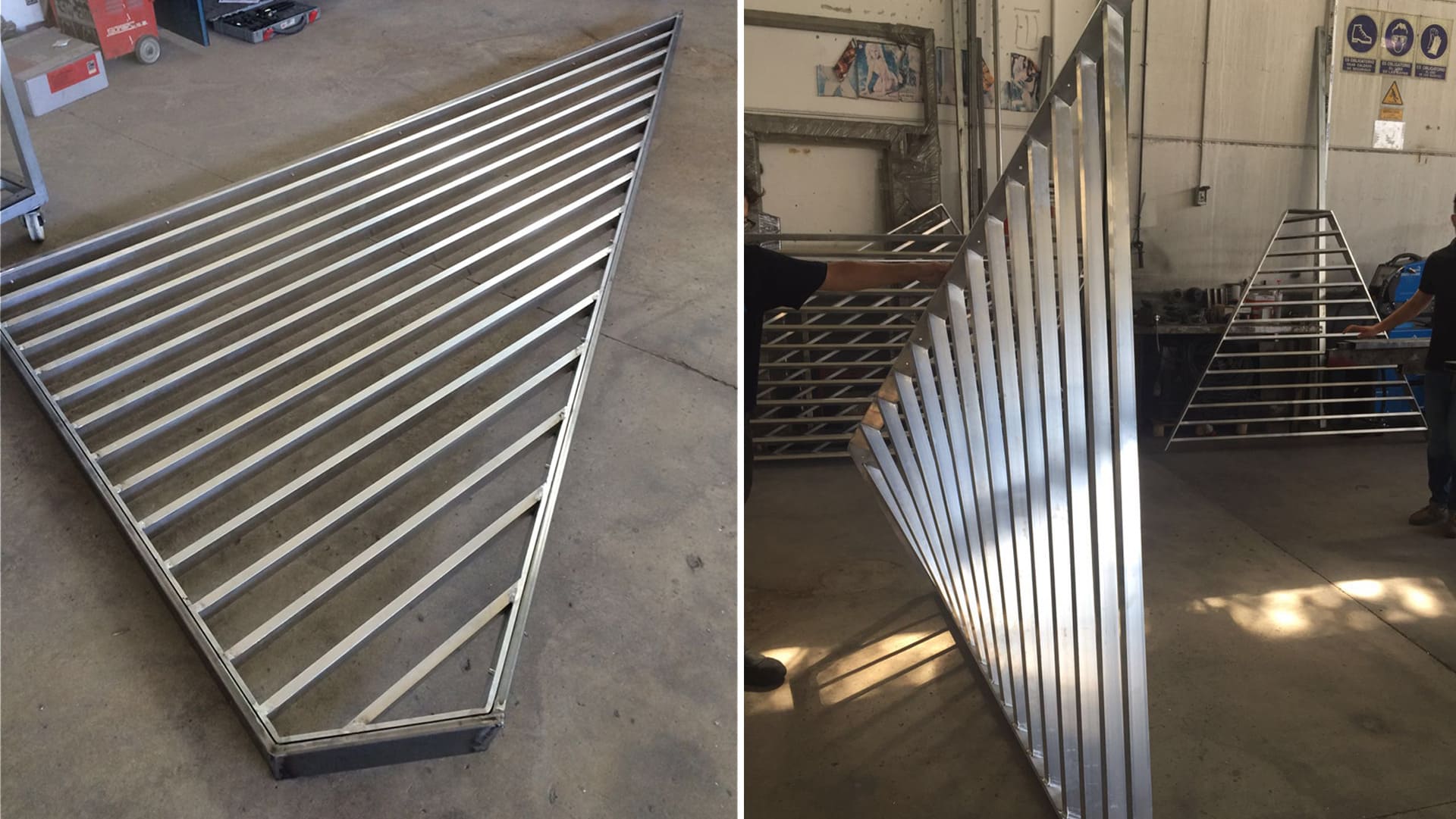
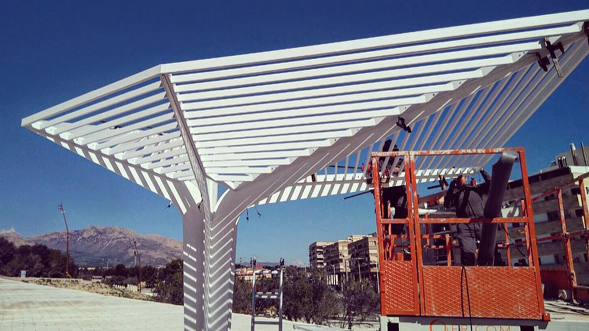
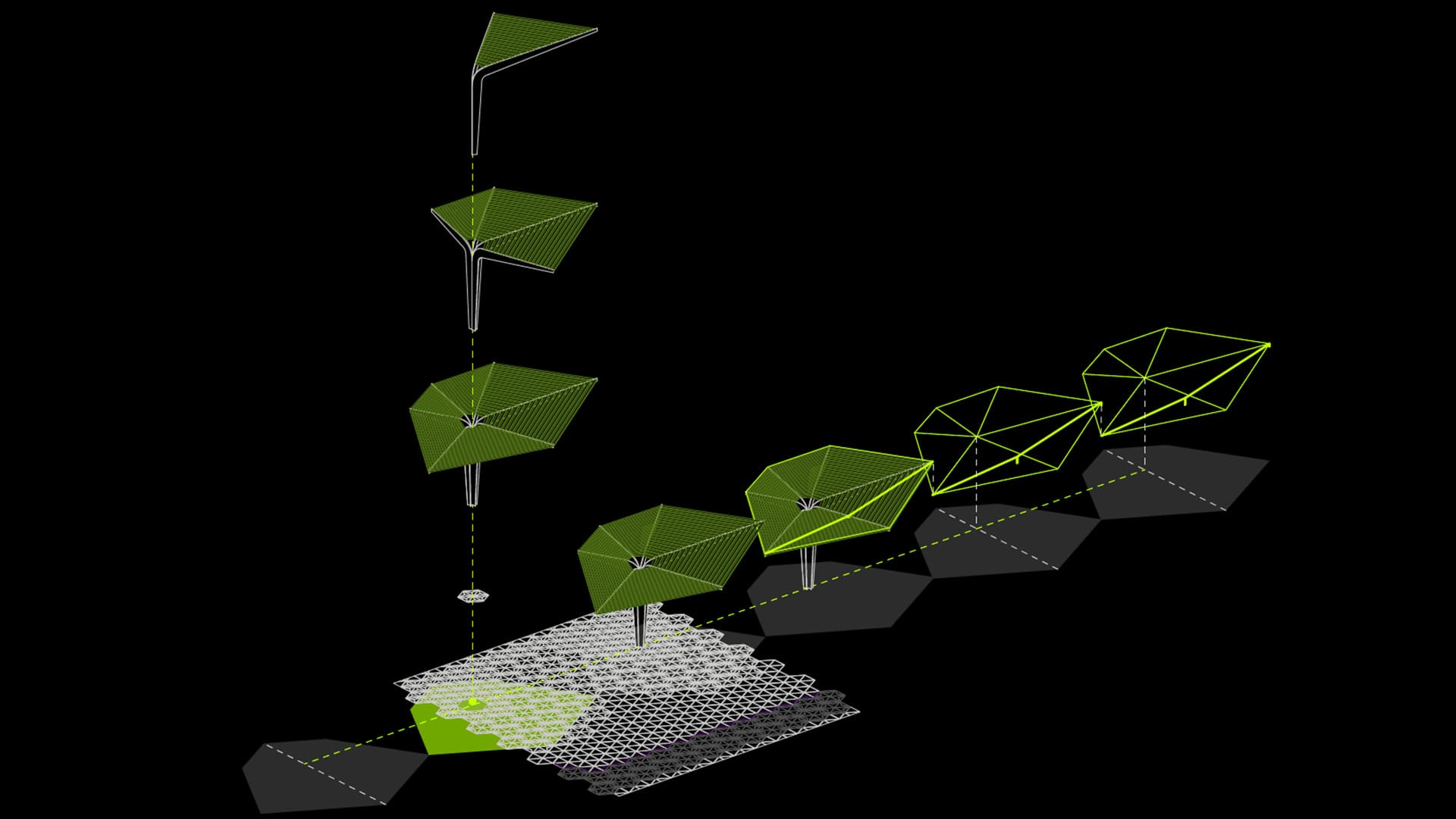
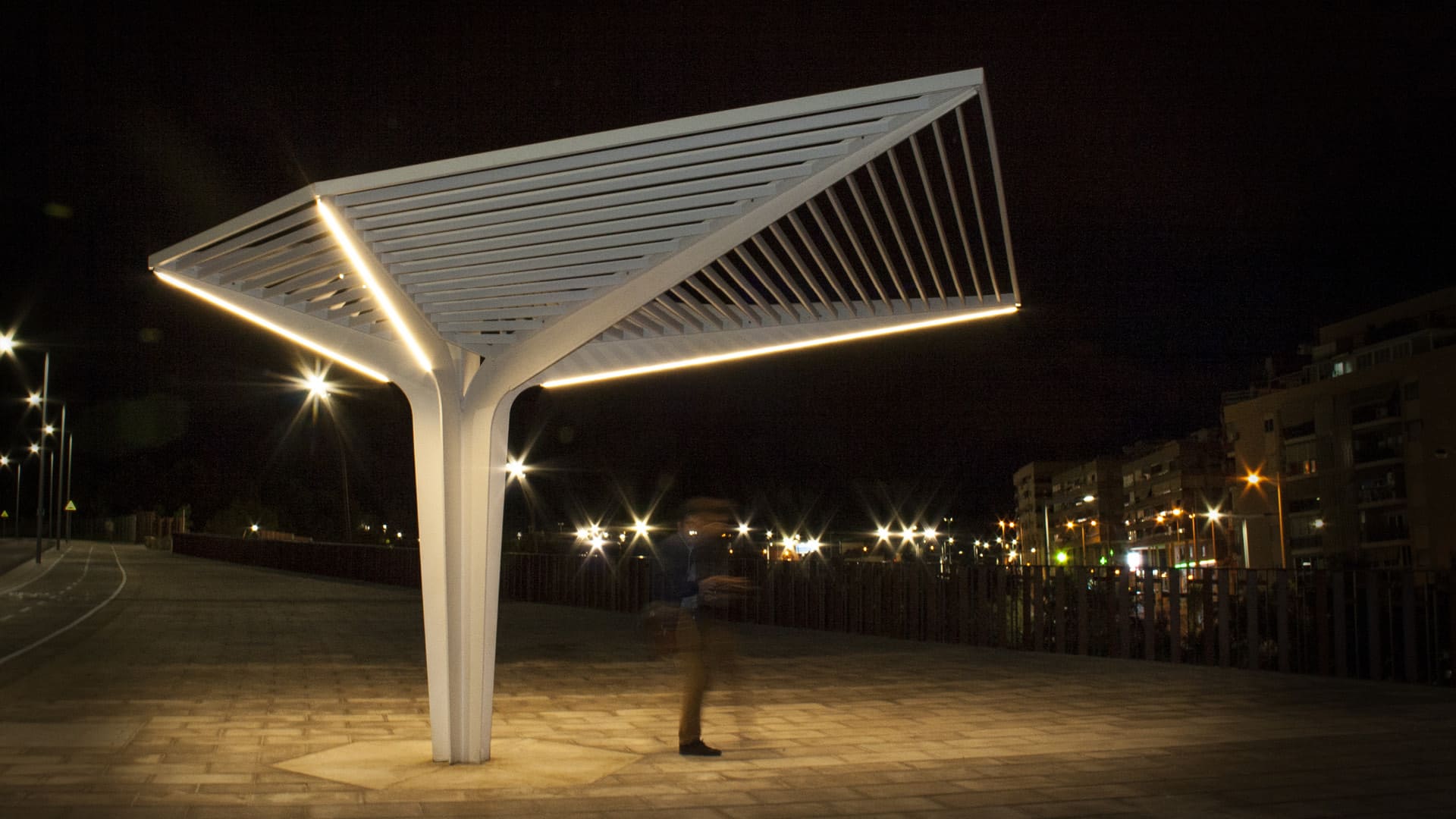
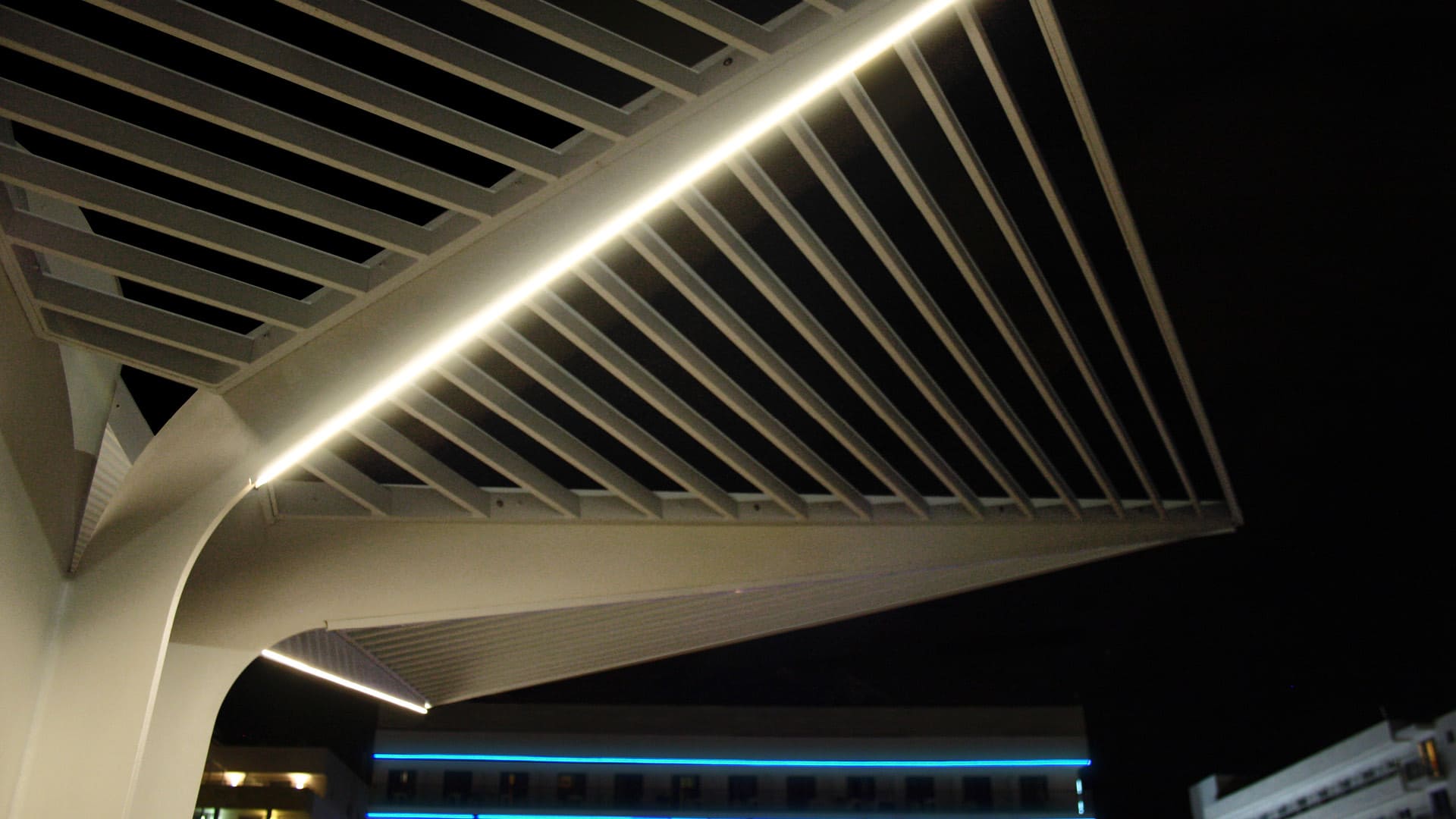
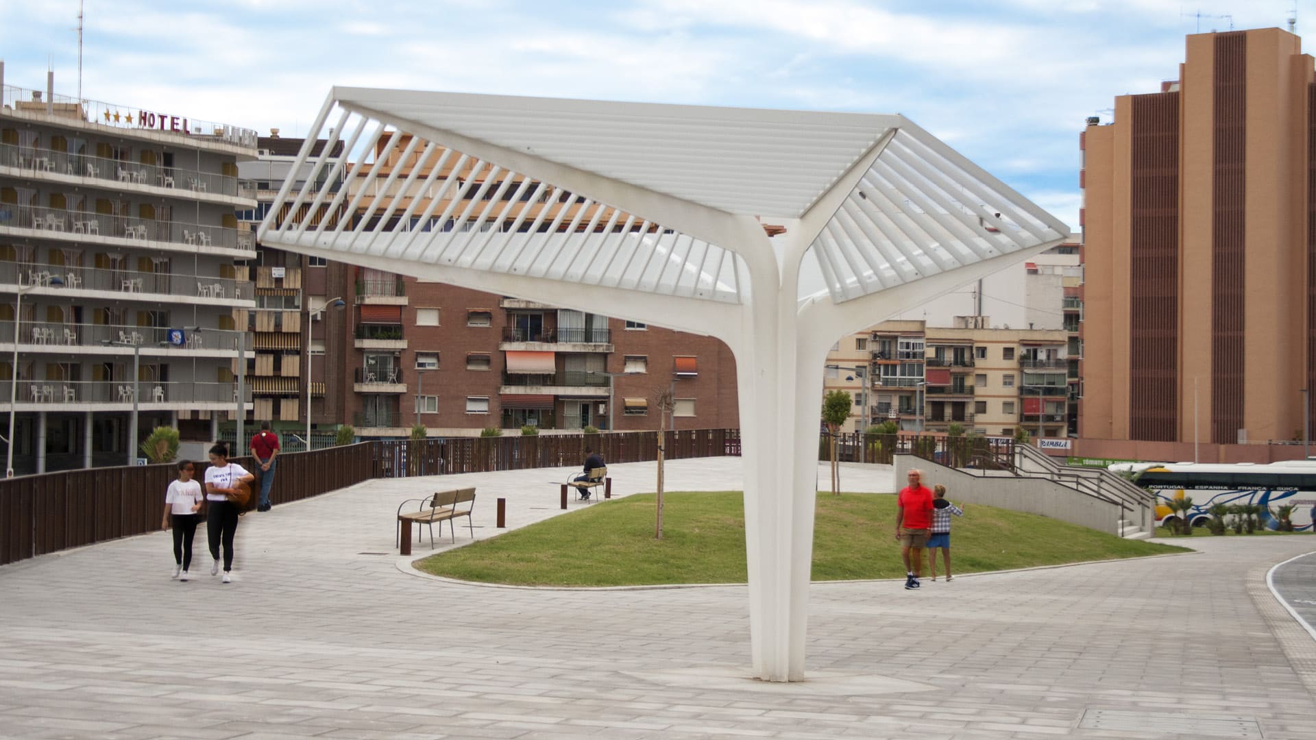
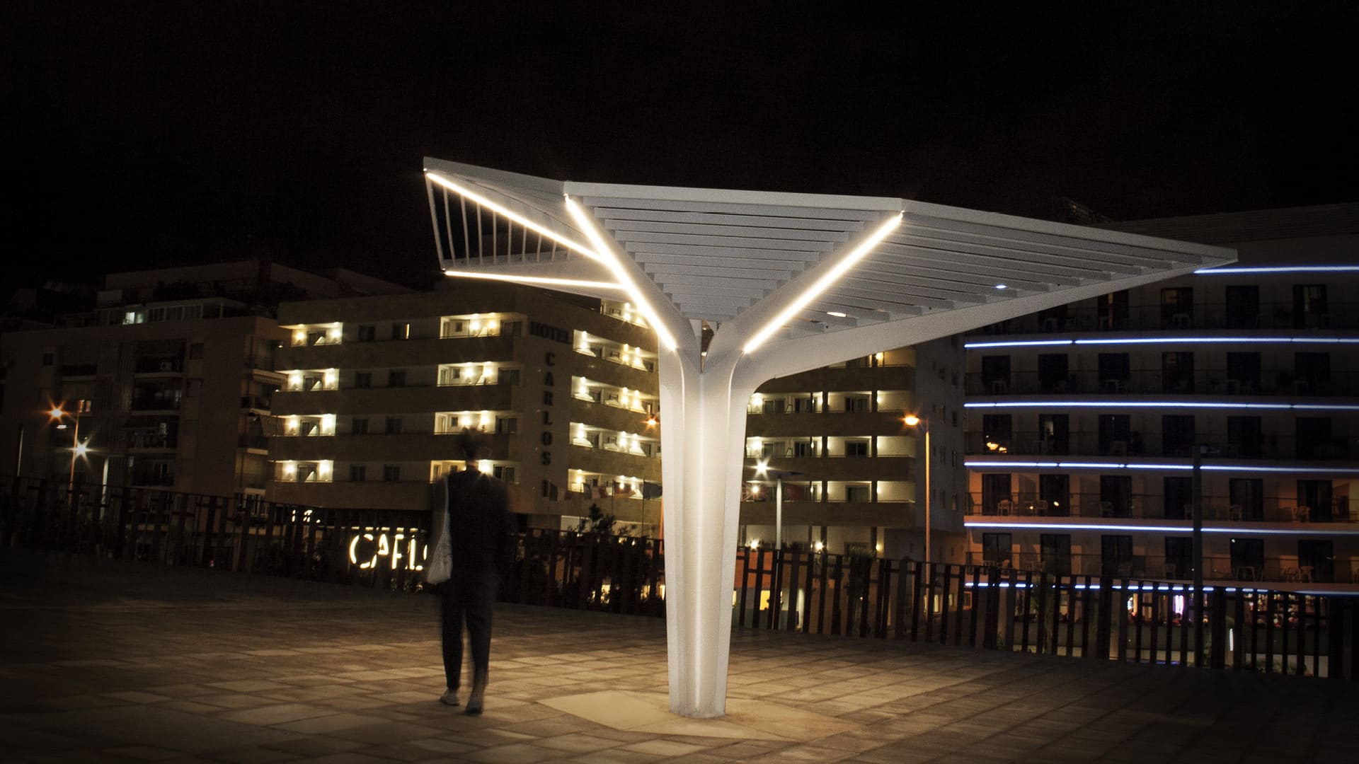
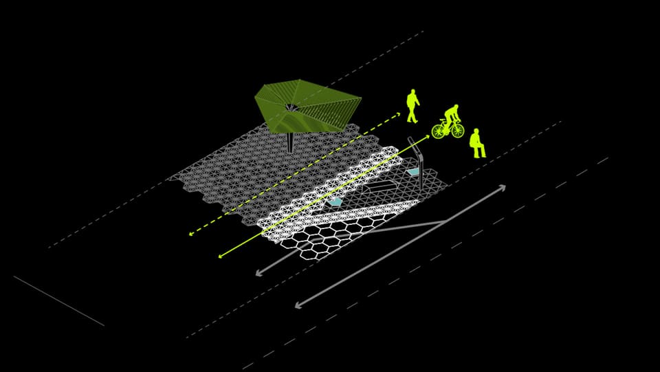
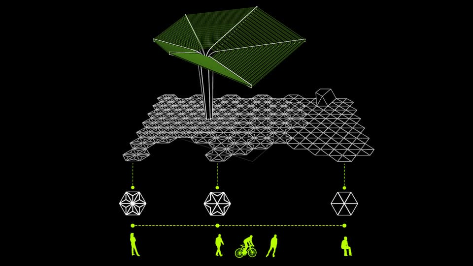
The Umbracle is a shading element that like an urban tree can define a shadow path to guide pedestrian in comfort.
The prototype has been placed in a new public space of the city to then be replicated in other parts of the city. The structure responds to sun orientation. There is one that responds to morning sun, and a second one that responds to afternoon sun. The different sizes of the section suggest the walking and resting area, this way the structure has a dialogue with the pedestrian behaviour.
The urban tree is also a night feature giving light to the street and creating a dynamic experience in the walk of floating light stripes.
In collaboration with Rafael Landete and Enrique Ferrer.

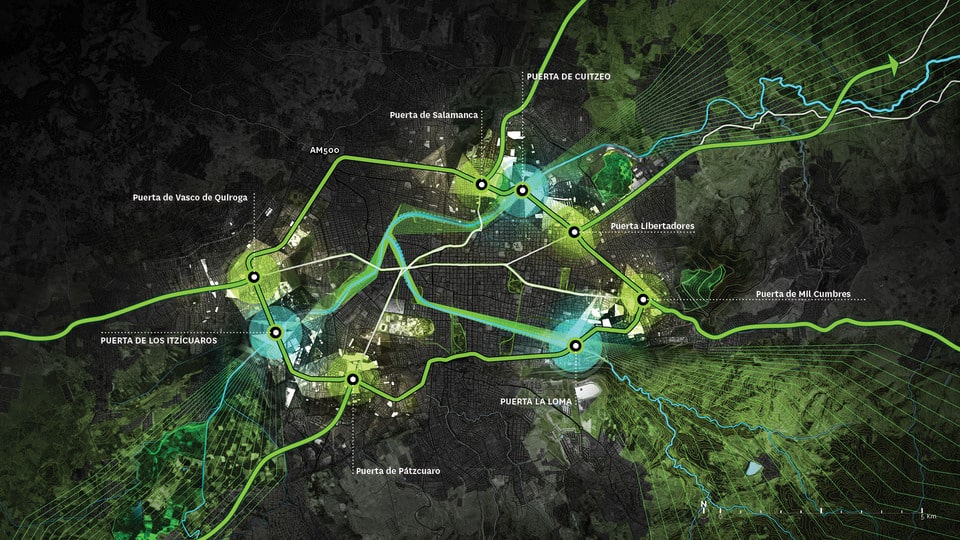
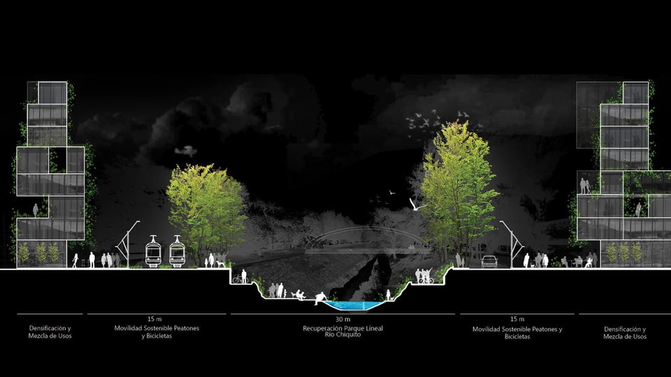
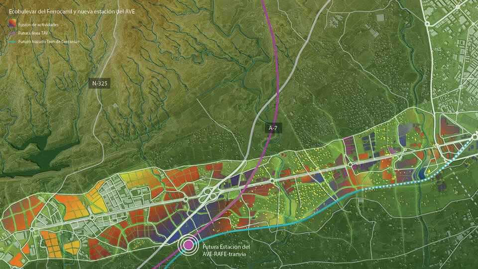
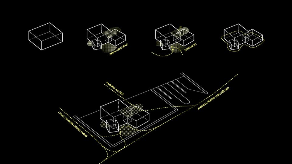
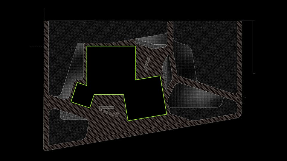
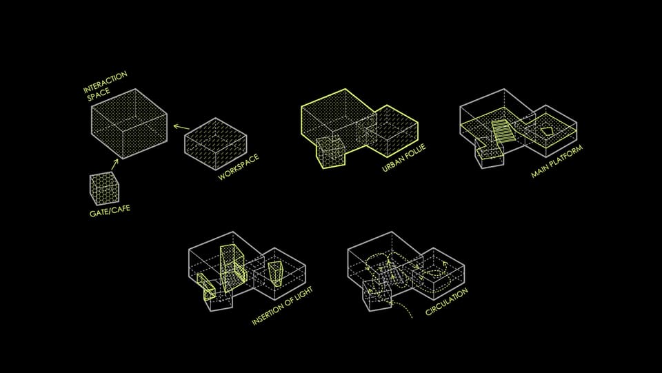
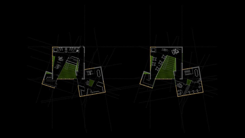
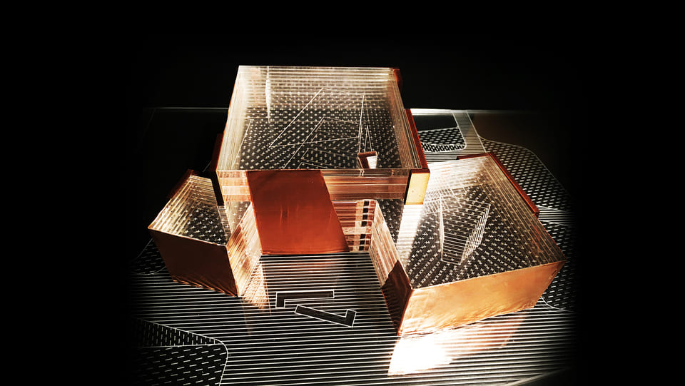
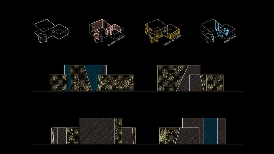
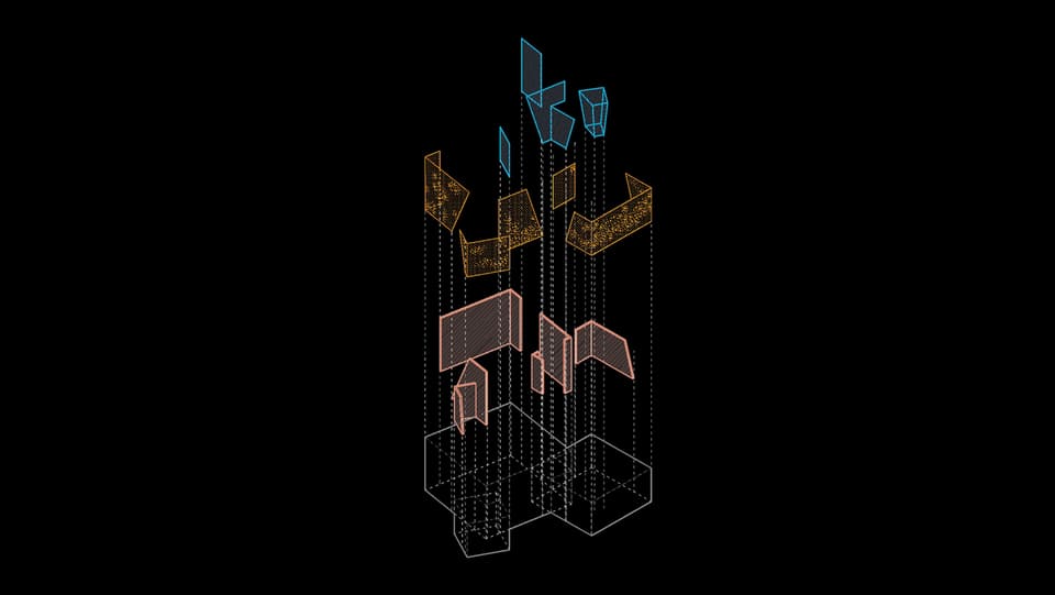
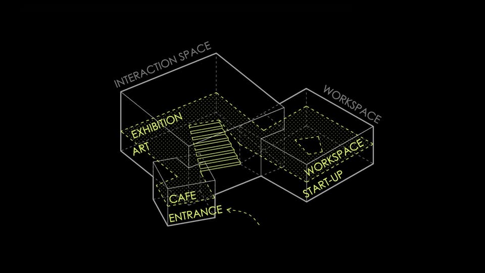
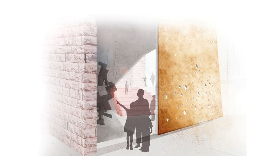
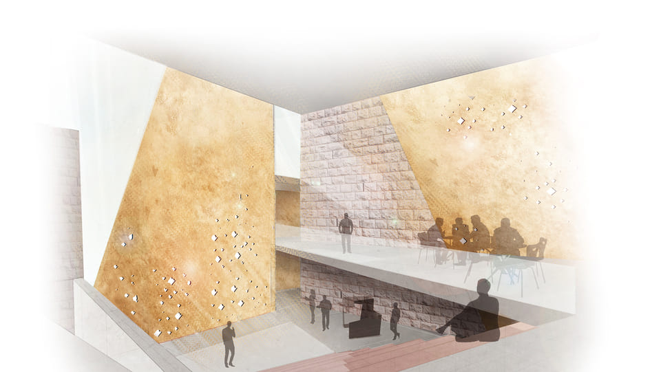
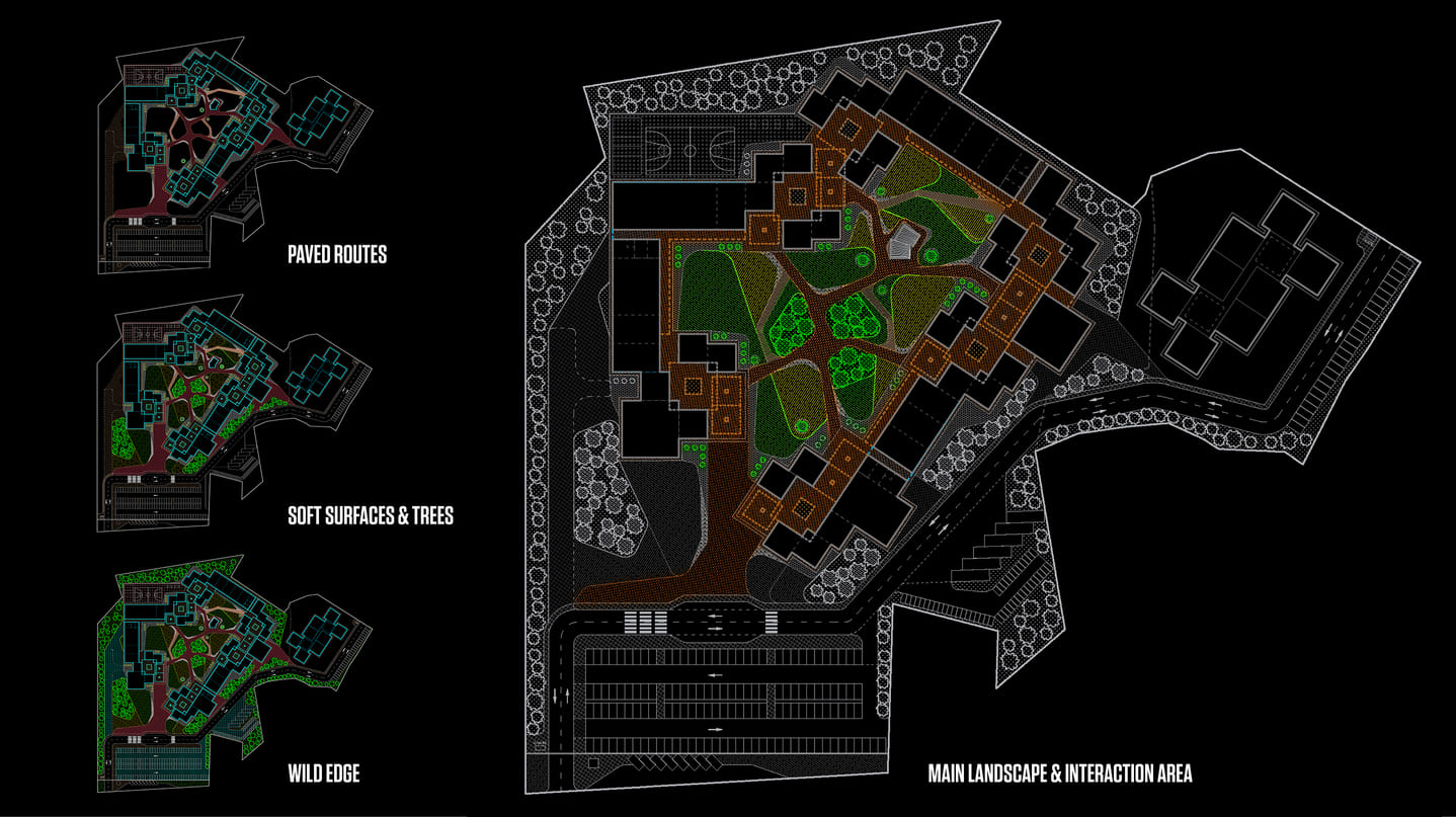
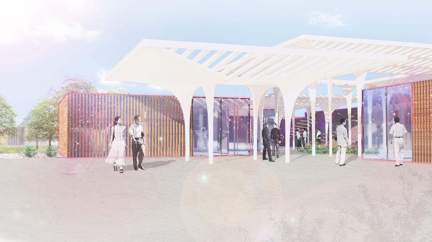
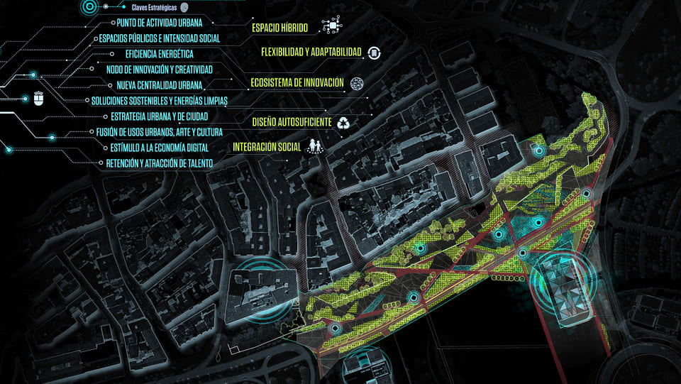
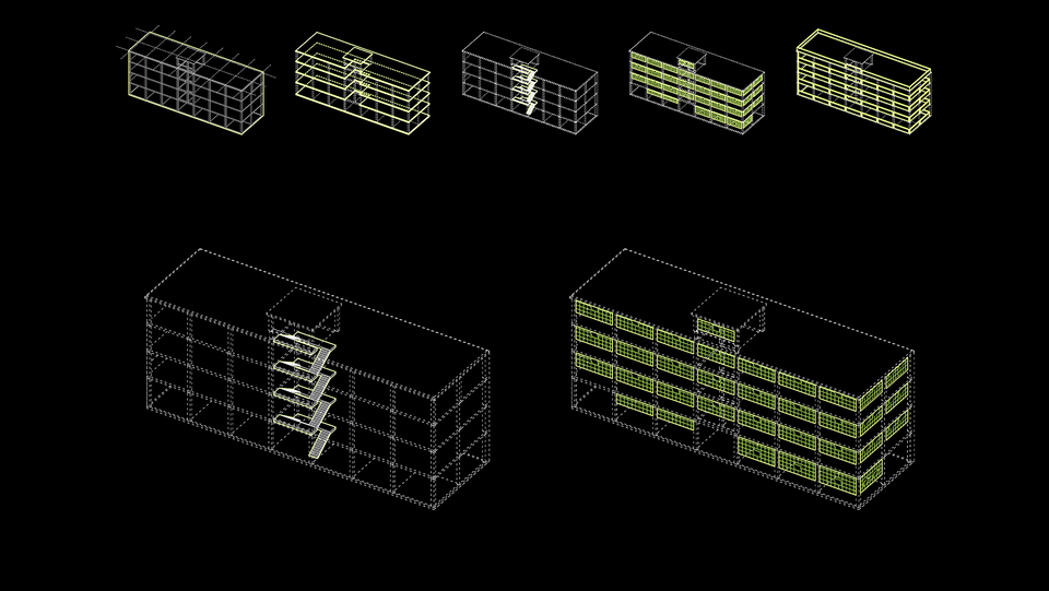
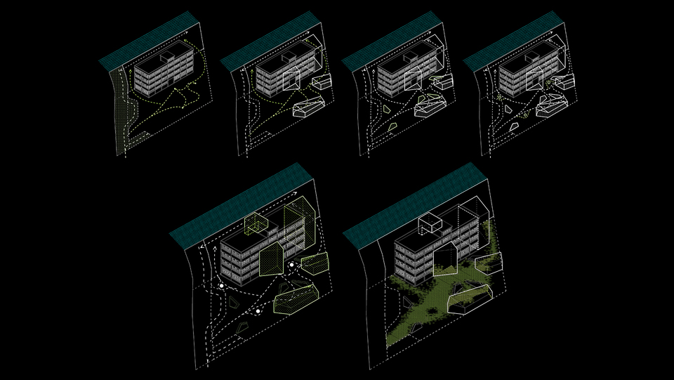
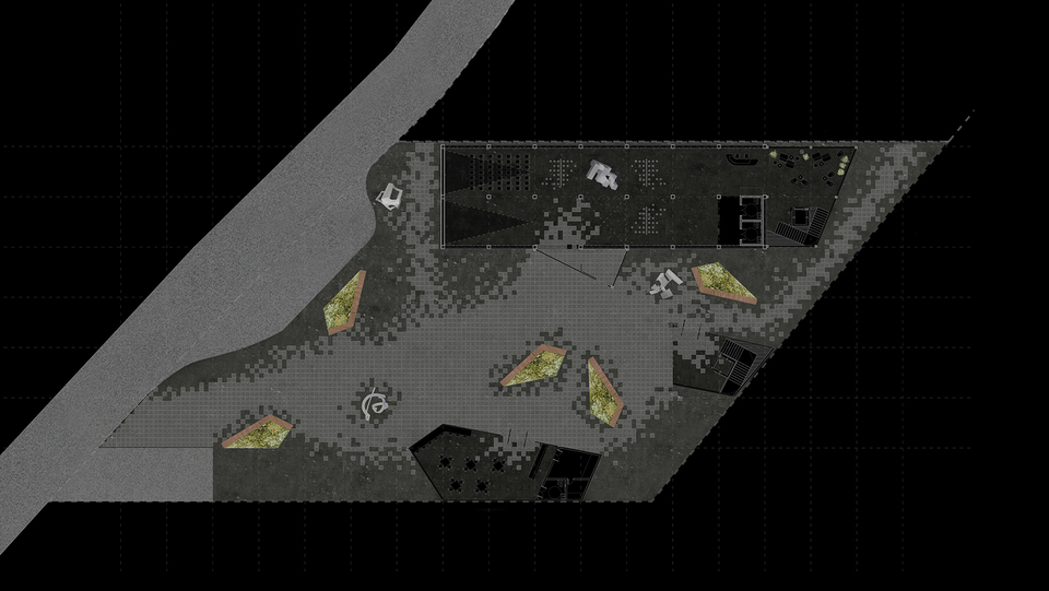
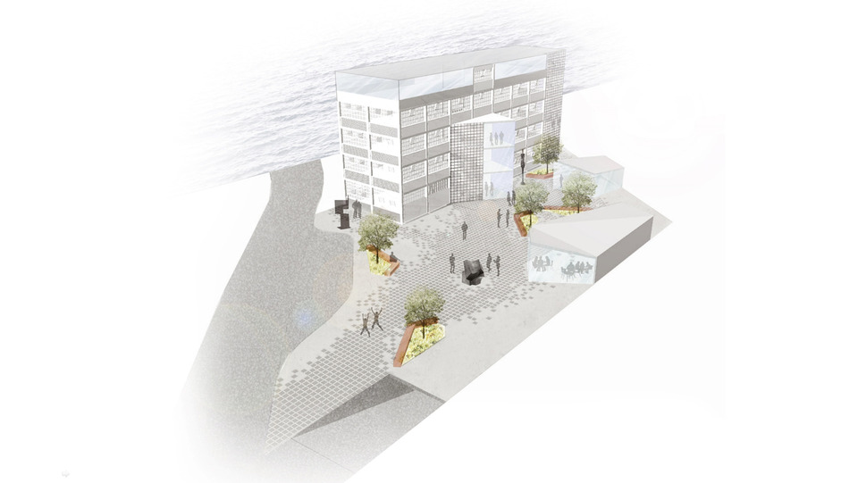
Morelia´s historic centre is a UNESCO World Heritage site. Its architectural buildings of pink stone create a unique cultural aesthetic. The cultural core is surrounded by industrial corridors. To the north “Avenida de Héroes de Necupétaro” is envisioned by FM to become an Eco Boulevard. The aim is to transform and regenerate this corridor to a pedestrian friendly avenue that connects to the historic centre whilst densifying activity to create complementary new economic hubs for Morelia.
The vision includes a strategy of inserting seed projects along the corridor to start the regeneration process. The first project, an urban Folies (Fomento de Lugares de Innovación Económica y Social) is the symbol to transmit the values of the regeneration project and the Eco boulevard. Three cubes intersect to create active public space in the perimeter allowing spaces of circulation and spaces to rest and interact. The relation of the exterior and the interior working areas is mediated by a public program that gives opportunities of exchange. The façade materiality reuses the traditional pink stone a reminiscent of cultural presence and combines it with perforated new materials to transmit innovation and future.
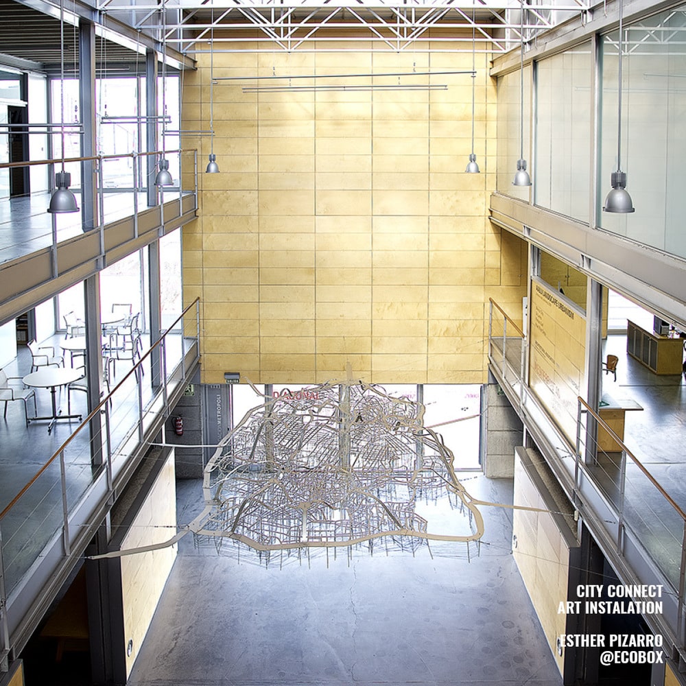
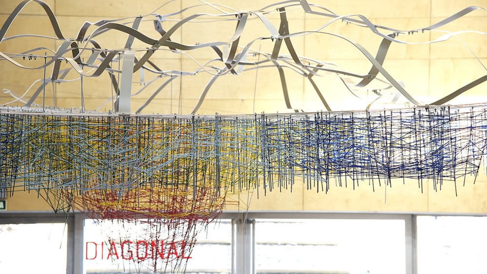
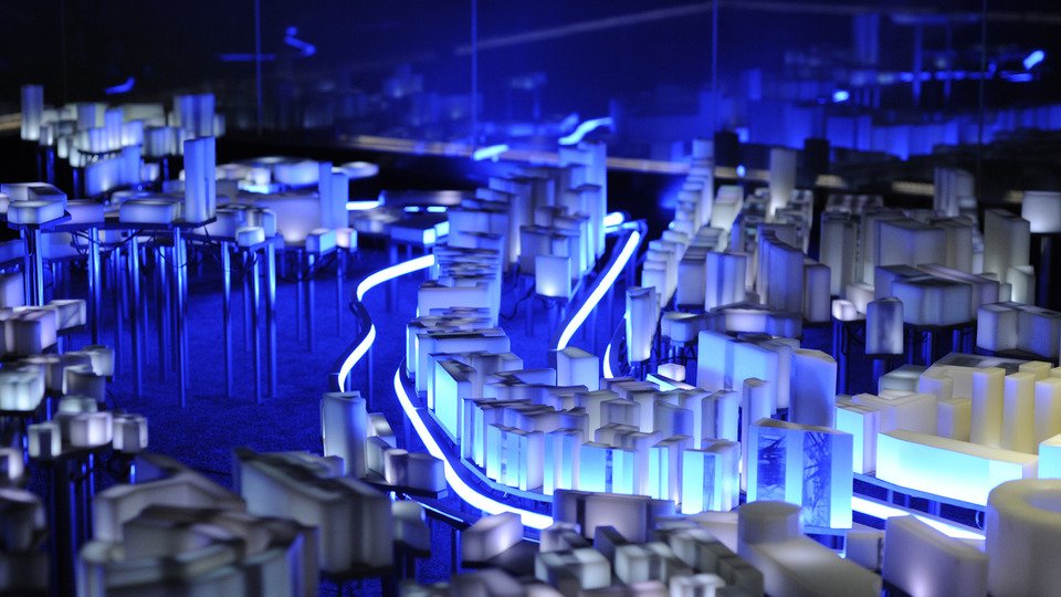
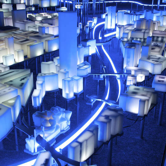
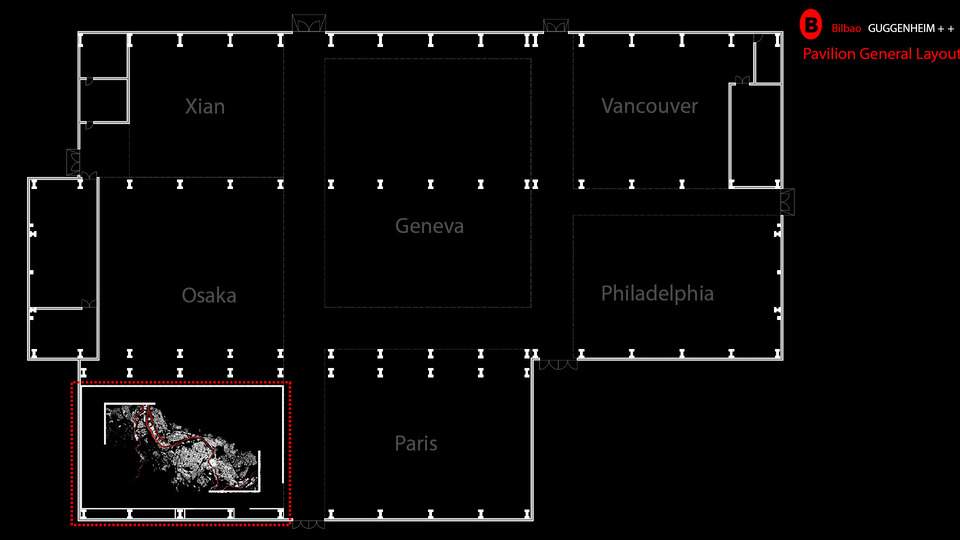
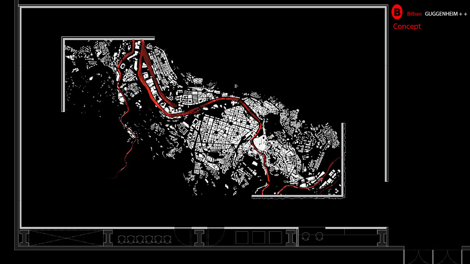
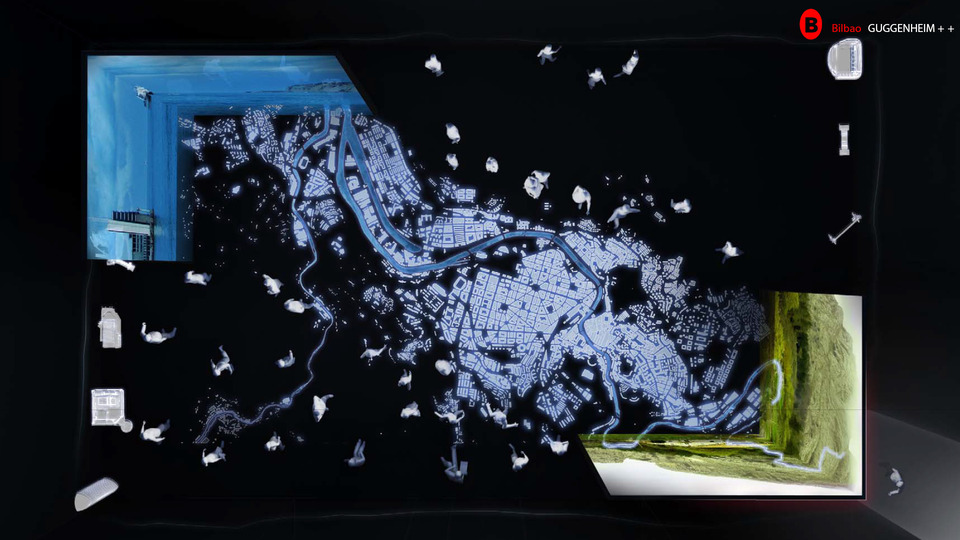
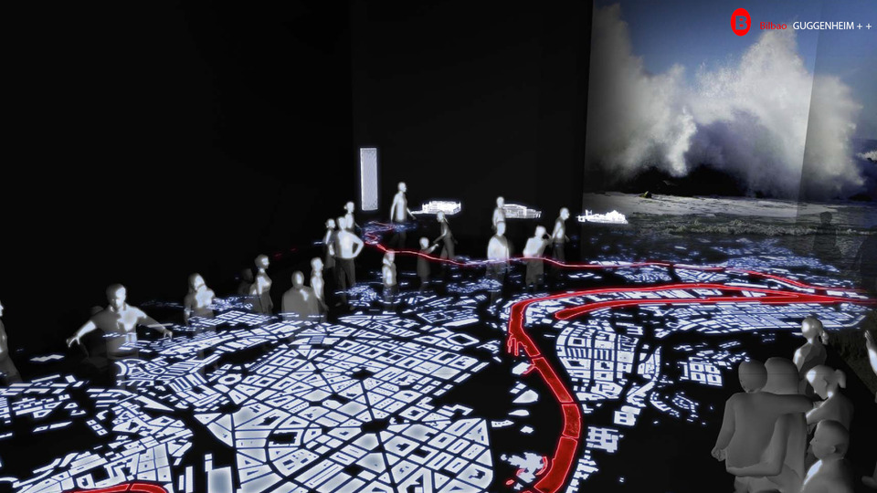
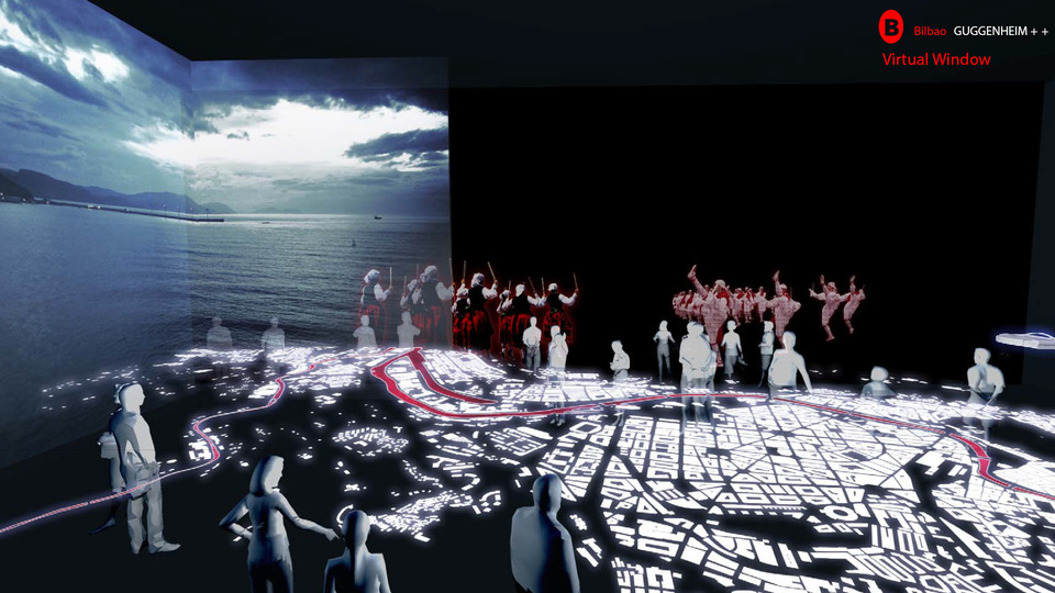
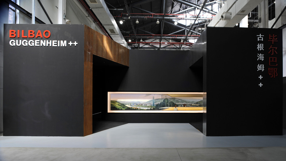
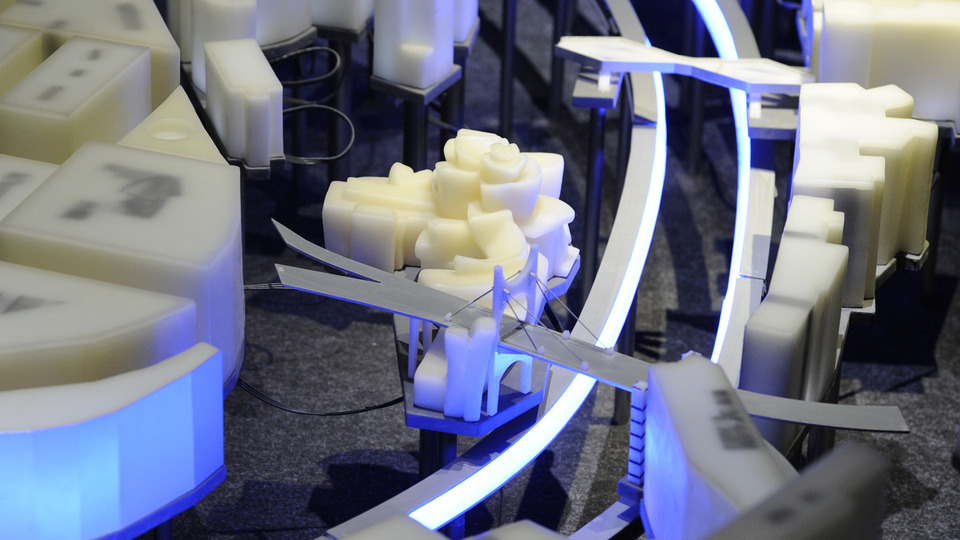
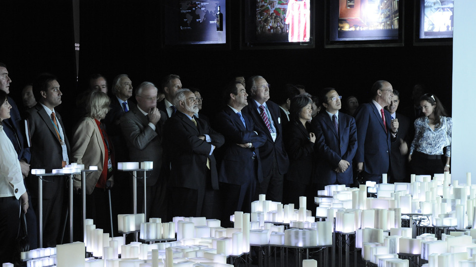
Bilbao was selected to be present at the World Expo 2010 with the show ‘Bilbao Guggenheim ++’. The pavilion aims to express the evolution of the city from a post-industrial, deteriorated city, to the vibrant and attractive city that is today. This transformation through three stages (the Industrial Revolution, the Urban Revolution and the Knowledge Revolution) is rendered by an interplay of art and multimedia. Paintings, projections, sculpture and light merge to convey the great transformation over time of this city, with the sculpture ‘Piel de Luz’, by the Madrilenian artist Esther Pizarro, as the great protagonist.
The installation, made out of wax blocks cover with methacrylate, displays the urban fabric of the city and its architectural highlights. Mixing matter with light and projection, it lights up to show the different transformations on the city, expressing this way the changing and organic nature of it. ‘Piel de Luz’ was later exhibited at Ecobox Building in Madrid and Alhondiga Bilbao.
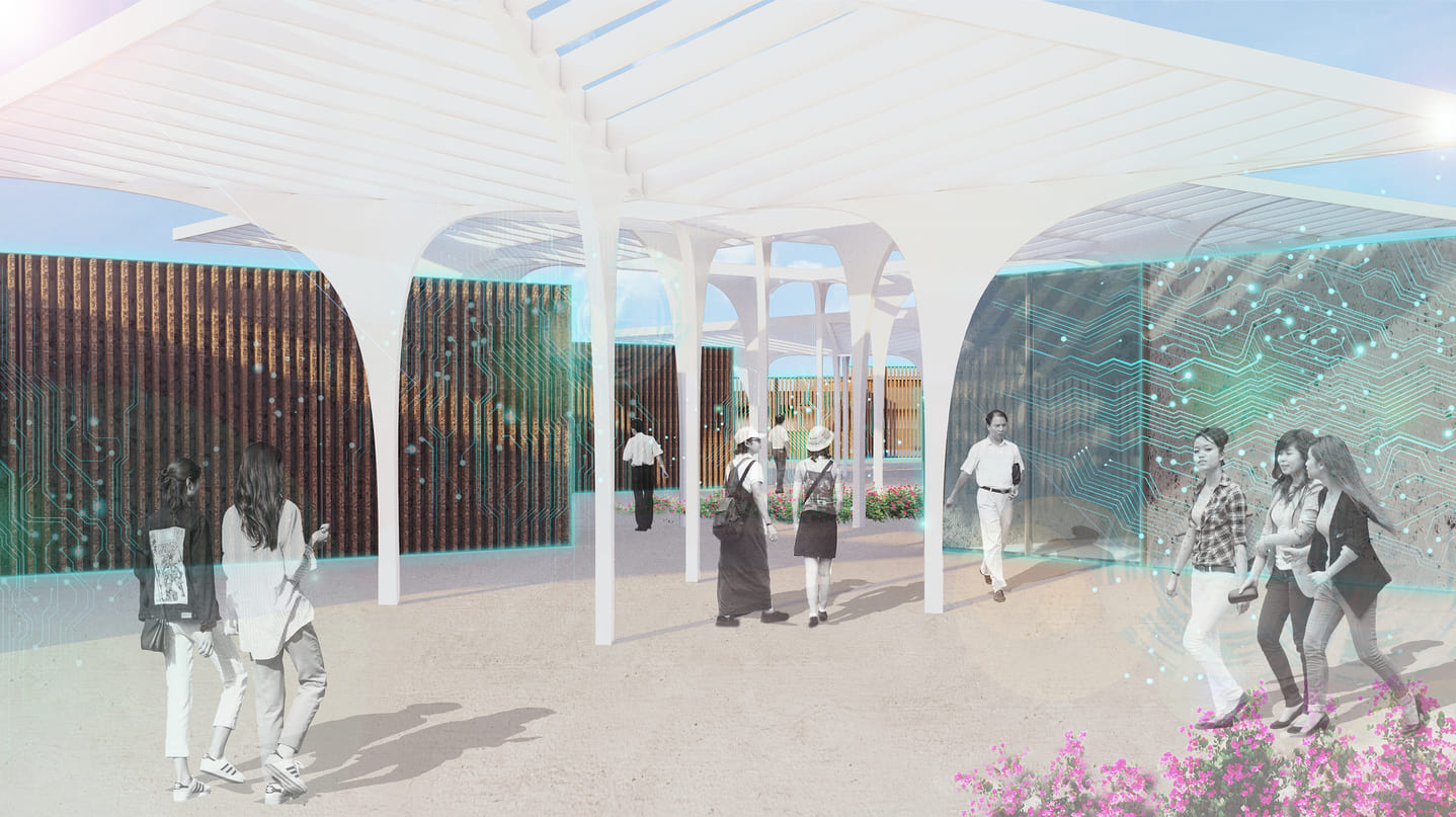
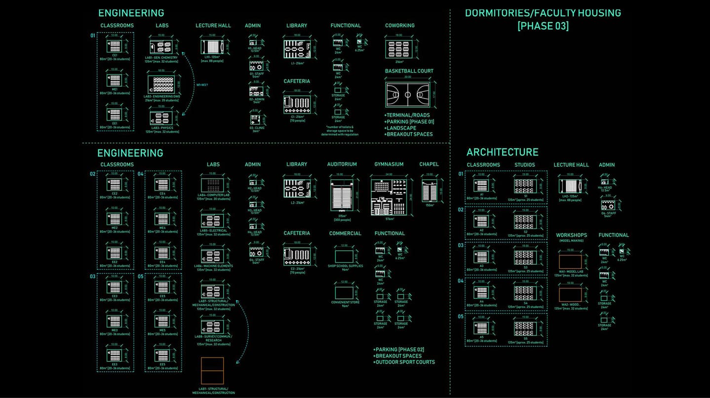
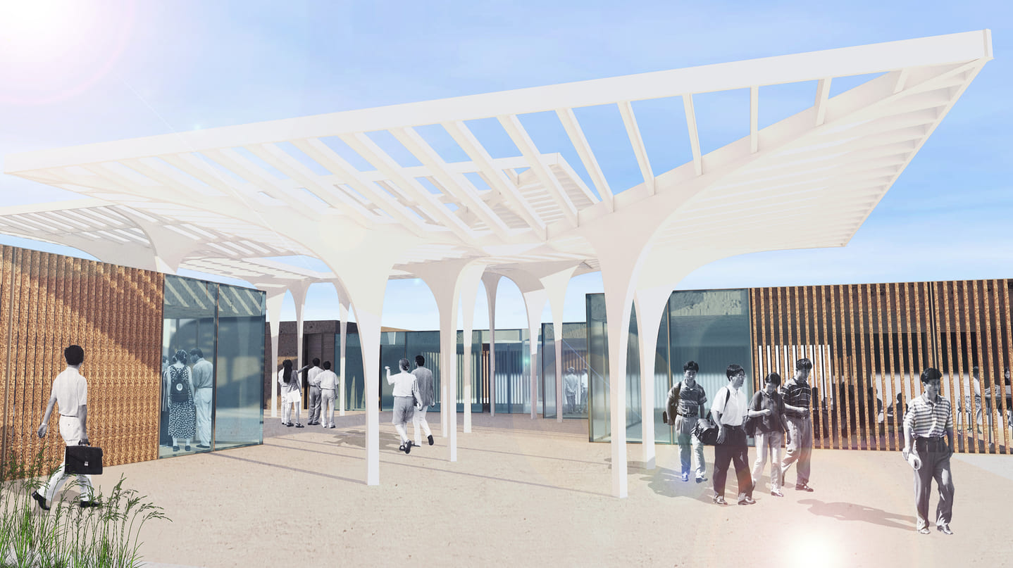
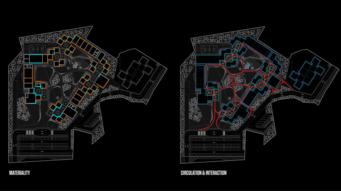
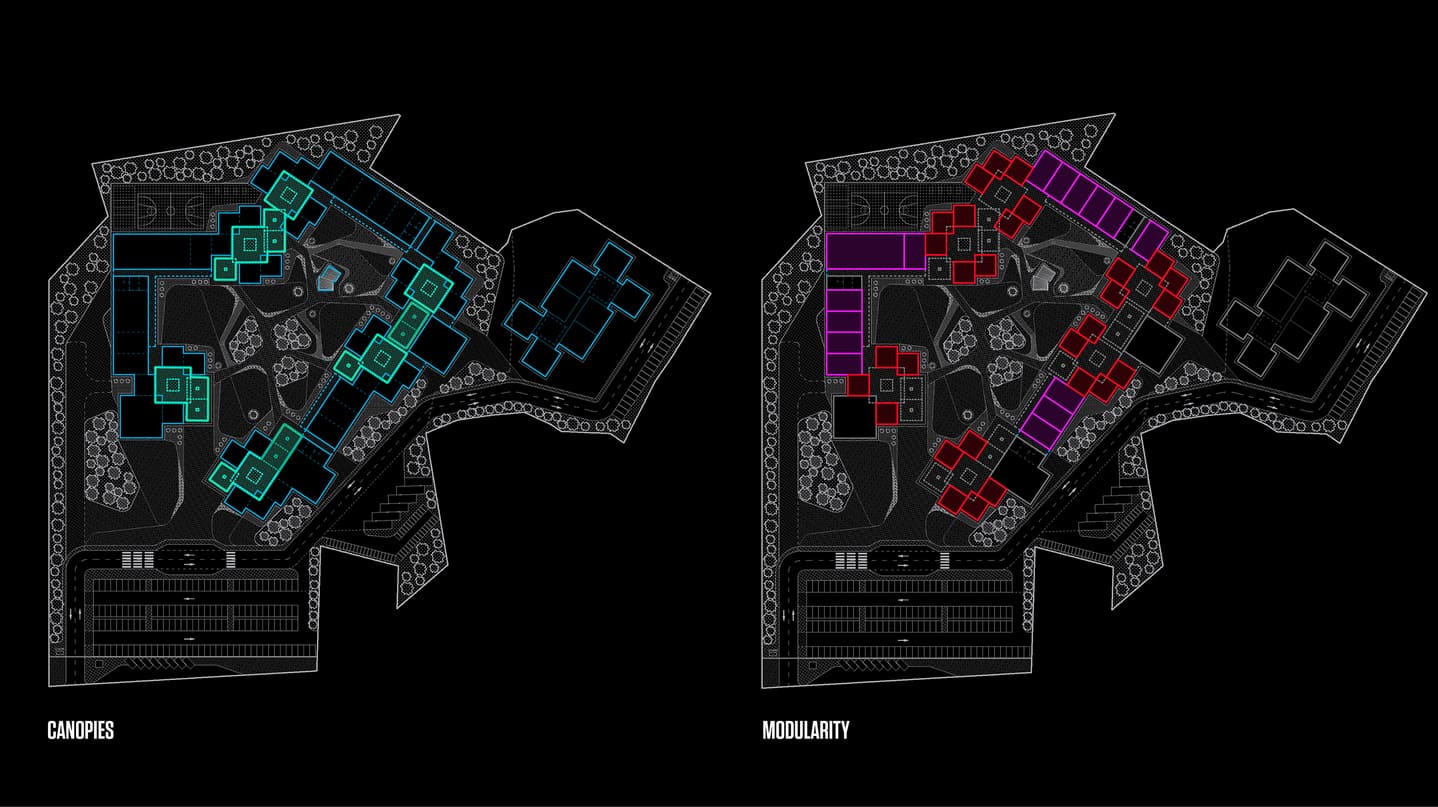
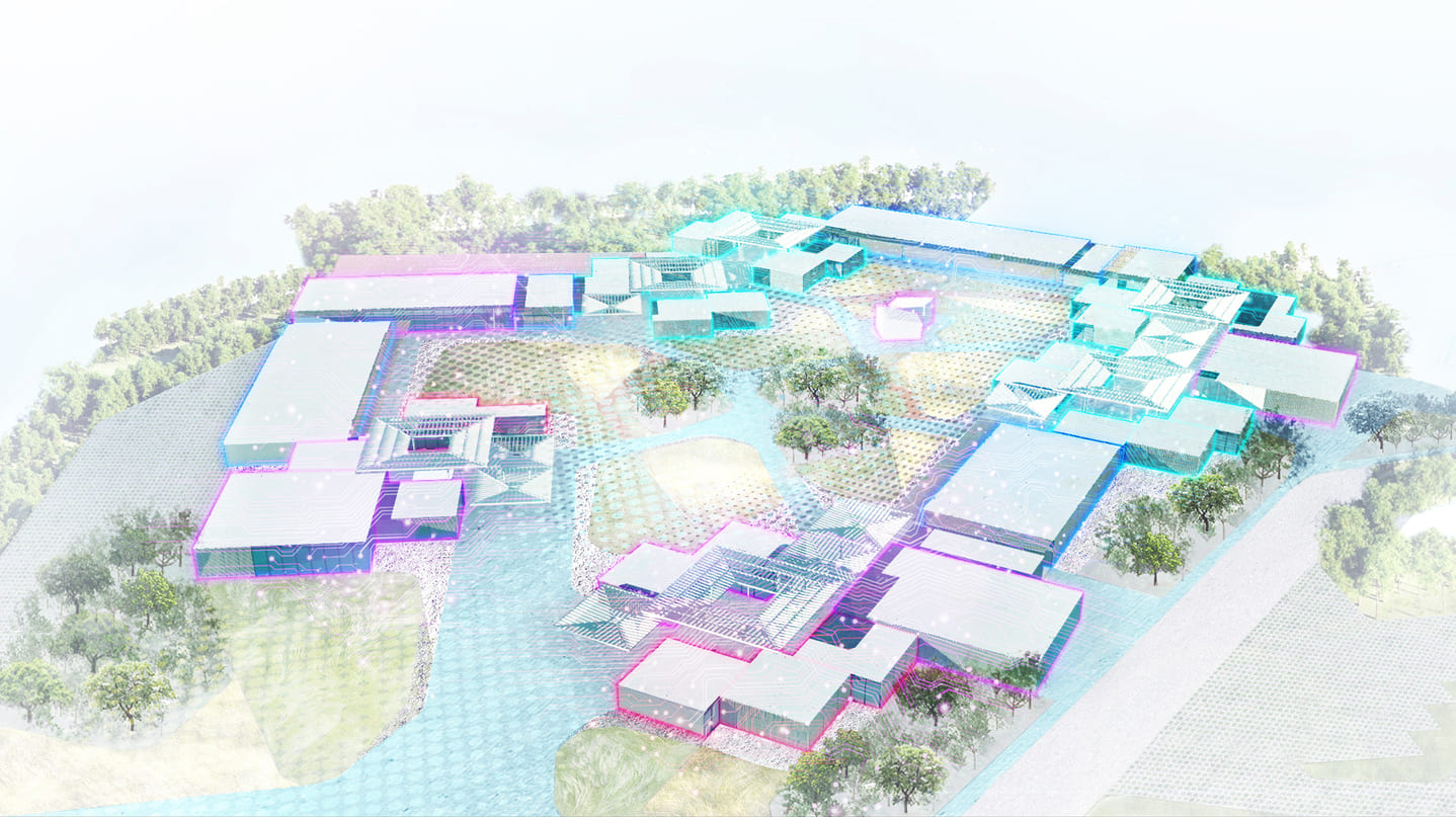
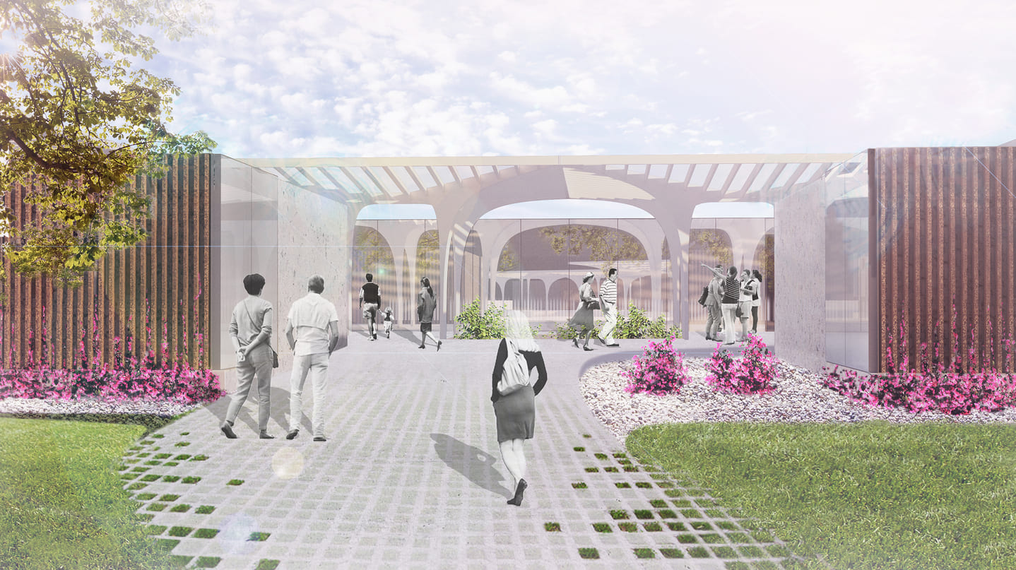
Located in the island of Mactan, BAST is a pioneering project to create a campus for educational facilities and young professionals.
The architecture is conceived as learning landscapes. It acts as a mat building where circulation and modular components define a pedestrian infrastructure. The architecture promotes the dialogue between spaces to learn, experiment and share knowledge with spaces to rest, sports and meet.
Due to the climate conditions the main path is a shaded and protected loop, other secondary paths offers options to experience gardens and nature. The orientation of the building is achieved by arranging clusters of rooms and small squares in-between linear components. The project offers too spaces for the public to come an enjoy such as event spaces, cafes and co-working.


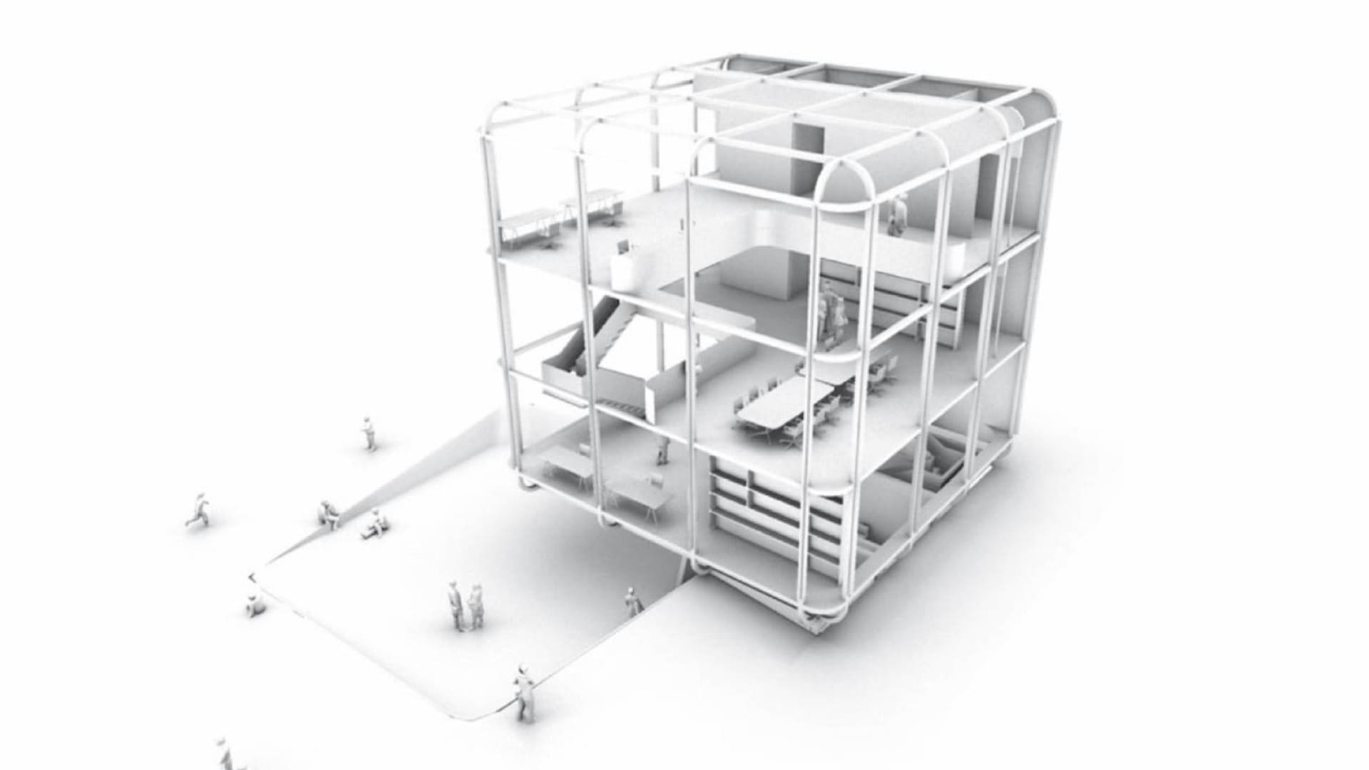
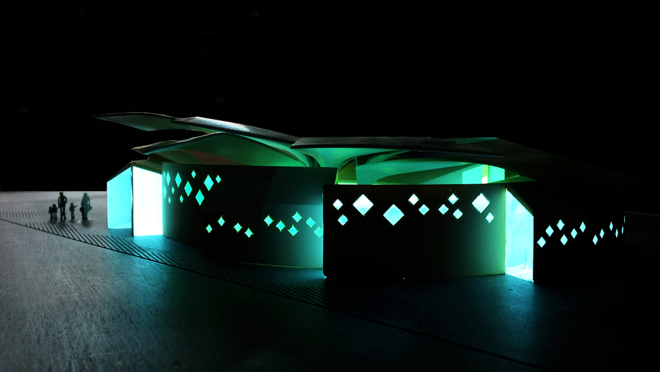
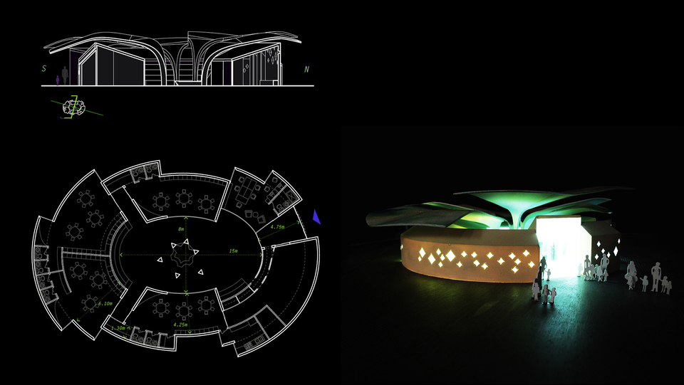
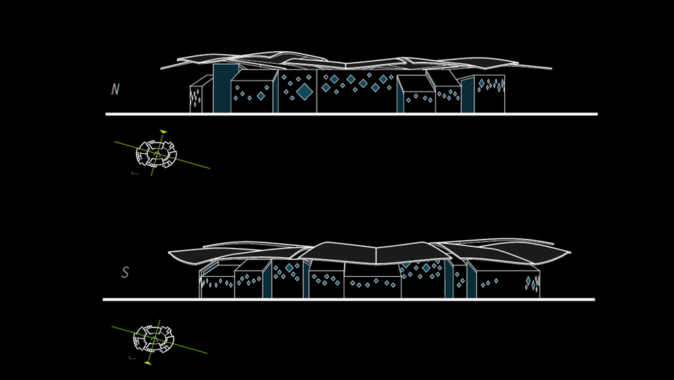
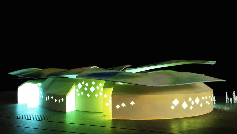
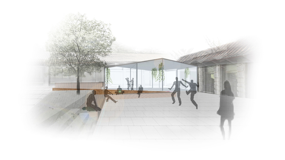
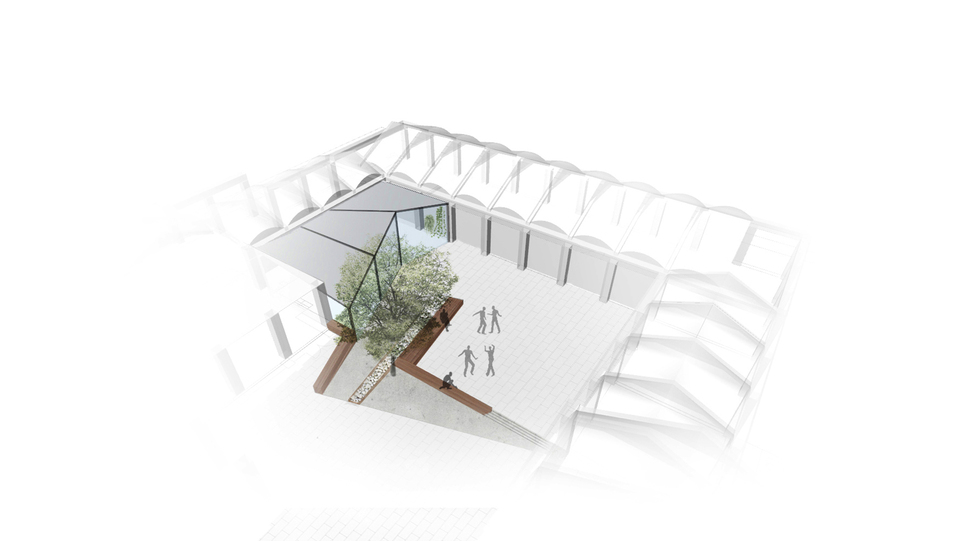
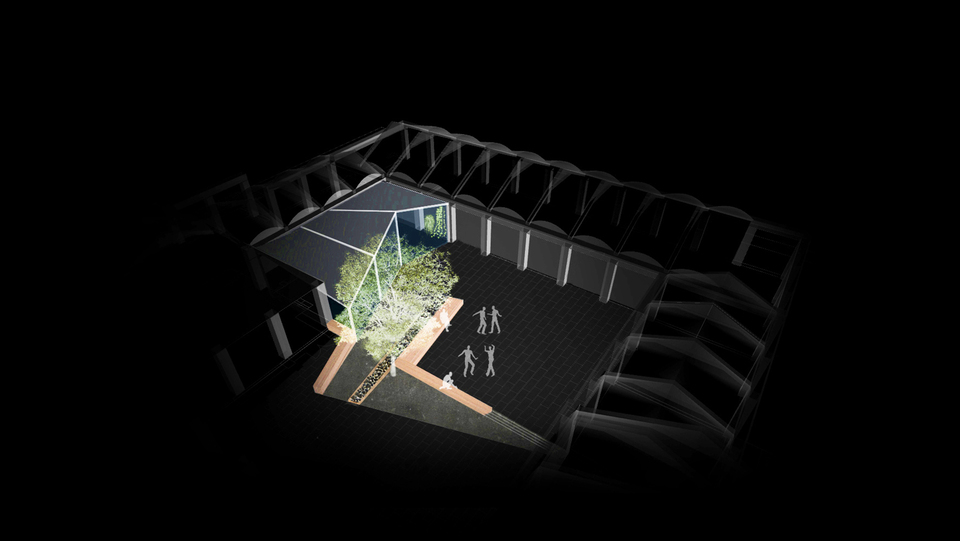
The Innovation Cubes are small buildings designed to accommodate innovative activities, as well as a wide variety of uses. As contributors to the advanced economy, their purpose ranges from lodging small businesses, acting as incubators, to carrying out innovative activities, such as research labs and R&D institutes. They can also be adapted to leisure and entertainment functions such as restaurants, small exhibition spaces, or tourist information centers, among many other possibilities.
When interacting with each other in the common public space, they activate the surroundings, being an element deeply entwined with their natural environment thanks to their bioclimatic design. The facades are the special features of the cubes. The bio-climatic parts of the blinds enable the buildings to provide views to the outside during the day while avoiding glare and direct solar radiation inside the buildings. At night, their double facades are lit up with images projected towards the outside to form an integral part of the public realm.
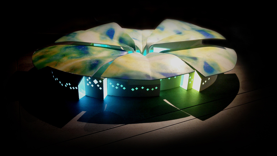
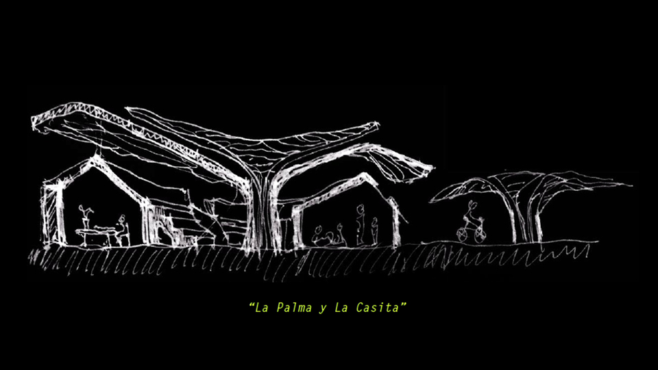
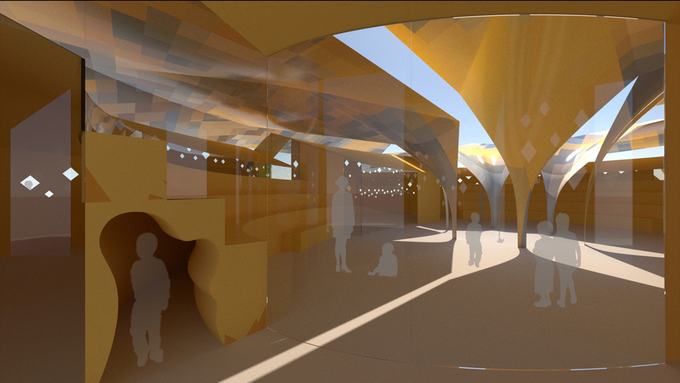
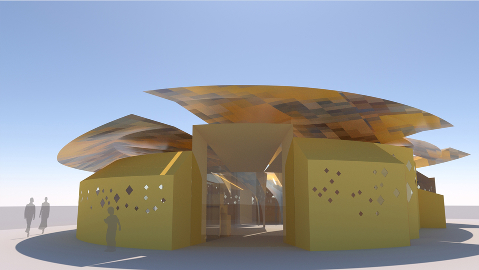
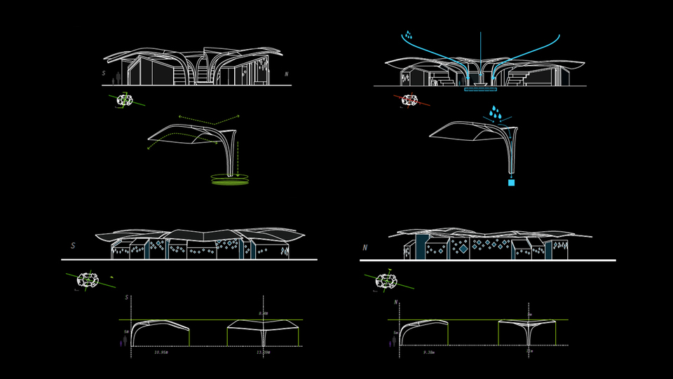
The palm tree and the “casita” are a kindergarten and a place to meet for the people of Jacarilla.
The floating roof behaves as a palm tree, which protects from solar radiation and allows for cross ventilation. It adapts to the building depending on orientation, protecting from the sun towards the south and opening to allow daylight in at the north side. The petals are also designed to collect rainwater which is then stored. They become a symbolic element that dialogues between nature, sustainability and program.
A semi-covered central patio articulates the project and creates the main gathering space while allowing for sunlight to be filtered through to the inside of the Casitas. Visual connections are generated between classrooms and towards the central meeting point.
Kids and adults use the space, therefore scale is considered as a parameter in the architecture that creates special moments and play areas. The building generates a play of light, , scale, visual connections, interstitial spaces and materials in a space where kids will develop their creativity.
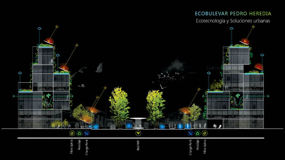
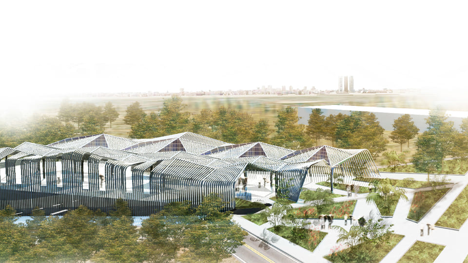
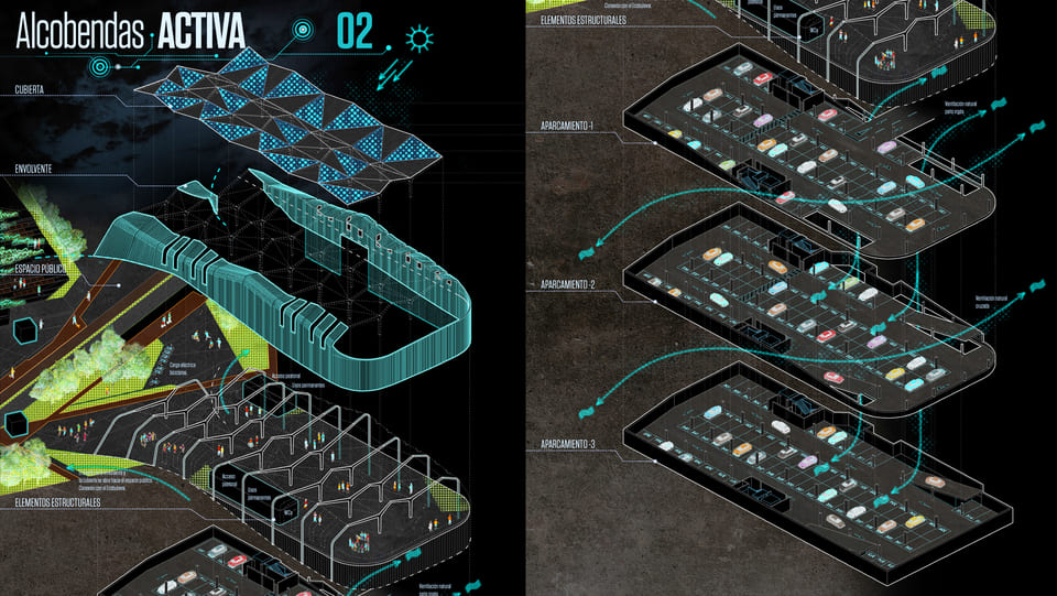
“Alcobendas Activa” is located within our Digital Ecoboulevard project in Alcobendas. It is both a mobility interchange point that gives access to the Ecoboulevard and an activity point that interacts with the main square of the project.
The upper floor is conceived as a continuous extension of the public space, providing a flexible covered area for activities and events. The lower floors contain the required parking space which allows for the Ecoboulevard to be car-free. The building therefore becomes an access point from where mobility is mainly pedestrian and bicycle.
The architectural design follows sustainable strategies, reducing to minimum energy consumption by including a sustainable façade that allows for natural ventilation and solar panels. Electrical vehicle charging points are inserted for both cars and bicycles.
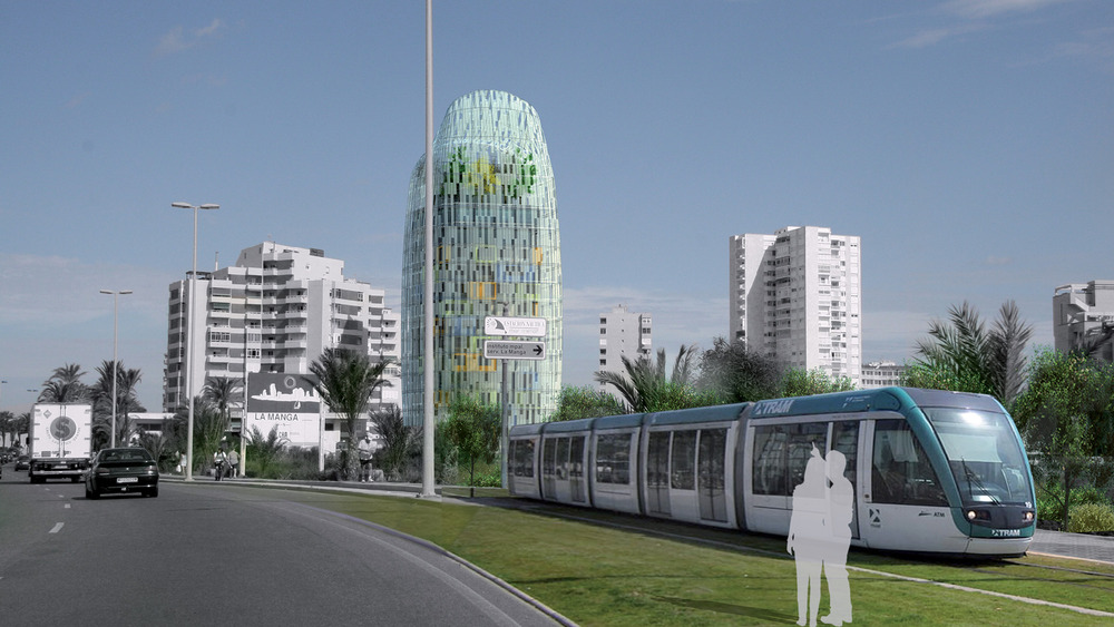
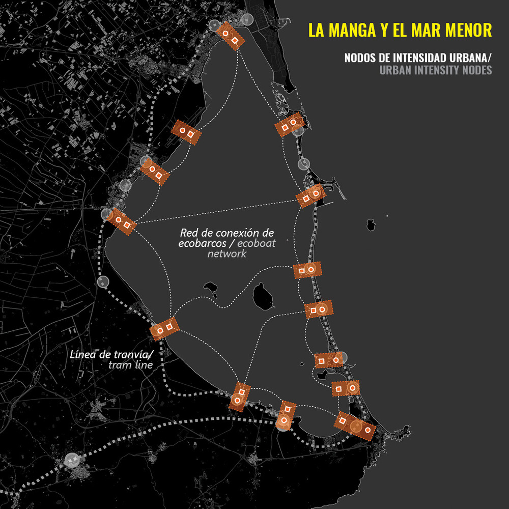
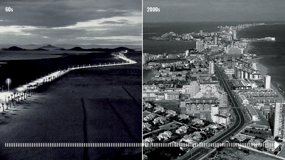
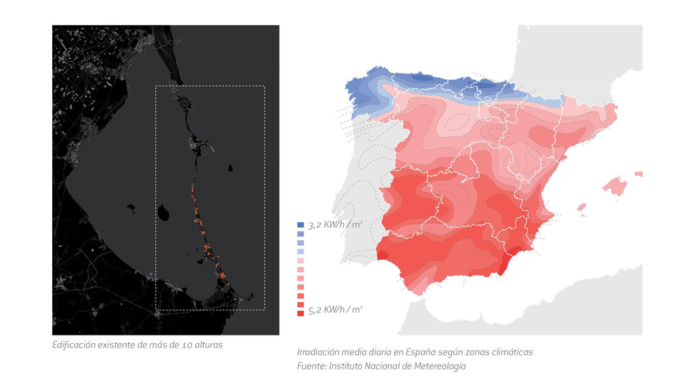
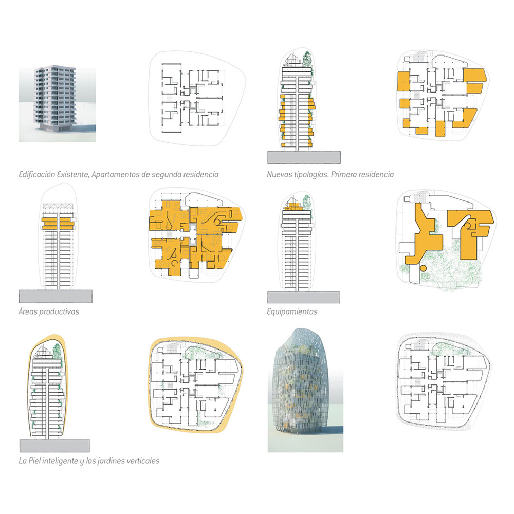
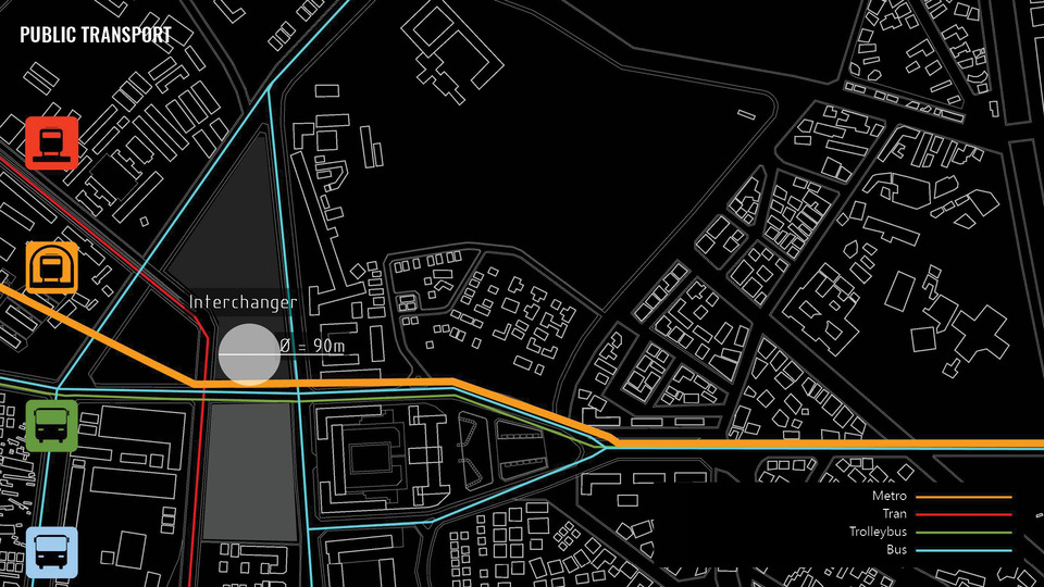
La Manga, with its sandy beaches and its early tourist occupation, shows very clearly the functional segregation between new tourist settlements and traditional towns. This stretch of land is occupied with a continuous alignment of high-rises that form a long urbanized line, with traffic problems, scarcity of public transport and lack of communal facilities.
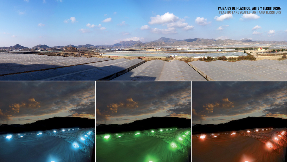
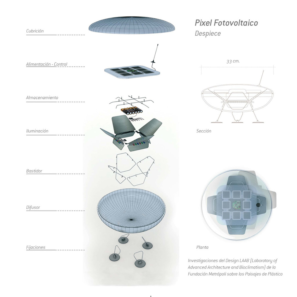
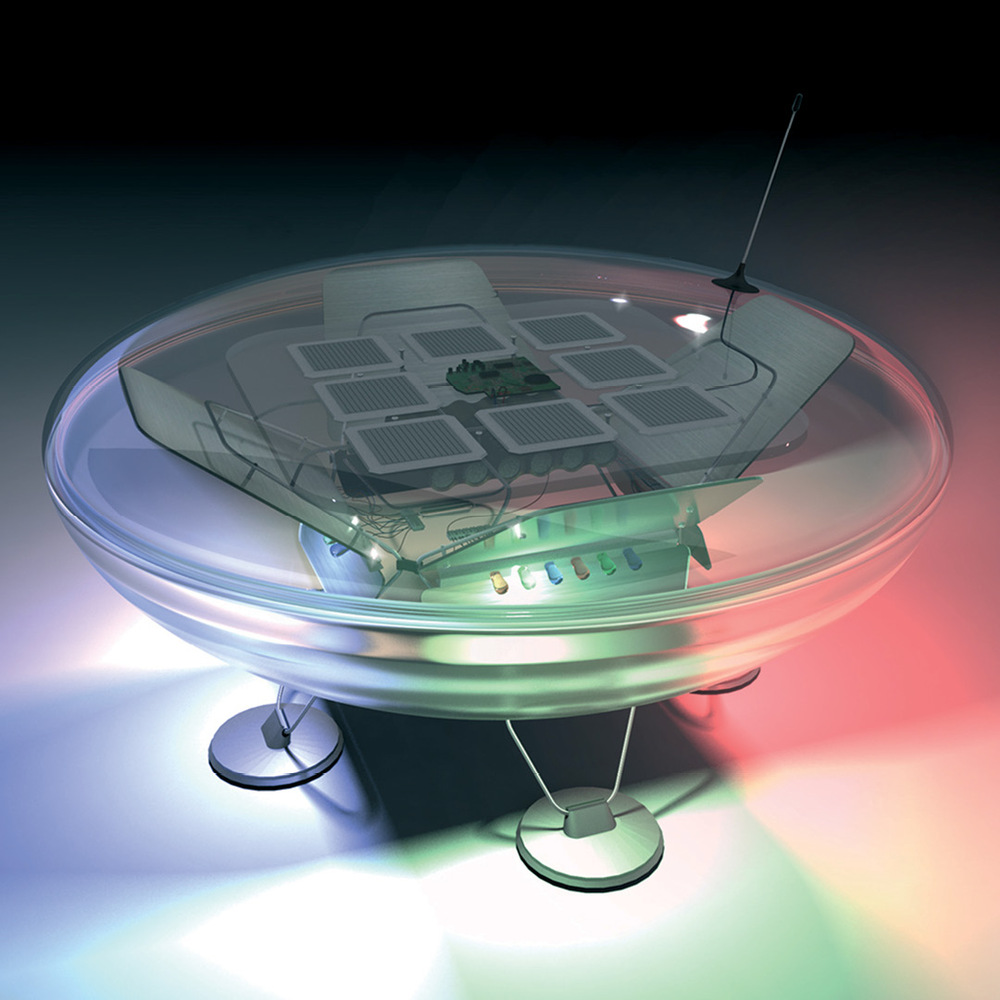
The Sculptures of the Sun are a proposal for transforming La Manga del Mar Menor into a magic space of art, light and architecture, turning its buildings into a large solar and photovoltaic power plant. An initiative to wrap some of these buildings with smart skins able to collect energy and to shape architectures designed by great architects and artists. A proposal to transform second residence into first home and to connect these tourists spaces with the main nodes of the region. A creative attempt of turning a problem into an opportunity. A way of overcoming the limitations of a space of obsolete architectures, seasonality and traffic congestion. The Sculptures of the Sun are an initiative for the radical formal and functional change of La Manga and the Minor Sea as a whole, making this space a reference in territorial recycling and sustainability in Europe.


“A pathway through history”
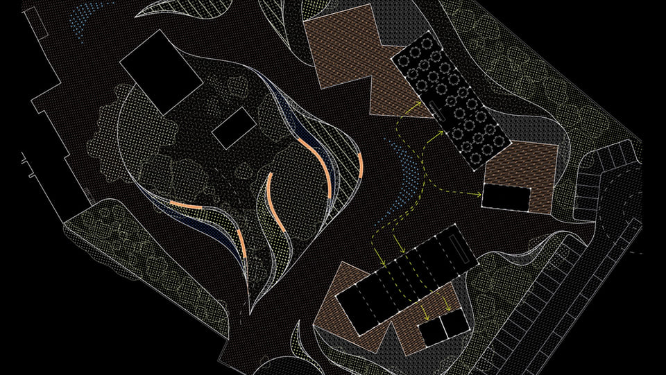
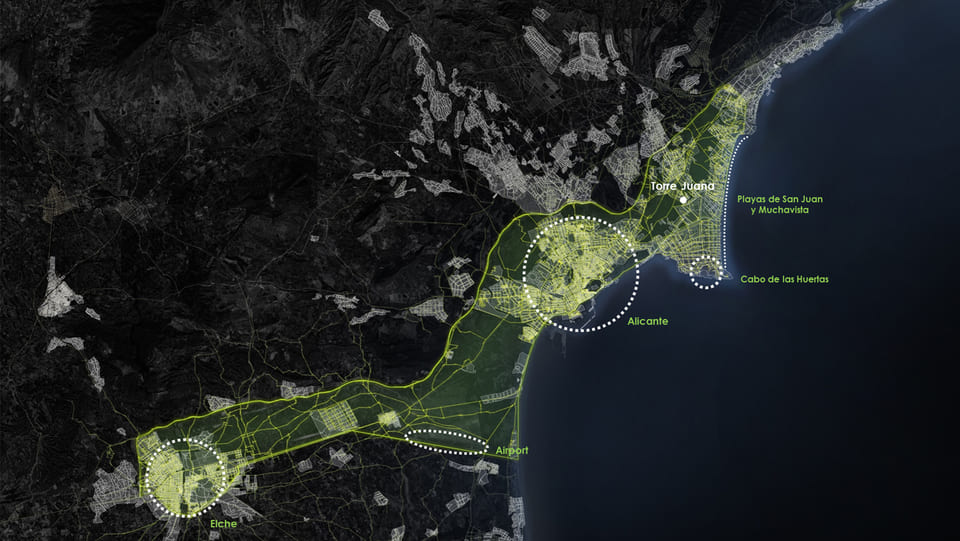
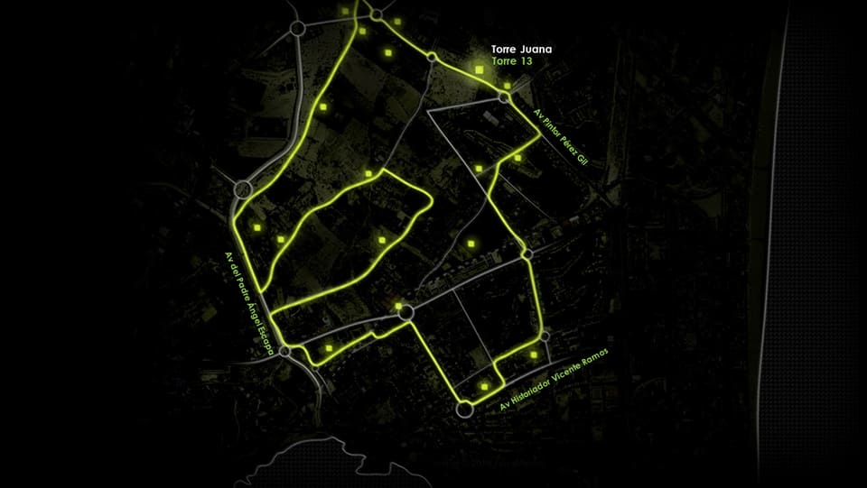
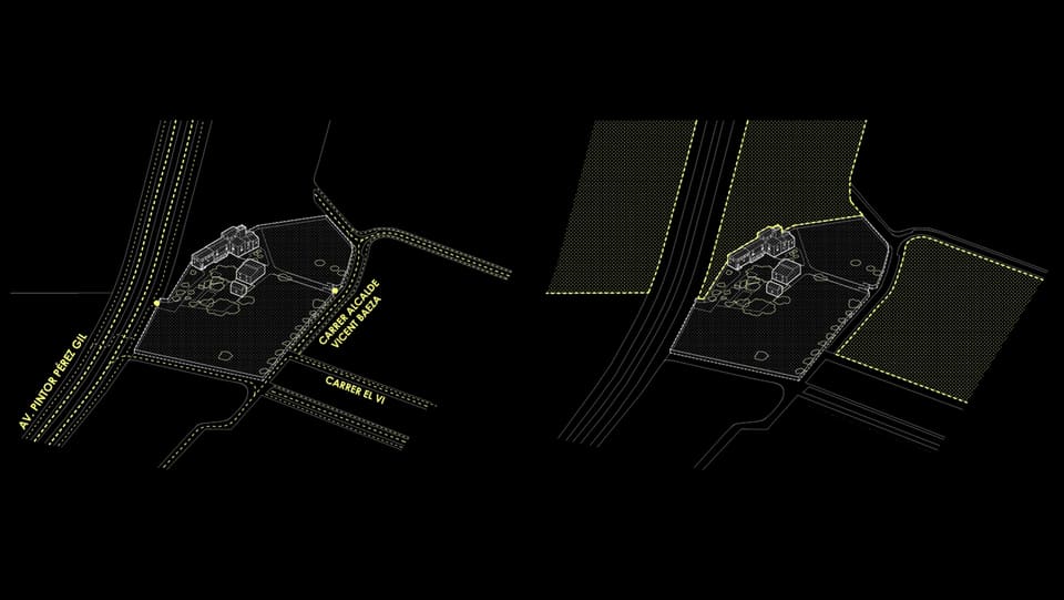
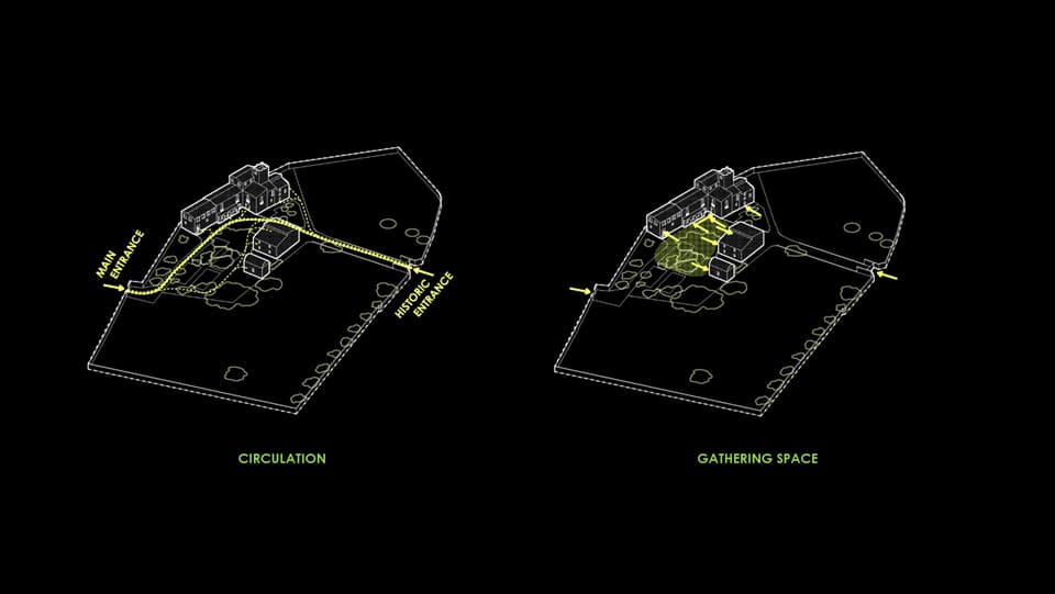
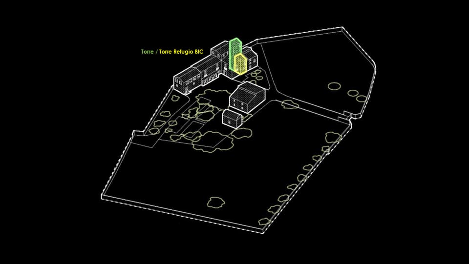
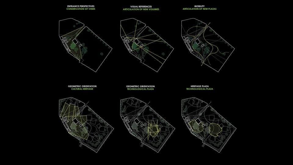
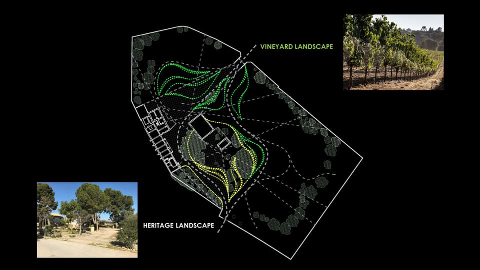
Torre Juana presence is defined by a BIC protected historic tower that refers to 17th Century when 21 Towers defined the territory of La huerta of Alicante. Its high cultural value is highlighted by the fact that Fondillón wine was cultivated in the site.
The project interprets the wine landscape to define organic paths that reminiscent the agricultural past of the site. The idea of pathway articulates the design. The landscape is shaped with a combination of soft and hard surfaces that create possibilities of direct and secondary mobility. These different landscape textures create the transition between the old buildings and the new ones, connecting tradition to innovation. New light buildings emerge in an angle from the landscape looking at the stone verticality of the existing volumes. Torre Juana Plus aspires to be a place to exchange and create knowledge, a tech park that sets in cultural roots to be a referential destination to experiment, research and create innovation.

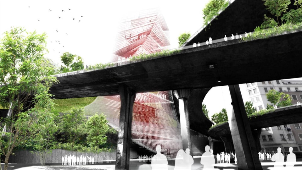
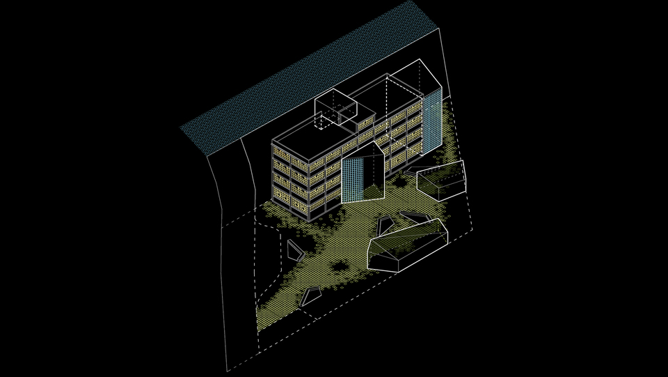
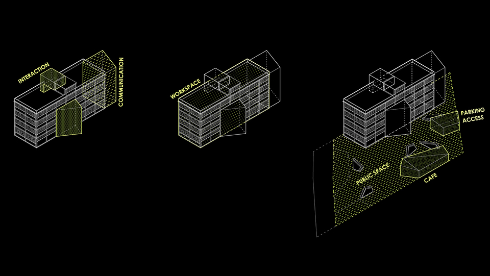
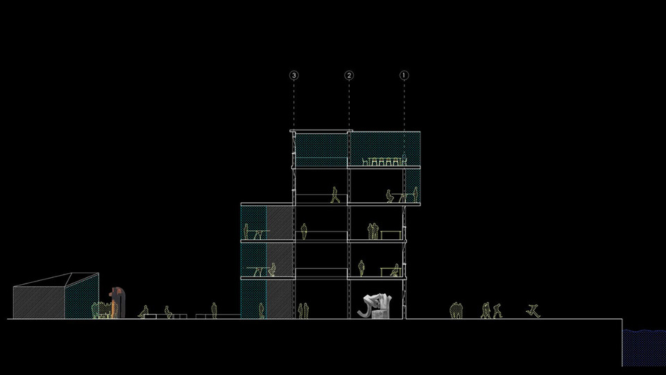
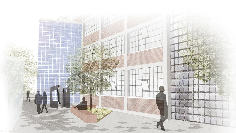
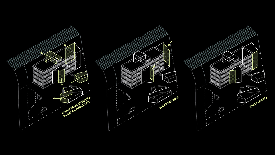
Tarabusi is an obsolete industrial building in Zorrozaure, the industrial core of the city of Bilbao. This building has been classified as a protected asset of industrial character in the master plan vision for transforming the industrial site into an integrated neighbourhood of Bilbao.
The project aims to retrofit the building and adapt it to co-working space. The strategy aims to plug in the circulation and common areas as new volumes whilst leaving the existing building as large open plan working space. This would allow for flexibility in the work areas and encourage interaction in the shared areas. A top floor is added to the building to increase its density.
The envelope of the new volumes responds to their orientation: the sides that face south become solar façades, the ones where view is required become transparent façades and the others become wind façades. The proportion and window pattern is interpreted into the rhythms of the new modules of all the new facades even if the differ materiality to integrate the presence of the old and the new.
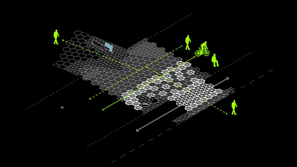
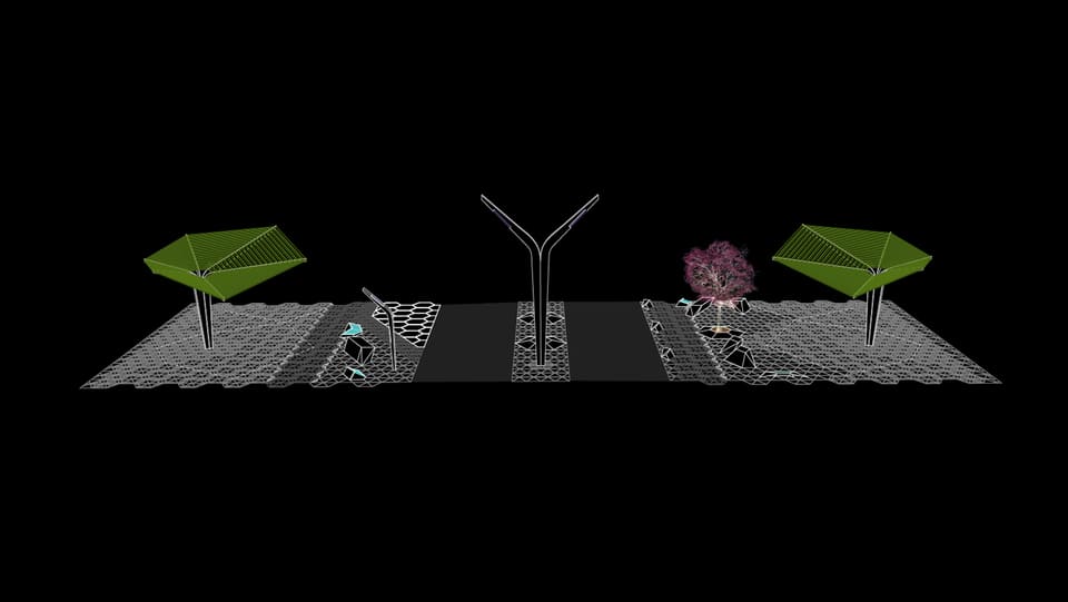
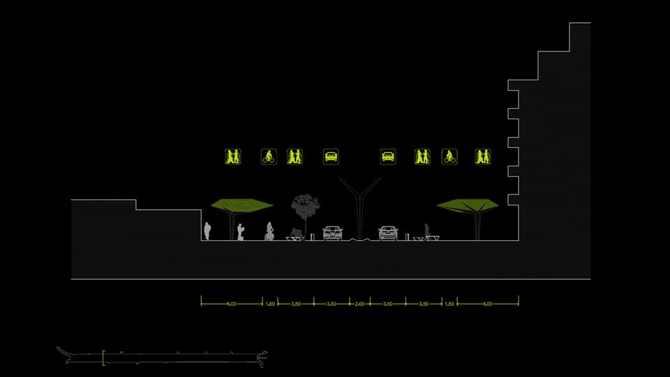
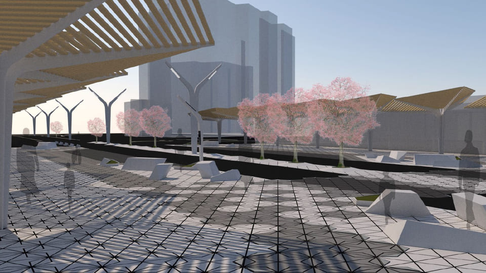
The Avenida Jaime I is one of the main connections between the city and the coastline of Benidorm. A clash is perceived between the diverse users/speeds that go through it on a daily basis.
New plans from the Municipality are aiming to reduce the vehicle circulation to allow for more space for pedestrians. With this opportunity in mind, the project understands different speeds, static and temporal activities, shadow paths, public transport stops, bicycle routes and crossings as an interconnected system that adapts to its best functionality.
Different color and degrees of floor pattern guide the walker’s circulation in relation to bicycle routes and crossing intersections. Shading elements like urban trees help experience a pedestrian comfort experience. All components of urban furniture create a catalog of same formal language that enables to understand the street as an avenue.

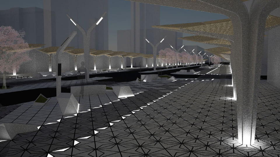
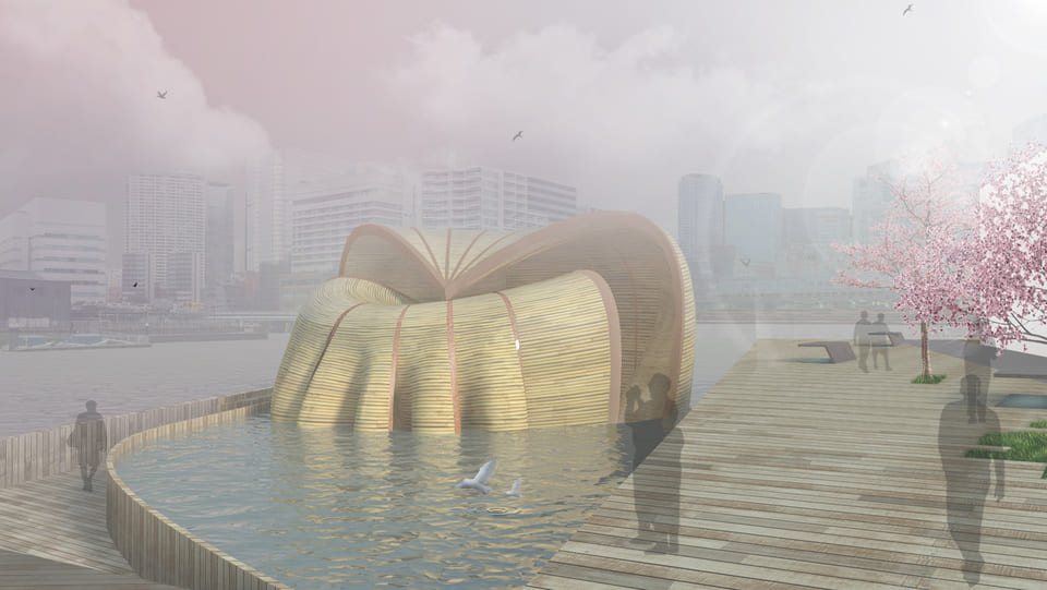
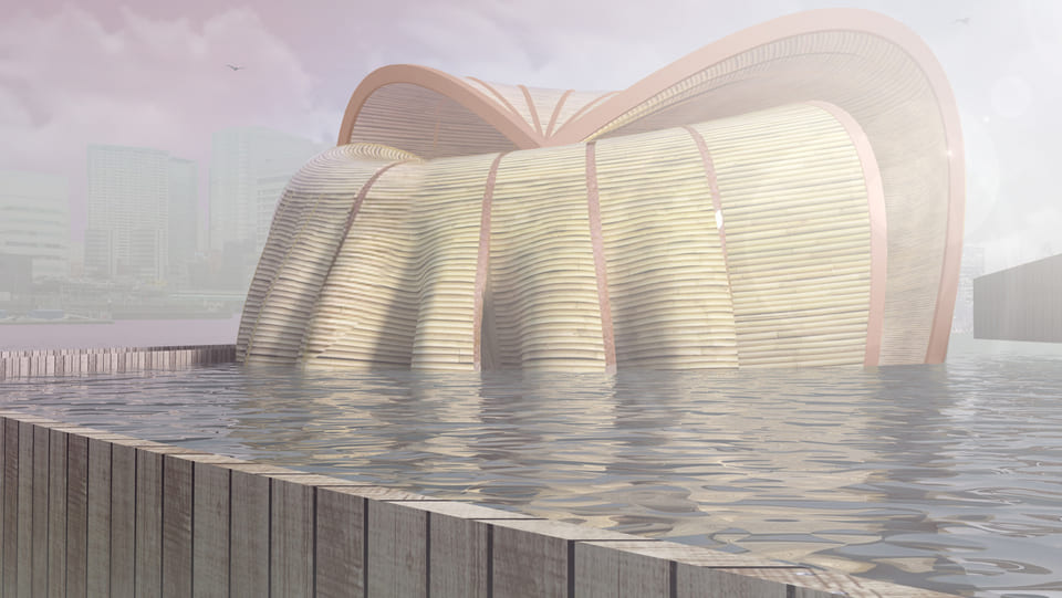
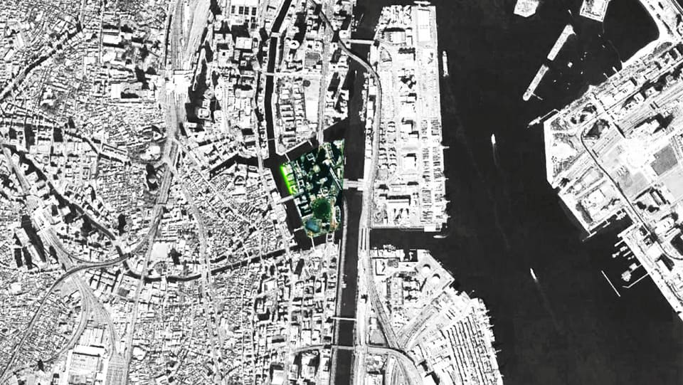
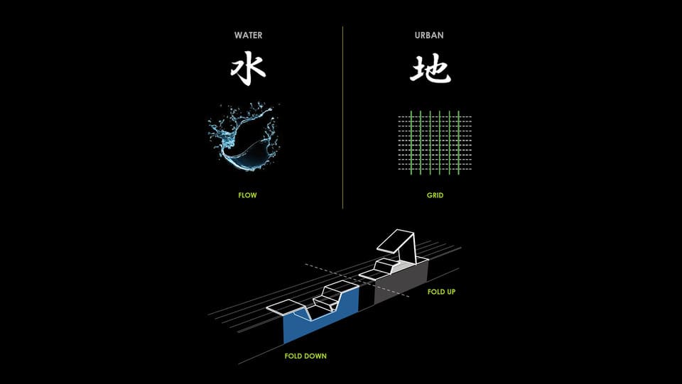
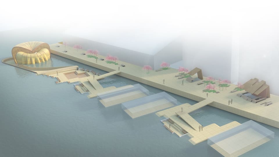
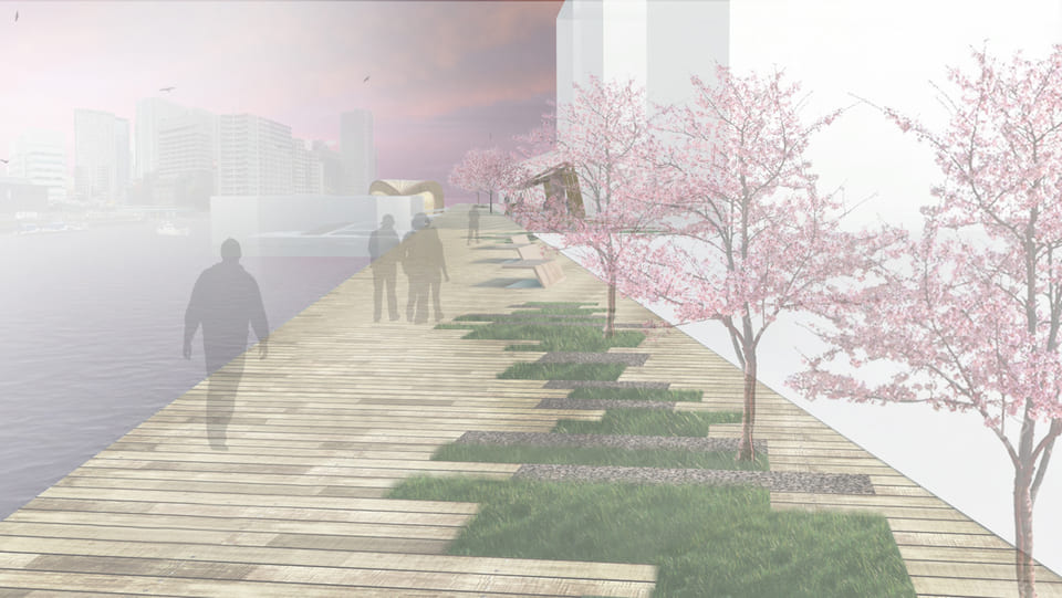
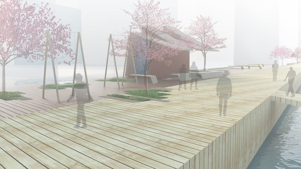
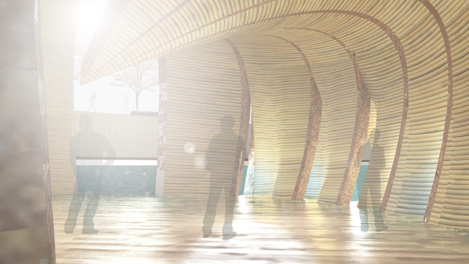
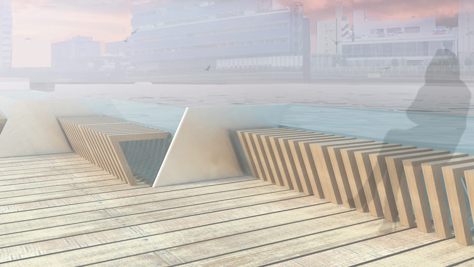
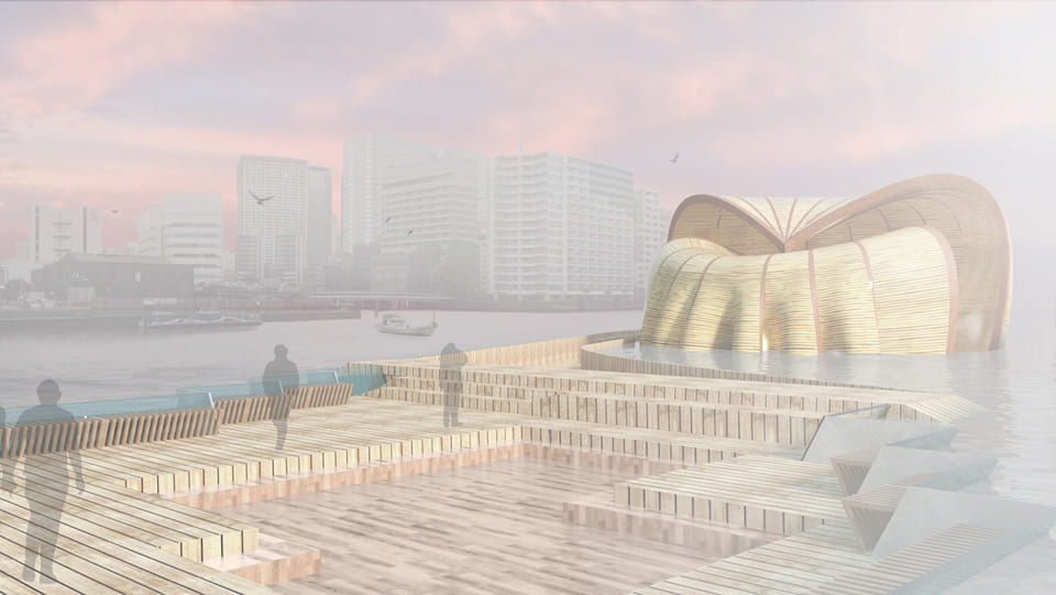
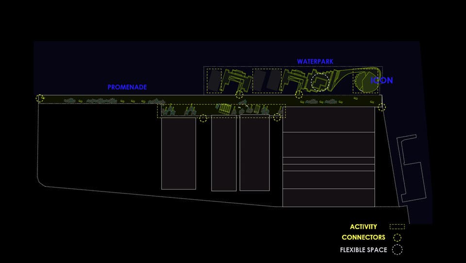
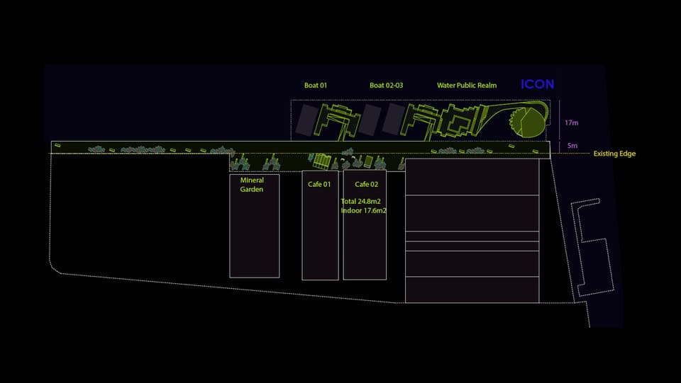
The project explores the relationship between water edge and city urbanity. As one of the key projects of a larger master plan vision, there is a challenge to integrate the water edge into the city. The project plays with actual extension of the edge combined with floating parts. The aim is to create a public realm by the water, a new destination for the people of Tokyo.
The main programmatic elements would be a flexible structure to hold events for Terrada, the main iconic feature of the project and secondary activities like a cafes and kiosk that complement the livelihood of the public space. Few boats are planned to be stationary becoming another progammatic complementation to the project.
Wood structures combine with moments of green, moments of resin, trying to transmit the wasi-sabi spirit of the place. The main icon becomes a floating flower that hugs events like any other location in Tokyo.
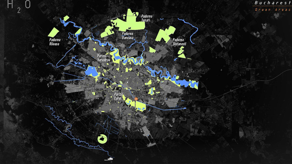
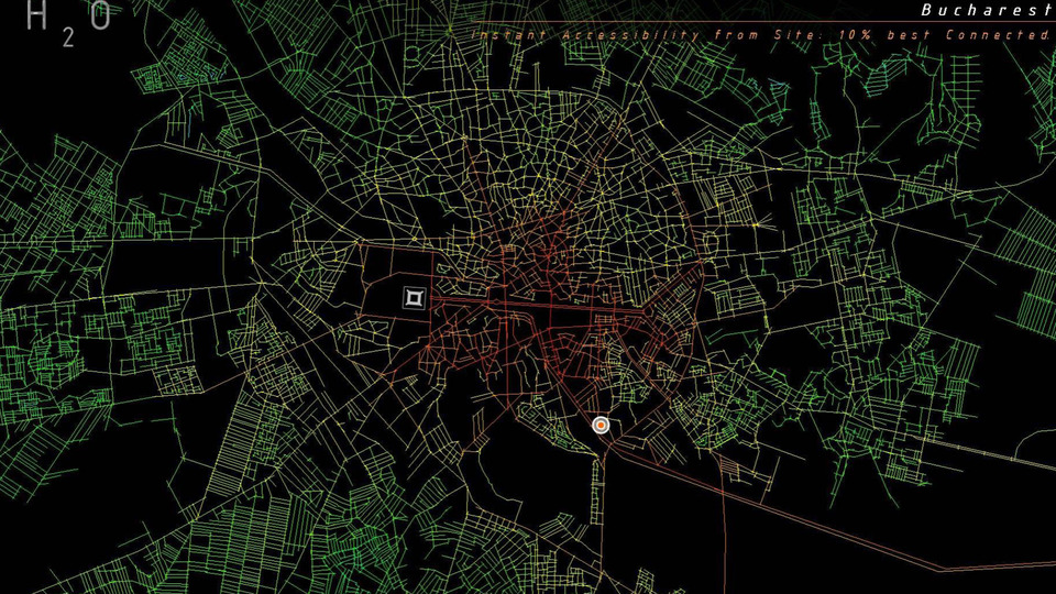
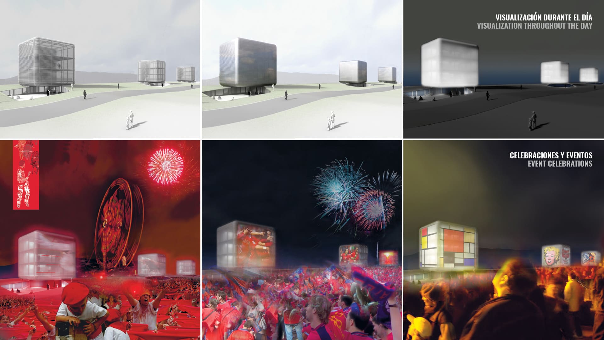
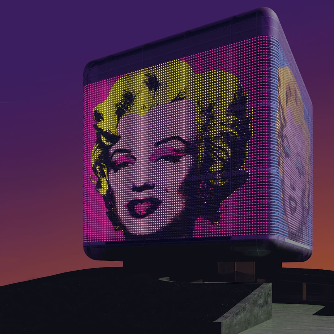
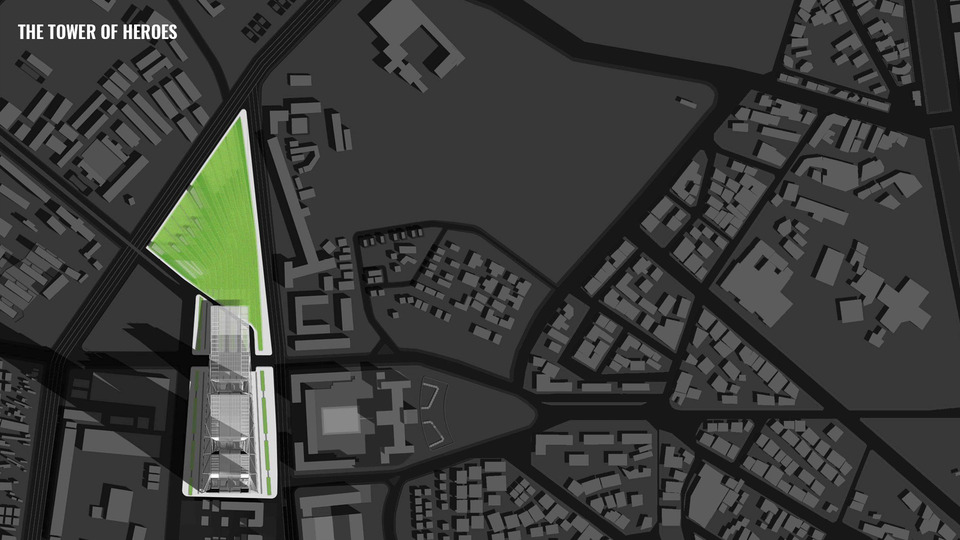
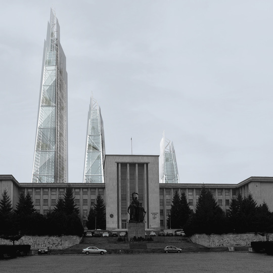
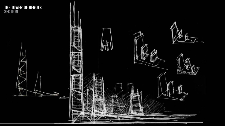
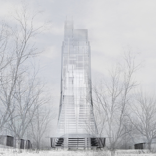
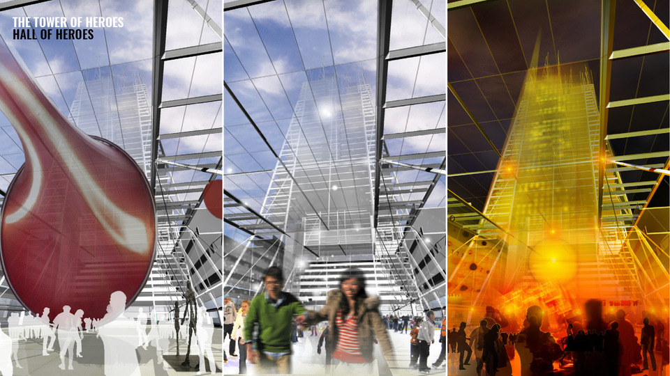
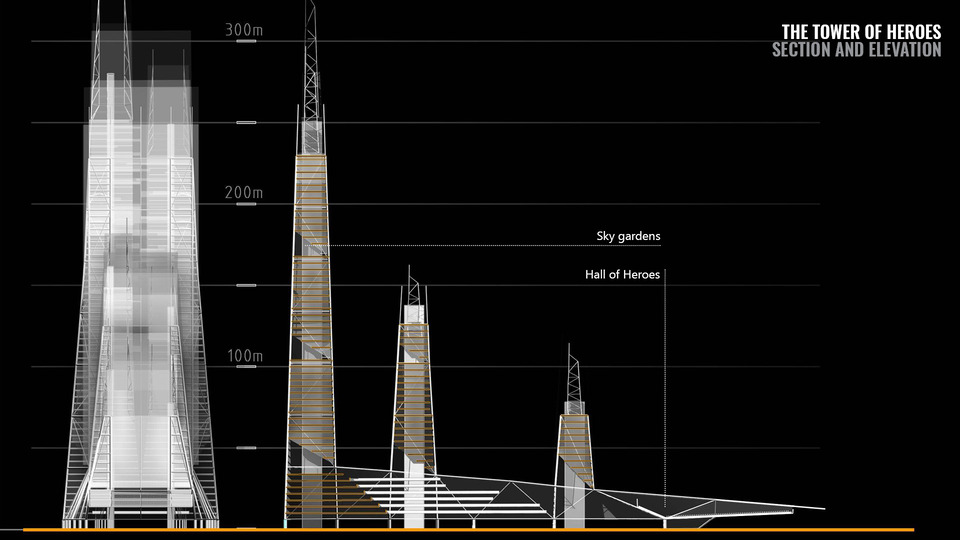
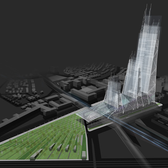
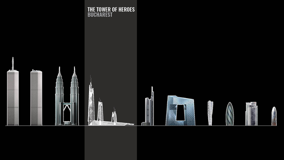
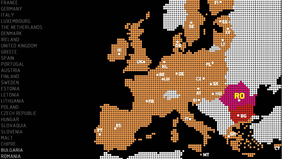
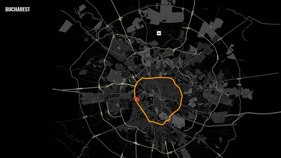
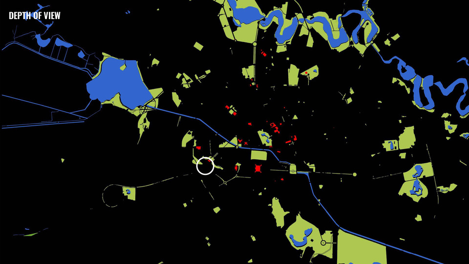
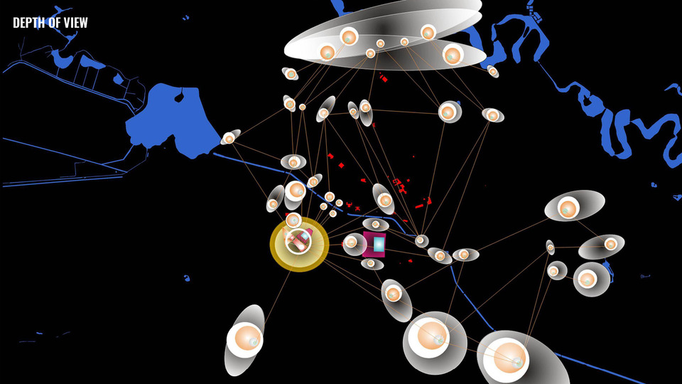
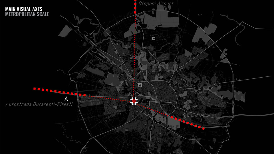
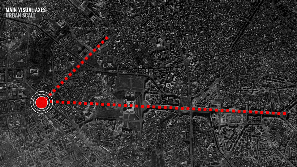
The experimental projects created by the Design LAAB of the Fundacion Metropoli for the city of Bucharest in Rumania were designed as new architectural symbols for the city. They are accompanied by cite-wide context analyses. Since the accession of Rumania to the European Union in January 2007 the country has been undergoing a difficult period of transition from communism to a market economy, under precarious economic conditions. The project of the ‘Heroes of Democracy’ towers originated as a homage of the city of Bucharest to the three million emigrants who are working abroad. They are considered the ‘heroes of democracy’ as their efforts are making a significant contribution to the societal, economic and political transformations of Rumania.
The ‘Heroes of Democracy’ towers symbolise the image of a new, more modern and more transparent Romania, contrasting the existing stocky buildings which represent the war heroes. The location of these towers, at the crossroads of the two most emblematic urban thoroughfares of Bucharest, with the best possible urban accessibility, on a topographic highpoint provides the towers with a particular urban prominence.

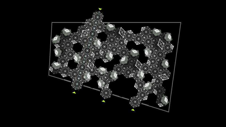
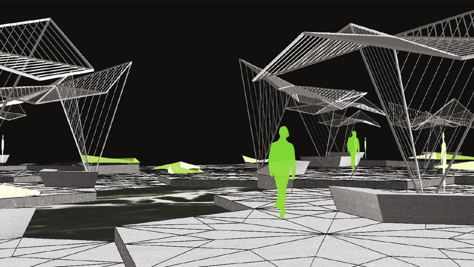
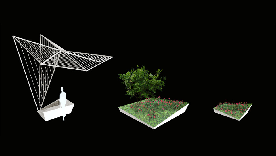
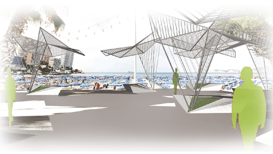
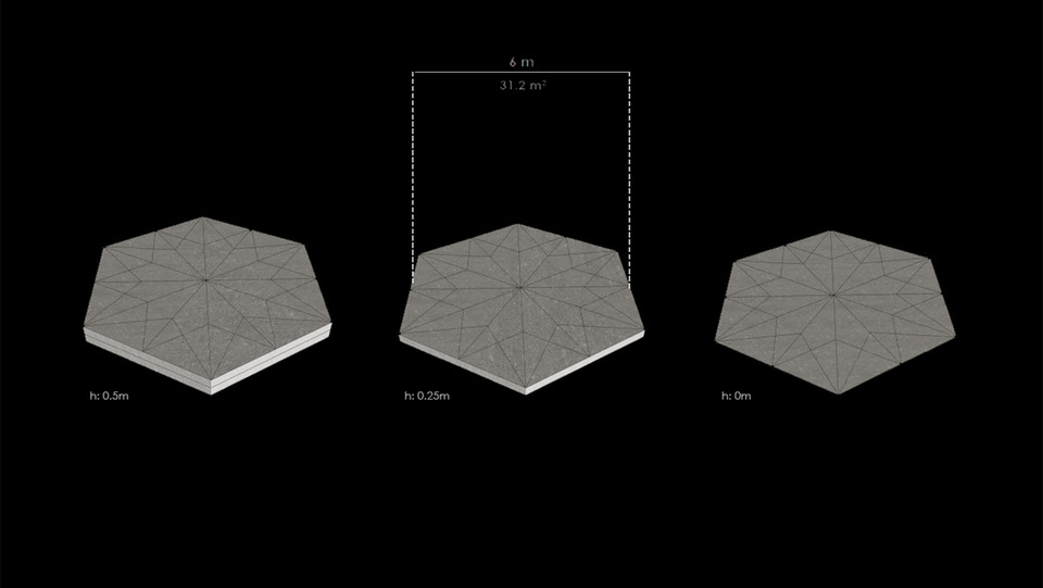
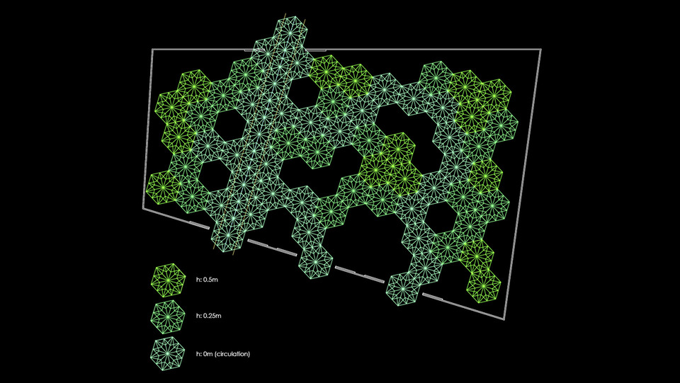
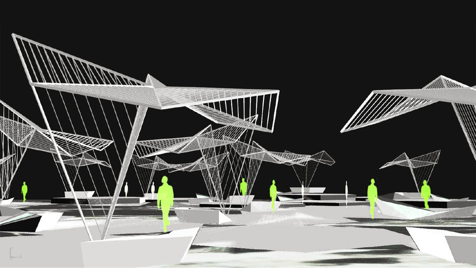
Concrete hexagons of different heights are combined over a white pebble landscape to create a dynamic platform of multiple circulation paths that create a public space by the sea. The shading devices remind us of the history of the place, a fishing village. This cultural interpretation is the key spatial element that defines the space. Moments to rest and enjoy the view are choreographed by the shades and the different levels of platform.
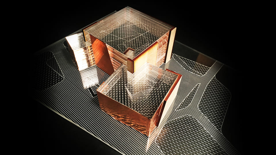
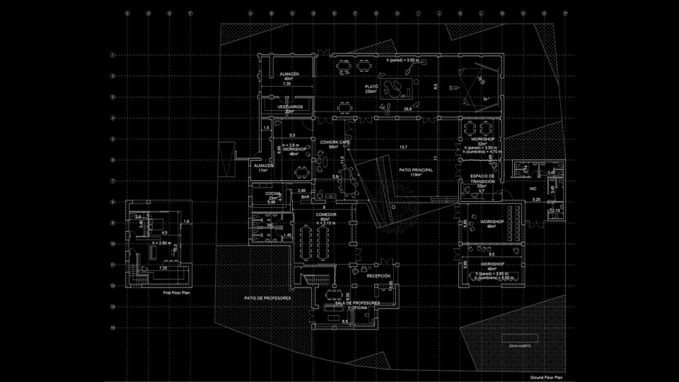
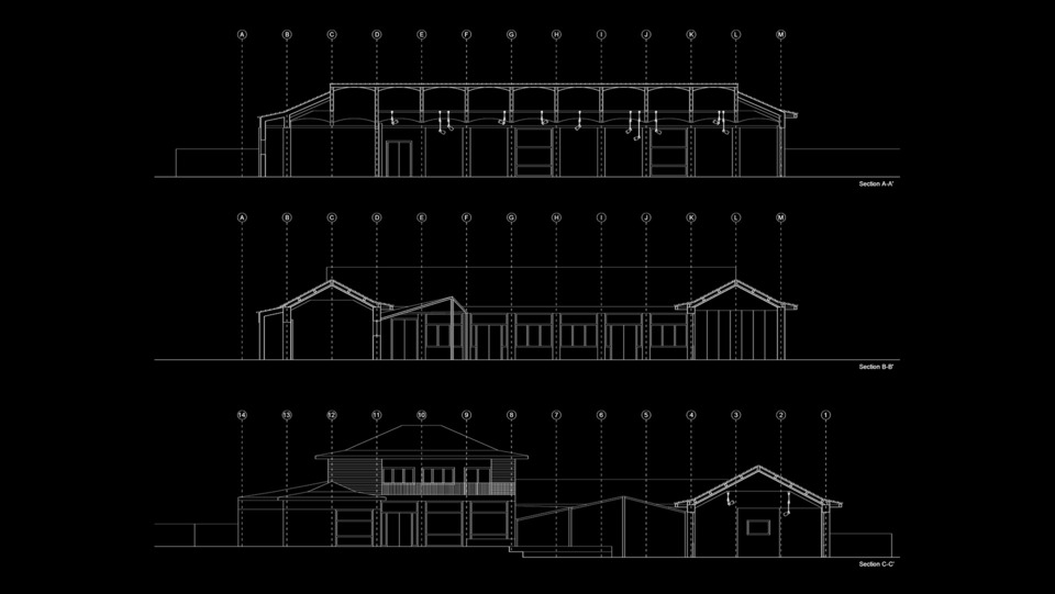
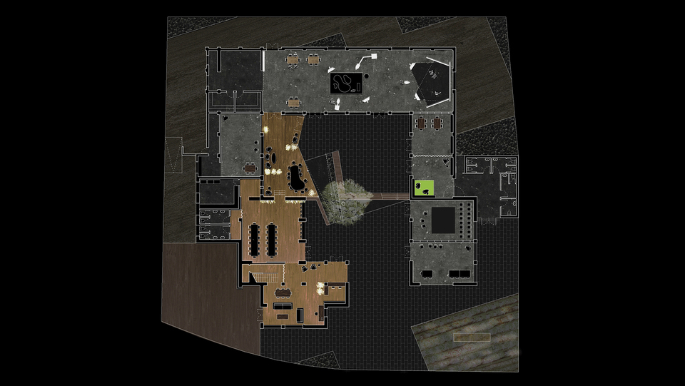
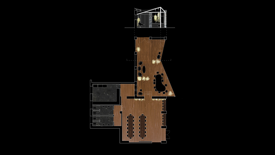
“Casa de Asturias”, an obsolete building in la Feria de Campo in Madrid aims to be transformed into a Film & Theatre School. The project makes use of the existing structure of the building by maximising the idea of architectural recycling. A new structure is added to the most public part of the building, a patio, whilst its existing structure is maintained. The existing spaces aim to be as flexible as possible so the subdivision of spaces can vary in relation to the required use of the space.
The plaza and the cafeteria become the social catalysers, from where the rest of the work and productions spaces are organised. The materiality and landscape adds to the experiential quality of the project.

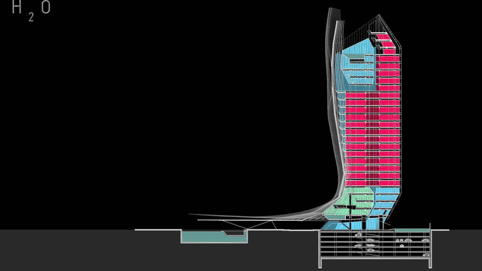
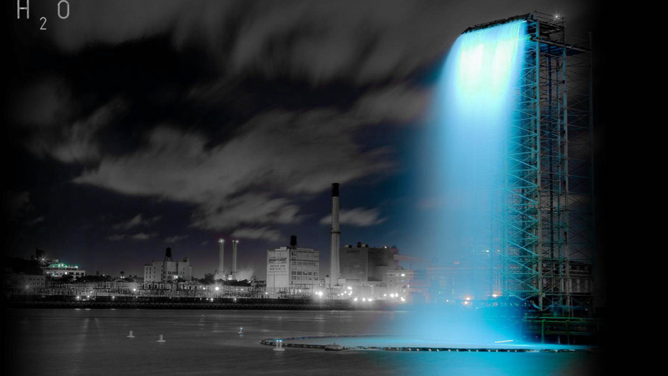
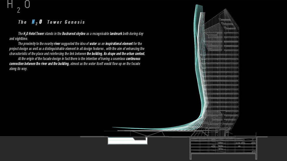
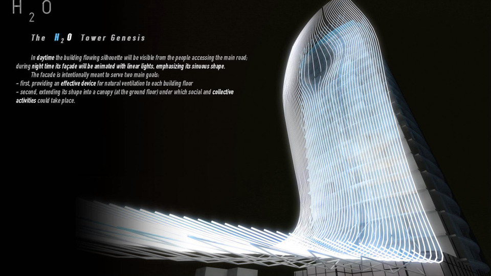
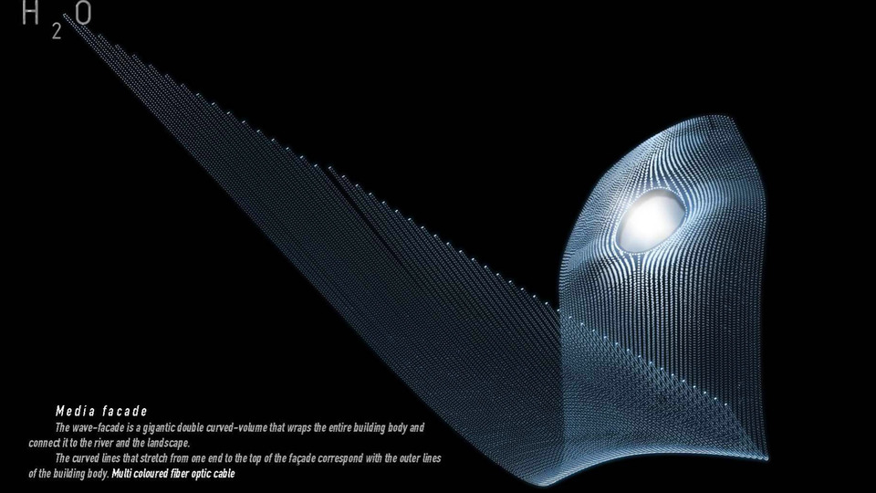
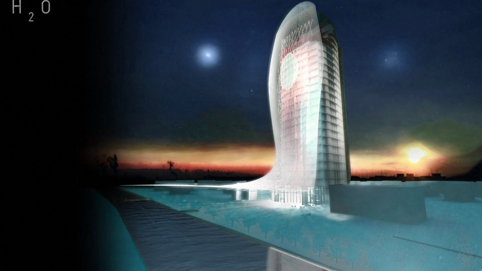
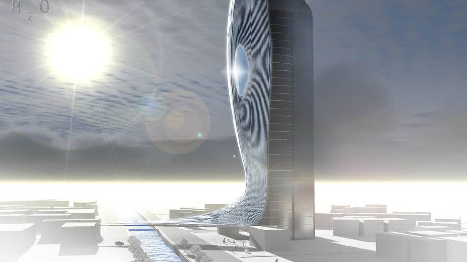
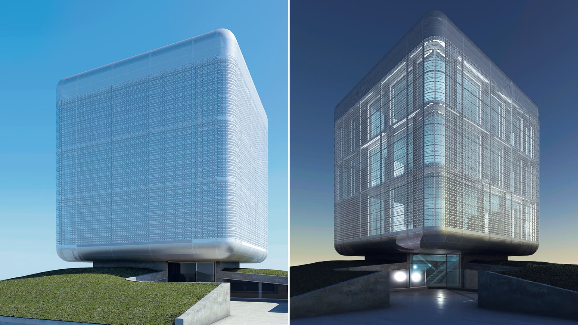
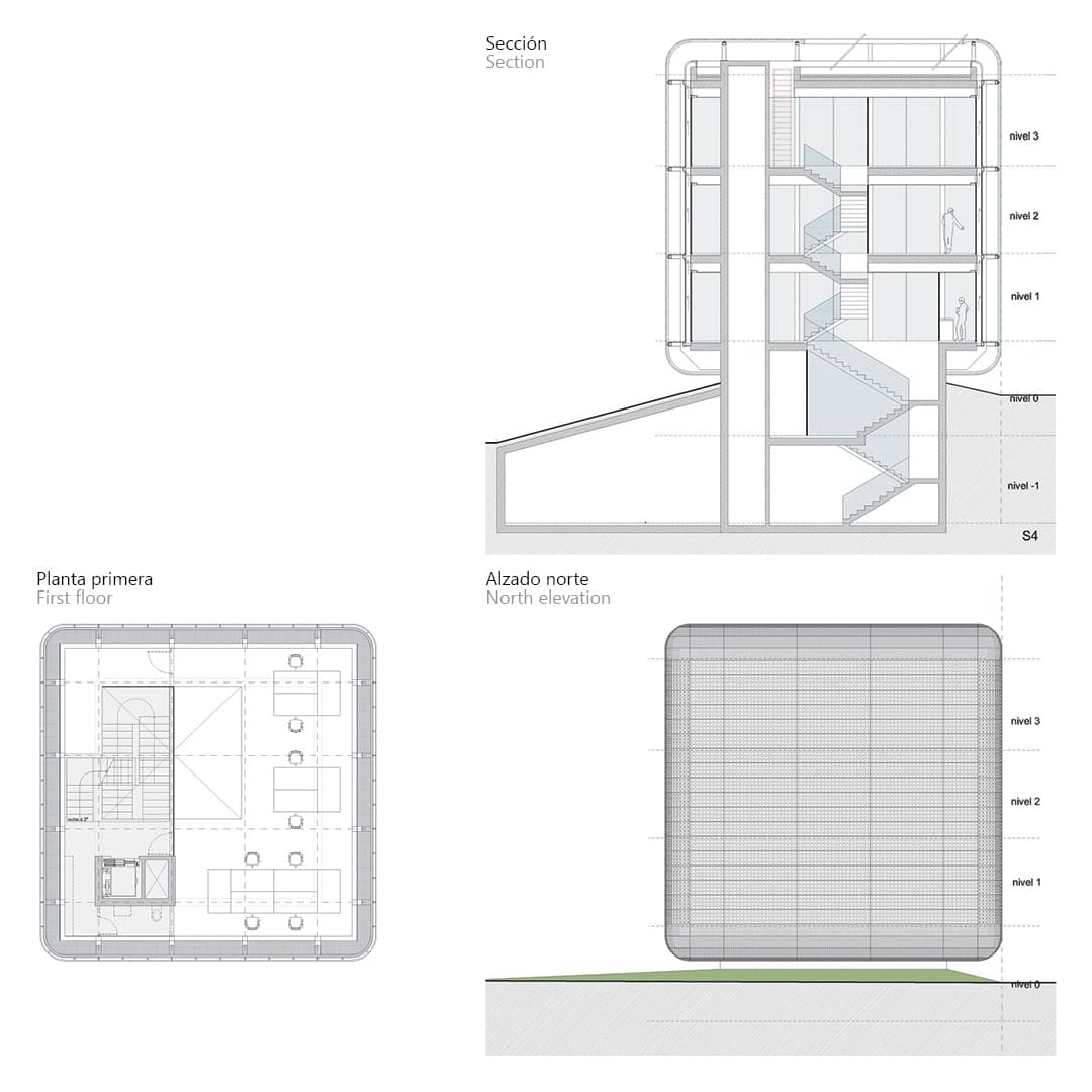
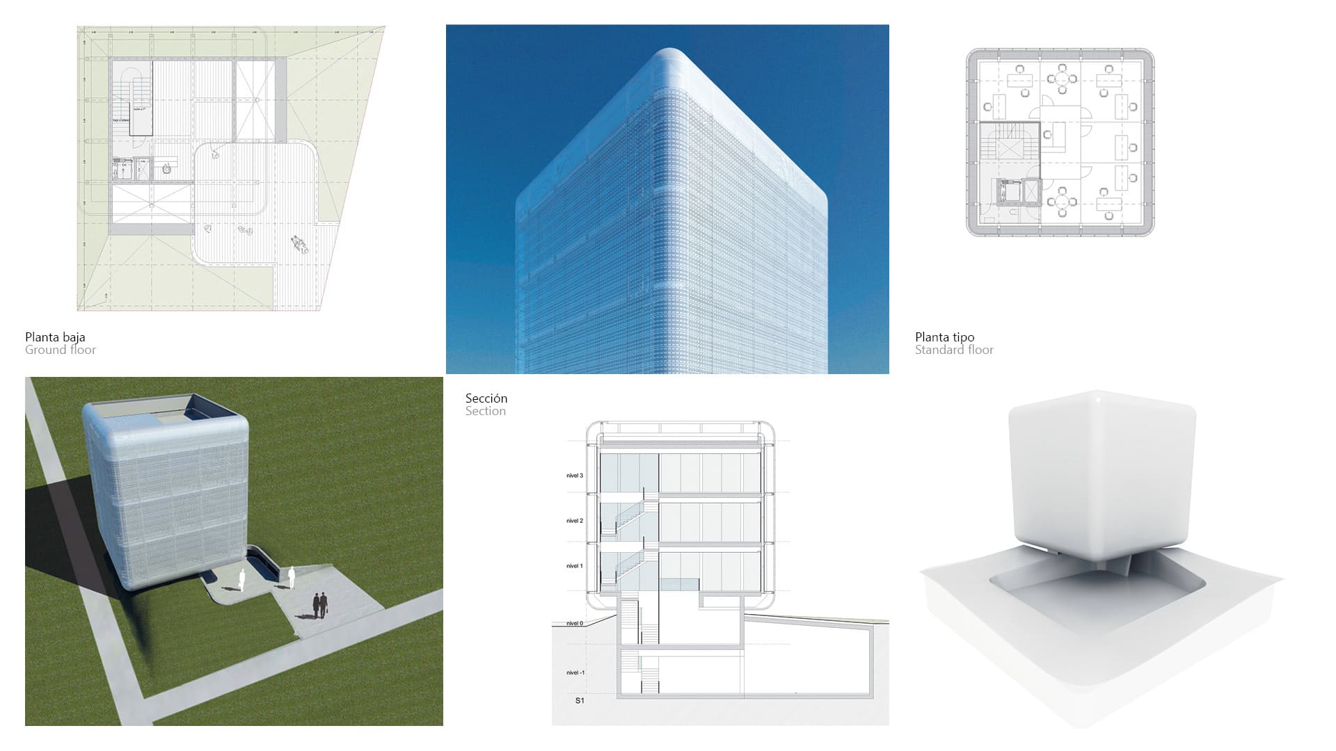
The Hotel H2O is an architectural experiment conceived by the Design LAAB of the Fundacion Metropoli. Forming part of Bucharest’s global modernisation strategy, the new hotel is inspired by water, more specifically by the dialogue between water and the city which is an essential feature of the townscape of Bucharest. The façade is designed with the intention to produce a seamless connection with the neighbouring river akin to a waterfall. The general aspect of the building symbolises the image of a waterfall sprawling into the city next to the river with the aim to make a mark on the urban scene of Bucharest.
The H2O Hotel Tower stands in the Bucharest skyline as a recognizable landmark both during day and night time. The proximity to the nearby river suggested the idea of water as an inspirational element for the project design as well as a distinguishable element in all design features, with the aim of enhancing the characteristic of the place and reinforcing the link between the building, its shape and the urban context. The origin of the facade design lies on the intention of having a seamless continuous connection between the river and the building, almost as if the water itself would flow up along the facade.